Category:Sumner Butte
Jump to navigation
Jump to search
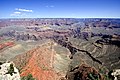
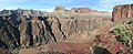
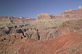
English: Sumner Butte — in Grand Canyon National Park.
- East it's on the perimeter of Bright Angel Canyon, and it's on north edge of Granite Gorge, (Tonto Platform).
Composed of Redwall Limestone, sitting on top of the en:Muav Limestone-(upon the (greenish)-Bright Angel Shale). The Clear Creek Trail start is to the west, from Bright Angel Canyon, crosses up through Tapeats Sandstone, and then at center base of Sumner Butte, crosses the Bright Angle Shale-(of Tonto Group, with Muav L. and Tapeats S.), (on the Tonto Platform); the trail continues east to Zoroaster Canyon (Zoroaster Temple's southeast), and then to Clear Creek (Arizona), a lower, middle section, endpoint.
- East it's on the perimeter of Bright Angel Canyon, and it's on north edge of Granite Gorge, (Tonto Platform).

Category:Bright Angel Canyon (lower canyon)]]
Subcategories
This category has the following 2 subcategories, out of 2 total.
C
S
- Sumner Butte closeup (14 F)
Media in category "Sumner Butte"
The following 47 files are in this category, out of 47 total.
-
 0059 Grand Canyon Mather Point Improvements (5373762649).jpg 4,293 × 2,976; 2.24 MB
-
 04052A Grand Canyon Historic Clear Creek Trail (7421393226).jpg 1,024 × 700; 225 KB
-
 Arizona. LOC 99446124-2.jpg 6,471 × 8,018; 12.08 MB
-
 Arizona. LOC 99446126-2.jpg 5,014 × 6,252; 6.24 MB
-
 Bright Angel Trail Plateau Point.jpg 3,008 × 2,000; 3.79 MB
-
 First canyon view.jpg 1,600 × 1,067; 914 KB
-
 From Mather Point - panoramio.jpg 1,600 × 575; 171 KB
-
 GC HDR 2 Yavapai Point.jpg 4,237 × 2,740; 7.17 MB
-
 Grand Canyon (1).jpg 3,000 × 2,000; 2.64 MB
-
 Grand Canyon (26374424110).jpg 4,608 × 3,456; 2.77 MB
-
 Grand Canyon 09 2017 5087.jpg 5,297 × 1,200; 6.29 MB
-
 Grand Canyon 20060612.jpg 3,504 × 2,336; 2.85 MB
-
 Grand Canyon at dusk, from Yavapai Point (6633034893).jpg 1,600 × 1,063; 735 KB
-
 Grand Canyon in Arizona - 2008-04-07 A.jpg 2,959 × 1,973; 5.83 MB
-
 Grand Canyon Mather Point01.jpg 1,680 × 2,520; 2.8 MB
-
 Grand Canyon National Park South Kaibab Trail 2604a (5490687676).jpg 9,036 × 3,705; 3.78 MB
-
 Grand Canyon National Park, Sunset from Yaki Point 5207 - Flickr - Grand Canyon NPS.jpg 4,421 × 2,871; 4.66 MB
-
 Grand Canyon North Rim View.jpg 3,504 × 2,336; 1.41 MB
-
 Grand Canyon Powell Point Evening Light 2013.jpg 4,611 × 2,162; 4.08 MB
-
 Grand Canyon South Rim 3.JPG 1,600 × 1,200; 406 KB
-
 Grand Canyon South Rim 4.JPG 1,600 × 1,200; 402 KB
-
 Grand Canyon Village, AZ 86023, USA - panoramio (50).jpg 4,000 × 2,672; 2.87 MB
-
 Grand Canyon Vincent Bloch.jpg 2,560 × 1,920; 3.28 MB
-
 Grand canyon yavapal point 2010.JPG 4,209 × 2,744; 4.55 MB
-
 Grand Canyon, from Mather Point (7901981906).jpg 4,272 × 2,848; 5.63 MB
-
 Grand Canyon, North Rim sunset 1989.jpg 1,007 × 701; 143 KB
-
 Grand Canyon, South Rim IMG 4521.tif 5,865 × 3,355; 46.56 MB
-
 Grand Canyon-Mather point.jpg 1,024 × 768; 136 KB
-
 Grand Caynon 08 2010 9988.jpg 1,200 × 800; 1.32 MB
-
 Grand Caynon South Rim 08 2010 9988.jpg 2,400 × 1,600; 3.84 MB
-
 Mather Point, Grand Canyon (30424684451).jpg 5,472 × 3,648; 9.29 MB
-
 Mather Point, Grand Canyon (31763816020).jpg 4,953 × 3,302; 7.06 MB
-
 Morning along the Colorado River.JPG 3,264 × 2,448; 4.31 MB
-

-
 Plateau Point - Pipe Springs Rapids (I think) - Flickr - brewbooks.jpg 3,264 × 2,448; 3.91 MB
-
 Plateau Point in Grand Canyon National Park.jpg 4,032 × 3,024; 4.08 MB
-
 South Kaibab Trail from Yaki Point, Grand Canyon (6633031507).jpg 1,600 × 1,063; 759 KB
-
 Sumner Butte and Zoroaster.jpg 4,444 × 3,522; 4.26 MB
-
 Sumner Butte.jpg 3,000 × 2,000; 4.7 MB
-
 View of Grand Canyon from Kaibab trail.jpg 3,840 × 2,391; 4.21 MB
-
 Yaki Point, Grand Canyon (6633031949).jpg 1,600 × 1,063; 642 KB
-
 Ylgdc bb (16835352735).jpg 2,175 × 1,979; 1.38 MB
-

-

-

-
-

.jpg)


.jpg)
.jpg)

.jpg)


.jpg)


.jpg)


.jpg)
.jpg)


_-_Flickr_-_brewbooks.jpg)

.jpg)


.jpg)
.jpg)


.jpg)
.jpg)