Category:Summits of Powys
Jump to navigation
Jump to search
Subcategories
This category has the following 2 subcategories, out of 2 total.
C
- Summit of Corn Du (11 F)
P
Media in category "Summits of Powys"
The following 46 files are in this category, out of 46 total.
-
 Allt Lwyd - geograph.org.uk - 53722.jpg 640 × 480; 82 KB
-
 Cairn at point 482m - geograph.org.uk - 1501957.jpg 640 × 424; 108 KB
-
 Carreg Lem - geograph.org.uk - 399147.jpg 640 × 480; 102 KB
-
 Corn Du from Pen y Fan - geograph.org.uk - 32496.jpg 640 × 367; 47 KB
-
 Cyrniau Nod - geograph.org.uk - 406344.jpg 640 × 480; 80 KB
-
 Drygarn Fawr - geograph.org.uk - 378098.jpg 640 × 417; 49 KB
-
-
 Godor North Top - geograph.org.uk - 29145.jpg 640 × 480; 106 KB
-
 Gwaunceste Hill - geograph.org.uk - 405244.jpg 640 × 480; 86 KB
-
 Moel Sych - geograph.org.uk - 29130.jpg 640 × 480; 96 KB
-
 Nuttall bagging. - geograph.org.uk - 542283.jpg 640 × 480; 99 KB
-
 Pen Allt Mawr summit - geograph.org.uk - 222123.jpg 640 × 480; 70 KB
-
 Pen Cerrig-calch - geograph.org.uk - 369364.jpg 640 × 480; 157 KB
-
 Plateau on Waun Fach - geograph.org.uk - 23975.jpg 640 × 486; 102 KB
-
 Stile and summit cairn on Moel Sych - geograph.org.uk - 471617.jpg 640 × 364; 39 KB
-
 Summit area of Fan Frynych - geograph.org.uk - 3803624.jpg 1,500 × 825; 1.23 MB
-
 Summit Cairn on Pen y Gadair Fawr - geograph.org.uk - 23969.jpg 640 × 479; 96 KB
-
 Summit of Carreg Goch - geograph.org.uk - 397132.jpg 640 × 480; 96 KB
-
 Summit of Fan Fawr - geograph.org.uk - 239856.jpg 640 × 480; 108 KB
-
 Summit of Fan Fraith - geograph.org.uk - 257645.jpg 640 × 480; 92 KB
-
 Summit of Fan Llia - geograph.org.uk - 408807.jpg 640 × 480; 89 KB
-
 Summit of Waun Fach - geograph.org.uk - 23972.jpg 640 × 480; 69 KB
-
 The Beacons from Cribyn - geograph.org.uk - 2881773.jpg 640 × 480; 54 KB
-
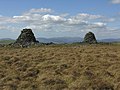 The cairns of Carn Gwilym - geograph.org.uk - 479460.jpg 1,000 × 750; 305 KB
-
 The summit cairn of Cefn Gwyntog - geograph.org.uk - 784813.jpg 640 × 381; 97 KB
-
 The summit of Fan Fawr - geograph.org.uk - 2599999.jpg 2,592 × 1,944; 1.54 MB
-
 The summit of Gorllwyn - geograph.org.uk - 565725.jpg 640 × 429; 62 KB
-
 The summit of Twmpa - geograph.org.uk - 1748822.jpg 640 × 426; 92 KB
-
 The summit of Twmpa - geograph.org.uk - 1748830.jpg 640 × 426; 92 KB
-
 The summit of Yr Allt - geograph.org.uk - 2464470.jpg 2,592 × 1,944; 1.4 MB
-
 Twr y Fan Foel summit cairn - geograph.org.uk - 171061.jpg 480 × 359; 31 KB
-
 Waun Fach Summit. - geograph.org.uk - 36378.jpg 640 × 377; 33 KB
-
 Boundary stones - geograph.org.uk - 414032.jpg 640 × 480; 92 KB
-
 Bwlch Y Ddwyallt - geograph.org.uk - 53732.jpg 640 × 480; 104 KB
-
 Cilfaesty Hill - geograph.org.uk - 310246.jpg 640 × 480; 108 KB
-
 Cilfaesty Hill - geograph.org.uk - 609769.jpg 640 × 480; 67 KB
-
 Dewey bagging - geograph.org.uk - 733842.jpg 640 × 480; 89 KB
-
 Godor - geograph.org.uk - 29155.jpg 640 × 480; 143 KB
-
 Gro Hill - geograph.org.uk - 733950.jpg 640 × 480; 65 KB
-
 Gwastedyn Hill - geograph.org.uk - 733350.jpg 640 × 480; 58 KB
-
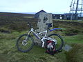 Radnor Forest mountain bike ride. - geograph.org.uk - 544108.jpg 640 × 480; 85 KB
-
 Remains of a weather post on Gorllwyn^ - geograph.org.uk - 560104.jpg 640 × 426; 131 KB
-
 Standing Stone - geograph.org.uk - 618401.jpg 640 × 427; 191 KB
-
 The summit of Esgair Wen - geograph.org.uk - 566978.jpg 640 × 480; 61 KB
-

-
 Waun Rydd - geograph.org.uk - 53727.jpg 640 × 480; 82 KB


_-_geograph.org.uk_-_47072.jpg)
