Category:Suikerfabriek (Hoogkerk)
Jump to navigation
Jump to search
| Object location | | View all coordinates using: OpenStreetMap |
|---|
Media in category "Suikerfabriek (Hoogkerk)"
The following 7 files are in this category, out of 7 total.
-
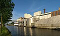
 20090728 Suikerfabriek Hoogkerk Gn NL.jpg 3,000 × 914; 1.49 MB
-
 20120526 Suikerfabriek Suiker Unie Hoogkerk Groningen NL (2).jpg 5,000 × 3,000; 4.52 MB
-
 20120526 Suikerfabriek Suiker Unie Hoogkerk Groningen NL.jpg 8,000 × 2,000; 4.21 MB
-
 20120820 Suikerfabriek Suiker Unie Hoogkerk Groningen NL (1).jpg 7,500 × 2,500; 4.83 MB
-
 20120820 Suikerfabriek Suiker Unie Hoogkerk Groningen NL (2).jpg 8,800 × 2,400; 5.29 MB
-
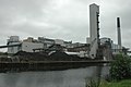 Sugar factory.jpg 3,008 × 2,000; 2.6 MB
-
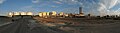
 Uitzicht naar het zuiden - panoramio.jpg 2,048 × 1,536; 683 KB
.jpg)


.jpg)
.jpg)