Category:Stybarrow Dodd
Jump to navigation
Jump to search
Media in category "Stybarrow Dodd"
The following 17 files are in this category, out of 17 total.
-
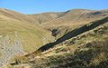
 Ascending Hart Side - geograph.org.uk - 3254231.jpg 2,560 × 1,920; 916 KB
-
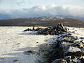
 Cairn on Stybarrow Dodd - geograph.org.uk - 1775535.jpg 640 × 480; 93 KB
-
 Declining grassy slope of Stybarrow Dodd - geograph.org.uk - 2056476.jpg 2,000 × 1,123; 1.33 MB
-
 Descending Stybarrow Dodd - geograph.org.uk - 1046830.jpg 640 × 480; 54 KB
-
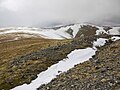 Hart Side summit - trench and ridge.JPG 1,024 × 768; 428 KB
-
 Heading for Stybarrow Dodd - geograph.org.uk - 2585675.jpg 640 × 480; 45 KB
-
 On Stybarrow Dodd - geograph.org.uk - 1046824.jpg 640 × 480; 51 KB
-
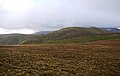 Stybarrow Dodd from Gt D.JPG 958 × 603; 153 KB
-
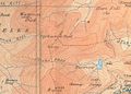 Stybarrow Dodd Map.jpg 730 × 525; 69 KB
-
 Stybarrow Dodd summit ridge.JPG 1,024 × 768; 284 KB
-
 Stybarrow Dodd summit wall.JPG 1,024 × 768; 438 KB
-
 Stybarrow.jpg 600 × 376; 79 KB
-
 Summit Cairn, Stybarrow Dodd - geograph.org.uk - 649223.jpg 640 × 480; 66 KB
-
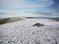
 Summit Stybarrow Dodd - geograph.org.uk - 1048106.jpg 640 × 470; 75 KB
-
 Ullswater Stybarrow Crag Lake District England.jpg 840 × 1,075; 251 KB
-
 Watson's Dodd, from Stybarrow Dodd.JPG 1,024 × 768; 366 KB
-
 Watson's Dodd, from W ridge of Sty D.jpg 1,174 × 390; 90 KB


