Category:Sturton le Steeple
Jump to navigation
Jump to search
English: Sturton le Steeple is a village in Nottinghamshire, England. It is located 6 miles east of Retford. According to the 2001 census it had a population of 497.
village in Nottinghamshire, England, UK | |||||
| Upload media | |||||
| Instance of | |||||
|---|---|---|---|---|---|
| Location | Bassetlaw, Nottinghamshire, East Midlands, England | ||||
| Population |
| ||||
 | |||||
Subcategories
This category has the following 3 subcategories, out of 3 total.
Media in category "Sturton le Steeple"
The following 200 files are in this category, out of 398 total.
(previous page) (next page)-
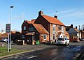 "The Reindeer Inn", Sturton-le-Steeple - geograph.org.uk - 4340239.jpg 5,017 × 3,604; 4.14 MB
-
 A glimpse of power - geograph.org.uk - 5093469.jpg 3,072 × 1,728; 4.13 MB
-
 A strange day to die - geograph.org.uk - 4095492.jpg 683 × 1,024; 241 KB
-
 A sudden flash of gold - geograph.org.uk - 1291297.jpg 640 × 480; 197 KB
-
 A wet corner at the top of High House Road - geograph.org.uk - 4311975.jpg 4,000 × 2,248; 3.97 MB
-

-
 Apple Wood - geograph.org.uk - 4310350.jpg 800 × 600; 100 KB
-
 Barn, North Street Farm - geograph.org.uk - 2688706.jpg 640 × 480; 69 KB
-
 Bench mark, Railway bridge, West Burton - geograph.org.uk - 4235395.jpg 960 × 1,280; 581 KB
-
 Bench mark, Station Road bridge - geograph.org.uk - 4190043.jpg 1,280 × 960; 530 KB
-
 Bench mark, Sturton telephone exchange - geograph.org.uk - 4189758.jpg 1,280 × 960; 382 KB
-
 Beside the River Trent - geograph.org.uk - 5087438.jpg 800 × 508; 84 KB
-
 Big load for Power Station - geograph.org.uk - 2223687.jpg 1,600 × 1,200; 485 KB
-
 Big sky over Upper Ings Lane - geograph.org.uk - 5090139.jpg 800 × 599; 114 KB
-
 Blacksmiths Arms Cottage - geograph.org.uk - 4189761.jpg 1,280 × 960; 281 KB
-
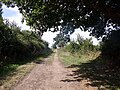
 Blue Stocking Lane (track) - geograph.org.uk - 2688432.jpg 640 × 480; 62 KB
-
 Bonfire by the railway - geograph.org.uk - 3045861.jpg 1,024 × 768; 221 KB
-
 Border Patrol - geograph.org.uk - 2534294.jpg 1,024 × 768; 173 KB
-
 Bracket Fungus - geograph.org.uk - 285283.jpg 640 × 427; 96 KB
-
 Bridge and gate at Manor Farm - geograph.org.uk - 4188772.jpg 960 × 1,280; 550 KB
-
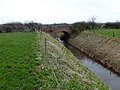
 Bridge over Catchwater Drain - geograph.org.uk - 2193578.jpg 1,024 × 768; 151 KB
-
 Bridleway off Littleborough Road - geograph.org.uk - 3747446.jpg 2,256 × 1,504; 2.62 MB
-
 Bull in a field - geograph.org.uk - 2916978.jpg 640 × 427; 74 KB
-
 Burton Chateau - geograph.org.uk - 3158790.jpg 640 × 448; 225 KB
-

-
 Burton Park from across the Trent - geograph.org.uk - 2534363.jpg 1,024 × 768; 172 KB
-
 Burton Round - geograph.org.uk - 484915.jpg 640 × 427; 119 KB
-
 By the Trent at Littleborough - geograph.org.uk - 2534027.jpg 1,024 × 768; 186 KB
-
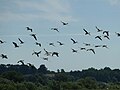 Canada geese in flight - geograph.org.uk - 5089551.jpg 800 × 600; 48 KB
-
 Catchwater drain - geograph.org.uk - 2052497.jpg 640 × 427; 78 KB
-
 Catchwater Drain - geograph.org.uk - 2193588.jpg 1,024 × 768; 146 KB
-
 Catchwater drain - geograph.org.uk - 2916970.jpg 640 × 427; 88 KB
-
 Catchwater Drain - geograph.org.uk - 4311154.jpg 4,000 × 2,248; 4.42 MB
-
 Catchwater Drain - geograph.org.uk - 4311161.jpg 4,000 × 2,248; 4.46 MB
-
 Catchwater Drain - geograph.org.uk - 4311162.jpg 4,000 × 2,248; 4.78 MB
-
 Catchwater Drain and bridge on Common Lane - geograph.org.uk - 4311158.jpg 4,000 × 2,248; 5.2 MB
-

-
 Catchwater drain looking west - geograph.org.uk - 2052509.jpg 640 × 427; 89 KB
-
 Catchwater Drain near Low Holland Farm - geograph.org.uk - 4188764.jpg 1,280 × 960; 424 KB
-
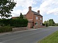
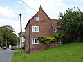
 Church Farm House and adjoining cottages - geograph.org.uk - 4188792.jpg 1,280 × 953; 406 KB
-
 Climbing to the heavens - geograph.org.uk - 4235385.jpg 960 × 1,280; 114 KB
-
 Coal by Rail - geograph.org.uk - 2221847.jpg 1,600 × 1,200; 579 KB
-
 Common Lane bridge over Catchwater Drain - geograph.org.uk - 4310601.jpg 800 × 600; 115 KB
-
 Common Lane bridge over Catchwater Drain - geograph.org.uk - 4310603.jpg 800 × 600; 135 KB
-
 Common Lane heading east - geograph.org.uk - 3512049.jpg 640 × 480; 65 KB
-
 Common Lane, Sturton le Steeple - geograph.org.uk - 2193572.jpg 1,024 × 768; 144 KB
-
 Continuing up the Trent - geograph.org.uk - 3158611.jpg 640 × 427; 136 KB
-
 Converted barn at Church Hill Farm - geograph.org.uk - 4189755.jpg 1,280 × 960; 292 KB
-

-
 Cooling towers, West Burton - geograph.org.uk - 4235391.jpg 902 × 1,280; 124 KB
-

-
 Cottam power station across the snowy fields - geograph.org.uk - 2193817.jpg 1,024 × 768; 51 KB
-
 Cowpasture Lane - geograph.org.uk - 2193749.jpg 1,024 × 768; 170 KB
-
 Cowpasture Lane - geograph.org.uk - 3512051.jpg 640 × 480; 74 KB
-
 Cowpasture Lane - geograph.org.uk - 3512063.jpg 640 × 480; 70 KB
-
 Cowpasture Lane - geograph.org.uk - 3734974.jpg 2,256 × 1,504; 2.82 MB
-
 Cowpasture Lane looking east - geograph.org.uk - 2193775.jpg 1,024 × 768; 176 KB
-
 Cowpasture Lane looking west - geograph.org.uk - 2193777.jpg 1,024 × 768; 100 KB
-
 Cross Street Barn and Cottage - geograph.org.uk - 4189760.jpg 1,280 × 845; 303 KB
-
 Crow Tree Farm - geograph.org.uk - 2465383.jpg 640 × 427; 89 KB
-
 Crow Tree Farmhouse - geograph.org.uk - 4190018.jpg 1,280 × 960; 283 KB
-
 Crown Cottage, North Street - geograph.org.uk - 4189773.jpg 1,280 × 982; 397 KB
-
 Crown Cottage, North Street - geograph.org.uk - 5063949.jpg 1,024 × 768; 255 KB
-
 Crown Farm House, Sturton - geograph.org.uk - 4190014.jpg 1,280 × 960; 371 KB
-
 Distance marker along the River Trent - geograph.org.uk - 5366551.jpg 800 × 600; 113 KB
-

-
 Distance marker along the River Trent - geograph.org.uk - 5367550.jpg 800 × 582; 115 KB
-
 Distance marker along the River Trent - geograph.org.uk - 5367557.jpg 800 × 556; 133 KB
-
 Distance marker along the River Trent - geograph.org.uk - 5368481.jpg 800 × 611; 164 KB
-
 Distance marker along the River Trent - geograph.org.uk - 5371675.jpg 800 × 560; 129 KB
-
 Diverse objects - geograph.org.uk - 2193627.jpg 1,024 × 768; 175 KB
-
 Down the Trent - geograph.org.uk - 3158772.jpg 640 × 428; 146 KB
-
 Drain off Common Lane - geograph.org.uk - 3512046.jpg 640 × 480; 79 KB
-

-
 Dust bin day Gainsborough Road - geograph.org.uk - 1171103.jpg 640 × 454; 50 KB
-
 Dutch barn at Field Farm - geograph.org.uk - 3044348.jpg 1,024 × 768; 152 KB
-
 Dyke and pylon - geograph.org.uk - 2534025.jpg 1,024 × 768; 148 KB
-
 Empty coal train - geograph.org.uk - 3753149.jpg 2,256 × 1,504; 2.64 MB
-

-
 Entering Fenton - geograph.org.uk - 2533445.jpg 1,024 × 768; 132 KB
-
 Entering Sturton le Steeple - geograph.org.uk - 3048468.jpg 800 × 600; 98 KB
-
 Entering Sturton le Steeple - geograph.org.uk - 3048472.jpg 800 × 600; 119 KB
-
 Entering Sturton Le Steeple - geograph.org.uk - 3512043.jpg 640 × 480; 56 KB
-
 Entrance to Manor Farm - geograph.org.uk - 4188777.jpg 1,280 × 960; 495 KB
-
 Entrance to Sturton-le-Steeple - geograph.org.uk - 4138559.jpg 640 × 480; 81 KB
-
 Entrance to West Burton Power Station - geograph.org.uk - 3753154.jpg 2,256 × 1,504; 1.35 MB
-
 Entrance to West Burton Power Station - geograph.org.uk - 5138238.jpg 800 × 535; 118 KB
-
 Extended house at Fenton - geograph.org.uk - 1291326.jpg 640 × 480; 207 KB
-
 Farm buildings, Sturton le Steeple - geograph.org.uk - 2688715.jpg 640 × 480; 71 KB
-
 Farmland and pylons - geograph.org.uk - 3512050.jpg 640 × 480; 51 KB
-
 Farmland and pylons - geograph.org.uk - 3512069.jpg 640 × 480; 97 KB
-
 Farmland at Maumhill - geograph.org.uk - 5138361.jpg 800 × 600; 136 KB
-
 Farmland near Field Farm - geograph.org.uk - 2830274.jpg 640 × 475; 43 KB
-
 Farmland near South Wheatley - geograph.org.uk - 2688678.jpg 640 × 480; 68 KB
-
 Farmland near Woodland Farm - geograph.org.uk - 2688690.jpg 640 × 480; 38 KB
-
 Farmland off Cowpasture Lane - geograph.org.uk - 3512060.jpg 640 × 480; 88 KB
-
 Farmland off Ings Lane - geograph.org.uk - 3512054.jpg 640 × 480; 60 KB
-
 Farmland off Thornhill Lane - geograph.org.uk - 3512098.jpg 640 × 480; 70 KB
-
 Farmland off Whinleys Road - geograph.org.uk - 2688434.jpg 640 × 480; 60 KB
-
 Farmland towards Maumhill Wood - geograph.org.uk - 2830291.jpg 640 × 481; 59 KB
-
 Farmland towards Sturton High House - geograph.org.uk - 2830302.jpg 640 × 424; 59 KB
-
 Farmland, Sturton le Steeple - geograph.org.uk - 2688724.jpg 640 × 480; 51 KB
-
 Fenton farm buildings - geograph.org.uk - 1291322.jpg 640 × 480; 225 KB
-
 Fenton Lane crossing the Catchwater Drain - geograph.org.uk - 3414508.jpg 3,648 × 2,736; 3.86 MB
-
 Ferry Farm - geograph.org.uk - 4098619.jpg 1,024 × 683; 212 KB
-
 Ferry House, Littleborough - geograph.org.uk - 4188726.jpg 1,280 × 960; 343 KB
-
 Ferry Lane - geograph.org.uk - 2193746.jpg 1,024 × 768; 99 KB
-
 Field drain beside Old Upper Ings Lane - geograph.org.uk - 5090145.jpg 800 × 600; 114 KB
-
 Field Farm - geograph.org.uk - 3045890.jpg 1,024 × 768; 217 KB
-
 Fingerpost at a footpath junction - geograph.org.uk - 5090146.jpg 800 × 600; 156 KB
-
 Fingerpost at Thornhill Lane - geograph.org.uk - 4188637.jpg 899 × 1,280; 336 KB
-
 Flood bank along the River Trent - geograph.org.uk - 5367493.jpg 800 × 527; 120 KB
-
 Flood embankment beside the River Trent - geograph.org.uk - 5089557.jpg 800 × 600; 113 KB
-
 Footbridge and signpost on High House Road - geograph.org.uk - 3044525.jpg 1,024 × 768; 168 KB
-
 Footbridge near West Burton Power Station - geograph.org.uk - 2193617.jpg 1,024 × 768; 265 KB
-
 Footpath entrance and footbridge - geograph.org.uk - 3753132.jpg 3,000 × 2,000; 5 MB
-
 Footpath Junction - geograph.org.uk - 2248879.jpg 1,200 × 1,600; 384 KB
-
 Footpath marker next to the River Trent - geograph.org.uk - 5343428.jpg 800 × 562; 108 KB
-
 Footpath over Crow Tree Hill, Sturton le Steeple - geograph.org.uk - 3045902.jpg 1,024 × 768; 255 KB
-
 Footpath to Cross Street, Sturton le Steeple - geograph.org.uk - 3044359.jpg 1,024 × 768; 194 KB
-
 Footpath to High House Road - geograph.org.uk - 3045896.jpg 1,024 × 768; 218 KB
-
 Footpath to Sturton le Steeple - geograph.org.uk - 3044345.jpg 1,024 × 768; 178 KB
-
 Footpath to Thornhill Lane - geograph.org.uk - 2534447.jpg 1,024 × 768; 180 KB
-
 For 90 metres only - geograph.org.uk - 2193735.jpg 1,024 × 768; 175 KB
-
 Forever chasing - geograph.org.uk - 3158608.jpg 640 × 426; 154 KB
-
 Former Wesleyan Methodist Chapel - geograph.org.uk - 4190002.jpg 1,280 × 979; 462 KB
-
 Freeman's Lane - geograph.org.uk - 2465330.jpg 640 × 427; 149 KB
-
 Freeman's Lane crossing - geograph.org.uk - 2465336.jpg 640 × 427; 99 KB
-
 Fungus on tree stump in Sturton churchyard - geograph.org.uk - 4187541.jpg 1,280 × 960; 544 KB
-
 Fungus on tree stump in Sturton churchyard - geograph.org.uk - 4187544.jpg 1,280 × 960; 290 KB
-
 Gainsborough bound - geograph.org.uk - 3867871.jpg 800 × 533; 165 KB
-
 Gainsborough Road heading north - geograph.org.uk - 2688703.jpg 640 × 480; 62 KB
-
 Gas pipeline marker - geograph.org.uk - 5093463.jpg 3,072 × 1,728; 4.24 MB
-
 Gate and Oswald Beck - geograph.org.uk - 3044342.jpg 1,024 × 768; 197 KB
-
 Graffiti at White Bridge - geograph.org.uk - 4188747.jpg 1,280 × 960; 498 KB
-
 Graffiti at White Bridge - geograph.org.uk - 4188751.jpg 1,280 × 960; 579 KB
-
 Green Lane - geograph.org.uk - 2465302.jpg 640 × 427; 121 KB
-

-
 Harvested fields near Upper Ing - geograph.org.uk - 2057981.jpg 640 × 427; 86 KB
-
 High House Road - geograph.org.uk - 2465362.jpg 640 × 427; 88 KB
-
 High House Road - geograph.org.uk - 3837341.jpg 3,776 × 2,520; 4.21 MB
-
 High House Road - geograph.org.uk - 4311171.jpg 4,000 × 2,248; 4.11 MB
-
 High House Road at Maumhill - geograph.org.uk - 5138352.jpg 800 × 605; 150 KB
-
 High House Road bridge - geograph.org.uk - 2465356.jpg 640 × 427; 115 KB
-
 High House Road climbing Maumhill - geograph.org.uk - 3837360.jpg 3,776 × 2,520; 4 MB
-
 High House Road near Maumhill Wood - geograph.org.uk - 5138372.jpg 800 × 600; 180 KB
-
 Horses and ragwort - geograph.org.uk - 2534316.jpg 1,024 × 768; 194 KB
-
 House at Littleborough - geograph.org.uk - 3158820.jpg 640 × 425; 187 KB
-
 Houses at Littleborough - geograph.org.uk - 5371689.jpg 800 × 542; 115 KB
-
 Houses at Sturton High House - geograph.org.uk - 5146381.jpg 800 × 544; 166 KB
-
 Ings Lane - geograph.org.uk - 3512056.jpg 640 × 480; 73 KB
-
 Knaith Hall - geograph.org.uk - 3158672.jpg 640 × 427; 203 KB
-
 Knaith Hall Lane - geograph.org.uk - 5089782.jpg 800 × 600; 177 KB
-

-
 Knaith Hall Lane near the River Trent - geograph.org.uk - 5367572.jpg 800 × 642; 177 KB
-
 Knaith Hall overlooking the River Trent - geograph.org.uk - 5367569.jpg 800 × 560; 124 KB
-
 Knaith Hall seen across the Trent - geograph.org.uk - 2534284.jpg 1,024 × 768; 132 KB
-
 Knaith Reach - geograph.org.uk - 3158636.jpg 640 × 426; 178 KB
-
 Knaith Reach - geograph.org.uk - 3158643.jpg 640 × 427; 179 KB
-
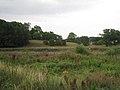
 Lagoon near Littleborough - geograph.org.uk - 2534038.jpg 1,024 × 768; 141 KB
-
 Lake beside the River Trent - geograph.org.uk - 5089780.jpg 800 × 600; 98 KB
-
 Lake next to the River Trent - geograph.org.uk - 5343435.jpg 800 × 564; 79 KB
-
 Lake next to the River Trent - geograph.org.uk - 5368483.jpg 800 × 508; 84 KB
-
 Lakes within a meander on River Trent - geograph.org.uk - 5091206.jpg 3,060 × 1,704; 3.51 MB
-
 Lea Marsh and the River Trent - geograph.org.uk - 5367548.jpg 800 × 645; 141 KB
-
 Left for West Burton - geograph.org.uk - 2193632.jpg 1,024 × 768; 139 KB
-
 Level crossing keeper's cottage, West Burton - geograph.org.uk - 4235403.jpg 1,280 × 920; 403 KB
-
 Leverton Road entering Sturton le Steeple - geograph.org.uk - 3837298.jpg 3,776 × 2,520; 3.96 MB
-
 Littleborough Cottage - geograph.org.uk - 3512082.jpg 640 × 480; 104 KB
-
 Littleborough Cottage and junction - geograph.org.uk - 3747119.jpg 2,030 × 1,313; 2.16 MB
-
 Littleborough Lane - geograph.org.uk - 3867130.jpg 3,167 × 2,159; 4.65 MB
-
 Littleborough postbox ref DH22 58 - geograph.org.uk - 4188727.jpg 960 × 1,280; 590 KB
-
 Littleborough Road - geograph.org.uk - 3512074.jpg 640 × 480; 61 KB
-
 Littleborough Road - geograph.org.uk - 3512080.jpg 640 × 480; 58 KB
-
 Littleborough Road - geograph.org.uk - 3512089.jpg 640 × 480; 68 KB
-
 Littleborough Road - geograph.org.uk - 3512094.jpg 640 × 480; 61 KB
-
 Littleborough Road - geograph.org.uk - 3885069.jpg 800 × 533; 143 KB
-
 Littleborough Road - geograph.org.uk - 3885183.jpg 800 × 533; 133 KB
-
 Littleborough Road - geograph.org.uk - 4188761.jpg 1,280 × 885; 265 KB
-
-
 Littleborough Road Nr Cottam - geograph.org.uk - 2060265.jpg 640 × 427; 64 KB
-
 Littleborough scene - geograph.org.uk - 2534343.jpg 1,024 × 768; 185 KB
-
 Littleborough Toll Cottage - geograph.org.uk - 4188644.jpg 1,280 × 960; 268 KB
-
 Long Farm Lane - geograph.org.uk - 5093458.jpg 3,072 × 1,728; 4.12 MB
-
 Looking towards West Burton Power stations - geograph.org.uk - 5093472.jpg 3,072 × 1,728; 2.85 MB
-
 Low Holland Lane heading east - geograph.org.uk - 2688728.jpg 640 × 480; 69 KB
-
 Low Holland Lane, Sturton le Steeple - geograph.org.uk - 3837252.jpg 3,776 × 2,520; 3.95 MB
-
 Mayflower House, North Street - geograph.org.uk - 4190006.jpg 1,280 × 960; 310 KB
-
 Mayflower House, North Street - geograph.org.uk - 5063956.jpg 1,024 × 768; 193 KB
-
 Meeting of bridleways - geograph.org.uk - 3044355.jpg 1,024 × 768; 210 KB
-
 Middle Lane and Mother Drain - geograph.org.uk - 2534263.jpg 1,024 × 768; 152 KB
-

-
 Mother Drain - geograph.org.uk - 3512064.jpg 640 × 480; 79 KB
-
 Mother Drain - geograph.org.uk - 3885177.jpg 800 × 533; 155 KB
-
 Mother Drain at Knaith Hall Lane - geograph.org.uk - 5087444.jpg 800 × 600; 162 KB
-
 Mother Drain at South End Lane - geograph.org.uk - 5089785.jpg 800 × 600; 131 KB
-
 Mother Drain at South End Lane - geograph.org.uk - 5089787.jpg 800 × 600; 139 KB
-
 Mother Drain near Littleborough - geograph.org.uk - 4188755.jpg 1,280 × 960; 403 KB
-
 Mother Drain seen from White Bridge - geograph.org.uk - 2534439.jpg 1,024 × 768; 149 KB
-
 Narrowboat on the River Trent - geograph.org.uk - 5089550.jpg 800 × 600; 109 KB


_-_geograph.org.uk_-_2688432.jpg)


