Category:Stuifzand (Hoogeveen)
Jump to navigation
Jump to search
| Object location | | View all coordinates using: OpenStreetMap |
|---|
village   | |||||
| Upload media | |||||
| Instance of | |||||
|---|---|---|---|---|---|
| Location |
| ||||
 | |||||
Media in category "Stuifzand (Hoogeveen)"
The following 5 files are in this category, out of 5 total.
-

-

-
 Achtergevel - Stuifzand - 20206662 - RCE.jpg 1,195 × 1,200; 460 KB
-
 Schuur - Stuifzand - 20206663 - RCE.jpg 1,183 × 1,200; 431 KB
-
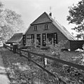 Voorgevel - Stuifzand - 20206661 - RCE.jpg 1,200 × 1,200; 390 KB


