Category:Studland
Jump to navigation
Jump to search
village and civil parish in Dorset, England  | |||||
| Upload media | |||||
| Instance of | |||||
|---|---|---|---|---|---|
| Location | Dorset, South West England, England | ||||
| Population |
| ||||
| official website | |||||
 | |||||
Subcategories
This category has the following 14 subcategories, out of 14 total.
B
- Ballard Cliff (24 F)
- Bankes Arms, Studland (7 F)
F
- Fort Henry, Studland (11 F)
H
M
- Middle Beach, Dorset (7 F)
S
- Sandbanks Ferry (63 F)
- Shell Bay, Dorset (63 F)
- Studland and Godlingston Heath (153 F)
W
- Wytch Farm Oilfield (5 F)
Media in category "Studland"
The following 200 files are in this category, out of 1,292 total.
(previous page) (next page)-
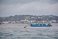
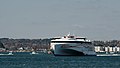 'Condor Liberation' Leaving Poole - geograph.org.uk - 4417362.jpg 5,109 × 2,874; 5.31 MB
-
 'Condor Liberation' Leaving Poole - geograph.org.uk - 4417390.jpg 4,000 × 2,666; 6.66 MB
-
 17th century Jacobean pulpit - St Nicholas' Church, Studland - geograph.org.uk - 6363849.jpg 5,472 × 7,296; 6.53 MB
-
 2 ^ 3, Watery Lane - geograph.org.uk - 4395904.jpg 640 × 426; 78 KB
-
 2010-04-05 Studland Village Hall.jpg 1,869 × 1,295; 628 KB
-
 A bridleway near Godlingston Heath - geograph.org.uk - 6362081.jpg 3,648 × 2,736; 2.29 MB
-

-
 A choice of Trails - geograph.org.uk - 2043869.jpg 1,024 × 683; 216 KB
-
 A collection of tractors - geograph.org.uk - 4002585.jpg 640 × 480; 76 KB
-
 A faded toposcope^ - geograph.org.uk - 2045203.jpg 1,024 × 683; 248 KB
-
 A field near Studland - geograph.org.uk - 268692.jpg 640 × 480; 106 KB
-
 A Field of Wheat - geograph.org.uk - 4156917.jpg 640 × 409; 406 KB
-
 A Gentle Landing - geograph.org.uk - 2619271.jpg 1,024 × 768; 182 KB
-
 A gentle ride - geograph.org.uk - 4382538.jpg 640 × 426; 79 KB
-
 A junction of bridleways near the edge of Godlingston Heath - geograph.org.uk - 6362080.jpg 3,648 × 2,736; 5.87 MB
-
 A large patch of scrub and Studland Wood - geograph.org.uk - 4837909.jpg 1,600 × 1,200; 229 KB
-
 A private view from Studland.jpg 3,264 × 2,448; 2.66 MB
-
 A trio of posts on a footpath near Studland church - geograph.org.uk - 6362083.jpg 3,648 × 2,736; 5.86 MB
-
 Access road to the sewage works - geograph.org.uk - 4368189.jpg 640 × 426; 102 KB
-
 Across Brands Bay to Goathorn Point - geograph.org.uk - 288393.jpg 640 × 480; 96 KB
-
 Across to Sandbanks - geograph.org.uk - 4687342.jpg 800 × 530; 427 KB
-
 Across to Sandbanks - geograph.org.uk - 4687361.jpg 800 × 530; 501 KB
-
 Aggleston Rock, Godlingston Heath - geograph.org.uk - 5504984.jpg 640 × 530; 115 KB
-
 Almost at the ferry - geograph.org.uk - 2349048.jpg 800 × 600; 92 KB
-

-

-

-
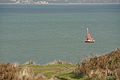
 Anti-Tank defences Studland Bay - geograph.org.uk - 3528538.jpg 640 × 480; 128 KB
-
 Approach to Sandbanks Toll - geograph.org.uk - 2349041.jpg 640 × 480; 55 KB
-
-
 Arch in the stacks at Old Harry - geograph.org.uk - 6063470.jpg 1,024 × 683; 208 KB
-
 Argiope bruennichi (Wasp Spider) - geograph.org.uk - 6060387.jpg 1,600 × 1,067; 343 KB
-
 Arrival of the Condor Express - geograph.org.uk - 2461959.jpg 4,592 × 3,056; 4.45 MB
-
 Arriving at Brownsea Island - geograph.org.uk - 5091425.jpg 640 × 480; 69 KB
-
 At Redhorn Quay, Poole Harbour - geograph.org.uk - 6060742.jpg 1,600 × 900; 395 KB
-
 B3351 - geograph.org.uk - 4368150.jpg 640 × 426; 81 KB
-
 B3351 on Dean Hill - geograph.org.uk - 1945169.jpg 640 × 480; 198 KB
-
 B3351 Swanage Road - geograph.org.uk - 5725871.jpg 640 × 428; 151 KB
-
 B3351 towards Studland - geograph.org.uk - 5725923.jpg 640 × 428; 138 KB
-
 B3351 towards Studland - geograph.org.uk - 5725926.jpg 640 × 428; 96 KB
-
 B3351 towards Studland - geograph.org.uk - 5725939.jpg 640 × 428; 86 KB
-
 B3351 towards Studland - geograph.org.uk - 5725946.jpg 640 × 428; 127 KB
-
 Back of the beach, Studland - geograph.org.uk - 4382467.jpg 640 × 426; 85 KB
-
-
 Ballard Cliff - geograph.org.uk - 5393769.jpg 1,600 × 1,200; 852 KB
-
 Ballard Down - geograph.org.uk - 5405665.jpg 1,024 × 752; 244 KB
-
 Ballard Down Trigpoint - geograph.org.uk - 5405676.jpg 1,024 × 758; 283 KB
-
 Ballard Point - geograph.org.uk - 5668100.jpg 771 × 514; 168 KB
-
 Ballard Point from White Cliff Beach - geograph.org.uk - 5393758.jpg 1,600 × 1,200; 740 KB
-
 Ballard Point in Swanage Bay - geograph.org.uk - 5010029.jpg 1,500 × 952; 196 KB
-
 Bankes Arms pub, Studland - geograph.org.uk - 5890722.jpg 1,463 × 1,080; 1,021 KB
-
 Barbecue area on the edge of the dunes - geograph.org.uk - 5916300.jpg 1,024 × 768; 90 KB
-
 Beach and rainbow at Studland Bay - geograph.org.uk - 5639231.jpg 5,312 × 2,988; 3.54 MB
-
 Beach at Brownsea Island - geograph.org.uk - 5423321.jpg 5,184 × 3,413; 3.96 MB
-
 Beach at Brownsea Island - geograph.org.uk - 5423323.jpg 4,000 × 3,000; 3.36 MB
-
 Beach at Brownsea Island - geograph.org.uk - 5423325.jpg 5,184 × 3,456; 4.63 MB
-
 Beach at Brownsea Island - geograph.org.uk - 5423327.jpg 5,184 × 3,456; 5.4 MB
-
 Beach at Brownsea Island - geograph.org.uk - 5423330.jpg 5,184 × 3,456; 5.78 MB
-
 Beach at Brownsea Island - geograph.org.uk - 5423365.jpg 4,000 × 3,000; 2.79 MB
-
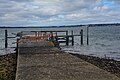
 Beach at South Haven Point - geograph.org.uk - 2349492.jpg 800 × 600; 104 KB
-
 Beach at South Haven Point - geograph.org.uk - 6267948.jpg 800 × 534; 68 KB
-
 Beach at Studland - geograph.org.uk - 4837912.jpg 1,200 × 1,600; 321 KB
-

-
 Beach by Pottery Pier - geograph.org.uk - 5423368.jpg 4,000 × 3,000; 3.05 MB
-
 Beach Huts - Studland South Beach - geograph.org.uk - 5402130.jpg 886 × 552; 87 KB
-
 Beach huts at Middle Beach, Studland - geograph.org.uk - 6362031.jpg 3,648 × 2,736; 3.86 MB
-
 Beach huts at Studland - geograph.org.uk - 5014442.jpg 1,500 × 999; 284 KB
-
 Beach huts on Studland Beach - geograph.org.uk - 5014473.jpg 1,500 × 999; 190 KB
-
 Beach near Pottery Pier - geograph.org.uk - 5417351.jpg 5,184 × 3,456; 4.86 MB
-
 Beach near Pottery Pier - geograph.org.uk - 5423367.jpg 4,000 × 3,000; 3.63 MB
-
 Beach on Studland Heath - geograph.org.uk - 5336861.jpg 640 × 480; 21 KB
-

-
 Beach, South Haven Point - geograph.org.uk - 5727589.jpg 640 × 480; 94 KB
-
 Bench Mark - geograph.org.uk - 4156713.jpg 402 × 640; 411 KB
-
 Bench near Handfast Point - geograph.org.uk - 6292368.jpg 4,288 × 2,848; 2.07 MB
-

-
 Blackthorn blossom by the coast path - geograph.org.uk - 6292308.jpg 4,092 × 2,451; 1.72 MB
-
 Blow out - geograph.org.uk - 4377030.jpg 640 × 426; 73 KB
-

-
 Boat off Brownsea Island - geograph.org.uk - 5423403.jpg 5,184 × 3,456; 7.54 MB
-
 Boat off Studland (2564).jpg 4,288 × 2,848; 4.43 MB
-
 Boat off Studland (2586).jpg 4,288 × 2,848; 4.31 MB
-
 Boats near South Haven Point - geograph.org.uk - 6267945.jpg 800 × 334; 62 KB
-
 Boundary Stone - geograph.org.uk - 3685092.jpg 640 × 480; 125 KB
-
 Boundary Stone - geograph.org.uk - 4156795.jpg 427 × 640; 499 KB
-
 Boundary stone - geograph.org.uk - 4537864.jpg 640 × 480; 105 KB
-
 Boundary stone on Ballard Down - geograph.org.uk - 5153606.jpg 640 × 427; 63 KB
-

-
-
 Bournemouth from Studland (2514).jpg 4,288 × 2,848; 3.72 MB
-
 Bournemouth from Studland (2532).jpg 4,288 × 2,848; 3.62 MB
-
 Bournemouth from Studland (2533).jpg 4,288 × 2,848; 3.91 MB
-
 Bournemouth from Studland (2555).jpg 4,288 × 2,848; 4.04 MB
-
 Bournemouth from Studland (2561).jpg 4,288 × 2,848; 3.68 MB
-
 Bramble Bush Bay - geograph.org.uk - 2617778.jpg 3,648 × 2,736; 2.13 MB
-
 Bramble Bush Bay, pond - geograph.org.uk - 1255815.jpg 640 × 480; 116 KB
-
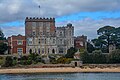
 Branksea Castle - geograph.org.uk - 4973680.jpg 640 × 481; 441 KB
-
 Branksea Castle - geograph.org.uk - 5242124.jpg 640 × 427; 65 KB
-

-
 Bridleway off the B3351 - geograph.org.uk - 4368167.jpg 640 × 426; 104 KB
-
 Bridleway on Studland Hill - geograph.org.uk - 6293056.jpg 1,111 × 1,533; 399 KB
-
 Brookdene - geograph.org.uk - 4389054.jpg 640 × 426; 109 KB
-
 Brownsea Church - geograph.org.uk - 5144406.jpg 800 × 600; 159 KB
-
 Brownsea Deer - geograph.org.uk - 5144428.jpg 800 × 600; 222 KB
-
 Brownsea Farm - geograph.org.uk - 4973269.jpg 640 × 480; 633 KB
-
 Brownsea Heath - geograph.org.uk - 5144492.jpg 800 × 600; 113 KB
-
 Brownsea Island , Baden Powell First Camp Memorial - geograph.org.uk - 5735434.jpg 6,000 × 4,000; 6.07 MB
-
 Brownsea Island , Brownsea Castle - geograph.org.uk - 5734664.jpg 6,000 × 4,000; 6.22 MB
-
 Brownsea Island , Brownsea Castle - geograph.org.uk - 5735449.jpg 6,000 × 4,000; 7.45 MB
-
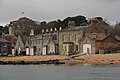 Brownsea Island , Buildings - geograph.org.uk - 5734649.jpg 6,000 × 4,000; 7.13 MB
-
 Brownsea Island , Buildings - geograph.org.uk - 5734655.jpg 6,000 × 4,000; 7.49 MB
-
 Brownsea Island , Carpenter's Cottage - geograph.org.uk - 5735446.jpg 6,000 × 4,000; 6.18 MB
-
 Brownsea Island , Channel Markers - geograph.org.uk - 5735424.jpg 6,000 × 4,000; 5.49 MB
-
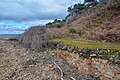
 Brownsea Island , Coastal Scenery - geograph.org.uk - 5735417.jpg 6,000 × 4,000; 5.94 MB
-
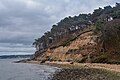 Brownsea Island , Coastal Scenery - geograph.org.uk - 5735418.jpg 6,000 × 4,000; 7.08 MB
-
 Brownsea Island , Coastal Scenery - geograph.org.uk - 5735420.jpg 6,000 × 4,000; 5.84 MB
-
 Brownsea Island , Coastal Scenery - geograph.org.uk - 5735421.jpg 4,000 × 6,000; 7.59 MB
-
 Brownsea Island , Coastal Scenery - geograph.org.uk - 5735422.jpg 6,000 × 4,000; 7.87 MB
-
 Brownsea Island , Coastal Scenery - geograph.org.uk - 5735423.jpg 6,000 × 4,000; 7.04 MB
-
 Brownsea Island , Coastal Scenery - geograph.org.uk - 5735425.jpg 6,000 × 4,000; 6.89 MB
-
 Brownsea Island , Deer Park Road - geograph.org.uk - 5735436.jpg 6,000 × 4,000; 7.46 MB
-
 Brownsea Island , Deer Park Road - geograph.org.uk - 5735438.jpg 6,000 × 4,000; 6.81 MB
-
 Brownsea Island , Deer Park Road - geograph.org.uk - 5735439.jpg 6,000 × 4,000; 7.53 MB
-
 Brownsea Island , Deer Park Road - geograph.org.uk - 5735440.jpg 6,000 × 4,000; 6.8 MB
-
 Brownsea Island , Deer Park Road - geograph.org.uk - 5735441.jpg 6,000 × 4,000; 6.99 MB
-
 Brownsea Island , Deer Park Road - geograph.org.uk - 5735442.jpg 6,000 × 4,000; 7.78 MB
-
 Brownsea Island , East Lake - geograph.org.uk - 5735202.jpg 6,000 × 4,000; 6.87 MB
-
 Brownsea Island , Footpath - geograph.org.uk - 5734666.jpg 6,000 × 4,000; 7.27 MB
-
 Brownsea Island , Footpath - geograph.org.uk - 5734667.jpg 6,000 × 4,000; 7.5 MB
-
 Brownsea Island , Footpath - geograph.org.uk - 5734669.jpg 6,000 × 4,000; 7.74 MB
-
 Brownsea Island , Footpath - geograph.org.uk - 5734672.jpg 6,000 × 4,000; 6.46 MB
-
 Brownsea Island , Footpath - geograph.org.uk - 5734673.jpg 6,000 × 4,000; 7.7 MB
-
 Brownsea Island , Footpath - geograph.org.uk - 5735183.jpg 5,785 × 3,856; 6.31 MB
-
 Brownsea Island , Footpath - geograph.org.uk - 5735184.jpg 6,000 × 4,000; 7.13 MB
-
 Brownsea Island , Footpath - geograph.org.uk - 5735195.jpg 6,000 × 4,000; 7.64 MB
-
 Brownsea Island , Footpath - geograph.org.uk - 5735197.jpg 6,000 × 4,000; 6.15 MB
-
 Brownsea Island , Footpath - geograph.org.uk - 5735199.jpg 6,000 × 4,000; 6.41 MB
-
 Brownsea Island , Footpath - geograph.org.uk - 5735204.jpg 6,000 × 4,000; 7.57 MB
-
 Brownsea Island , Footpath - geograph.org.uk - 5735206.jpg 6,000 × 4,000; 6.53 MB
-
 Brownsea Island , Footpath - geograph.org.uk - 5735212.jpg 6,000 × 4,000; 6.81 MB
-
 Brownsea Island , Footpath - geograph.org.uk - 5735214.jpg 4,000 × 6,000; 6.28 MB
-
 Brownsea Island , Footpath - geograph.org.uk - 5735389.jpg 4,000 × 6,000; 6.9 MB
-
 Brownsea Island , Footpath - geograph.org.uk - 5735397.jpg 6,000 × 4,000; 7.42 MB
-
 Brownsea Island , Footpath - geograph.org.uk - 5735399.jpg 6,000 × 4,000; 7.46 MB
-
 Brownsea Island , Footpath - geograph.org.uk - 5735400.jpg 4,000 × 6,000; 6.03 MB
-
 Brownsea Island , Footpath - geograph.org.uk - 5735404.jpg 6,000 × 4,000; 6.82 MB
-
 Brownsea Island , Footpath - geograph.org.uk - 5735405.jpg 6,000 × 4,000; 6.24 MB
-
 Brownsea Island , Footpath - geograph.org.uk - 5735406.jpg 6,000 × 4,000; 7.08 MB
-
 Brownsea Island , Footpath - geograph.org.uk - 5735427.jpg 4,000 × 6,000; 7.75 MB
-
 Brownsea Island , Footpath - geograph.org.uk - 5735429.jpg 6,000 × 4,000; 6.09 MB
-
 Brownsea Island , Footpath - geograph.org.uk - 5735430.jpg 6,000 × 4,000; 6.44 MB
-
 Brownsea Island , Footpath - geograph.org.uk - 5735432.jpg 6,000 × 4,000; 7.26 MB
-
 Brownsea Island , Footpath - geograph.org.uk - 5735433.jpg 6,000 × 4,000; 7.83 MB
-
 Brownsea Island , Gatehouse - geograph.org.uk - 5734662.jpg 6,000 × 4,000; 7.53 MB
-
 Brownsea Island , Gatehouse - geograph.org.uk - 5735445.jpg 6,000 × 4,000; 7.08 MB
-
 Brownsea Island , Grassland - geograph.org.uk - 5734675.jpg 6,000 × 4,000; 6.31 MB
-
 Brownsea Island , Grassy Footpath - geograph.org.uk - 5735412.jpg 6,000 × 4,000; 6.5 MB
-
 Brownsea Island , Grassy Footpath - geograph.org.uk - 5735415.jpg 6,000 × 4,000; 5.94 MB
-
 Brownsea Island , Horse Field - geograph.org.uk - 5735437.jpg 6,000 × 4,000; 7.5 MB
-
 Brownsea Island , Information Sign - geograph.org.uk - 5735426.jpg 6,000 × 4,000; 7.62 MB
-
 Brownsea Island , Island Scenery - geograph.org.uk - 5734656.jpg 6,000 × 4,000; 7.63 MB
-
 Brownsea Island , Island Scenery - geograph.org.uk - 5734658.jpg 6,000 × 4,000; 5.17 MB
-
 Brownsea Island , Island Scenery - geograph.org.uk - 5735448.jpg 6,000 × 4,000; 6.22 MB
-
 Brownsea Island , Lookout Hut - geograph.org.uk - 5734665.jpg 6,000 × 4,000; 6.39 MB
-
 Brownsea Island , Lord Baden Powell Statue - geograph.org.uk - 5734663.jpg 4,000 × 6,000; 5.77 MB
-
 Brownsea Island , Marshland - geograph.org.uk - 5734668.jpg 6,000 × 4,000; 7.48 MB
-
 Brownsea Island , Marshland - geograph.org.uk - 5734671.jpg 6,000 × 4,000; 7.55 MB
-
 Brownsea Island , Maryland - geograph.org.uk - 5735409.jpg 6,000 × 4,000; 6.74 MB
-
 Brownsea Island , Maryland - geograph.org.uk - 5735410.jpg 6,000 × 4,000; 6.87 MB
-
 Brownsea Island , Maryland - geograph.org.uk - 5735411.jpg 6,000 × 4,000; 6.93 MB
-
 Brownsea Island , Middle Street - geograph.org.uk - 5735213.jpg 6,000 × 4,000; 6.51 MB
-
 Brownsea Island , Middle Street - geograph.org.uk - 5735297.jpg 6,000 × 4,000; 7.31 MB
-
 Brownsea Island , Middle Street - geograph.org.uk - 5735384.jpg 6,000 × 4,000; 7.46 MB
-
 Brownsea Island , Middle Street - geograph.org.uk - 5735386.jpg 6,000 × 4,000; 6.36 MB
-
 Brownsea Island , Middle Street - geograph.org.uk - 5735390.jpg 6,000 × 4,000; 6.3 MB
-
 Brownsea Island , Middle Street - geograph.org.uk - 5735391.jpg 6,000 × 4,000; 7.59 MB
-
 Brownsea Island , Middle Street - geograph.org.uk - 5735396.jpg 6,000 × 4,000; 5.74 MB
-
 Brownsea Island , Middle Street - geograph.org.uk - 5735398.jpg 6,000 × 4,000; 6.27 MB
-
 Brownsea Island , National Trust Buildings - geograph.org.uk - 5734661.jpg 6,000 × 4,000; 7.73 MB
-
 Brownsea Island , Open Space - geograph.org.uk - 5735443.jpg 6,000 × 4,000; 6.24 MB
-
 Brownsea Island , Open Space - geograph.org.uk - 5735444.jpg 6,000 × 4,000; 6.46 MB
-
 Brownsea Island , Parkyn Copse - geograph.org.uk - 5735403.jpg 6,000 × 4,000; 5.64 MB
-
 Brownsea Island , Penelope Park - geograph.org.uk - 5735431.jpg 6,000 × 4,000; 7.68 MB
-
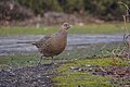 Brownsea Island , Pheasant - geograph.org.uk - 5735435.jpg 6,000 × 4,000; 5.26 MB
-
 Brownsea Island , Play Area - geograph.org.uk - 5735395.jpg 6,000 × 4,000; 6.72 MB
-
 Brownsea Island , Poole Harbour - geograph.org.uk - 5734659.jpg 6,000 × 4,000; 5.07 MB
-
 Brownsea Island , Poole Harbour - geograph.org.uk - 5734676.jpg 6,000 × 4,000; 6.27 MB
-
 Brownsea Island , Poole Harbour - geograph.org.uk - 5735419.jpg 6,000 × 4,000; 5.57 MB
-
 Brownsea Island , Poole Harbour Scenery - geograph.org.uk - 5735428.jpg 6,000 × 4,000; 7.39 MB
-
 Brownsea Island , Pottery Pier - geograph.org.uk - 5735416.jpg 6,000 × 4,000; 7.72 MB
-
 Brownsea Island , Red Squirrel - geograph.org.uk - 5735189.jpg 6,000 × 4,000; 5.19 MB
-
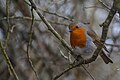 Brownsea Island , Robin - geograph.org.uk - 5734677.jpg 6,000 × 4,000; 7.59 MB
-
 Brownsea Island , The Lagoon - geograph.org.uk - 5734678.jpg 6,000 × 4,000; 6.52 MB
-
 Brownsea Island , The Lagoon - geograph.org.uk - 5734679.jpg 6,000 × 4,000; 7.14 MB
-
 Brownsea Island , The Lagoon - geograph.org.uk - 5735209.jpg 6,000 × 4,000; 7.36 MB
-
 Brownsea Island , The Villa - geograph.org.uk - 5735193.jpg 6,000 × 4,000; 7.5 MB
-
 Brownsea Island , The Villa - geograph.org.uk - 5735207.jpg 6,000 × 4,000; 7 MB
-
 Brownsea Island , Tree - geograph.org.uk - 5734670.jpg 6,000 × 4,000; 5.08 MB
-
 Brownsea Island , Tree - geograph.org.uk - 5735188.jpg 4,000 × 6,000; 5.87 MB
-
 Brownsea Island , West Lake - geograph.org.uk - 5735388.jpg 6,000 × 4,000; 7.26 MB


,_off_Studland_Bay,_Dorset,_UK._MOD_45155975.jpg)


_-_geograph.org.uk_-_6060387.jpg)


.jpg)
.jpg)


.jpg)
.jpg)
.jpg)
.jpg)
.jpg)


