Category:Stubshaw Cross, Ashton-in-Makerfield
Jump to navigation
Jump to search
Media in category "Stubshaw Cross, Ashton-in-Makerfield"
The following 21 files are in this category, out of 21 total.
-
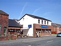
 Ashton Carpets - geograph.org.uk - 6217282.jpg 800 × 533; 504 KB
-
 Avon Road joins Riding Lane at Stubshaw Cross - geograph.org.uk - 2059781.jpg 1,600 × 1,198; 285 KB
-

-
 Bolton Road (A58), Stubshaw Cross - geograph.org.uk - 3334344.jpg 640 × 480; 61 KB
-
 Bolton Road at Stubshaw Cross - geograph.org.uk - 3387050.jpg 640 × 480; 54 KB
-
 Bolton Road north of Stubshaw Cross - geograph.org.uk - 3387717.jpg 640 × 480; 41 KB
-
 Bolton Road, Stubshaw Cross - geograph.org.uk - 6217212.jpg 800 × 600; 612 KB
-
 Edge Green Road - geograph.org.uk - 6217326.jpg 800 × 533; 586 KB
-

-
 Footpath near Lily Lane Farm - geograph.org.uk - 6217197.jpg 800 × 600; 751 KB
-
 Heritage Garden at Stubshaw Cross - geograph.org.uk - 6217272.jpg 600 × 800; 646 KB
-
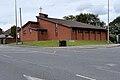 St Luke's Church Centre, Stubshaw Cross - geograph.org.uk - 6217278.jpg 800 × 533; 505 KB
-
 Stubshaw Cross Heritage Garden - geograph.org.uk - 6217274.jpg 800 × 600; 653 KB
-

-

-

-
 The Harrow Inn, Edge Green Road - geograph.org.uk - 6217331.jpg 800 × 533; 554 KB
-
 The Road to Ashton-in-Makerfield - geograph.org.uk - 6217283.jpg 800 × 533; 463 KB
-
 The Stables, Lily Lane Farm - geograph.org.uk - 6217200.jpg 800 × 533; 461 KB
-
 The Triangle Snooker Club at Stubshaw Cross - geograph.org.uk - 2044750.jpg 1,600 × 1,198; 390 KB
-
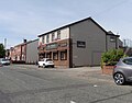 Triangle Snooker Club, Stubshaw Cross - geograph.org.uk - 5826324.jpg 1,024 × 803; 139 KB


,_Stubshaw_Cross_-_geograph.org.uk_-_3334344.jpg)


