Category:Stubble fields in Midlothian
Jump to navigation
Jump to search
Media in category "Stubble fields in Midlothian"
The following 18 files are in this category, out of 18 total.
-
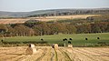 Bales, Blackcastle - geograph.org.uk - 1025045.jpg 640 × 359; 82 KB
-
 Expanding Pathhead - geograph.org.uk - 38054.jpg 640 × 480; 76 KB
-
 Harvested field, Pathhead - geograph.org.uk - 1482941.jpg 640 × 377; 71 KB
-
 Harvested field, Pathhead - geograph.org.uk - 1482949.jpg 640 × 480; 111 KB
-
 Pylons and stubble. - geograph.org.uk - 49095.jpg 640 × 480; 60 KB
-
 Rooks and stubble, Fala. - geograph.org.uk - 83048.jpg 640 × 417; 56 KB
-
 Stubble and trees near Whitehill - geograph.org.uk - 1565119.jpg 640 × 480; 102 KB
-
 Stubble and woodland strip - geograph.org.uk - 1174313.jpg 640 × 480; 57 KB
-
 Stubble field at Middleton - geograph.org.uk - 1185389.jpg 640 × 480; 77 KB
-
 Stubble field near Fordel Mains - geograph.org.uk - 1565319.jpg 640 × 480; 104 KB
-
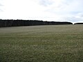
 Stubble landscape, Midlothian - geograph.org.uk - 1597279.jpg 640 × 480; 93 KB
-
 Stubble near Cakemuir - geograph.org.uk - 541667.jpg 640 × 480; 72 KB
-
 Stubble near Capielaw. - geograph.org.uk - 49144.jpg 640 × 480; 91 KB
-
 Stubble off the Salter's Road. - geograph.org.uk - 82963.jpg 640 × 480; 101 KB
-
 Stubble, Blackcastle - geograph.org.uk - 544955.jpg 640 × 480; 98 KB
-
 Stubble, Fala. - geograph.org.uk - 83058.jpg 640 × 480; 79 KB
-
 Stubble, Fordel. - geograph.org.uk - 43864.jpg 640 × 480; 62 KB
-
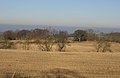
 Whitehill - geograph.org.uk - 582476.jpg 640 × 480; 80 KB


