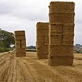
Category:Stubble fields in Lincolnshire
Jump to navigation
Jump to search
Ceremonial counties of England: Berkshire · Cornwall · East Riding of Yorkshire · East Sussex · Herefordshire · Lancashire · Lincolnshire · Norfolk · North Yorkshire · Wiltshire ·
City-counties:
Former historic counties:
Other former counties:
City-counties:
Former historic counties:
Other former counties:
Subcategories
This category has the following 3 subcategories, out of 3 total.
B
- Stubble fields in Bonby (2 F)
H
- Stubble fields in Horkstow (10 F)
Media in category "Stubble fields in Lincolnshire"
The following 45 files are in this category, out of 45 total.
-
"God speed the plough" - geograph.org.uk - 953269.jpg 640 × 457; 148 KB
-
A gap in the hedge - geograph.org.uk - 590653.jpg 640 × 480; 63 KB
-
Bales of wheat straw, Laughton, Lincs - geograph.org.uk - 227505.jpg 640 × 480; 295 KB
-
At the top of Gorse Hill - geograph.org.uk - 256864.jpg 640 × 427; 152 KB
-
Barn at Sand Hills - geograph.org.uk - 518445.jpg 640 × 426; 109 KB
-
After the Harvest - geograph.org.uk - 2551152.jpg 1,280 × 1,280; 1.42 MB
-
Large Balestack - geograph.org.uk - 244348.jpg 640 × 427; 79 KB
-
BIG bales - geograph.org.uk - 297896.jpg 640 × 480; 131 KB
-
Stubble field near Atterby - geograph.org.uk - 544683.jpg 640 × 480; 117 KB
-
Country road near Swayfield - geograph.org.uk - 629027.jpg 640 × 427; 63 KB
-
Cultivating on Beacon Hill - geograph.org.uk - 2545178.jpg 1,280 × 1,280; 1.11 MB
-
Farm track at Keisby House Farm - geograph.org.uk - 600828.jpg 640 × 427; 100 KB
-
Farm track to Cradge Farm - geograph.org.uk - 589702.jpg 640 × 427; 103 KB
-
Farmland in the Fens - geograph.org.uk - 589008.jpg 640 × 427; 99 KB
-
Fens, Hop Pole - geograph.org.uk - 961466.jpg 640 × 480; 47 KB
-
Footpath to Stainfield Spa - geograph.org.uk - 983602.jpg 640 × 427; 113 KB
-
Farmland near Walk Farm. - geograph.org.uk - 1010290.jpg 640 × 457; 142 KB
-
Bag Enderby farmland - geograph.org.uk - 511821.jpg 640 × 427; 85 KB
-
Harvest field at Alvingham, Lincolnshire - geograph.org.uk - 953158.jpg 640 × 457; 139 KB
-
Harvest's Over - geograph.org.uk - 1467503.jpg 640 × 480; 169 KB
-
Langtoft Fen - geograph.org.uk - 589036.jpg 640 × 427; 93 KB
-
The Viking Way near Marston - geograph.org.uk - 215710.jpg 640 × 427; 83 KB
-
The A1173 To Riby - geograph.org.uk - 554666.jpg 640 × 480; 123 KB
-
Straw Baling at New Holland - geograph.org.uk - 2038986.jpg 1,000 × 750; 181 KB
-
Stubble Field near Barton Hill Farm - geograph.org.uk - 1456999.jpg 640 × 480; 86 KB
-
The Grange, Firsby - geograph.org.uk - 471744.jpg 640 × 403; 67 KB
-
The Track to Grange Farm - geograph.org.uk - 979450.jpg 640 × 446; 77 KB
-
Farmland on Thurlby Fen - geograph.org.uk - 587836.jpg 640 × 427; 113 KB
-
Looking towards Winteringham - geograph.org.uk - 930981.jpg 640 × 480; 102 KB
-
On the Winterton Footpath - geograph.org.uk - 223091.jpg 640 × 480; 143 KB
-
Stubble Field with Glider - geograph.org.uk - 223914.jpg 640 × 480; 116 KB
-
Baler at work near Southwold Farm - geograph.org.uk - 1458310.jpg 640 × 425; 88 KB
-
Baling near Southwold Farm - geograph.org.uk - 1453329.jpg 640 × 425; 85 KB
-
Harvest Time - geograph.org.uk - 52339.jpg 640 × 482; 135 KB
-
Stubble Field near Southwold Farm - geograph.org.uk - 1453339.jpg 640 × 425; 99 KB
-
Stubble Field on Elsham Hill - geograph.org.uk - 1462371.jpg 640 × 425; 44 KB
-
Wrawby Postmill - geograph.org.uk - 54031.jpg 640 × 480; 139 KB
-
Farmland in Whaplode - geograph.org.uk - 592175.jpg 640 × 480; 66 KB
-
Farmland, Mareham on the Hill - geograph.org.uk - 560253.jpg 640 × 480; 104 KB
-
Farmland, Mareham on the Hill - geograph.org.uk - 560271.jpg 640 × 480; 91 KB
-
Straw and Tumuli - geograph.org.uk - 230975.jpg 640 × 480; 108 KB


