Category:Structures in San Bernardino County, California
Jump to navigation
Jump to search
Counties of California: Alameda · Amador · Butte · Calaveras · Contra Costa · Del Norte · El Dorado · Fresno · Glenn · Humboldt · Imperial · Inyo · Kern · Kings · Lake · Lassen · Los Angeles · Madera · Marin · Mariposa · Mendocino · Merced · Modoc · Mono · Monterey · Napa · Nevada · Orange · Placer · Plumas · Riverside · Sacramento · San Benito · San Bernardino · San Diego · San Joaquin · San Luis Obispo · San Mateo · Santa Barbara · Santa Clara · Santa Cruz · Shasta · Sierra · Siskiyou · Solano · Sonoma · Stanislaus · Tehama · Trinity · Tulare · Tuolumne · Ventura · Yuba – Consolidated city-county: San Francisco
Subcategories
This category has the following 16 subcategories, out of 16 total.
B
G
- Gene Pump Plant (21 F)
I
- Integratron (19 F)
- Iron Mountain Pump Plant (13 F)
K
- Keller Peak Lookout (7 F)
L
- Lake Hodges Flume (26 F)
M
- Mount Baldy Ski Lifts (12 F)
S
W
- Whitsett Pump Plant (19 F)
Media in category "Structures in San Bernardino County, California"
The following 34 files are in this category, out of 34 total.
-
069 Bailey Peak Trail Views (65) - Bailey Peak, With Antenna Towers.jpg 3,000 × 2,000; 4.2 MB
-
A Lone Desert Resident - panoramio.jpg 2,592 × 1,560; 884 KB
-
Backup Units Waiting on Standby - panoramio.jpg 2,592 × 1,936; 2.35 MB
-
Broken Windmill - panoramio.jpg 1,600 × 1,067; 1.42 MB
-
Bunker - panoramio (14).jpg 4,288 × 3,216; 3.38 MB
-
Buried Fiberoptic Fiber - panoramio.jpg 1,936 × 2,592; 2.81 MB
-
Cell Tower and Power Lines - panoramio.jpg 1,936 × 2,592; 2.33 MB
-
Communications Antenna for the Relay - panoramio.jpg 2,592 × 1,936; 1.71 MB
-
Essex, CA GWEN site 1.jpg 2,448 × 3,264; 2.84 MB
-
Government Holes - panoramio.jpg 1,600 × 1,067; 1.74 MB
-
Hart Mine - panoramio.jpg 1,600 × 1,067; 1.49 MB
-
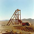
HEADFRAME, 1965 - NOW GONE - panoramio.jpg 945 × 934; 1.08 MB
-
Mysterious Pump Station for "Seepage" - panoramio.jpg 1,936 × 2,592; 2.38 MB
-
October 2012 - panoramio (41).jpg 4,000 × 3,000; 4.69 MB
-
October 2012 - panoramio (5).jpg 4,000 × 3,000; 2.98 MB
-
October 2012 - panoramio (6).jpg 4,000 × 3,000; 4.63 MB
-
October 2012 - panoramio (7).jpg 4,000 × 3,000; 4.82 MB
-
Old Antenna Dish - panoramio.jpg 1,936 × 2,592; 2.14 MB
-
Power lines - panoramio (2).jpg 2,592 × 3,888; 2.94 MB
-
Power, Water, and Fiber Optics - panoramio.jpg 2,592 × 1,936; 2.02 MB
-
Power, Water, and Fire Optic Node - panoramio.jpg 2,592 × 1,936; 2.16 MB
-
Solar Power - panoramio.jpg 3,888 × 2,592; 3.71 MB
-
Stone Structure - panoramio.jpg 2,000 × 1,500; 791 KB
-
The Distant Peak of Radio Transmission - panoramio.jpg 2,592 × 1,936; 2.16 MB
-
The Winding Road to the high mountain transmission towers - panoramio.jpg 2,592 × 1,936; 2.47 MB
-
Travelers No Longer Welcome - panoramio.jpg 2,592 × 1,936; 1.81 MB
-
Turbine hall at Parker Dam 1973.jpg 2,534 × 2,066; 826 KB
-
Turquise Mountain - panoramio.jpg 2,048 × 1,360; 785 KB
-
U.S. 395 LOOKING SOUTH TOWARDS KRAMER JUNCTION - panoramio.jpg 1,600 × 1,200; 137 KB
-
Water, Power, and Communications All in One - panoramio.jpg 2,592 × 1,936; 2.21 MB
-
Water, Power, and Fiber Optic Node just beyond the pavement - panoramio.jpg 2,592 × 1,936; 1.67 MB
-
Water, Power, Communications at Sunset - panoramio.jpg 2,592 × 1,936; 2.09 MB
-
Wells, Water Tanks, Power Transformer, and Communications Relay - panoramio.jpg 2,592 × 1,936; 2.67 MB
-
Yellow Water Line - panoramio.jpg 1,936 × 2,592; 2.51 MB


