Category:Structures in Devon
Appearance
Ceremonial counties of England: Bedfordshire · Berkshire · Buckinghamshire · Cambridgeshire · Cheshire · Cornwall · Cumbria · Derbyshire · Devon · Dorset · Durham · East Riding of Yorkshire · East Sussex · Essex · Gloucestershire · Greater London · Greater Manchester · Hampshire · Herefordshire · Hertfordshire · Kent · Lancashire · Leicestershire · Lincolnshire · Merseyside · Norfolk · North Yorkshire · Northamptonshire · Northumberland · Nottinghamshire · Oxfordshire · Rutland · Shropshire · Somerset · South Yorkshire · Staffordshire · Suffolk · Surrey · Tyne and Wear · Warwickshire · West Midlands · West Sussex · West Yorkshire · Wiltshire · Worcestershire
City-counties: Bristol · City of London
Former historic counties: Huntingdonshire ·
Other former counties:
City-counties: Bristol · City of London
Former historic counties: Huntingdonshire ·
Other former counties:
Subcategories
This category has the following 44 subcategories, out of 44 total.
*
A
B
- Bird hides in Devon (8 F)
C
D
E
F
G
L
M
P
- Phillip Lucette Beacon (12 F)
- Plant nurseries in Devon (13 F)
- Playgrounds in Devon (70 F)
- Pumping stations in Devon (14 F)
R
- Rocket Pole, Lundy (1 F)
S
- Scaffolding in Devon (18 F)
- Sluices in Devon (50 F)
- Stiles in Devon (171 F)
T
- Trig points in Devon (86 F)
V
W
- Watering troughs in Devon (18 F)
- Wind turbines in Devon (10 F)
Media in category "Structures in Devon"
The following 110 files are in this category, out of 110 total.
-
A crown of thorns - geograph.org.uk - 1521475.jpg 640 × 480; 62 KB
-
Aqueduct flows towards the River Otter - geograph.org.uk - 1701396.jpg 480 × 640; 132 KB
-
Aqueduct, East Budleigh (2) - geograph.org.uk - 1112460.jpg 640 × 430; 79 KB
-
Aqueduct, East Budleigh - geograph.org.uk - 1112457.jpg 640 × 430; 98 KB
-
Arch, Plympton - geograph.org.uk - 1620018.jpg 480 × 640; 71 KB
-
At your convenience - geograph.org.uk - 1399147.jpg 640 × 480; 102 KB
-
Beacon above Plymouth Sound - geograph.org.uk - 1579711.jpg 640 × 420; 62 KB
-
Beacon at Devil's Point - geograph.org.uk - 917277.jpg 480 × 640; 60 KB
-
Beacon, cat and tractor - geograph.org.uk - 942042.jpg 640 × 482; 68 KB
-
Berry Head DVOR - geograph.org.uk - 495495.jpg 640 × 423; 44 KB
-
Berry Head DVOR - geograph.org.uk - 940050.jpg 640 × 480; 90 KB
-
Berry Head, lookout-type building - geograph.org.uk - 1464928.jpg 640 × 480; 70 KB
-
Bird Hide at Wistlandpound - geograph.org.uk - 1498602.jpg 640 × 480; 114 KB
-
Birdwatching Hide - geograph.org.uk - 941297.jpg 640 × 428; 102 KB
-
Bottle Kiln and Water Feature - geograph.org.uk - 500930.jpg 438 × 640; 56 KB
-
Bottle kiln, Liverton - geograph.org.uk - 132073.jpg 640 × 480; 85 KB
-
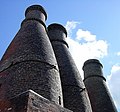
Bottle Kilns - geograph.org.uk - 20403.jpg 640 × 505; 76 KB
-
Bottle kilns at the old pottery - geograph.org.uk - 65392.jpg 640 × 597; 107 KB
-
Brick structure beside the Teign estuary - geograph.org.uk - 546238.jpg 640 × 480; 112 KB
-
Broadsands beach, Rusting iron pile - geograph.org.uk - 376007.jpg 640 × 399; 103 KB
-
Column, Cann Wood - geograph.org.uk - 1534219.jpg 492 × 640; 118 KB
-
Concrete Drinking Trough - geograph.org.uk - 1402379.jpg 640 × 427; 108 KB
-
Cranmere Pool letterbox.jpg 3,704 × 2,516; 4.64 MB
-
Denbury Cistern - geograph.org.uk - 1630311.jpg 480 × 640; 61 KB
-
Devils Point Channel Marker - geograph.org.uk - 907391.jpg 428 × 640; 63 KB
-
Disused windpump, Lower Creedy, Devon - geograph.org.uk - 448303.jpg 640 × 480; 130 KB
-
East Budleigh aqueduct - geograph.org.uk - 1139287.jpg 425 × 640; 211 KB
-
Feu directionnel Salcombe.jpg 686 × 514; 47 KB
-
Flag pole^ Baggy Point - geograph.org.uk - 1366687.jpg 480 × 640; 57 KB
-
Fuel tanks near Yelland - geograph.org.uk - 37953.jpg 640 × 512; 83 KB
-
Garage, Smugglers' Lane - geograph.org.uk - 3191112.jpg 640 × 480; 141 KB
-
Gas pipeline marker - geograph.org.uk - 607122.jpg 480 × 640; 126 KB
-
Gazebo at Fordmill Farm - geograph.org.uk - 676141.jpg 640 × 480; 197 KB
-
Gazebo, Coleton Fishacre - geograph.org.uk - 1189729.jpg 640 × 480; 113 KB
-
Gazebo, Coleton Fishacre - geograph.org.uk - 1352464.jpg 640 × 480; 121 KB
-
Harbour light, Haldon Pier, Torquay - geograph.org.uk - 1198104.jpg 480 × 640; 36 KB
-
Hide by Templar Way - geograph.org.uk - 1052557.jpg 640 × 480; 125 KB
-
Hydraulic Ram near Patsford - geograph.org.uk - 778555.jpg 640 × 480; 106 KB
-
Instow Range Rear Light - geograph.org.uk - 942026.jpg 544 × 640; 90 KB
-
Launder, Buckfastleigh - geograph.org.uk - 1124709.jpg 640 × 480; 121 KB
-
Lundy Water Tanks - geograph.org.uk - 618467.jpg 640 × 480; 89 KB
-
Manstone Ave Vent Pipe ( East) - geograph.org.uk - 1479431.jpg 640 × 480; 91 KB
-
Manstone Ave Vent Pipe ( west) - geograph.org.uk - 1479420.jpg 640 × 480; 74 KB
-
Marker at Berry Head - geograph.org.uk - 750316.jpg 640 × 480; 108 KB
-
Metal post above Dower Road. Torquay - geograph.org.uk - 1774862.jpg 480 × 640; 85 KB
-
Mid Devon , Weather Radar - geograph.org.uk - 1214849.jpg 611 × 640; 206 KB
-
Mid Devon , Weather Radar - geograph.org.uk - 1214850.jpg 480 × 640; 103 KB
-
Mid Devon , Weather Radar - geograph.org.uk - 1214852.jpg 360 × 640; 83 KB
-
Military flagpole on Watchet Hill - geograph.org.uk - 1517051.jpg 640 × 427; 60 KB
-
Milk churn stand at Weeke - geograph.org.uk - 809693.jpg 640 × 426; 125 KB
-
Modbury ROC post - geograph.org.uk - 945655.jpg 480 × 640; 67 KB
-
Navigational aid, Berry Head - geograph.org.uk - 1269008.jpg 640 × 480; 138 KB
-
Otter Pen - geograph.org.uk - 924284.jpg 640 × 427; 119 KB
-
Outfall pipe near former HMS Cambridge - geograph.org.uk - 993414.jpg 2,576 × 2,576; 1.4 MB
-
Overflow - geograph.org.uk - 665871.jpg 640 × 480; 149 KB
-
Paignton - Outfall Pipe - geograph.org.uk - 1617184.jpg 640 × 480; 64 KB
-
Parasol, Beacon Quay, Torquay - geograph.org.uk - 1199974.jpg 640 × 419; 42 KB
-
Pipebridge across Aller Brook - geograph.org.uk - 834951.jpg 515 × 640; 138 KB
-
Plinth, Chapel Hill Pleasure Grounds - geograph.org.uk - 1509769.jpg 640 × 480; 140 KB
-
Poles, on Hamel Down - geograph.org.uk - 1046922.jpg 640 × 480; 56 KB
-
Post at Caters Beam - geograph.org.uk - 1483156.jpg 640 × 480; 81 KB
-
Post by Blacklane Brook - geograph.org.uk - 1247257.jpg 640 × 427; 97 KB
-
Post in the field - geograph.org.uk - 1533294.jpg 640 × 427; 58 KB
-
Post near Blacklane Brook - geograph.org.uk - 1247265.jpg 640 × 427; 92 KB
-
R.O.C. station above Tiverton - geograph.org.uk - 1572106.jpg 480 × 640; 176 KB
-
Radar beacon near Hartland Point - geograph.org.uk - 1520202.jpg 480 × 640; 72 KB
-
Radar Station - Burrington - geograph.org.uk - 37394.jpg 640 × 425; 59 KB
-
Radar station on the headland - geograph.org.uk - 1071423.jpg 640 × 480; 78 KB
-
Radar Station, Burrington - geograph.org.uk - 7145.jpg 600 × 450; 77 KB
-
Radar Station, Burrington Moor - geograph.org.uk - 585208.jpg 640 × 426; 73 KB
-
RNLI charity box, Clovelly - geograph.org.uk - 1361179.jpg 480 × 640; 64 KB
-
Rosemoor gazebo 23106.JPG 3,648 × 2,736; 3.69 MB
-
RSPB hide, Bowling Green Marsh, Topsham - geograph.org.uk - 1653978.jpg 640 × 480; 131 KB
-
Rural water tank - geograph.org.uk - 740206.jpg 640 × 480; 104 KB
-
Score box, Torquay Cricket Club - geograph.org.uk - 1722798.jpg 525 × 640; 96 KB
-
Scorer's box, Barton Cricket Club - geograph.org.uk - 1092027.jpg 480 × 640; 126 KB
-
Seafield Road, Vent pipe - geograph.org.uk - 1521444.jpg 640 × 480; 101 KB
-
Sewer Vent Pipe, Alexandria road - geograph.org.uk - 1471867.jpg 640 × 480; 79 KB
-
Shelter, Tarka Trail. - panoramio.jpg 1,953 × 1,383; 491 KB
-
Slurry tank, Luton - geograph.org.uk - 988158.jpg 640 × 480; 81 KB
-
Spire Court, Plymouth - geograph.org.uk - 1777260.jpg 444 × 640; 65 KB
-
Stocks, Ashburton - geograph.org.uk - 1202366.jpg 640 × 483; 80 KB
-
Storage tanks on West Beacon Hill - geograph.org.uk - 1074719.jpg 640 × 480; 69 KB
-
Tamar Bridge toll booths and canopy - geograph.org.uk - 206735.jpg 640 × 427; 131 KB
-
Telephone pole, Westwood - geograph.org.uk - 1621213.jpg 512 × 640; 375 KB
-
The aqueduct, East Budleigh - geograph.org.uk - 1112455.jpg 640 × 430; 48 KB
-
The Cistern, Denbury - geograph.org.uk - 1090458.jpg 640 × 429; 60 KB
-
The Cistern, Denbury - geograph.org.uk - 1615918.jpg 640 × 480; 64 KB
-
The promenade at Goodrington Sands - geograph.org.uk - 1505505.jpg 474 × 640; 61 KB
-
Ugborough conduit - geograph.org.uk - 233348.jpg 480 × 640; 88 KB
-
Water Trough - geograph.org.uk - 571975.jpg 480 × 631; 187 KB
-
Waymark beside Exeter Canal towpath - geograph.org.uk - 1455046.jpg 480 × 640; 278 KB
-
Wheelwright's form, Moretonhampstead - geograph.org.uk - 1293091.jpg 480 × 640; 120 KB
-
Whidbey beacon - geograph.org.uk - 914019.jpg 2,000 × 3,008; 1.91 MB
-
Wind pump at Wood Farm - geograph.org.uk - 1467426.jpg 640 × 480; 147 KB
-
Working, abandoned or decorative^ - geograph.org.uk - 1332111.jpg 480 × 640; 89 KB


