Category:Strohdachhaus, Kölliken
Jump to navigation
Jump to search
| Object location | | View all coordinates using: OpenStreetMap |
|---|
building in Kölliken in the canton of Aargau, Switzerland  | |||||
| Upload media | |||||
| Instance of |
| ||||
|---|---|---|---|---|---|
| Part of | |||||
| Location | Kölliken, Zofingen District, Aargau, Switzerland | ||||
| Street address |
| ||||
| Heritage designation | |||||
| Inception |
| ||||
 | |||||
Media in category "Strohdachhaus, Kölliken"
The following 5 files are in this category, out of 5 total.
-
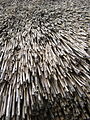
 Dachbedeckung Kölliken Strohdachhaus.JPG 2,592 × 1,944; 1.37 MB
-
 Dachbedeckung Strohdachhaus Kölliken.JPG 1,944 × 2,592; 1.67 MB
-
 Kölliken Stohdachhaus 001.jpg 3,888 × 2,592; 5.16 MB
-
 Kölliken Strohdachhaus 002.jpg 3,888 × 2,592; 4.17 MB
-
 Kölliken Strohdachhaus 003.jpg 3,888 × 2,592; 4.49 MB


