Category:Stretton Grandison
Jump to navigation
Jump to search
village in the United Kingdom  | |||||
| Upload media | |||||
| Instance of | |||||
|---|---|---|---|---|---|
| Location | Herefordshire, West Midlands, England | ||||
| Population |
| ||||
 | |||||
English: Stretton Grandison is a hamlet and small civil parish in Herefordshire, England. The population of the civil parish at the 2011 census was 175.
Polski: Stretton Grandison – wieś i civil parish w Anglii, w hrabstwie Herefordshire. W 2011 roku civil parish liczyła 175 mieszkańców. Stretton Grandison jest wspomniana w Domesday Book (1086) jako Stratune.

Subcategories
This category has the following 3 subcategories, out of 3 total.
L
O
- Oasts in Stretton Grandison (21 F)
Media in category "Stretton Grandison"
The following 123 files are in this category, out of 123 total.
-

-
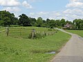
 A Country Gateway - geograph.org.uk - 2377063.jpg 2,592 × 1,944; 2.33 MB
-
 A muddy River Frome near Canon Frome - geograph.org.uk - 3109591.jpg 4,000 × 3,000; 3.47 MB
-

-
 A417 at Filling Bridge - geograph.org.uk - 4281939.jpg 800 × 451; 200 KB
-
 A417 past Town's End - geograph.org.uk - 4640655.jpg 5,184 × 3,456; 6.88 MB
-
 Apple orchard near Stretton Grandison - geograph.org.uk - 4040907.jpg 800 × 531; 161 KB
-
 Armorial Bearings of the YOUNGER family of Stretton Grandson, Herefordshire.png 1,200 × 1,200; 417 KB
-
 Bridge over former Herefordshire ^ Gloucestershire Canal - geograph.org.uk - 4640764.jpg 4,000 × 3,000; 5.07 MB
-

-
 Church Cottage (Stretton Grandison) - geograph.org.uk - 6024238.jpg 3,648 × 2,736; 4.71 MB
-
 Church Cottage (Stretton Grandison) - geograph.org.uk - 6027425.jpg 3,648 × 2,736; 4.68 MB
-
 Churchyard at St. Lawrence's Church (Stretton Grandison) - geograph.org.uk - 6025358.jpg 3,648 × 2,736; 4.81 MB
-

-
 Countryside Near Stretton Grandison - geograph.org.uk - 1349838.jpg 640 × 480; 198 KB
-
 Covender Cattle - geograph.org.uk - 1349853.jpg 640 × 480; 179 KB
-
 Crop field by New House Farm - geograph.org.uk - 4639428.jpg 4,000 × 3,000; 4.23 MB
-
 Derestriction sign north of Stretton Grandison - geograph.org.uk - 5890501.jpg 1,600 × 1,141; 716 KB
-

-
 Drain under the A417 - geograph.org.uk - 4281935.jpg 800 × 451; 174 KB
-
 Drainage ditch near The Homend - geograph.org.uk - 2927581.jpg 1,764 × 1,189; 529 KB
-
 Dry drainage ditch north of the River Frome - geograph.org.uk - 3109596.jpg 4,000 × 3,000; 3.74 MB
-
 Entrance to Stretton Grandison - geograph.org.uk - 3240476.jpg 640 × 480; 45 KB
-
 Entrance to Stretton Grandison - geograph.org.uk - 3780917.jpg 640 × 480; 39 KB
-
 Entrance to Stretton Grandison - geograph.org.uk - 3934939.jpg 640 × 480; 52 KB
-
 Estate cottage at Homend Park - geograph.org.uk - 4304456.jpg 800 × 451; 198 KB
-
 Field South of Stretton Grandison - geograph.org.uk - 4639405.jpg 8,506 × 2,300; 6.64 MB
-
 Fields near Town's End - geograph.org.uk - 4640691.jpg 4,000 × 3,000; 3.32 MB
-
 Filling Bridge south of Newtown - geograph.org.uk - 4454360.jpg 1,600 × 961; 1.13 MB
-
 Footbridge and pylons on the path to New House - geograph.org.uk - 3109610.jpg 4,000 × 3,000; 3.28 MB
-
 Footpath across a ploughed field - geograph.org.uk - 1056364.jpg 640 × 480; 101 KB
-
 Footpath alongside Homend - geograph.org.uk - 3109616.jpg 4,000 × 3,000; 4.1 MB
-
 Former canal embankment - geograph.org.uk - 6690759.jpg 1,024 × 768; 338 KB
-
 Former Hereford ^ Gloucester Canal by Monksbury Court - geograph.org.uk - 4640709.jpg 4,000 × 3,000; 4.34 MB
-
 Gatehouse at Homend Park - geograph.org.uk - 546524.jpg 640 × 490; 79 KB
-

-
 Grazing Land At Covender - geograph.org.uk - 1349863.jpg 640 × 480; 211 KB
-
 Homend Lane - geograph.org.uk - 1349883.jpg 640 × 480; 202 KB
-
 Homend Park (1) - geograph.org.uk - 1349886.jpg 640 × 480; 213 KB
-
 Homend Park (2) - geograph.org.uk - 1349887.jpg 640 × 480; 190 KB
-
 Homend Park - geograph.org.uk - 3148249.jpg 640 × 480; 327 KB
-
 Homend Park, 1 - geograph.org.uk - 4304458.jpg 800 × 457; 197 KB
-
 Homend Park, 2 - geograph.org.uk - 4304460.jpg 800 × 533; 204 KB
-
 Hopper Huts - geograph.org.uk - 4640696.jpg 4,000 × 3,000; 4 MB
-
 House on Watery Lane - geograph.org.uk - 6691318.jpg 1,024 × 768; 293 KB
-
 Houses at Upper Egleton - geograph.org.uk - 3392470.jpg 1,024 × 680; 234 KB
-

-
 Lane through Homend Park - geograph.org.uk - 4639432.jpg 5,184 × 3,456; 7.8 MB
-
 Lane To Stretton Grandison - geograph.org.uk - 1349841.jpg 640 × 480; 203 KB
-
 Lane towards A417 - geograph.org.uk - 4639406.jpg 1,500 × 1,000; 1.09 MB
-
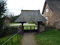 Lychgate at St. Lawrence's Church (Stretton Grandison) - geograph.org.uk - 6027398.jpg 3,648 × 2,736; 4.54 MB
-

-
 Memorial of John Taylor (Stretton Grandison) - geograph.org.uk - 6022931.jpg 4,096 × 3,072; 4.42 MB
-

-
 Moorfields Farm - geograph.org.uk - 1349850.jpg 640 × 480; 167 KB
-
 Newhouse Farm Access Track - geograph.org.uk - 1349889.jpg 640 × 480; 200 KB
-
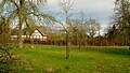
 Oak in Stretton Grandison Park - geograph.org.uk - 1056398.jpg 640 × 562; 151 KB
-
 Oaks in Stretton Grandison Park - geograph.org.uk - 1056387.jpg 640 × 401; 78 KB
-
 Old Hop Barn (Stretton Grandison) - geograph.org.uk - 6027437.jpg 3,648 × 2,736; 4.54 MB
-
 Orchard and half-timbered house - geograph.org.uk - 4304156.jpg 800 × 451; 188 KB
-
 Orchard House, Stretton Grandison - geograph.org.uk - 2089169.jpg 640 × 480; 57 KB
-
 Orchard, Stretton Grandison - geograph.org.uk - 2542319.jpg 640 × 480; 133 KB
-
 Ploughed field - geograph.org.uk - 1277804.jpg 640 × 384; 199 KB
-
 Pylon in the Frome valley - geograph.org.uk - 2284871.jpg 640 × 430; 37 KB
-
 Resurfacing the A417 - geograph.org.uk - 6690740.jpg 1,024 × 768; 234 KB
-
 Sheep by St. Lawrence's Church (Stretton Grandison) - geograph.org.uk - 6025336.jpg 3,648 × 2,736; 4.23 MB
-
 Sheep pasture by Watery Lane - geograph.org.uk - 4279052.jpg 800 × 451; 175 KB
-
 Shucknall Hill (Viewed from Stretton Grandison) - geograph.org.uk - 6022809.jpg 1,920 × 1,080; 1.01 MB
-
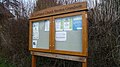 Sign at St. Lawrence's Church (Stretton Grandison) - geograph.org.uk - 6022812.jpg 1,920 × 1,080; 1.05 MB
-

-
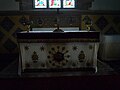 St. Lawrence's Church (Altar ^ Stretton Grandison) - geograph.org.uk - 6023005.jpg 3,648 × 2,736; 3.08 MB
-

-
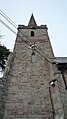 St. Lawrence's Church (Bell Tower ^ Stretton Grandison) - geograph.org.uk - 6022818.jpg 1,080 × 1,920; 1.04 MB
-
 St. Lawrence's Church (Bell Tower ^ Stretton Grandison) - geograph.org.uk - 6027369.jpg 2,736 × 3,648; 3.42 MB
-
 St. Lawrence's Church (Bell Tower ^ Stretton Grandison) - geograph.org.uk - 6027371.jpg 2,736 × 3,648; 4.18 MB
-
 St. Lawrence's Church (Chancel ^ Stretton Grandison) - geograph.org.uk - 6023020.jpg 3,648 × 2,736; 2.78 MB
-
 St. Lawrence's Church (Font ^ Stretton Grandison) - geograph.org.uk - 6022918.jpg 3,648 × 2,736; 2.43 MB
-
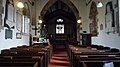
 St. Lawrence's Church (Nave ^ Stretton Grandison) - geograph.org.uk - 6023030.jpg 3,648 × 2,736; 3.15 MB
-
 St. Lawrence's Church (Organ ^ Stretton Grandison) - geograph.org.uk - 6022991.jpg 2,736 × 3,648; 2.15 MB
-
 St. Lawrence's Church (Porch ^ Stretton Grandison) - geograph.org.uk - 6022825.jpg 2,736 × 3,648; 4.47 MB
-
 St. Lawrence's Church (Porch ^ Stretton Grandison) - geograph.org.uk - 6024253.jpg 3,648 × 2,736; 4.82 MB
-

-
 St. Lawrence's Church (Screen ^ Stretton Grandison) - geograph.org.uk - 6023015.jpg 3,648 × 2,736; 2.33 MB
-
 St. Lawrence's Church (Stretton Grandison) - geograph.org.uk - 6022929.jpg 1,920 × 1,080; 701 KB
-
 St. Lawrence's Church (Stretton Grandison) - geograph.org.uk - 6024330.jpg 3,648 × 2,736; 4.02 MB
-
 St. Lawrence's Church (Stretton Grandison) - geograph.org.uk - 6025338.jpg 3,648 × 2,736; 4.1 MB
-
 St. Lawrence's Church (Stretton Grandison) - geograph.org.uk - 6025343.jpg 3,648 × 2,736; 3.98 MB
-
 St. Lawrence's Church (Stretton Grandison) - geograph.org.uk - 6025344.jpg 3,648 × 2,736; 3.65 MB
-
 St. Lawrence's Church (Stretton Grandison) - geograph.org.uk - 6025350.jpg 3,648 × 2,736; 3.38 MB
-
 St. Lawrence's Church (Stretton Grandison) - geograph.org.uk - 6027421.jpg 2,736 × 3,648; 4.19 MB
-
 St. Lawrence's Church (Stretton Grandison) - geograph.org.uk - 6030150.jpg 3,648 × 2,736; 2.92 MB
-
 Stream in the Frome valley - geograph.org.uk - 6690755.jpg 1,024 × 768; 216 KB
-
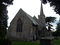
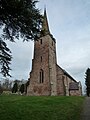
 Stretton Grandison Church - geograph.org.uk - 2927558.jpg 1,776 × 1,091; 486 KB
-
 Stretton Grandison Church - geograph.org.uk - 4327771.jpg 592 × 640; 289 KB
-
 Stretton Grandison church - geograph.org.uk - 6691305.jpg 1,024 × 768; 243 KB
-

-
 Stretton Grange, Stretton Grandison - geograph.org.uk - 459247.jpg 640 × 426; 114 KB
-
 Tarmac bridleway - geograph.org.uk - 4304444.jpg 800 × 451; 184 KB
-
 The A4117 Road (Stretton Grandison) - geograph.org.uk - 6030158.jpg 3,648 × 2,736; 2.39 MB
-
 The A417 near Filling Bridge - geograph.org.uk - 4053885.jpg 1,024 × 680; 272 KB
-
 The remains of a moat - geograph.org.uk - 3069767.jpg 1,024 × 680; 279 KB
-
 The Village of Stretton Grandison - geograph.org.uk - 6027432.jpg 3,648 × 2,736; 4.15 MB
-
 The Village of Stretton Grandison - geograph.org.uk - 6030148.jpg 3,648 × 2,736; 2.74 MB
-
 Tree at St. Lawrence's Church (Stretton Grandison) - geograph.org.uk - 6025332.jpg 2,736 × 3,648; 3.82 MB
-
 Turning from A417 to Yarkhill - geograph.org.uk - 4454353.jpg 1,600 × 1,200; 1.24 MB
-
 View from St. Lawrence's Church (Stretton Grandison) - geograph.org.uk - 6027345.jpg 3,648 × 2,736; 4.38 MB
-
 View over the Frome valley - geograph.org.uk - 3392475.jpg 1,024 × 680; 229 KB
-
 View to Stretton Coppice - geograph.org.uk - 4281937.jpg 800 × 451; 188 KB
-
 Watery Lane (Stretton Grandison) - geograph.org.uk - 6030153.jpg 3,648 × 2,736; 2.55 MB
-
 Watery Lane - geograph.org.uk - 6691315.jpg 1,024 × 768; 288 KB
-
 Watery Lane leading to Yarkhill - geograph.org.uk - 5890490.jpg 1,600 × 1,200; 746 KB
-
 Wheat field near Homend Park - geograph.org.uk - 546562.jpg 640 × 480; 122 KB
-

-

-

-

-

-
 Dutch barn, Stretton Grandison - geograph.org.uk - 463570.jpg 640 × 426; 122 KB
-
 Entrance to Homend Park - geograph.org.uk - 546565.jpg 640 × 480; 117 KB
-
 Half Timbered House and Orchard - geograph.org.uk - 101470.jpg 640 × 479; 162 KB
-
 Homend Bank - geograph.org.uk - 466550.jpg 640 × 480; 154 KB
-
 Homend Park - geograph.org.uk - 545552.jpg 640 × 480; 115 KB
-


_-_geograph.org.uk_-_6024238.jpg)
_-_geograph.org.uk_-_6027425.jpg)
_-_geograph.org.uk_-_6025358.jpg)
_-_geograph.org.uk_-_6023170.jpg)


_-_geograph.org.uk_-_6023027.jpg)


_-_geograph.org.uk_-_6022967.jpg)


_-_geograph.org.uk_-_1349886.jpg)
_-_geograph.org.uk_-_1349887.jpg)


_-_geograph.org.uk_-_6022927.jpg)


_-_geograph.org.uk_-_6027398.jpg)
_-_geograph.org.uk_-_6023024.jpg)
_-_geograph.org.uk_-_6022931.jpg)
_-_geograph.org.uk_-_6023003.jpg)


_-_geograph.org.uk_-_6027437.jpg)


_-_geograph.org.uk_-_6025336.jpg)

_-_geograph.org.uk_-_6022809.jpg)
_-_geograph.org.uk_-_6022812.jpg)

_-_geograph.org.uk_-_6023005.jpg)
_-_geograph.org.uk_-_6023149.jpg)
_-_geograph.org.uk_-_6022818.jpg)
_-_geograph.org.uk_-_6027369.jpg)
_-_geograph.org.uk_-_6027371.jpg)
_-_geograph.org.uk_-_6023020.jpg)
_-_geograph.org.uk_-_6022918.jpg)
_-_geograph.org.uk_-_6023030.jpg)
_-_geograph.org.uk_-_6022991.jpg)
_-_geograph.org.uk_-_6022825.jpg)
_-_geograph.org.uk_-_6024253.jpg)
_-_geograph.org.uk_-_6022983.jpg)
_-_geograph.org.uk_-_6023015.jpg)
_-_geograph.org.uk_-_6022929.jpg)
_-_geograph.org.uk_-_6024330.jpg)
_-_geograph.org.uk_-_6025338.jpg)
_-_geograph.org.uk_-_6025343.jpg)
_-_geograph.org.uk_-_6025344.jpg)
_-_geograph.org.uk_-_6025350.jpg)
_-_geograph.org.uk_-_6027421.jpg)
_-_geograph.org.uk_-_6030150.jpg)


_-_geograph.org.uk_-_6030158.jpg)


_-_geograph.org.uk_-_6025332.jpg)

_-_geograph.org.uk_-_6027345.jpg)


_-_geograph.org.uk_-_6030153.jpg)


_-_geograph.org.uk_-_6022999.jpg)
_-_geograph.org.uk_-_6023008.jpg)
_-_geograph.org.uk_-_6023011.jpg)
_-_geograph.org.uk_-_6023032.jpg)
_-_geograph.org.uk_-_6023034.jpg)


