Category:Stretton, Rutland
Jump to navigation
Jump to search
village in Rutland, United Kingdom  | |||||
| Upload media | |||||
| Instance of | |||||
|---|---|---|---|---|---|
| Location | Rutland, East Midlands, England | ||||
| Population |
| ||||
| Area |
| ||||
 | |||||

Deutsch: Stretton ist eine Gemeinde (civil parish) im Norden der englischen Unitary Authority Rutland in der Region East Midlands. Im Jahr 2001 zählte sie 770 Einwohner.
English: Stretton is a small village and civil parish in the county of Rutland, England, just off the A1 Great North Road.
Subcategories
This category has the following 2 subcategories, out of 2 total.
S
- Stocken Hall (2 F)
Media in category "Stretton, Rutland"
The following 127 files are in this category, out of 127 total.
-
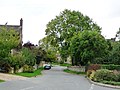 A green village - geograph.org.uk - 2121440.jpg 1,024 × 768; 166 KB
-
 A1 - speed camera warning - geograph.org.uk - 2643885.jpg 640 × 428; 75 KB
-
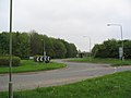 A1 junction near Stretton - geograph.org.uk - 169682.jpg 640 × 480; 58 KB
-
 A1 North of Stretton - geograph.org.uk - 4218142.jpg 640 × 480; 237 KB
-
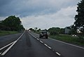 A1 north of the Ram Jam Inn - geograph.org.uk - 3187170.jpg 640 × 430; 38 KB
-
 A1 northbound - geograph.org.uk - 2643903.jpg 640 × 428; 74 KB
-
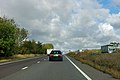
 A1 southbound approaching junction for B668 - geograph.org.uk - 3465970.jpg 1,554 × 934; 878 KB
-
 A1 southbound towards Stretton - geograph.org.uk - 3614684.jpg 1,870 × 1,148; 1.17 MB
-
 A1, northbound - geograph.org.uk - 3187187.jpg 640 × 430; 36 KB
-
 Addah Wood - geograph.org.uk - 5888424.jpg 640 × 480; 131 KB
-
 Bridge carrying the A1 near Stretton - geograph.org.uk - 819397.jpg 640 × 419; 66 KB
-
 Church Lane and the Jackson Stops Inn, Stretton (geograph 6263120).jpg 1,024 × 767; 241 KB
-
 Church of St. Nicholas, Stretton - geograph.org.uk - 5911967.jpg 640 × 480; 95 KB
-
 Church stile - geograph.org.uk - 359405.jpg 640 × 427; 108 KB
-
 Clipsham Road from Stretton - geograph.org.uk - 2904501.jpg 640 × 467; 110 KB
-
 Clipsham Road, Stretton - geograph.org.uk - 1527671.jpg 640 × 480; 77 KB
-
 Corner of the wood - geograph.org.uk - 2121461.jpg 1,024 × 768; 135 KB
-

-
 Entrance to George Henry Wood - geograph.org.uk - 4904511.jpg 1,024 × 768; 182 KB
-

-
 Entrance to Stretton - geograph.org.uk - 2118969.jpg 1,024 × 768; 214 KB
-
 Entrance to Stretton Wood - geograph.org.uk - 169691.jpg 640 × 480; 62 KB
-
 Entrance to The Manor - geograph.org.uk - 2121434.jpg 1,024 × 768; 220 KB
-
 Entrance to Walnut Close - geograph.org.uk - 2121432.jpg 1,024 × 768; 117 KB
-

-

-
 Farm gates along New Road - geograph.org.uk - 6291816.jpg 800 × 486; 79 KB
-
 Farm Track, Clipsham Road, Stretton - geograph.org.uk - 1527624.jpg 640 × 480; 57 KB
-

-
 Farmland - geograph.org.uk - 5888465.jpg 640 × 480; 67 KB
-
 Field boundary along New Road - geograph.org.uk - 5240310.jpg 640 × 479; 110 KB
-
 Field boundary eastwards - geograph.org.uk - 5240311.jpg 640 × 438; 108 KB
-

-

-
 Fingerpost on New Road - geograph.org.uk - 4795545.jpg 1,280 × 960; 602 KB
-
-
 Footpath off Clipsham Road - geograph.org.uk - 2118979.jpg 1,024 × 768; 246 KB
-

-
 Gas Tanks - geograph.org.uk - 1538390.jpg 640 × 480; 109 KB
-
 George Henry Wood - geograph.org.uk - 4904505.jpg 1,024 × 768; 146 KB
-
 George Henry Wood, Stretton - geograph.org.uk - 1528360.jpg 640 × 480; 55 KB
-
 Grassland track - geograph.org.uk - 2121475.jpg 1,024 × 768; 181 KB
-
 Grazing sheep and farm buildings, Stretton - geograph.org.uk - 6263123.jpg 1,024 × 768; 166 KB
-
 Hedgerow trees - geograph.org.uk - 2121452.jpg 1,024 × 768; 166 KB
-

-
 HM Prison - geograph.org.uk - 5888457.jpg 640 × 480; 61 KB
-
 HM prison Stocken - geograph.org.uk - 169700.jpg 640 × 480; 51 KB
-

-
 HMP Stocken - geograph.org.uk - 1538430.jpg 640 × 480; 66 KB
-
 Hooby Lane Quarry, Stretton - geograph.org.uk - 1533852.jpg 640 × 480; 59 KB
-
 Hoorah for Herbicide^ - geograph.org.uk - 188915.jpg 640 × 480; 89 KB
-
 Jackson Stops Inn at Stretton - geograph.org.uk - 114418.jpg 640 × 480; 100 KB
-

-
 Jct of Hooby Lane and New Road - geograph.org.uk - 1534007.jpg 640 × 480; 75 KB
-

-

-
 Large lay-by off Stretton Road - geograph.org.uk - 1277261.jpg 640 × 480; 138 KB
-
 Layby on Northbound A1 North of Stretton - geograph.org.uk - 4218154.jpg 640 × 480; 284 KB
-
 Maize field by the A1 - geograph.org.uk - 6558396.jpg 1,024 × 768; 179 KB
-
 Manor Road, Stretton - geograph.org.uk - 1527593.jpg 640 × 480; 77 KB
-
 Manor Road, Stretton - geograph.org.uk - 2121430.jpg 1,024 × 768; 109 KB
-
 Manor Road, Stretton joining Clipsham Road - geograph.org.uk - 5443904.jpg 3,776 × 2,520; 4.18 MB
-
 New Road - geograph.org.uk - 2318791.jpg 1,024 × 768; 130 KB
-
 New Road - geograph.org.uk - 2916291.jpg 1,024 × 768; 209 KB
-
 New Road - geograph.org.uk - 5240313.jpg 640 × 466; 97 KB
-
 New Road towards Thistleton - geograph.org.uk - 6291539.jpg 800 × 600; 118 KB
-
 New Road, looking north - geograph.org.uk - 4795548.jpg 1,280 × 828; 260 KB
-
 North along New Road - geograph.org.uk - 6291811.jpg 800 × 624; 137 KB
-

-

-

-
 Padlocked roadside handle - geograph.org.uk - 2118994.jpg 1,024 × 768; 203 KB
-
 Path through George Henry Wood - geograph.org.uk - 2121479.jpg 1,024 × 768; 212 KB
-
 Pond Near Stocken Hall - geograph.org.uk - 1538447.jpg 640 × 480; 128 KB
-

-
 Powerlines westwards - geograph.org.uk - 2904503.jpg 640 × 471; 78 KB
-
 Pump and telephone box, Stretton - geograph.org.uk - 4449850.jpg 4,320 × 3,240; 4.96 MB
-
 Ram Jam Inn July 2009 (1).jpg 3,488 × 2,616; 2.15 MB
-
 Rectory Farm Cottage - geograph.org.uk - 2121437.jpg 1,024 × 768; 169 KB
-
 Road junction, New Road and Hooby Lane - geograph.org.uk - 4795549.jpg 1,280 × 960; 394 KB
-
 Road to HM Prison Stocken - geograph.org.uk - 169770.jpg 640 × 480; 126 KB
-
 Roadside trees - geograph.org.uk - 2118958.jpg 1,024 × 768; 181 KB
-
 Rookery Lane, Stretton - geograph.org.uk - 1527442.jpg 640 × 480; 72 KB
-
 Rutland lay-by on the A1 south - geograph.org.uk - 1280403.jpg 640 × 410; 48 KB
-
 Rutland Round footpath along New Road - geograph.org.uk - 6291561.jpg 800 × 761; 232 KB
-

-
 Shades of green - geograph.org.uk - 2121456.jpg 1,024 × 768; 140 KB
-
 Signpost along New Road - geograph.org.uk - 6291545.jpg 800 × 539; 170 KB
-
 St Nicholas, Stretton - Corbel - geograph.org.uk - 5976566.jpg 752 × 1,000; 487 KB
-
 St Nicholas, Stretton - Corbel - geograph.org.uk - 5976570.jpg 744 × 1,000; 412 KB
-
 St Nicholas, Stretton - Porch - geograph.org.uk - 5976573.jpg 739 × 1,000; 343 KB
-
 St Nicholas, Stretton, Rutland - geograph.org.uk - 5976558.jpg 1,000 × 725; 422 KB
-
 St Nicholas, Stretton, Rutland - geograph.org.uk - 5976559.jpg 1,000 × 705; 417 KB
-
 St Nicholas, Stretton, Rutland - geograph.org.uk - 5976562.jpg 693 × 1,000; 323 KB
-
 St Nicholas, Stretton, Rutland - geograph.org.uk - 5976563.jpg 1,000 × 831; 467 KB
-

-

-
 Stocken Hall Mews, Stretton - geograph.org.uk - 1538510.jpg 640 × 480; 65 KB
-

-
 Stocken Hall Road, Stretton - geograph.org.uk - 1538404.jpg 640 × 480; 67 KB
-
 Stone Drive, leading to Morkery Woods - geograph.org.uk - 1538543.jpg 640 × 480; 107 KB
-
-
 Stretton horses - geograph.org.uk - 2118986.jpg 1,024 × 768; 113 KB
-
 Stretton Pumping Station - geograph.org.uk - 1527289.jpg 640 × 480; 114 KB
-
 Stretton Road - geograph.org.uk - 2121464.jpg 1,024 × 768; 213 KB
-
 Stretton Road, Stretton - geograph.org.uk - 1527271.jpg 640 × 480; 122 KB
-
 Stretton Rutland, Jackson Stops.JPG 3,712 × 2,404; 3.83 MB
-
 The footpath to Hooby Lodge - geograph.org.uk - 2318800.jpg 1,024 × 768; 205 KB
-
 The Jackson Stops Inn, Stretton - geograph.org.uk - 1527370.jpg 640 × 480; 71 KB
-
 The path into George Henry Wood - geograph.org.uk - 2121474.jpg 1,024 × 768; 206 KB
-

-
 Towards New Road - geograph.org.uk - 5240312.jpg 640 × 480; 117 KB
-
 Track into Stretton Wood - geograph.org.uk - 1528588.jpg 640 × 480; 126 KB
-

-

-
 Track to Hooby Lodge - geograph.org.uk - 5059000.jpg 3,776 × 2,520; 4.27 MB
-
 Track to Stretton Wood - geograph.org.uk - 1528530.jpg 640 × 480; 89 KB
-
 Tracks in the crops, east of New Road - geograph.org.uk - 2318821.jpg 1,024 × 768; 163 KB
-
 Tree-lined road - geograph.org.uk - 2121482.jpg 1,024 × 768; 246 KB
-
 Viking Way towards Thistleton - geograph.org.uk - 6291517.jpg 800 × 600; 161 KB
-
 Village pump (geograph 7410155).jpg 4,097 × 6,205; 6.63 MB
-
 Walnut Close, Stretton - geograph.org.uk - 1527501.jpg 640 × 480; 69 KB
-

-
 Woodland Path, Stretton - geograph.org.uk - 1527278.jpg 640 × 480; 160 KB
-
 Woodland Trust sign - geograph.org.uk - 5119600.jpg 640 × 480; 102 KB
-
 Young trees in George Henry Wood - geograph.org.uk - 2121481.jpg 1,024 × 768; 231 KB
-
 Truck Stop A1 near Stamford - geograph.org.uk - 350772.jpg 640 × 480; 87 KB


.jpg)


.jpg)


.jpg)


