Category:Streetscapes in New South Wales
Jump to navigation
Jump to search
Subcategories
This category has the following 7 subcategories, out of 7 total.
Media in category "Streetscapes in New South Wales"
The following 84 files are in this category, out of 84 total.
-
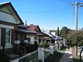
 164-176 Beach Street South Coogee NSW.jpg 2,000 × 1,024; 1.45 MB
-
 168-172 Beach Street South Coogee NSW.jpg 2,000 × 1,369; 1.88 MB
-
 26-28 Carr Street Coogee NSW.jpg 2,000 × 1,380; 2.09 MB
-
 341-343 Arden Street Coogee NSW.jpg 2,000 × 1,500; 2.03 MB
-

-
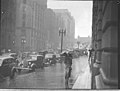
 A wet Angel Place, Sydney, 1930s - Sam Hood (3293630577).jpg 1,128 × 837; 675 KB
-
 Anderson's Buildings, Ryde (14782568642).jpg 1,400 × 1,032; 799 KB
-
 Anglican Church building in Trangie,, New South Wales.png 1,920 × 2,560; 8.76 MB
-
 Anglican church Nevertire.png 2,385 × 1,401; 5.96 MB
-
 Apple tree flat area, tannabutta parish (wellingtom county) north of cudgegong 2.png 1,920 × 2,560; 5.28 MB
-
 Apple tree flat area, tannabutta parish (wellingtom county) north of cudgegong 3.png 1,920 × 1,766; 4.33 MB
-
 Arden Streetscape Coogee NSW.jpg 2,000 × 1,453; 2.08 MB
-
 Auburn Street, Goulburn (24632192456).jpg 3,149 × 2,123; 1.03 MB
-
 BaroogaStreetscape.JPG 2,272 × 1,704; 708 KB
-
 Beach Street Federation Streetscape Coogee NSW.jpg 2,000 × 1,024; 1.22 MB
-
 Berrigan New South Wales Streetscape.JPG 2,272 × 1,704; 1.2 MB
-
 BlayneyStreetscape.jpg 2,627 × 1,367; 778 KB
-
 Canadian Lead, New South Wales, c.1872.jpg 779 × 523; 203 KB
-
 Capertree township, Badamora Parish (Roxbourgh county) NSW 4.png 2,560 × 1,920; 5.96 MB
-
 Capertree township, Badamora Parish (Roxbourgh county) NSW looking north 7.png 2,560 × 1,920; 7.02 MB
-
 Castlereage River Coonabarabran.png 1,920 × 2,560; 7.93 MB
-
 Church building Trangie, Trangie Parish, Narromine County, New South Wales.png 1,920 × 2,560; 8.45 MB
-
 Church, Trangie, Trangie Parish, Narromine County, New South Wales.jpg 1,920 × 2,560; 2.22 MB
-
 Church, Trangie, Trangie Parish, Narromine County, New South Wales.png 1,920 × 2,560; 8.12 MB
-
 ColeamballyStreetscape.JPG 2,272 × 1,704; 966 KB
-

-
 CorowaStreetscape.JPG 2,272 × 1,704; 867 KB
-
 Cullen Bullen Main street.png 2,558 × 1,578; 5.26 MB
-
 Dalgarno st Coonabarabran.png 1,910 × 1,466; 5.43 MB
-
 DeniStreetscape.JPG 2,272 × 1,704; 964 KB
-
 EstellaStreetscape.jpg 2,816 × 2,112; 1.93 MB
-
 GanmainStreetscape4.JPG 3,464 × 2,181; 1.47 MB
-
 Gloucester Street looking south from No. 41, The Rocks (2632250969).jpg 1,024 × 753; 597 KB
-
 HayStreetscape.JPG 2,272 × 1,704; 724 KB
-

-
 HillstonStreetscape.JPG 2,272 × 1,704; 772 KB
-
 Hotel, Trangie township , Trangie Parish, Narromine County, New South Wales.png 1,749 × 1,314; 3.05 MB
-
 HowlongStreetscape.JPG 2,272 × 1,704; 822 KB
-
 JerilderieStreetscape.JPG 2,272 × 1,704; 699 KB
-
 JinderaStreetscape.JPG 2,272 × 1,704; 1.04 MB
-
 LakeCargelligoStreetscape.JPG 2,272 × 1,704; 771 KB
-
 Landscape (wellington county) north of cudgegong.jpg 2,560 × 1,480; 1.05 MB
-
 Lanscapes (wellingtom county) north of cudgegong.jpg 2,560 × 1,472; 1.04 MB
-
 Level crossings in New Berrima NSW, Australia.jpg 2,700 × 1,800; 1.35 MB
-
 LyndhurstStreetscape.jpg 2,813 × 1,454; 958 KB
-
 Main Street Nyngan, New South Wales.jpg 2,560 × 1,920; 1.61 MB
-
 ManduramaStreetscape.jpg 2,816 × 2,112; 1.38 MB
-
 Mayfield Streetscape.jpg 800 × 499; 422 KB
-
 Mechanics institute Mendoran NSW Australia.png 2,560 × 1,920; 5.13 MB
-
 Milton streetscape.JPG 3,888 × 2,592; 2.77 MB
-
 Mitchell Highway Nyngan NSW.png 2,551 × 1,409; 5.86 MB
-
 MoamaStreetscape.JPG 2,272 × 1,704; 1.4 MB
-
 Mudgee Main Street 2.png 2,560 × 1,920; 6.31 MB
-
 Mudgee Main Street 3.png 2,560 × 1,920; 6.45 MB
-
 Mudgee RSL Street 3.png 2,560 × 1,920; 5.7 MB
-
 Mudgee town center 4.png 2,293 × 1,778; 5.92 MB
-
 Mudgee town center Street 3.png 2,560 × 1,920; 5.7 MB
-
 MudgeeUniting Church2.png 2,560 × 1,920; 5.74 MB
-
 Nyngan Main Street Oxley County NSW.png 2,560 × 1,920; 7.33 MB
-
 OaklandsStreetscape.JPG 2,272 × 1,704; 915 KB
-

-
 Plumpton streetscape.jpg 1,648 × 1,236; 334 KB
-

-
 Public school Tooraweenah NSW (Gowen County) looking North.png 2,554 × 1,438; 6.16 MB
-
 Queanbeyan Streetscape.jpg 923 × 692; 113 KB
-
 Rain, Martin Place, Sydney, 1937 - by Sam Hood (3293872363).jpg 640 × 483; 44 KB
-
 Saint Johns Anglican church Mudgee(back).jpg 1,920 × 2,560; 2.25 MB
-
 Saint Johns Anglican church Mudgee.jpg 2,560 × 1,920; 1.38 MB
-
 Second Street Ashbury, Federation Streetscape.jpg 5,312 × 2,988; 7.41 MB
-
 SLNSW 796088 Auburn Rd.jpg 1,400 × 854; 194 KB
-
 SLNSW 796089 Auburn Rd and Post Office.jpg 1,400 × 837; 242 KB
-
 St Andrew's Cathedral, Sydney, 1892-3 - Fred Hardie (3419073589).jpg 535 × 640; 71 KB
-
 Stanmore (1).jpg 2,000 × 1,000; 656 KB
-
 Streetscape, Mitchell Highway Service Road, Coolabah, New South Wales, 2007.jpg 1,280 × 960; 261 KB
-

-

-
-
 Tooraweenah NSW (Gowen County) looking North.png 2,558 × 1,458; 5.7 MB
-
 Trangie streetscape, Trangie Parish, Narromine County, New South Wales.png 1,882 × 1,321; 3.23 MB
-
 Trangie War Memorial Hall.png 1,901 × 1,648; 3.57 MB
-
 Trangie, Narromine County NSW.png 1,914 × 1,482; 5.65 MB
-
 View of Circular Quay.jpg 1,500 × 1,235; 137 KB
-
 WalbundrieStreetscape.JPG 2,272 × 1,704; 955 KB
-
 Walla Walla Streetscape.JPG 3,872 × 2,592; 4.26 MB


.jpg)
.jpg)
.jpg)


_north_of_cudgegong_2.png)
_north_of_cudgegong_3.png)

.jpg)


_NSW_4.png)
_NSW_looking_north_7.png)


.jpg)


.jpg)

,_1935_-_by_Sam_Hood_(3294694544).jpg)


_north_of_cudgegong.jpg)
_north_of_cudgegong.jpg)


_on_rainy_day,_c.1933_-_by_Sam_Hood_(3294687758).jpg)

,_ca._1925-ca._1955_-_Sam_Hood_(2965732580).jpg)
_looking_North.png)

.jpg)
.jpg)


.jpg)
.jpg)

.jpg)
.jpg)
.jpg)
_looking_North.png)


