Category:Streets in the London Borough of Hammersmith and Fulham
Jump to navigation
Jump to search

Wikimedia category | |||||
| Upload media | |||||
| Instance of | |||||
|---|---|---|---|---|---|
| Category combines topics | |||||
| |||||
Subcategories
This category has the following 88 subcategories, out of 88 total.
A
- Adelaide Grove, London (6 F)
- Ariel Way, London W12 (6 F)
- Askew Crescent, London (5 F)
- Askew Road, London (25 F)
- Australia Road, London (9 F)
B
- Beaconsfield Walk (2 F)
- Black Lion Lane (8 F)
- Bloemfontein Road, London W12 (27 F)
- Braybrook Street (London) (8 F)
- Bryony Road, London W12 (3 F)
- Bute Gardens, London (5 F)
C
- Ceylon Road (2 F)
D
E
- Ellerslie Road, London (3 F)
- Erica Street, London W12 (2 F)
- Eyot Gardens, London (1 F)
F
- Fitzneal Street (4 F)
G
- Galloway Road, London W12 (3 F)
- Godolphin Road, London (7 F)
- Great West Road, Hammersmith (9 F)
H
- Hammersmith Bridge Road (4 F)
- Hammersmith Flyover (24 F)
- Hammersmith Grove, London (5 F)
K
L
M
- Margravine Gardens, London (5 F)
- Margravine Road, London W14 (1 F)
- Maxwell Road, London (1 F)
- Mornington Avenue (1 F)
N
- North Pole Road, London (5 F)
O
- Old Oak Common Lane (28 F)
- Old Oak Lane, London (13 F)
- Old Oak Road, London (3 F)
P
- Putney Bridge Approach (4 F)
Q
- Queens Club Gardens, London (5 F)
R
- Rowan Road, Hammersmith (11 F)
S
- Sandilands Road, Fulham (1 F)
- Sawley Road, London (5 F)
- Stanlake Road, London (3 F)
T
- Townmead Road (14 F)
U
W
- Weltje Road (1 F)
- West Cromwell Road (24 F)
- West Cross Route (7 F)
- Wormholt Road, London W12 (9 F)
- Wulfstan Street (London) (9 F)
Media in category "Streets in the London Borough of Hammersmith and Fulham"
The following 200 files are in this category, out of 342 total.
(previous page) (next page)-
 63 - 73 Marchbank Road, W14 - geograph.org.uk - 1443343.jpg 640 × 427; 40 KB
-
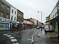
 A401, Shepherd's Bush Green - geograph.org.uk - 1151487.jpg 640 × 480; 97 KB
-
 Abdale Road, W12 - geograph.org.uk - 697038.jpg 480 × 640; 77 KB
-
 Agate Road - geograph.org.uk - 5129329.jpg 4,000 × 3,000; 3.88 MB
-
 Agate Road, Hammersmith - geograph.org.uk - 3420364.jpg 4,288 × 3,216; 5.52 MB
-
 Aisgill Avenue, W14 - geograph.org.uk - 1443875.jpg 640 × 480; 50 KB
-
 Aldbourne Road London W12 - geograph.org.uk - 1707248.jpg 4,000 × 3,000; 3.57 MB
-
 Aldine Street, W12 - geograph.org.uk - 688449.jpg 640 × 480; 67 KB
-
 Amor Road, Hammersmith - geograph.org.uk - 3420399.jpg 4,288 × 3,216; 5.91 MB
-
 Archdale Court, W12 - geograph.org.uk - 889511.jpg 640 × 480; 106 KB
-
 Arminger Road, Shepherd's Bush - geograph.org.uk - 3067154.jpg 1,600 × 1,200; 605 KB
-
 Arminger Road, W12 - geograph.org.uk - 836822.jpg 640 × 480; 78 KB
-
 Askham Road, W12 - geograph.org.uk - 710708.jpg 640 × 480; 96 KB
-
 Astrop Terrace, W6 - geograph.org.uk - 1048404.jpg 640 × 480; 96 KB
-
 Atalanta Road, Fulham - geograph.org.uk - 5966077.jpg 1,600 × 1,200; 277 KB
-
 Auriol Road, W14 - geograph.org.uk - 873128.jpg 640 × 480; 98 KB
-
 Avalon Road, Fulham - geograph.org.uk - 4585544.jpg 2,272 × 1,704; 977 KB
-
 Avonmore Road - geograph.org.uk - 1533840.jpg 640 × 480; 85 KB
-
 Avonmore Road - geograph.org.uk - 655347.jpg 640 × 499; 85 KB
-
 Avonmore Road housing - geograph.org.uk - 655378.jpg 640 × 500; 102 KB
-
 Avonmore Road, W14 - geograph.org.uk - 655337.jpg 640 × 480; 99 KB
-
 Aycliffe Road, W12 - geograph.org.uk - 711342.jpg 640 × 480; 70 KB
-
 Aycliffe Road, W12 - geograph.org.uk - 833229.jpg 640 × 480; 79 KB
-
 Bagley's Lane, SW6 - geograph.org.uk - 1035409.jpg 640 × 480; 89 KB
-
 Barclay Road, Fulham Broadway - geograph.org.uk - 3423986.jpg 4,288 × 3,216; 6.83 MB
-
 Bassein Park Rd - geograph.org.uk - 4071015.jpg 640 × 430; 70 KB
-
 Bassein Park Rd - geograph.org.uk - 4071022.jpg 640 × 430; 52 KB
-
 Bassein Park Rd - geograph.org.uk - 4071023.jpg 640 × 430; 63 KB
-
 Bath Rd - geograph.org.uk - 4070875.jpg 640 × 430; 72 KB
-
 Bath Rd - geograph.org.uk - 4070882.jpg 640 × 430; 61 KB
-
 Batman Close - geograph.org.uk - 680236.jpg 640 × 480; 93 KB
-
 Batman Close, W12 - geograph.org.uk - 680284.jpg 640 × 480; 64 KB
-
 Beadon Road Hammersmith - geograph.org.uk - 4425162.jpg 4,000 × 2,666; 7.45 MB
-
 Beadon Road W6 - geograph.org.uk - 1769356.jpg 480 × 640; 61 KB
-
 Beadon Road, Hammersmith - geograph.org.uk - 4081957.jpg 2,304 × 1,728; 830 KB
-
 Becklow Rd - geograph.org.uk - 4121099.jpg 640 × 430; 68 KB
-
 Becklow Rd - geograph.org.uk - 4121160.jpg 640 × 430; 77 KB
-
 Becklow Road, Shepherds Bush - geograph.org.uk - 1708746.jpg 1,600 × 1,200; 589 KB
-
 Becklow Road, Shepherds Bush - geograph.org.uk - 1708748.jpg 1,600 × 1,200; 603 KB
-
 Benbow Road, W6 - geograph.org.uk - 851347.jpg 640 × 480; 80 KB
-
 Bentworth Road - geograph.org.uk - 680240.jpg 640 × 480; 74 KB
-
 Bentworth Road, W12 - geograph.org.uk - 678461.jpg 640 × 480; 119 KB
-
 Bishop King's Road - geograph.org.uk - 1533863.jpg 640 × 480; 86 KB
-
 Bishop Kings Road, W14 - geograph.org.uk - 1995884.jpg 2,336 × 3,504; 1.88 MB
-
 Bishop Kings Road, W14 - geograph.org.uk - 655385.jpg 640 × 480; 81 KB
-
 Bishops Park Road - geograph.org.uk - 1039093.jpg 640 × 480; 166 KB
-
 Bishops Park Road, Fulham - geograph.org.uk - 3071857.jpg 640 × 480; 88 KB
-
 Black Lion Lane - geograph.org.uk - 5129344.jpg 3,820 × 2,868; 1.88 MB
-
 Black Lion Lane, Hammersmith - geograph.org.uk - 3610475.jpg 1,000 × 693; 207 KB
-
 Bloemfontein Avenue, W12 - geograph.org.uk - 711348.jpg 640 × 480; 56 KB
-
 Blythe Road, W14 - geograph.org.uk - 870736.jpg 640 × 480; 52 KB
-
 Boscombe Rd - geograph.org.uk - 4131411.jpg 640 × 443; 70 KB
-
 Boscombe Road, W12 - geograph.org.uk - 836858.jpg 640 × 480; 79 KB
-
 Boscombe Road, W12 - geograph.org.uk - 836947.jpg 640 × 480; 98 KB
-
 Bowfell Road - geograph.org.uk - 4348159.jpg 683 × 1,024; 207 KB
-
 Bowfell Road - geograph.org.uk - 4348160.jpg 1,024 × 768; 170 KB
-
 Brackenbury Village II, W6 - geograph.org.uk - 892551.jpg 640 × 480; 76 KB
-
 Brackenbury Village, W6 - geograph.org.uk - 892537.jpg 480 × 640; 75 KB
-
 Bramber Road - geograph.org.uk - 4466712.jpg 1,600 × 1,200; 865 KB
-
 Bramber Road - geograph.org.uk - 4466713.jpg 1,600 × 1,200; 826 KB
-
 Bridge Avenue, W6 - geograph.org.uk - 889595.jpg 640 × 480; 130 KB
-
 Bridge Avenue, W6 - geograph.org.uk - 934039.jpg 640 × 480; 97 KB
-
 Bridge View, W6 - geograph.org.uk - 934037.jpg 640 × 480; 93 KB
-
 Britannia Road, Fulham - geograph.org.uk - 4585538.jpg 2,272 × 1,704; 792 KB
-
 British Grove W4 - geograph.org.uk - 1736991.jpg 800 × 600; 206 KB
-
 Bronsart Road, Fulham - geograph.org.uk - 5964613.jpg 1,600 × 1,200; 313 KB
-
 Brook Green III, W6 - geograph.org.uk - 908413.jpg 640 × 480; 83 KB
-
 Brook Green, W6 - geograph.org.uk - 860600.jpg 640 × 480; 101 KB
-
 Brook Green, W6 - geograph.org.uk - 861898.jpg 640 × 480; 70 KB
-
 Broomhouse Road, Parsons Green - geograph.org.uk - 5620135.jpg 1,600 × 819; 248 KB
-
 Bulwer Street, Hammersmith - geograph.org.uk - 2214975.jpg 640 × 480; 164 KB
-
 Bulwer Street, Westfield just behind - geograph.org.uk - 1069347.jpg 640 × 480; 92 KB
-
 Cambridge Grove - geograph.org.uk - 5129331.jpg 4,000 × 3,000; 3.43 MB
-
 Camera Clinic - geograph.org.uk - 655314.jpg 640 × 473; 93 KB
-
 Canada Way, White City Estate - geograph.org.uk - 680249.jpg 640 × 480; 115 KB
-
 Caxton Road - geograph.org.uk - 2081013.jpg 640 × 480; 73 KB
-
 Caxton Road, W12 - geograph.org.uk - 278368.jpg 640 × 480; 110 KB
-
 Caxton Street with Westfield beyond - geograph.org.uk - 1069358.jpg 640 × 480; 84 KB
-
 Ceylon Road, W14 - geograph.org.uk - 908238.jpg 640 × 480; 57 KB
-
 Chalkhill Road II, W6 - geograph.org.uk - 1077585.jpg 640 × 480; 91 KB
-
 Chalkhill Road, W6 - geograph.org.uk - 1076293.jpg 640 × 480; 95 KB
-
 Challoner Street W14 - geograph.org.uk - 1229522.jpg 640 × 479; 77 KB
-
 Chelsea Football Club - geograph.org.uk - 313273.jpg 640 × 480; 84 KB
-
 Chipstead Street, Fulham - geograph.org.uk - 4585564.jpg 2,272 × 1,704; 961 KB
-
 Church Gate - geograph.org.uk - 1568900.jpg 640 × 480; 67 KB
-
 Church Gate - geograph.org.uk - 1576670.jpg 640 × 480; 88 KB
-
 Clematis Street, W12 - geograph.org.uk - 835554.jpg 480 × 640; 59 KB
-
 Clifton Avenue, W12 - geograph.org.uk - 710701.jpg 640 × 480; 92 KB
-
 Cobbold Rd - geograph.org.uk - 4121094.jpg 640 × 430; 71 KB
-
 Collingbourne Road, W12 - geograph.org.uk - 835502.jpg 640 × 480; 62 KB
-
 Comeragh Road, W14 - geograph.org.uk - 905786.jpg 640 × 480; 67 KB
-
 Coningham Rd - geograph.org.uk - 4131427.jpg 640 × 430; 98 KB
-
 Coningham Road, W12 - geograph.org.uk - 711336.jpg 640 × 480; 79 KB
-
 Conningham Road, W12 - geograph.org.uk - 851345.jpg 640 × 480; 101 KB
-
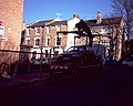 Council Tow Truck - geograph.org.uk - 681789.jpg 640 × 512; 70 KB
-
 Crisp Road, W6 - geograph.org.uk - 934044.jpg 640 × 480; 83 KB
-
 Cromwell Avenue, Ravenscourt Park - geograph.org.uk - 2149752.jpg 1,600 × 1,200; 465 KB
-
 Dalling Road - geograph.org.uk - 1558088.jpg 640 × 473; 104 KB
-
 Dalling Road - geograph.org.uk - 4512602.jpg 1,024 × 768; 224 KB
-
 Dancer Road - geograph.org.uk - 4422797.jpg 1,440 × 1,080; 478 KB
-
 Davisville Road, W12 - geograph.org.uk - 889549.jpg 640 × 480; 73 KB
-
 Dawes Road, London SW6 - geograph.org.uk - 2509365.jpg 4,320 × 3,240; 4.22 MB
-
 Dieppe Close, W14 - geograph.org.uk - 1443942.jpg 640 × 480; 37 KB
-

-
 Dorando Close (2), W12 - geograph.org.uk - 833215.jpg 640 × 480; 86 KB
-
 Dorando Close, W12 - geograph.org.uk - 679721.jpg 640 × 480; 66 KB
-
 Doria Road, Fulham - geograph.org.uk - 4585579.jpg 2,272 × 1,704; 734 KB
-
 Dunraven Road, W12 - geograph.org.uk - 835494.jpg 640 × 480; 70 KB
-
 Eddiscombe Road, Fulham - geograph.org.uk - 4585589.jpg 2,272 × 1,704; 929 KB
-
 Edenhurst Avenue - geograph.org.uk - 5276555.jpg 640 × 426; 83 KB
-
 Edith Villas - geograph.org.uk - 655299.jpg 640 × 480; 87 KB
-
 Edith Villas W14 - geograph.org.uk - 1229441.jpg 640 × 479; 74 KB
-

-
 Ellerby Street - geograph.org.uk - 4374460.jpg 4,239 × 3,434; 1.78 MB
-
 Ellingham Road, W12 - geograph.org.uk - 855545.jpg 640 × 480; 77 KB
-
 Empress Place, Fulham in 2015.jpg 3,089 × 2,048; 860 KB
-
 Epple Road, Fulham - geograph.org.uk - 4585616.jpg 2,272 × 1,704; 822 KB
-
 Epple Road, Fulham - geograph.org.uk - 4679941.jpg 4,000 × 2,664; 1.73 MB
-
 Essex Court, Hammersmith Grove W6 - geograph.org.uk - 1311366.jpg 640 × 479; 103 KB
-
 Exhibition Close - White City Road - geograph.org.uk - 679046.jpg 640 × 480; 116 KB
-
 Farm Lane, SW6 - geograph.org.uk - 915658.jpg 640 × 480; 117 KB
-
 Faroe Road, W14 - geograph.org.uk - 861806.jpg 640 × 480; 84 KB
-
 Field Road, W6 - geograph.org.uk - 860566.jpg 640 × 480; 59 KB
-
 Fielding Road, London W14 - geograph.org.uk - 1549013.jpg 640 × 427; 80 KB
-
 Filmer Road - geograph.org.uk - 5205975.jpg 3,000 × 4,000; 6.75 MB
-
 Findon Road - geograph.org.uk - 1193883.jpg 640 × 480; 75 KB
-
 Findon Road, W12 - geograph.org.uk - 851343.jpg 640 × 480; 67 KB
-
 Finlay Street, Fulham, London - geograph.org.uk - 3173673.jpg 4,800 × 3,152; 7.28 MB
-
 Fire engine in Bolingbroke Road, W14 - geograph.org.uk - 859160.jpg 640 × 480; 96 KB
-
 Fitzneal Street, East Acton - geograph.org.uk - 2214588.jpg 4,320 × 3,240; 4 MB
-
 Fitzneal Street, East Acton - geograph.org.uk - 2214592.jpg 4,320 × 3,240; 3.84 MB
-

-
 Fulham, Cedarne Road, SW6 - geograph.org.uk - 864349.jpg 640 × 480; 97 KB
-
 Fulham, Clonmel Road, SW6 - geograph.org.uk - 864571.jpg 640 × 480; 103 KB
-
 Galena Road - geograph.org.uk - 1558099.jpg 640 × 473; 82 KB
-
 Girdlers Road, W14 - geograph.org.uk - 871278.jpg 640 × 480; 108 KB
-
 Glazbury Rd, London - geograph.org.uk - 2059034.jpg 3,296 × 2,472; 1.81 MB
-
 Glazbury Road W14 - geograph.org.uk - 1288516.jpg 640 × 479; 92 KB
-

-
 Glenthorne Road - geograph.org.uk - 1558003.jpg 640 × 473; 90 KB
-
 Glenthorne Road - geograph.org.uk - 1558024.jpg 640 × 473; 87 KB
-
 Glenthorne Road, Hammersmith - geograph.org.uk - 1814977.jpg 480 × 640; 68 KB
-
 Gowan Avenue, Fulham - geograph.org.uk - 3820132.jpg 2,304 × 1,728; 832 KB
-
 Gravesend Road - Wormholt estate - geograph.org.uk - 679793.jpg 640 × 480; 65 KB
-
 Gravesend Road 2 - geograph.org.uk - 687909.jpg 640 × 480; 59 KB
-
 Greswell Street, Fulham - geograph.org.uk - 1972667.jpg 640 × 480; 79 KB
-
 Greyhound Road, W14 - geograph.org.uk - 905776.jpg 640 × 480; 87 KB
-
 Guion Road - geograph.org.uk - 4243819.jpg 1,024 × 768; 190 KB
-
 Guion Road, Fulham - geograph.org.uk - 4585582.jpg 2,272 × 1,704; 752 KB
-
 Halsbury Road and Ormiston Grove - geograph.org.uk - 711368.jpg 640 × 480; 92 KB
-
 Halsbury-Collingbourne Road, W12 - geograph.org.uk - 836885.jpg 640 × 480; 56 KB
-
 Hamble Street SW - geograph.org.uk - 1568887.jpg 640 × 480; 71 KB
-
 Hamble Street, Sands End - geograph.org.uk - 263176.jpg 640 × 480; 83 KB
-
 Hammersmith - geograph.org.uk - 5723315.jpg 3,720 × 2,480; 7.76 MB
-
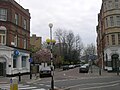
 Hammersmith, Beadon Road and Underground station - geograph.org.uk - 3589980.jpg 1,600 × 899; 344 KB
-
 Hannell Road - geograph.org.uk - 3951370.jpg 640 × 480; 85 KB
-
 Harwood Road, SW6 - geograph.org.uk - 1036259.jpg 640 × 480; 63 KB
-
 Haydn Park Road, W12 - geograph.org.uk - 889567.jpg 640 × 480; 63 KB
-
 Hetley Road, W12 - geograph.org.uk - 833264.jpg 640 × 480; 79 KB
-
 Hilary Road, Wormholt Estate, W12 - geograph.org.uk - 679653.jpg 640 × 480; 94 KB
-
 Holmead Road - geograph.org.uk - 4220028.jpg 640 × 480; 121 KB
-
 Holmead Road - geograph.org.uk - 957178.jpg 640 × 480; 84 KB
-
 Holmead Road, Fulham - geograph.org.uk - 4585259.jpg 2,272 × 1,704; 846 KB
-

-
 Houses on Rivercourt Road, W6 - geograph.org.uk - 841297.jpg 640 × 480; 101 KB
-
 Hurlingham Gardens - geograph.org.uk - 5276580.jpg 640 × 426; 94 KB
-
 Hurlingham Rd - geograph.org.uk - 5276588.jpg 640 × 426; 80 KB
-
 Hurlingham Road and Hurlingham Park, London SW6 - geograph.org.uk - 1704312.jpg 1,920 × 1,080; 907 KB
-
 Hurlingham Road viewed from Hurlingham Park, London SW6 - geograph.org.uk - 1704318.jpg 1,920 × 1,080; 960 KB
-
 Hurlingham Road, Fulham - geograph.org.uk - 685229.jpg 640 × 480; 61 KB
-
 Hurlingham Road, London SW6 - geograph.org.uk - 1108923.jpg 640 × 480; 102 KB
-
 Hythe Road, White City, London NW10 - geograph.org.uk - 925572.jpg 640 × 480; 56 KB
-
 Iffley Road, W6 - geograph.org.uk - 2102429.jpg 480 × 640; 127 KB
-
 Iffley Road, W6 - geograph.org.uk - 965636.jpg 640 × 480; 91 KB
-
 Imre Close, W12 - geograph.org.uk - 836866.jpg 640 × 480; 62 KB
-
 Imre Close, W12 - geograph.org.uk - 887188.jpg 640 × 480; 70 KB
-
 In Westfield's Shadow - geograph.org.uk - 1326023.jpg 480 × 640; 152 KB
-

-
 Keith Grove - geograph.org.uk - 4121168.jpg 640 × 430; 69 KB
-
 Keith Grove, W12 - geograph.org.uk - 710704.jpg 640 × 480; 85 KB
-
 Kingwood Road, Fulham - geograph.org.uk - 5964602.jpg 1,600 × 1,200; 228 KB
-
 Kingwood Road, Fulham - geograph.org.uk - 5964616.jpg 1,600 × 1,200; 264 KB
-
 Kingwood Road, Fulham - geograph.org.uk - 5964621.jpg 1,600 × 1,200; 370 KB
-
 Leigh Court - Avonmore Road - geograph.org.uk - 1533833.jpg 480 × 640; 59 KB
-
 Leigh Court, Avonmore Road - geograph.org.uk - 655371.jpg 480 × 640; 78 KB
-
 Lettice Street, Fulham - geograph.org.uk - 4585599.jpg 2,272 × 1,704; 735 KB
-
 Lime Grove, W12 - geograph.org.uk - 849524.jpg 640 × 480; 73 KB
-
 Loftus Road, W12 - geograph.org.uk - 676827.jpg 640 × 480; 140 KB
-
 Loftus Road, W12 - geograph.org.uk - 889981.jpg 640 × 480; 101 KB
-
 London , Hammersmith - Colet Gardens - geograph.org.uk - 2408834.jpg 4,152 × 2,626; 3.93 MB
-
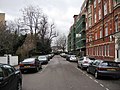
 London , Hammersmith - Hammersmith Grove - geograph.org.uk - 2408906.jpg 4,288 × 2,848; 4.78 MB
-
 London , Hammersmith - Shortlands - geograph.org.uk - 2408857.jpg 4,288 × 2,848; 5.66 MB
-
 London - April 2009 (3515745611).jpg 2,816 × 2,112; 3.15 MB
-
 London, UK - panoramio (501).jpg 3,264 × 2,448; 2.42 MB
-
 London, UK - panoramio (503).jpg 3,264 × 2,448; 2.25 MB
-
 Mablethorpe Road, Fulham - geograph.org.uk - 5964629.jpg 1,600 × 1,200; 333 KB
-
 Macfarlane Road, W12 - geograph.org.uk - 679752.jpg 640 × 480; 125 KB
-
 Maxwell Road, Fulham - geograph.org.uk - 4585526.jpg 2,272 × 1,704; 820 KB
-
 Melina Road, Hammersmith - geograph.org.uk - 3420317.jpg 4,288 × 3,216; 6.11 MB
-
 Milfoil Street, W12 - geograph.org.uk - 697097.jpg 640 × 480; 88 KB


,_W12_-_geograph.org.uk_-_833215.jpg)


.jpg)
.jpg)
.jpg)


