Category:Streets in Withernsea
Jump to navigation
Jump to search
Subcategories
This category has the following 35 subcategories, out of 35 total.
A
B
C
- Chestnut Avenue, Withernsea (6 F)
E
- Egrom's Lane, Withernsea (4 F)
H
- Hollym Road, Withernsea (7 F)
- Holmpton Road, Withernsea (10 F)
K
- Kirkfield Road, Withernsea (1 F)
L
M
- Memorial Avenue, Withernsea (11 F)
N
- North Gate, Withernsea (3 F)
- Northfield, Withernsea (2 F)
P
- Park Avenue, Withernsea (6 F)
- Prince's Avenue, Withernsea (5 F)
Q
R
- Railway Crescent, Withernsea (2 F)
S
- Scott Gardens, Withernsea (1 F)
- Seathorne, Withernsea (6 F)
- South Promenade, Withernsea (3 F)
T
- The Promenade, Withernsea (33 F)
W
Y
- Young Street, Withernsea (3 F)
Media in category "Streets in Withernsea"
The following 11 files are in this category, out of 11 total.
-
 Cammidge Street off Arthur Street, Withernsea (geograph 3611128).jpg 1,024 × 768; 150 KB
-
 Edward Street off Arthur Street, Withernsea (geograph 3611183).jpg 1,024 × 768; 186 KB
-
 Lascelles Avenue - Hull Road (geograph 4595299).jpg 640 × 480; 56 KB
-
 Newsham Gardens - geograph.org.uk - 1047974.jpg 640 × 427; 284 KB
-
 Oak Avenue, Withernsea (geograph 2096133).jpg 800 × 600; 192 KB
-
 Oak Avenue, Withernsea (geograph 5065360).jpg 1,200 × 799; 318 KB
-
 Owthorne Walk off North Road, Withernsea (geograph 3611109).jpg 1,024 × 768; 141 KB
-
 Turner Avenue, Withernsea (geograph 2096128).jpg 800 × 600; 163 KB
-
 View from top of Withernsea Lighthouse (2) (geograph 4099600).jpg 3,072 × 2,304; 1.77 MB
-
 Withernsea and its lighthouse- aerial 2015 (geograph 4583282).jpg 1,600 × 1,067; 329 KB
-
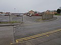 Withernsea railway station (site), Yorkshire (geograph 5657768).jpg 1,600 × 1,200; 401 KB
.jpg)
.jpg)
.jpg)

.jpg)
.jpg)
.jpg)
.jpg)
_(geograph_4099600).jpg)
.jpg)
,_Yorkshire_(geograph_5657768).jpg)