Category:Streets in Tingley
Jump to navigation
Jump to search
Subcategories
This category has the following 3 subcategories, out of 3 total.
Media in category "Streets in Tingley"
The following 48 files are in this category, out of 48 total.
-

-
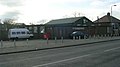
 Beech Street - Bradford Road - geograph.org.uk - 2980670.jpg 640 × 480; 76 KB
-
 Beech Street - Low Street - geograph.org.uk - 2980677.jpg 640 × 480; 85 KB
-
 Bishop Way - Constable Road - geograph.org.uk - 2981676.jpg 640 × 480; 72 KB
-

-
 Blackgates Drive - Constable Road - geograph.org.uk - 2980881.jpg 640 × 480; 73 KB
-
 Blackgates Fold - Blackgates Drive - geograph.org.uk - 2980886.jpg 640 × 479; 89 KB
-
 Blackgates Rise - Blackgates Drive - geograph.org.uk - 2980893.jpg 640 × 480; 76 KB
-
 Broadcroft Chase - Broadcroft Drive - geograph.org.uk - 2981678.jpg 640 × 480; 77 KB
-
 Broadcroft Drive - Constable Road - geograph.org.uk - 2981677.jpg 640 × 480; 64 KB
-

-
 Broadcroft Grove - Broadcroft Way - geograph.org.uk - 2981674.jpg 640 × 480; 80 KB
-
 Broadcroft Way - Constable Road - geograph.org.uk - 2981670.jpg 640 × 480; 74 KB
-

-
 Chapel Street - Thorpe Lane - geograph.org.uk - 2980691.jpg 640 × 480; 65 KB
-
 Constable Road - Smithy Lane - geograph.org.uk - 2980828.jpg 640 × 480; 69 KB
-
 Constable Road - Westerton Road - geograph.org.uk - 2982387.jpg 640 × 480; 84 KB
-
 Constable Road at Blackgates Drive - geograph.org.uk - 3057572.jpg 800 × 600; 109 KB
-
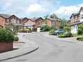
 Eastleigh Court - Eastleigh Drive - geograph.org.uk - 3204575.jpg 640 × 422; 51 KB
-
 Eastleigh Drive - Smithy Lane - geograph.org.uk - 2980813.jpg 640 × 480; 60 KB
-

-

-
 Eastleigh Mews - Eastleigh Drive - geograph.org.uk - 3204579.jpg 640 × 436; 42 KB
-
 Fairleigh Crescent - Fairleigh Road - geograph.org.uk - 3204586.jpg 640 × 480; 52 KB
-
 Fairleigh Crescent - Fairleigh Road - geograph.org.uk - 3204591.jpg 640 × 480; 70 KB
-
 Fairleigh Road - Eastleigh Drive - geograph.org.uk - 3204578.jpg 640 × 480; 48 KB
-
 Fairleigh Road - Smithy Lane - geograph.org.uk - 2980814.jpg 640 × 480; 58 KB
-
 Fenton Street - Bradford Road - geograph.org.uk - 2980673.jpg 640 × 480; 76 KB
-
 Fenton Street - Low Street - geograph.org.uk - 2980684.jpg 640 × 480; 62 KB
-
 Folly Hall Mount - Folly Hall Road - geograph.org.uk - 2980899.jpg 640 × 480; 92 KB
-
 Folly Hall Road - Lowry Road - geograph.org.uk - 2980898.jpg 640 × 480; 69 KB
-
 Garden House Lane - Bradford Road - geograph.org.uk - 3204512.jpg 640 × 480; 48 KB
-

-
 Landseer Avenue - Lowry Road - geograph.org.uk - 2981662.jpg 640 × 480; 65 KB
-
 Leigh Avenue - Eastleigh Drive - geograph.org.uk - 3204580.jpg 640 × 480; 50 KB
-
 Leigh Avenue - Leigh Road - geograph.org.uk - 3204584.jpg 640 × 438; 51 KB
-
 Leigh Road - Eastleigh Drive - geograph.org.uk - 3204581.jpg 640 × 480; 45 KB
-
 Leigh View - Bradford Road - geograph.org.uk - 3204516.jpg 640 × 480; 95 KB
-
 Leigh View - Smithy Lane - geograph.org.uk - 2980805.jpg 640 × 480; 60 KB
-
 Low Street - Chapel Street - geograph.org.uk - 2980687.jpg 640 × 480; 80 KB
-

-

-
 Old Hall Road - Smithy Lane - geograph.org.uk - 2982422.jpg 640 × 430; 64 KB
-
 Poppleton Drive - Poppleton Road - geograph.org.uk - 2980910.jpg 640 × 480; 82 KB
-
 Poppleton Rise - Lowry Road - geograph.org.uk - 2980905.jpg 640 × 480; 90 KB
-
 Poppleton Road - Lowry Road - geograph.org.uk - 2980907.jpg 640 × 480; 81 KB
-
 Redwood Avenue - Bradford Road - geograph.org.uk - 3204503.jpg 640 × 480; 51 KB
-