Category:Streets in Saltillo
Jump to navigation
Jump to search
Media in category "Streets in Saltillo"
The following 44 files are in this category, out of 44 total.
-

-
 Arbre en sursis.JPG 3,072 × 2,304; 1.48 MB
-
 Atardecer en esquina de Privada Chihuahua y Cuatrocienegas.jpg 4,476 × 2,826; 8.88 MB
-
 Bravo a norte.jpg 5,184 × 3,456; 7.9 MB
-
 Bulevar Venustiano Carranza.jpg 1,000 × 1,500; 149 KB
-
 Calle Allende.jpg 5,184 × 3,456; 5.34 MB
-
 Calle de bravo.jpg 5,184 × 3,456; 7.4 MB
-
 Calle Francisco Coss.jpg 1,000 × 1,500; 232 KB
-
 Calle Hidalgo, Saltillo.jpg 1,000 × 1,500; 207 KB
-
 Calle Ocampo, Saltillo Coahuila - panoramio.jpg 1,936 × 2,896; 2.76 MB
-
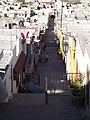 Callejon de Miraflores, Desde su mirador, Saltillo Coahuila - panoramio.jpg 3,216 × 4,288; 5.87 MB
-
 Callejón del Beso, Saltillo Coahuila - panoramio.jpg 3,216 × 4,288; 4.34 MB
-
 Callejón Santos Rojo.jpg 1,728 × 2,592; 1.74 MB
-
 CARRETERA MONTERREY SALTILLO SOLA - panoramio (1).jpg 3,872 × 2,592; 2.2 MB
-
 CARRETERA MONTERREY SALTILLO SOLA - panoramio (2).jpg 3,872 × 2,592; 2.98 MB
-
 CARRETERA MONTERREY SALTILLO SOLA - panoramio (3).jpg 3,872 × 2,592; 2.6 MB
-
 CARRETERA MONTERREY SALTILLO SOLA - panoramio (4).jpg 3,872 × 2,592; 2.4 MB
-
 Cars over the water.JPG 3,072 × 2,304; 1.02 MB
-
 Casino de Saltillo.jpg 3,456 × 2,304; 3 MB
-
 Cañon de San Lorenzo. Saltillo, Coahuila - panoramio (36).jpg 3,072 × 2,048; 1.65 MB
-
 Cañon de San Lorenzo. Saltillo, Coahuila - panoramio (38).jpg 3,072 × 2,048; 1.61 MB
-
 Colonia Zaragoza.jpg 3,456 × 5,184; 4.86 MB
-
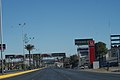
 CRUCERO LA LECHERA - panoramio.jpg 1,773 × 1,330; 403 KB
-
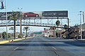
 DESPUES DEL TUNEL o paso a desnivel - panoramio.jpg 1,925 × 1,444; 391 KB
-
 Enero 16 del 2010 Saltillo Coahuila helada en sierras desde el puente - panoramio.jpg 3,296 × 2,472; 1.12 MB
-
 ENTRANDO AL TUNEL 1 - panoramio.jpg 1,773 × 1,330; 303 KB
-
 ENTRANDO AL TUNEL 2 o paso a desnivel - panoramio.jpg 1,723 × 1,292; 300 KB
-
 IMG 0080 Saltillo, Coahuila, México.jpg 2,592 × 1,728; 2.08 MB
-
 IMG 0082 Saltillo, Coahuila, México.jpg 2,592 × 1,728; 1.74 MB
-
 IMG 0098 Saltillo, Coahuila, México.jpg 2,592 × 1,728; 2.15 MB
-
 KE GEMAS 1 - panoramio.jpg 4,288 × 3,216; 4.5 MB
-
 Lo que queda de un puente para el Tren, Saltillo Coahuila - panoramio (1).jpg 3,072 × 2,304; 2.72 MB
-
 Lo que queda de un puente para el Tren, Saltillo Coahuila - panoramio (2).jpg 3,072 × 2,304; 3.06 MB
-
 Lo que queda de un puente para el Tren, Saltillo Coahuila - panoramio (3).jpg 3,072 × 2,304; 2.89 MB
-
 Lo que queda de un puente para el Tren, Saltillo Coahuila - panoramio.jpg 3,072 × 2,304; 3.18 MB
-
 Periférico Luis Echeverría de noche.jpg 5,184 × 2,912; 4.11 MB
-
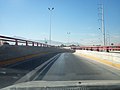
 SALIENDO DEL TUNEL o paso a desnivel - panoramio (1).jpg 2,280 × 1,710; 594 KB
-
 SALIENDO DEL TUNEL o paso a desnivel - panoramio.jpg 1,925 × 1,444; 376 KB
-
 Street Scene - Historic Center - Saltillo - Coahuila - Mexico (44450301670).jpg 3,560 × 2,717; 2.13 MB
-
 Torre Élite.jpg 1,000 × 645; 90 KB
-
 Un callejon de Saltillo - panoramio.jpg 1,632 × 1,224; 333 KB
-
 V. Carranza desde el tec.jpg 2,048 × 1,365; 198 KB
-
 V. Carranza.jpg 2,048 × 1,365; 206 KB
-
 Vista debajo del puente que conecta el Ateneo Fuente y el Instituto Tecnológico de Saltillo.jpg 4,675 × 3,117; 12.39 MB


.jpg)
.jpg)
.jpg)
.jpg)


.jpg)
.jpg)


.jpg)
.jpg)
.jpg)


.jpg)

.jpg)


