Category:Streets in Newcastle, County Down
Jump to navigation
Jump to search
Subcategories
This category has the following 11 subcategories, out of 11 total.
D
K
M
Q
R
Media in category "Streets in Newcastle, County Down"
The following 60 files are in this category, out of 60 total.
-
 Ardaluin Court, Newcastle - geograph.org.uk - 339760.jpg 640 × 436; 52 KB
-
 Ardaluin Heights, Newcastle - geograph.org.uk - 339761.jpg 640 × 298; 36 KB
-

-
 Bryansford Gardens off Main Street - geograph.org.uk - 1474778.jpg 640 × 480; 68 KB
-

-
 Elmgrove Park, Newcastle - geograph.org.uk - 1520493.jpg 640 × 387; 42 KB
-

-
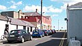
 King Street, Newcastle - geograph.org.uk - 1264917.jpg 640 × 349; 99 KB
-
 Newcastle, County Down - geograph.org.uk - 1428119.jpg 640 × 479; 51 KB
-
 Primrose Lane, Newcastle - geograph.org.uk - 1133127.jpg 640 × 437; 92 KB
-
 Shan Slieve Drive - geograph.org.uk - 1471544.jpg 640 × 481; 88 KB
-
-
-
 Spelga Avenue, Newcastle - geograph.org.uk - 1472346.jpg 640 × 480; 68 KB
-

-
-

-
-

-
-

-
-

-

-

-
-

-

-
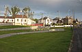
 The lower end of Castlewellan road - geograph.org.uk - 1461029.jpg 640 × 487; 73 KB
-
 The lower end of Commedagh Park - geograph.org.uk - 1471565.jpg 640 × 481; 73 KB
-
 The lower end of Tullybrannigan Road - geograph.org.uk - 1471541.jpg 640 × 621; 115 KB
-

-

-

-
-
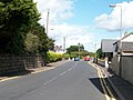
 The sea-ward end of Causeway Road - geograph.org.uk - 1469640.jpg 640 × 357; 59 KB
-

-
 The southern end of Shimna Road - geograph.org.uk - 1469243.jpg 640 × 481; 71 KB
-
 The southern end of Tipperary Lane - geograph.org.uk - 1460504.jpg 640 × 480; 68 KB
-
 The southern end of Valentia Place - geograph.org.uk - 1723266.jpg 1,024 × 768; 138 KB
-
 The sylvan Shan Slieve Drive, Newcastle - geograph.org.uk - 1471547.jpg 640 × 480; 109 KB
-

-
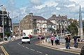
 Traffic in Main Street - geograph.org.uk - 1471173.jpg 640 × 352; 58 KB
-
-
-
 Tullybrannigan Road, Newcastle - geograph.org.uk - 1748745.jpg 1,024 × 769; 112 KB
-
-
 View NNE along Main Street - geograph.org.uk - 1521633.jpg 640 × 425; 53 KB
-

-

-
 View south along Beechvale Park - geograph.org.uk - 1520507.jpg 640 × 375; 51 KB
-
 View south along Golf Links Road - geograph.org.uk - 1461191.jpg 640 × 480; 90 KB
-
 View south along Spelga Avenue - geograph.org.uk - 1472350.jpg 640 × 480; 65 KB
-
-
 View south along Valentia Place - geograph.org.uk - 1723261.jpg 1,600 × 1,091; 332 KB
-

-

-
 View westwards along Larchfield Park - geograph.org.uk - 1723277.jpg 1,024 × 628; 94 KB
-

-


