Category:Streets in Nakskov
Jump to navigation
Jump to search

English: This category is intended for streets, roads, squares and similar traffic areas in the city of Nakskov, Denmark. The main criteria is that the traffic area has a steet name. Eventually check internet map services.
Wikimedia category | |||||
| Upload media | |||||
| Instance of | |||||
|---|---|---|---|---|---|
| Category combines topics | |||||
| Category contains | |||||
| Nakskov | |||||
town in Denmark    | |||||
| Instance of | |||||
| Location | Lolland Municipality, Region Zealand, Denmark | ||||
| Located in or next to body of water | |||||
| Population |
| ||||
 | |||||
Subcategories
This category has the following 6 subcategories, out of 6 total.
Media in category "Streets in Nakskov"
The following 16 files are in this category, out of 16 total.
-
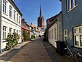
 Blindestræde.jpg 3,927 × 2,808; 9.47 MB
-
 Gaasetorvet i Nakskov.jpg 4,032 × 3,024; 8.23 MB
-
 Jernbanegade, Nakskov 2024 5.jpg 5,472 × 3,648; 8.16 MB
-
 Maribovej, Nakskov.jpg 3,990 × 3,024; 7.44 MB
-
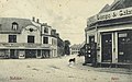
 Market in Nakskov, Denmark (8099165322).jpg 1,024 × 711; 123 KB
-
 Naksk loejtoftevej.jpg 1,142 × 915; 1.15 MB
-
 Naksk nicolaj bredg.jpg 1,220 × 1,050; 1.46 MB
-
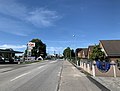
 Naksk oesterboulevard.jpg 1,270 × 940; 1.41 MB
-
 Naksk svingelvej.jpg 1,147 × 853; 1.01 MB
-
 Naksk vejlegade.jpg 1,056 × 830; 886 KB
-
 Nakskov 2024 6.jpg 5,472 × 3,648; 7.96 MB
-
 Nakskov danagade.jpg 1,640 × 1,021; 1.61 MB
-
 Nakskov nytorv.jpg 1,634 × 1,024; 1.44 MB
-
 Nakskov rundkørsel Perlestikkergade X Rødbyvej.jpg 1,028 × 1,527; 58 KB
-
 Nakskov Vandtårn.jpg 1,200 × 1,600; 250 KB
-
 Tolderensstræde (Nakskov).jpg 3,264 × 2,448; 2.41 MB


.jpg)


.jpg)