Category:Streets in Morley, West Yorkshire
Jump to navigation
Jump to search
Subcategories
This category has the following 22 subcategories, out of 22 total.
*
A
- Ackroyd Street, Morley (6 F)
B
- Bridge Street, Morley (4 F)
- Bruntcliffe Lane, Morley (4 F)
C
- Cooperative Road, Morley (5 F)
D
H
- Howden Clough Road (9 F)
I
- Ingle Avenue, Morley (4 F)
Q
T
Media in category "Streets in Morley, West Yorkshire"
The following 195 files are in this category, out of 195 total.
-
 Accommodation for hire on Quarry Lane, Woodkirk - geograph.org.uk - 3306361.jpg 1,024 × 614; 105 KB
-
 Airedale Terrace - Middleton Road - geograph.org.uk - 1494418.jpg 640 × 480; 238 KB
-
 Albert Road - viewed from Troy Road - geograph.org.uk - 1499794.jpg 640 × 480; 227 KB
-
 Albert Road - viewed from Troy Road - geograph.org.uk - 1499797.jpg 640 × 480; 260 KB
-
 Albion Street, Morley - geograph.org.uk - 217988.jpg 640 × 475; 95 KB
-
 Baker Street - Fountain Street - geograph.org.uk - 1492804.jpg 640 × 480; 256 KB
-
 Big "K" shows the way-Howley Mill Viaduct - geograph.org.uk - 442996.jpg 480 × 640; 126 KB
-
 Bridge Court - Bridge Road - geograph.org.uk - 671157.jpg 640 × 389; 21 KB
-
 Brunswick Place - Clough Street - geograph.org.uk - 1499664.jpg 640 × 480; 249 KB
-
 California Mews - Victoria Road - geograph.org.uk - 1500667.jpg 640 × 480; 259 KB
-
 California Street - South Parade - geograph.org.uk - 1771272.jpg 640 × 480; 66 KB
-
 Chapel Hill - Station Road - geograph.org.uk - 1499808.jpg 640 × 480; 245 KB
-
 Charles Street - Ackroyd Street - geograph.org.uk - 1499681.jpg 640 × 480; 239 KB
-
 Charles Street - Clough Street - geograph.org.uk - 1499665.jpg 640 × 480; 242 KB
-
 Chartists Way - geograph.org.uk - 1492893.jpg 640 × 480; 230 KB
-
 Chatsworth Mews - Wide Lane - geograph.org.uk - 1494345.jpg 640 × 480; 223 KB
-
 Clarendon Terrace - Elland Road - geograph.org.uk - 631958.jpg 640 × 480; 38 KB
-
 Clifford Place - Hartley Street - geograph.org.uk - 1501102.jpg 640 × 480; 207 KB
-
-
 Clough Street - viewed from Peel Street - geograph.org.uk - 1499662.jpg 640 × 480; 214 KB
-
 Clough Street - viewed from Peel Street - geograph.org.uk - 1499663.jpg 640 × 480; 240 KB
-
 Clough Street - Wide Lane - geograph.org.uk - 1494347.jpg 640 × 480; 217 KB
-
 Croft House Avenue - King George Avenue - geograph.org.uk - 1500557.jpg 640 × 480; 230 KB
-
 Croft House Close - Croft House Road - geograph.org.uk - 1500568.jpg 640 × 480; 253 KB
-
 Croft House Drive - Croft House Avenue - geograph.org.uk - 1500565.jpg 640 × 480; 216 KB
-
 Croft House Drive - New Bank Street - geograph.org.uk - 1499832.jpg 640 × 480; 224 KB
-
 Croft House Gardens - Croft House Road - geograph.org.uk - 1500567.jpg 640 × 480; 230 KB
-
 Croft House Gardens - New Bank Street - geograph.org.uk - 1499827.jpg 640 × 480; 234 KB
-
 Croft House Grove - Croft House Road - geograph.org.uk - 1500570.jpg 640 × 480; 226 KB
-
 Croft House Grove - New Bank Street - geograph.org.uk - 1499822.jpg 640 × 480; 236 KB
-
 Croft House Lane - Croft House Avenue - geograph.org.uk - 1500559.jpg 640 × 480; 216 KB
-
 Croft House Lane - New Bank Street - geograph.org.uk - 1499842.jpg 640 × 480; 245 KB
-
 Croft House Mews - King George Avenue - geograph.org.uk - 1500556.jpg 640 × 480; 240 KB
-
 Croft House Road - Church Street - geograph.org.uk - 1500571.jpg 640 × 480; 220 KB
-
 Croft House View - Croft House Avenue - geograph.org.uk - 1500564.jpg 640 × 480; 217 KB
-
 Croft House View - New Bank Street - geograph.org.uk - 1499837.jpg 640 × 480; 221 KB
-
 Croft House Way - Croft House Avenue - geograph.org.uk - 1500563.jpg 640 × 480; 218 KB
-
 Cross Peel Street - Ackroyd Street - geograph.org.uk - 1499683.jpg 640 × 480; 236 KB
-
 Cross Peel Street - Peel Street - geograph.org.uk - 1499657.jpg 640 × 480; 233 KB
-
 Crossland Road - Elland Road - geograph.org.uk - 1501132.jpg 640 × 480; 213 KB
-
 Dartmouth Avenue - Britannia Road - geograph.org.uk - 1492924.jpg 640 × 480; 262 KB
-
 Dean Hall Close - Wynyard Drive - geograph.org.uk - 1492099.jpg 640 × 480; 223 KB
-
 Deanfield Avenue - Ingle Avenue - geograph.org.uk - 1500609.jpg 640 × 480; 219 KB
-
 DHL warehouse off Howden Clough Road, Morley - geograph.org.uk - 2134886.jpg 2,000 × 1,398; 513 KB
-
 East Park Street - Fountain Street - geograph.org.uk - 1492796.jpg 640 × 480; 237 KB
-
 East Park Street - Scatcherd Lane - geograph.org.uk - 1492168.jpg 640 × 480; 273 KB
-
 East Park Street - Scatcherd Lane - geograph.org.uk - 1492171.jpg 640 × 480; 241 KB
-
 Elland Road - viewed from Westwood Side - geograph.org.uk - 1501094.jpg 640 × 480; 245 KB
-
 Elvaston Road - Hanley Road - geograph.org.uk - 1492900.jpg 640 × 480; 264 KB
-
 Fielding Way - Bruntcliffe Road - geograph.org.uk - 1492095.jpg 640 × 468; 197 KB
-
 Flexbury Avenue - Elvaston Road - geograph.org.uk - 1492906.jpg 640 × 480; 221 KB
-
 Florence Terrace - Middleton Road - geograph.org.uk - 1494410.jpg 640 × 480; 243 KB
-

-
 Gerard Avenue - Scatcherd Lane - geograph.org.uk - 1492141.jpg 640 × 480; 214 KB
-
 Gerard Avenue - Wynyard Drive - geograph.org.uk - 1492106.jpg 640 × 480; 230 KB
-
 Gillroyd Parade - Middleton Road - geograph.org.uk - 1494430.jpg 640 × 480; 241 KB
-
 Gillroyd Parade - South Street - geograph.org.uk - 1494426.jpg 640 × 480; 238 KB
-
 Grange Park Mews - Westwood Side - geograph.org.uk - 1501074.jpg 640 × 454; 191 KB
-
 Grange Park Way - Westwood Side - geograph.org.uk - 1501083.jpg 640 × 480; 216 KB
-
 Great Northern Street - Chartists Way - geograph.org.uk - 1492896.jpg 640 × 480; 208 KB
-
 Hanley Road - Chartists Way - geograph.org.uk - 1492894.jpg 640 × 480; 245 KB
-
 Hardy Street - Marshall Street - geograph.org.uk - 1499697.jpg 640 × 480; 246 KB
-
 Harlington Court - Harlington Road - geograph.org.uk - 1492916.jpg 640 × 480; 226 KB
-
 Harlington Road - High Street - geograph.org.uk - 1492918.jpg 640 × 480; 225 KB
-

-
 Harrop Avenue - Britannia Road - geograph.org.uk - 1492931.jpg 640 × 480; 207 KB
-
 Harrop Grove - Britannia Road - geograph.org.uk - 1492929.jpg 640 × 480; 246 KB
-
 Harrop Terrace - Britannia Road - geograph.org.uk - 1492928.jpg 640 × 480; 232 KB
-
 Hartley Place - South Parade - geograph.org.uk - 1771265.jpg 640 × 480; 65 KB
-
 Hartley Street - Clough Street - geograph.org.uk - 1494348.jpg 640 × 480; 210 KB
-
 Hartley Street - Elland Road - geograph.org.uk - 1501095.jpg 640 × 480; 216 KB
-
 Hartley Street - South Parade - geograph.org.uk - 1771268.jpg 640 × 480; 59 KB
-
 High Street - Britannia Road - geograph.org.uk - 1492920.jpg 640 × 480; 224 KB
-
 High Street - viewed from Bridge Street - geograph.org.uk - 1494306.jpg 640 × 480; 234 KB
-
 High Street - viewed from Bridge Street - geograph.org.uk - 1494308.jpg 640 × 480; 218 KB
-
 Highcliffe Road - Wynyard Drive - geograph.org.uk - 1492101.jpg 640 × 480; 209 KB
-
 Hindle Place - Hartley Street - geograph.org.uk - 1501109.jpg 640 × 480; 220 KB
-
 Hodgson Place - Hartley Street - geograph.org.uk - 1501103.jpg 640 × 480; 300 KB
-
 Homefield Avenue - Britannia Road - geograph.org.uk - 1492925.jpg 640 × 480; 253 KB
-
 Hope Street - Queen Street - geograph.org.uk - 1494454.jpg 640 × 480; 236 KB
-

-
 Hull Street - Ackroyd Street - geograph.org.uk - 1499692.jpg 640 × 480; 234 KB
-
 Ilford Street - Ackroyd Street - geograph.org.uk - 1499690.jpg 640 × 480; 236 KB
-
 Ilford Street - Peel Street - geograph.org.uk - 1499652.jpg 640 × 480; 238 KB
-
 Ingle Crescent - Ingle Avenue - geograph.org.uk - 1500591.jpg 640 × 480; 232 KB
-
 Ingle Crescent - Ingle Avenue - geograph.org.uk - 1500595.jpg 640 × 480; 264 KB
-
 Ingle Grove - Ingle Avenue - geograph.org.uk - 1500593.jpg 640 × 480; 235 KB
-
 Ingle Grove - Ingle Avenue - geograph.org.uk - 1500606.jpg 640 × 480; 249 KB
-
 Johnson Street - Peel Street - geograph.org.uk - 1499653.jpg 640 × 480; 256 KB
-
 Johnson Terrace - Ackroyd Street - geograph.org.uk - 1499687.jpg 640 × 480; 244 KB
-
 King George Avenue - New Bank Street - geograph.org.uk - 1500038.jpg 640 × 480; 201 KB
-
 King George Avenue - Victoria Road - geograph.org.uk - 1500669.jpg 640 × 468; 176 KB
-
 King George Croft - New Bank Street - geograph.org.uk - 1500026.jpg 640 × 480; 244 KB
-
 King Street - geograph.org.uk - 1494319.jpg 640 × 480; 237 KB
-
 Laneside Gardens - Westwood Side - geograph.org.uk - 1500682.jpg 640 × 480; 229 KB
-
 Margaret Close - Daisy Hill - geograph.org.uk - 1500055.jpg 640 × 461; 207 KB
-
 Marshall Street - Ackroyd Street - geograph.org.uk - 1499695.jpg 640 × 480; 245 KB
-
 Marston Avenue - Hanley Road - geograph.org.uk - 1492898.jpg 640 × 480; 214 KB
-
 Marston Avenue - Hanley Road - geograph.org.uk - 1492902.jpg 640 × 480; 221 KB
-
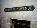 Merlyn Rees Avenue.jpg 1,600 × 1,200; 663 KB
-
 Middleton Grove - Middleton Road - geograph.org.uk - 1494398.jpg 640 × 480; 208 KB
-

-

-
 Middleton Road - viewed from High Street - geograph.org.uk - 1494339.jpg 640 × 480; 247 KB
-
 Middleton Terrace - Clough Street - geograph.org.uk - 1494349.jpg 640 × 480; 232 KB
-
 Mill Street - Bridge Street - geograph.org.uk - 1492940.jpg 480 × 640; 233 KB
-
 Morris Place - Wood Street - geograph.org.uk - 1492092.jpg 640 × 480; 250 KB
-
 Moss Lea - Hartley Street - geograph.org.uk - 1501099.jpg 640 × 480; 256 KB
-
 Nelson Place - Croft House Road - geograph.org.uk - 1500573.jpg 640 × 480; 253 KB
-
 New Bank Street - Chapel Hill - geograph.org.uk - 1499817.jpg 640 × 480; 256 KB
-

-
 New Park Street - Scatcherd Lane - geograph.org.uk - 1492174.jpg 640 × 480; 271 KB
-
 Oak Road - New Park Street - geograph.org.uk - 1492792.jpg 640 × 480; 238 KB
-
 Oak Street - Crossland Road - geograph.org.uk - 1501134.jpg 640 × 480; 247 KB
-
 Oak Street, Morley - geograph.org.uk - 639916.jpg 427 × 640; 257 KB
-
 Oddfellow Street - geograph.org.uk - 1494316.jpg 640 × 480; 260 KB
-
 Park Avenue - Scatcherd Lane - geograph.org.uk - 1492172.jpg 640 × 480; 333 KB
-
 Park Parade - Fountain Street - geograph.org.uk - 1492795.jpg 640 × 485; 212 KB
-
 Pawson Street - St Andrew's Avenue - geograph.org.uk - 1492360.jpg 640 × 480; 231 KB
-
 Peel Street - from Commercial Street - geograph.org.uk - 1494440.jpg 640 × 480; 225 KB
-
 Peel Street - Queen Street - geograph.org.uk - 1494447.jpg 640 × 480; 254 KB
-

-
 Pembroke Close - geograph.org.uk - 648570.jpg 640 × 421; 22 KB
-
 Priority this way - geograph.org.uk - 1121099.jpg 640 × 445; 52 KB
-
 Prospect Place - Victoria Road - geograph.org.uk - 1500586.jpg 640 × 480; 245 KB
-
 Quarry Lane - Bridge Street - geograph.org.uk - 671159.jpg 575 × 640; 34 KB
-
 Quarry Lane - geograph.org.uk - 6544811.jpg 1,024 × 768; 279 KB
-
 Quarry Lane, Woodkirk - geograph.org.uk - 2142275.jpg 2,000 × 1,488; 662 KB
-
 Queen's Place - Queen Street - geograph.org.uk - 1494450.jpg 480 × 640; 224 KB
-
 Queen's Road - Fountain Road - geograph.org.uk - 1492799.jpg 640 × 541; 207 KB
-
 Queen's Road - Scatcherd Lane - geograph.org.uk - 1492152.jpg 640 × 480; 215 KB
-
 Rooms Lane - Victoria Road - geograph.org.uk - 1500661.jpg 640 × 480; 221 KB
-
 Sandmead Close - geograph.org.uk - 631886.jpg 640 × 402; 19 KB
-
 Sandmead Close - Woodcross - geograph.org.uk - 1500677.jpg 640 × 480; 199 KB
-
 Sandmead Croft - Sandmead Close - geograph.org.uk - 1500674.jpg 640 × 480; 214 KB
-
 Sandmead Way - Sandmead Close - geograph.org.uk - 1500671.jpg 640 × 480; 235 KB
-
 Scatcherd Grove - Scatcherd Lane - geograph.org.uk - 1492144.jpg 640 × 480; 217 KB
-
 Scatcherd Lane - Corporation Street - geograph.org.uk - 1492138.jpg 640 × 456; 166 KB
-
 School Street - Churwell - geograph.org.uk - 631988.jpg 640 × 402; 26 KB
-
 Scotchman Lane - Bruntcliffe Road - geograph.org.uk - 1492391.jpg 640 × 480; 234 KB
-
 Shipton Mews - Wide Lane - geograph.org.uk - 1494344.jpg 640 × 480; 235 KB
-
 South Parade - Middleton Road - geograph.org.uk - 1494408.jpg 640 × 480; 231 KB
-
 South Parade - Middleton Road - geograph.org.uk - 1494417.jpg 640 × 480; 242 KB
-
 South Parade - Peel Street - geograph.org.uk - 1499647.jpg 640 × 480; 240 KB
-
 South Queen Street - High Street - geograph.org.uk - 1494326.jpg 640 × 480; 266 KB
-
 South Street - Middleton Road - geograph.org.uk - 1494420.jpg 640 × 480; 248 KB
-
 South Street - Middleton Road - geograph.org.uk - 1494422.jpg 640 × 480; 195 KB
-
 Spenslea Grove - Britannia Road - geograph.org.uk - 1492927.jpg 640 × 480; 213 KB
-
 Springfield Avenue - geograph.org.uk - 1500652.jpg 640 × 480; 238 KB
-
 Springfield Avenue - Springfield Road - geograph.org.uk - 1500660.jpg 640 × 480; 234 KB
-
 Springfield Avenue, Morley. - geograph.org.uk - 249906.jpg 640 × 480; 76 KB
-

-

-
 Springfield Lane - Victoria Road - geograph.org.uk - 1500579.jpg 640 × 480; 223 KB
-
 Springfield Road - Victoria Road - geograph.org.uk - 1500582.jpg 640 × 480; 229 KB
-
 St Andrew's Avenue - Bruntcliffe Road - geograph.org.uk - 1492378.jpg 640 × 480; 262 KB
-
 St Andrew's Avenue - Scatcherd Lane - geograph.org.uk - 1492177.jpg 640 × 480; 269 KB
-
 St Andrew's Close - St Andrew's Avenue - geograph.org.uk - 1492365.jpg 640 × 480; 224 KB
-
 St Andrew's Grove - St Andrew's Avenue - geograph.org.uk - 1492351.jpg 640 × 480; 247 KB
-
 St Paul's Street - King Street - geograph.org.uk - 1494320.jpg 640 × 480; 253 KB
-
 St Paul's Street - South Queen Street - geograph.org.uk - 1494323.jpg 640 × 480; 249 KB
-
 Station Road - geograph.org.uk - 1499805.jpg 640 × 480; 230 KB
-
 Sutton Grove - Elvaston Road - geograph.org.uk - 1492904.jpg 640 × 537; 191 KB
-
 Tennyson Street - Peel Street - geograph.org.uk - 1499650.jpg 640 × 480; 256 KB
-
 Tennyson Terrace - Peel Street - geograph.org.uk - 1499651.jpg 640 × 480; 252 KB
-
 Thackray Street - Fountain Street - geograph.org.uk - 1492802.jpg 640 × 480; 270 KB
-
 The Shoulder of Mutton, Howden Clough Road, Morley - geograph.org.uk - 2134926.jpg 2,000 × 1,394; 465 KB
-
 Thornville - Hartley Street - geograph.org.uk - 1501106.jpg 640 × 480; 279 KB
-
 Troy Rise - Troy Road - geograph.org.uk - 1499790.jpg 640 × 480; 220 KB
-
 Troy Road - viewed from Zoar Street - geograph.org.uk - 1499704.jpg 640 × 480; 263 KB
-
 Troy Road - viewed from Zoar Street - geograph.org.uk - 1499705.jpg 640 × 480; 235 KB
-
 Victoria Avenue - Victoria Road - geograph.org.uk - 1500584.jpg 640 × 480; 273 KB
-
 Victoria Grove Way - Victoria Road - geograph.org.uk - 1500588.jpg 640 × 480; 230 KB
-

-

-

-
 Walker Place - Hartley Street - geograph.org.uk - 1501098.jpg 640 × 470; 202 KB
-
 Watson Street - Fountain Street - geograph.org.uk - 1492801.jpg 640 × 480; 256 KB
-
 Wesley Street - Queen Street - geograph.org.uk - 1494453.jpg 640 × 480; 250 KB
-
 Wesley Street, Morley. - geograph.org.uk - 529626.jpg 640 × 426; 217 KB
-
 West Street - King Street - geograph.org.uk - 1494322.jpg 640 × 480; 236 KB
-
 West Street - South Queen Street - geograph.org.uk - 1494324.jpg 640 × 480; 265 KB
-
 Westwood Close - Westwood Side - geograph.org.uk - 1500683.jpg 640 × 480; 247 KB
-
 Westwood Rise - Westwood Side - geograph.org.uk - 1500681.jpg 640 × 480; 204 KB
-
 Westwood Side - Victoria Road - geograph.org.uk - 1501087.jpg 640 × 480; 245 KB
-
 Wide Lane - viewed from High Street - geograph.org.uk - 1494338.jpg 640 × 480; 249 KB
-
 Woodcross - viewed from Sandmead Close - geograph.org.uk - 1500678.jpg 640 × 480; 215 KB
-
 Woodcross - viewed from Sandmead Close - geograph.org.uk - 1500679.jpg 640 × 456; 162 KB
-
 Woodcross Fold - Woodcross - geograph.org.uk - 1500680.jpg 640 × 480; 204 KB
-
 Woodlands Drive - Woodlands Avenue - geograph.org.uk - 1500612.jpg 640 × 480; 235 KB
-
 Woodside Close - Sandmead Close - geograph.org.uk - 1500675.jpg 640 × 480; 235 KB
-
 Wynford Drive - Bruntcliffe Lane - geograph.org.uk - 668750.jpg 640 × 409; 22 KB
-
 Wynford Mount - geograph.org.uk - 665363.jpg 640 × 411; 29 KB
-
 Wynyard Drive - Corporation Street - geograph.org.uk - 1492110.jpg 640 × 480; 224 KB
-
 Zoar Street - Troy Road - geograph.org.uk - 1499701.jpg 640 × 480; 244 KB


