Category:Streets in Lewes
Jump to navigation
Jump to search
Subcategories
This category has the following 7 subcategories, out of 7 total.
C
- Cliffe High Street, Lewes (44 F)
E
F
- Fisher Street, Lewes (6 F)
H
K
- Keere Street, Lewes (9 F)
N
- North Street, Lewes (3 F)
P
Media in category "Streets in Lewes"
The following 62 files are in this category, out of 62 total.
-
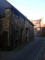 16-18 Castle Ditch Lane - geograph.org.uk - 1097580.jpg 479 × 640; 63 KB
-
 Argos, Cliffe High Street - geograph.org.uk - 1097723.jpg 640 × 543; 78 KB
-
 Brook Street - geograph.org.uk - 417440.jpg 479 × 640; 161 KB
-
 Castle Ditch Lane - geograph.org.uk - 1097577.jpg 479 × 640; 82 KB
-
 Castle Gate, Lewes - geograph.org.uk - 896986.jpg 480 × 640; 108 KB
-
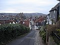
 Chapel Hill, Lewes, Sussex - geograph.org.uk - 2216725.jpg 1,871 × 2,794; 3.79 MB
-
 Church Lane, South Malling - geograph.org.uk - 417396.jpg 455 × 640; 137 KB
-
 Cliffe High Street - geograph.org.uk - 329303.jpg 640 × 479; 110 KB
-

-

-
 Cliffe High Street, Lewes - geograph.org.uk - 43480.jpg 640 × 426; 143 KB
-
 Cliffe High Street, Lewes - geograph.org.uk - 70594.jpg 640 × 479; 181 KB
-
 Cliffe High Street, Lewes, East Sussex - geograph.org.uk - 1111900.jpg 640 × 416; 123 KB
-
 Dorset Road - geograph.org.uk - 254981.jpg 640 × 479; 141 KB
-
 Eastport Lane - geograph.org.uk - 255351.jpg 479 × 640; 151 KB
-
 Keere Street - geograph.org.uk - 2092720.jpg 1,600 × 1,200; 496 KB
-
 Leicester Road, Lewes - geograph.org.uk - 284331.jpg 479 × 640; 146 KB
-
 Lewes - Chapel Hill - geograph.org.uk - 1188093.jpg 640 × 480; 88 KB
-
 Lewes - Chapel Hill - geograph.org.uk - 1188099.jpg 640 × 480; 81 KB
-
 Lewes - Cliffe High Street - geograph.org.uk - 1186616.jpg 640 × 480; 91 KB
-
 Lewes - High Street - geograph.org.uk - 1186572.jpg 640 × 480; 82 KB
-

-
 Lewes Arms - Dwyle Flunking - geograph.org.uk - 494221.jpg 640 × 468; 177 KB
-

-
 Lewes Cliffe High Street in September 2013 2.JPG 4,320 × 2,432; 5.14 MB
-
 Lewes Cliffe High Street in September 2013 3.JPG 4,320 × 2,432; 4.3 MB
-
 Lewes Cliffe High Street in September 2013 4.JPG 4,320 × 2,432; 4.07 MB
-
 Lewes Cliffe High Street in September 2013 5.JPG 4,320 × 2,432; 4.21 MB
-
 Lewes Cliffe High Street in September 2013.JPG 4,320 × 2,432; 4.49 MB
-
 Malling St (A26) - geograph.org.uk - 1834891.jpg 640 × 430; 75 KB
-
 Malling Street - geograph.org.uk - 2298342.jpg 640 × 480; 79 KB
-
 Malling Street - geograph.org.uk - 640124.jpg 479 × 640; 74 KB
-
 Market Lane - geograph.org.uk - 1097617.jpg 479 × 640; 67 KB
-
 Market Lane - geograph.org.uk - 331484.jpg 479 × 640; 120 KB
-
 Morris Road - geograph.org.uk - 292027.jpg 640 × 479; 130 KB
-
 Mount Pleasant in Lewes - geograph.org.uk - 1989053.jpg 2,584 × 3,328; 2.72 MB
-
 Old Malling Way Lewes - geograph.org.uk - 3054594.jpg 3,264 × 2,448; 3.61 MB
-
 Park Road - geograph.org.uk - 284478.jpg 640 × 479; 175 KB
-
 Rotten Row, Lewes - geograph.org.uk - 77707.jpg 479 × 640; 209 KB
-
 South Street - geograph.org.uk - 1073707.jpg 640 × 427; 35 KB
-
 South Street - geograph.org.uk - 640128.jpg 479 × 640; 65 KB
-
 South Street - geograph.org.uk - 972888.jpg 479 × 640; 75 KB
-
 South Street - geograph.org.uk - 972895.jpg 640 × 479; 95 KB
-
 South Street Lewes April 2018 01.jpg 5,313 × 2,989; 10.42 MB
-
 St James Street - geograph.org.uk - 255219.jpg 479 × 640; 164 KB
-
 St John's Street - geograph.org.uk - 331380.jpg 479 × 640; 131 KB
-
 St Nicholas Lane - geograph.org.uk - 329067.jpg 479 × 640; 124 KB
-
 St Nicholas Street, Lewes - geograph.org.uk - 2152774.jpg 480 × 640; 58 KB
-
 St Peters Place - geograph.org.uk - 284439.jpg 479 × 640; 95 KB
-
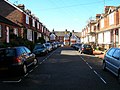
 Stansfield Road - geograph.org.uk - 417183.jpg 640 × 479; 111 KB
-
 Station Road - geograph.org.uk - 255321.jpg 640 × 479; 170 KB
-
 Station Street - geograph.org.uk - 974122.jpg 445 × 640; 101 KB
-
 Station Street, Lewes - geograph.org.uk - 2152722.jpg 480 × 640; 68 KB
-
 Station Street, Lewes - geograph.org.uk - 2152806.jpg 480 × 640; 77 KB
-
 Tanners Brook - geograph.org.uk - 254971.jpg 640 × 479; 154 KB
-
 The Avenue - geograph.org.uk - 284476.jpg 640 × 479; 191 KB
-
 The High Street at Lewes - geograph.org.uk - 1396251.jpg 640 × 480; 75 KB
-
 The Martlets - geograph.org.uk - 2115441.jpg 640 × 427; 91 KB
-
 The Spiral, Malling Street - geograph.org.uk - 291684.jpg 640 × 520; 160 KB
-
 Toronto Terrace - geograph.org.uk - 284496.jpg 479 × 640; 115 KB
-
 Valence Road - geograph.org.uk - 1097547.jpg 640 × 479; 93 KB
-
 Wallands Crescent - geograph.org.uk - 284490.jpg 479 × 640; 192 KB


_-_geograph.org.uk_-_1834891.jpg)


