Category:Streets in Ilfracombe
Jump to navigation
Jump to search
Subcategories
This category has the following 28 subcategories, out of 28 total.
B
- Belmont Avenue, Ilfracombe (2 F)
- Belmont Road, Ilfracombe (3 F)
- Brookdale Avenue, Ilfracombe (2 F)
C
- Capstone Road, Ilfracombe (3 F)
- Church Hill, Ilfracombe (3 F)
- Church Road, Ilfracombe (4 F)
- Church Street, Ilfracombe (23 F)
F
- Fore Street, Ilfracombe (38 F)
G
- Granville Road, Ilfracombe (6 F)
- Greenclose Road, Ilfracombe (3 F)
H
- Hierns Lane, Ilfracombe (2 F)
L
- Lee Place, Ilfracombe (1 F)
M
- Marlborough Road, Ilfracombe (1 F)
N
- Northfield Road, Ilfracombe (1 F)
O
- Osborne Road, Ilfracombe (5 F)
P
- Portland Street, Ilfracombe (20 F)
- Princess Avenue, Ilfracombe (1 F)
Q
R
- Regent Place, Ilfracombe (2 F)
S
- St James Place, Ilfracombe (5 F)
W
Media in category "Streets in Ilfracombe"
The following 200 files are in this category, out of 313 total.
(previous page) (next page)-

-

-

-
 A new parking meter in the High street - geograph.org.uk - 2198436.jpg 1,024 × 683; 148 KB
-
 A new parking meter in the High Street - geograph.org.uk - 2198438.jpg 1,024 × 683; 159 KB
-
 A new parking meter on Church Street - geograph.org.uk - 2198427.jpg 1,024 × 680; 164 KB
-
 A new parking meter on Fore Street - geograph.org.uk - 2198447.jpg 680 × 1,024; 143 KB
-
 A new parking meter on Wilder Road - geograph.org.uk - 2198418.jpg 1,024 × 680; 176 KB
-
 A new parking meter on Wilder Road - geograph.org.uk - 2198424.jpg 1,024 × 680; 146 KB
-

-
 A section of Bicclescombe Gardens. - geograph.org.uk - 940839.jpg 640 × 480; 93 KB
-
 A section of Furze Hill Road - geograph.org.uk - 859130.jpg 640 × 480; 83 KB
-

-

-

-
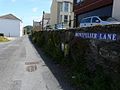 Another view of Montpelier Lane. - geograph.org.uk - 866736.jpg 640 × 480; 74 KB
-
 Arbour Close. - geograph.org.uk - 940901.jpg 640 × 480; 81 KB
-
-

-
 Avenue Street, Ilfracombe - geograph.org.uk - 731089.jpg 640 × 480; 74 KB
-

-

-
 Belvedere Road. - geograph.org.uk - 801136.jpg 640 × 480; 73 KB
-

-

-

-

-

-
 Brentwood Gardens, Ilfracombe - geograph.org.uk - 1608853.jpg 640 × 480; 66 KB
-

-
-

-
 Broad Park Avenue. - geograph.org.uk - 937056.jpg 640 × 480; 77 KB
-
 Broad street - geograph.org.uk - 744087.jpg 640 × 480; 66 KB
-
 Brookfield Place - geograph.org.uk - 795428.jpg 640 × 480; 100 KB
-
 Burnside Road. - geograph.org.uk - 954704.jpg 640 × 480; 79 KB
-
 Burrow Road - geograph.org.uk - 801124.jpg 640 × 480; 79 KB
-
-
-
 Cairnside. - geograph.org.uk - 940898.jpg 640 × 480; 104 KB
-

-
-

-
 Castle Hill - geograph.org.uk - 727494.jpg 640 × 428; 67 KB
-

-
 Cat Lane - geograph.org.uk - 957795.jpg 640 × 480; 88 KB
-
-

-

-
 Chichester Close. - geograph.org.uk - 954532.jpg 640 × 480; 103 KB
-
 Church Street, Ilfracombe - geograph.org.uk - 2849583.jpg 1,024 × 768; 177 KB
-

-
-
 Coronation Terrace - geograph.org.uk - 1392332.jpg 640 × 480; 64 KB
-

-
 Cow Lane off from the High Street - geograph.org.uk - 801153.jpg 640 × 480; 69 KB
-
 Crofts Lea Park - geograph.org.uk - 951655.jpg 640 × 480; 72 KB
-
 Crofts Lea Park - geograph.org.uk - 951663.jpg 640 × 480; 72 KB
-

-

-
 Crofts Lea Park. - geograph.org.uk - 951652.jpg 640 × 480; 92 KB
-
 Croftswood Gardens - geograph.org.uk - 954407.jpg 640 × 480; 65 KB
-

-
 Cross Park - geograph.org.uk - 795447.jpg 640 × 480; 68 KB
-
-

-
 Dovedale Close - geograph.org.uk - 957792.jpg 640 × 480; 73 KB
-
-
 Entering Cleave Wood from Score Valley. - geograph.org.uk - 804582.jpg 640 × 426; 118 KB
-

-

-

-

-
-
 Fore Street - geograph.org.uk - 1962890.jpg 480 × 640; 39 KB
-
 Fore Street Ilfracombe - geograph.org.uk - 2086478.jpg 480 × 640; 78 KB
-
 Fore Street, Ilfracombe - geograph.org.uk - 2849802.jpg 1,024 × 768; 151 KB
-

-

-
 Foxbeare Road. - geograph.org.uk - 957696.jpg 480 × 640; 88 KB
-

-

-
 Furze Hill Road - geograph.org.uk - 801106.jpg 640 × 480; 70 KB
-

-
 Gilbert Grove - geograph.org.uk - 727490.jpg 640 × 428; 66 KB
-
 Gilbert Grove - geograph.org.uk - 962018.jpg 640 × 480; 69 KB
-
 Gilbert Grove - geograph.org.uk - 962023.jpg 640 × 480; 73 KB
-
-

-

-
 Hele Business Park. - geograph.org.uk - 1302605.jpg 640 × 480; 67 KB
-
 Hele Business Park. - geograph.org.uk - 1302609.jpg 640 × 480; 69 KB
-
 Hermitage Road - geograph.org.uk - 795435.jpg 640 × 480; 88 KB
-

-

-
-

-

-

-

-

-

-

-

-

-

-

-

-

-
 Horne Park Road - geograph.org.uk - 801115.jpg 480 × 640; 71 KB
-

-
 Horne Road - geograph.org.uk - 741000.jpg 428 × 640; 62 KB
-

-

-
-

-
 St Philip and St James Church, Ilfracombe.jpg 3,596 × 2,685; 3.64 MB
-

-
 Ilfracombe Carlton Hotel - geograph.org.uk - 873679.jpg 640 × 427; 67 KB
-
 Ilfracombe High St - geograph.org.uk - 2997587.jpg 640 × 480; 76 KB
-

-
 Ilfracombe High street.jpg 750 × 536; 165 KB
-

-

-

-

-
 Lamb Park. - geograph.org.uk - 940951.jpg 640 × 480; 74 KB
-

-
-

-

-

-
 Larkstone Gardens - geograph.org.uk - 951697.jpg 640 × 480; 68 KB
-
 Larkstone Gardens. - geograph.org.uk - 951693.jpg 640 × 480; 101 KB
-

-

-

-

-

-
-

-
 Looking along The Quay, Ilfracombe - geograph.org.uk - 3065395.jpg 640 × 480; 126 KB
-

-

-

-

-

-

-
 Looking up Hillside Road. - geograph.org.uk - 957729.jpg 480 × 640; 97 KB
-

-
 Looking west along Queens Avenue - geograph.org.uk - 1392330.jpg 640 × 480; 70 KB
-

-
 Malborough Park on Malborough Road. - geograph.org.uk - 951628.jpg 640 × 480; 76 KB
-

-

-

-
 Market Street, Ilfracombe - geograph.org.uk - 731095.jpg 426 × 640; 52 KB
-

-

-

-
 Montpelier House, Montpelier Terrace, Ilfracombe - geograph.org.uk - 1747823.jpg 1,024 × 1,280; 175 KB
-

-

-
 No longer the Coop - soon to be Lidl - geograph.org.uk - 1573781.jpg 640 × 480; 56 KB
-

-
 Northfield Road, Lower end - geograph.org.uk - 731103.jpg 640 × 480; 73 KB
-

-
 Oaktree Gardens. - geograph.org.uk - 866254.jpg 480 × 640; 70 KB
-

-

-
 Orchard Grove, off Cambridge Grove. - geograph.org.uk - 866730.jpg 480 × 640; 73 KB
-
 Oxford Grove - geograph.org.uk - 873298.jpg 640 × 427; 79 KB
-

-
 Oxford Park. - geograph.org.uk - 866727.jpg 640 × 480; 78 KB
-

-
 Park Hill Road - geograph.org.uk - 801109.jpg 640 × 480; 87 KB
-

-

-
 Parkway - geograph.org.uk - 940885.jpg 640 × 480; 79 KB
-

-

-
 Part of Torr Park Road - geograph.org.uk - 801069.jpg 480 × 640; 77 KB
-

-
 Portland Street, Ilfracombe - geograph.org.uk - 3422731.jpg 1,600 × 1,220; 354 KB
-

-

-

-

-

-

-

-

-
 Road junction on Crofts Lea Park - geograph.org.uk - 951666.jpg 640 × 480; 55 KB
-

-
 Saint Brannock's Park Road heading south. - geograph.org.uk - 940806.jpg 640 × 480; 120 KB
-

-
 Saltmer Close. - geograph.org.uk - 954732.jpg 640 × 480; 86 KB
-

-
 Shaftesbury road. - geograph.org.uk - 808884.jpg 640 × 480; 106 KB
-


_-_geograph.org.uk_-_1494387.jpg)


._-_geograph.org.uk_-_808907.jpg)


