Category:Streets in Greengates, Bradford
Jump to navigation
Jump to search
Subcategories
This category has the following 12 subcategories, out of 12 total.
B
- Bridgegate Way, Bradford (2 F)
C
- Carr Bottom Road, Greengates (12 F)
H
I
N
O
- Old Park Road, Bradford (4 F)
- Osterley Grove, Greengates (3 F)
R
- Ranelagh Avenue, Greengates (4 F)
- Romanby Shaw (6 F)
- Roundwood Avenue, Greengates (5 F)
- Roundwood Glen (3 F)
Media in category "Streets in Greengates, Bradford"
The following 46 files are in this category, out of 46 total.
-
 Abinger Close, off Rockwell Lane, Thorpe Edge - geograph.org.uk - 6336694.jpg 1,024 × 768; 123 KB
-
 Ashgrove - Carr Bottom Road - geograph.org.uk - 2447888.jpg 640 × 480; 61 KB
-
 Averingcliffe Road - Orchard Grove - geograph.org.uk - 2371004.jpg 640 × 480; 56 KB
-
 Averingcliffe Road - Orchard Grove - geograph.org.uk - 2371006.jpg 640 × 480; 53 KB
-
 Bateson Street - Carr Bottom Road - geograph.org.uk - 1035414.jpg 640 × 402; 158 KB
-
 Crag View - Idlethorpe Way - geograph.org.uk - 2371010.jpg 640 × 480; 66 KB
-
 Crag View, Thorpe Edge - geograph.org.uk - 6336673.jpg 1,024 × 768; 216 KB
-
 Dorian Close - Castlegate Drive - geograph.org.uk - 2372688.jpg 640 × 480; 54 KB
-
 Elderwood Gardens - Rimswell Holt - geograph.org.uk - 2378423.jpg 640 × 480; 63 KB
-
 Farmstead Road - Idlethorpe Way - geograph.org.uk - 2371782.jpg 640 × 480; 57 KB
-
 Fir Tree Gardens - Orchard Grove - geograph.org.uk - 1412360.jpg 640 × 480; 250 KB
-
 Fir Tree Gardens - Orchard Grove - geograph.org.uk - 2371002.jpg 640 × 480; 118 KB
-
 Fir Tree Gardens - Orchard Grove - geograph.org.uk - 2462789.jpg 640 × 480; 60 KB
-

-
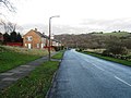
 Haigh Hall Road - New Line - geograph.org.uk - 2461177.jpg 640 × 462; 66 KB
-
 Harrogate Road and Cherry Tree Avenue, Greengates - geograph.org.uk - 6436291.jpg 2,000 × 1,360; 3.31 MB
-
 Hawthorn Drive - Parkland Drive - geograph.org.uk - 2462774.jpg 640 × 480; 53 KB
-
 Holybrook Avenue, off Harrogate Road, Greengates - geograph.org.uk - 6336649.jpg 1,024 × 768; 132 KB
-
 Jamie Court - Harrogate Road - geograph.org.uk - 1412154.jpg 640 × 480; 291 KB
-
 Kipling Court - Haigh Hall Road - geograph.org.uk - 2461180.jpg 640 × 480; 50 KB
-
 Newlay Close - Carr Bottom Road - geograph.org.uk - 2447885.jpg 640 × 480; 61 KB
-

-
 Pevensey Garth, Rowantree Drive, Thorpe Edge - geograph.org.uk - 6336698.jpg 1,024 × 768; 177 KB
-

-
-
 Rimswell Holt - Roundwood Glen - geograph.org.uk - 2378426.jpg 640 × 480; 55 KB
-

-
 Roans Brae - Redcar Road - geograph.org.uk - 1288279.jpg 640 × 480; 231 KB
-
 Roans Brae - Roundwood Glen - geograph.org.uk - 1288364.jpg 640 × 432; 170 KB
-
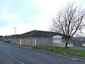 Rockwell Medical centre, Thorpe Edge - geograph.org.uk - 6336695.jpg 1,024 × 768; 177 KB
-

-
-
 Rosedale Fold, Thorpe Edge - geograph.org.uk - 6336674.jpg 1,024 × 768; 265 KB
-
 Roundwood Glen - geograph.org.uk - 3260458.jpg 640 × 480; 66 KB
-

-
 Rowlestone Rise - Redcar Road - geograph.org.uk - 2378394.jpg 640 × 480; 55 KB
-
 Rowlestone Rise - Rookwith Parade - geograph.org.uk - 2378396.jpg 640 × 521; 52 KB
-
 Rowlestone Rise, Greengates - geograph.org.uk - 2746712.jpg 640 × 480; 62 KB
-

-
 Skelton Way - Brunswick Road - geograph.org.uk - 2462784.jpg 640 × 480; 64 KB
-
 Stockhill Road, Greengates - geograph.org.uk - 3856677.jpg 4,018 × 2,908; 3.36 MB
-
 The Covet - Overland Crescent - geograph.org.uk - 2461195.jpg 640 × 473; 61 KB
-
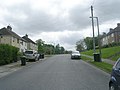
 The Drive, off Harrogate Road, Greengates - geograph.org.uk - 6336651.jpg 1,024 × 768; 306 KB
-
 The Haven - Farmstead Road - geograph.org.uk - 2371017.jpg 640 × 480; 72 KB
-
 Thorpe Edge Evangelical Church - geograph.org.uk - 6336671.jpg 1,024 × 768; 117 KB
-
 Fieldgate Road - Harrogate Road - geograph.org.uk - 1412367.jpg 640 × 480; 266 KB


