Category:Streets in Cobh
Jump to navigation
Jump to search

Subcategories
This category has the following 2 subcategories, out of 2 total.
C
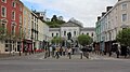
- Casement Square (11 F)
W
- West View, Cobh (40 F)
Media in category "Streets in Cobh"
The following 200 files are in this category, out of 244 total.
(previous page) (next page)-
 2017-06-14 4904x7356 cobh cathedral.jpg 4,904 × 7,356; 4.29 MB
-
 A Really Wet Day In Cobh (County Cork) (7359382976).jpg 5,597 × 3,731; 14.71 MB
-
 Albert Terrace, East Hill, Cobh - geograph.org.uk - 5840378.jpg 1,600 × 1,065; 592 KB
-
 Ballast Quay, Cobh - geograph.org.uk - 4182243.jpg 640 × 480; 157 KB
-
 Belvelly Bridge and Martello Tower - geograph.org.uk - 5829392.jpg 800 × 600; 629 KB
-
 Bishop Street - geograph.org.uk - 4909262.jpg 640 × 480; 186 KB
-
 Bishop Street, Cobh - geograph.org.uk - 4909348.jpg 640 × 480; 162 KB
-
 BMC Food Market - geograph.org.uk - 6035059.jpg 1,024 × 741; 181 KB
-
 Building at Marino Point - geograph.org.uk - 5837112.jpg 1,600 × 1,065; 495 KB
-
 Businesses on Westbourne Place, Cobh - geograph.org.uk - 5851990.jpg 1,600 × 1,065; 614 KB
-
 Carrig View the R624 at Summer Point - geograph.org.uk - 5836985.jpg 1,600 × 1,065; 550 KB
-
 Carrig View the R624, Rushbrooke - geograph.org.uk - 5836972.jpg 1,600 × 1,065; 595 KB
-
 Carrig View the R624, Rushbrooke - geograph.org.uk - 5836974.jpg 1,600 × 1,065; 609 KB
-
 Carrigaloe Ferry Terminal - geograph.org.uk - 5837040.jpg 1,600 × 1,065; 373 KB
-
 Carrignafoy Avenue, Cobh - geograph.org.uk - 4903488.jpg 640 × 480; 145 KB
-
 Carrignafoy Avenue, Cobh - geograph.org.uk - 5840335.jpg 1,600 × 1,065; 619 KB
-
 Carry Out, Cobh - geograph.org.uk - 4182247.jpg 640 × 480; 166 KB
-
 Casement Sq 20170427 3.jpg 1,920 × 1,080; 814 KB
-
 Casement Square, Cobh - geograph.org.uk - 4181406.jpg 640 × 480; 181 KB
-
 Casement Square, Cobh - geograph.org.uk - 5851861.jpg 1,600 × 1,065; 560 KB
-
 Casement Square, Cobh - geograph.org.uk - 5851864.jpg 1,600 × 1,065; 561 KB
-
 Casement Square, Cobh.jpg 2,272 × 1,704; 893 KB
-

-
 Cash for clothes collection point, Cobh - geograph.org.uk - 3060746.jpg 3,578 × 2,713; 1.37 MB
-
 Cathédrale de Cobh - panoramio.jpg 4,000 × 3,000; 2.65 MB
-
 Church St - geograph.org.uk - 6035114.jpg 1,024 × 681; 159 KB
-
 Cobh (2000) - panoramio (1).jpg 1,024 × 685; 298 KB
-
 Cobh (8103152561).jpg 3,168 × 2,112; 1.04 MB
-
 Cobh (8103154969).jpg 2,826 × 2,105; 4.61 MB
-
 Cobh (8103161674).jpg 3,168 × 2,112; 1.2 MB
-
 Cobh (8103165824).jpg 3,168 × 2,112; 897 KB
-
 Cobh (8103167532).jpg 3,168 × 2,112; 1.06 MB
-
 Cobh (An Cóbh), County Cork - geograph.org.uk - 4181396.jpg 640 × 480; 172 KB
-
 Cobh (pronounced Cove) - The Keen House (7359355004).jpg 6,000 × 4,000; 14.66 MB
-

-

-

-

-

-

-

-

-

-

-

-

-

-

-

-

-

-

-

-

-

-

-

-

-

-

-
 Cobh - panoramio (2).jpg 3,072 × 2,304; 2.15 MB
-
 Cobh - panoramio (3).jpg 3,072 × 2,304; 2.45 MB
-

-
 Cobh - The Last Port Of Call For The Titanic (7163955803).jpg 6,000 × 4,000; 20.76 MB
-
 Cobh - The Last Port Of Call For The Titanic (7163989915).jpg 6,000 × 4,000; 12.67 MB
-
 Cobh - The Last Port Of Call For The Titanic (7164000719).jpg 6,000 × 4,000; 13.68 MB
-
 Cobh - The Last Port Of Call For The Titanic (7164004059).jpg 6,000 × 4,000; 14.3 MB
-
 Cobh - The Last Port Of Call For The Titanic (7164006549).jpg 6,000 × 4,000; 17.97 MB
-
 Cobh - The Last Port Of Call For The Titanic (7349147246).jpg 6,000 × 4,000; 12.78 MB
-
 Cobh - The Last Port Of Call For The Titanic (7349156956).jpg 6,000 × 4,000; 14.79 MB
-
 Cobh - The Last Port Of Call For The Titanic (7349158250).jpg 6,000 × 4,000; 13.98 MB
-
 Cobh - The Last Port Of Call For The Titanic (7349159460).jpg 6,000 × 4,000; 12.77 MB
-
 Cobh - The Last Port Of Call For The Titanic (7349165562).jpg 6,000 × 4,000; 14.34 MB
-
 Cobh - The Last Port Of Call For The Titanic (7349173424).jpg 5,933 × 4,000; 18.86 MB
-
 Cobh - The Last Port Of Call For The Titanic (7349197826).jpg 6,000 × 4,000; 11.35 MB
-
 Cobh - The Last Port Of Call For The Titanic (7349199072).jpg 6,000 × 4,000; 13.14 MB
-
 Cobh - The Last Port Of Call For The Titanic (7349200222).jpg 6,000 × 4,000; 13.74 MB
-
 Cobh - The Last Port Of Call For The Titanic (7349202708).jpg 6,000 × 4,000; 12.46 MB
-
 Cobh - The Last Port Of Call For The Titanic (7349207044).jpg 5,385 × 3,591; 9.72 MB
-
 Cobh - The Last Port Of Call For The Titanic (7349210178).jpg 6,000 × 4,000; 14.15 MB
-
 Cobh - The Last Port Of Call For The Titanic (7349223738).jpg 6,000 × 4,000; 14.45 MB
-
 Cobh East Beach 1.jpg 4,529 × 3,321; 1.67 MB
-
 Cobh East Beach 2.jpg 4,514 × 3,315; 5.19 MB
-
 Cobh East Beach 3.jpg 4,542 × 3,380; 5.28 MB
-
 Cobh Garda Station - geograph.org.uk - 3060899.jpg 3,648 × 2,736; 3.06 MB
-
 Cobh Pearse Square 1.jpg 4,574 × 3,200; 5.59 MB
-
 Cobh Pearse Square 2.jpg 4,472 × 3,282; 6.28 MB
-
 Cobh Pearse Square 3.jpg 4,592 × 2,851; 5.14 MB
-
 Cobh Pearse Square 4.jpg 4,544 × 3,164; 1.62 MB
-
 Cobh Pearse Square 5.jpg 4,592 × 3,369; 2.15 MB
-
 Cobh West Beach 1.jpg 4,353 × 3,395; 4.46 MB
-
 Cobh West Beach 3.jpg 4,542 × 3,209; 5.14 MB
-
 Cobh West Beach 4.jpg 4,586 × 3,440; 5.17 MB
-
 Cobh West Beach 5.jpg 4,559 × 2,921; 1.46 MB
-
 Cobh West Beach 6.jpg 4,553 × 3,042; 5.36 MB
-
 Cobh West Beach 7.jpg 4,572 × 3,332; 1.69 MB
-
 Cobh West Beach 8.jpg 4,454 × 3,123; 5.1 MB
-
 Cobh Westbourne Place 1.jpg 4,519 × 2,880; 4.92 MB
-
 Cobh, 2001 - panoramio (1).jpg 1,024 × 685; 267 KB
-
 Cobh, 2001 - panoramio (2).jpg 1,024 × 685; 340 KB
-
 Cobh, 2001 - panoramio (4).jpg 1,024 × 685; 293 KB
-
 Cobh, Casement Square - geograph.org.uk - 5819408.jpg 600 × 800; 614 KB
-
 Cobh, Hilltop Park - geograph.org.uk - 5819693.jpg 800 × 533; 549 KB
-
 Cobh, Lynch's Quay - geograph.org.uk - 5819444.jpg 800 × 600; 586 KB
-
 Cobh. Co Cork. Ireland..jpg 1,061 × 1,419; 351 KB
-
 Cobh.JPG 2,048 × 1,536; 654 KB
-
 Cobh@street corner.JPG 3,170 × 2,381; 3.03 MB
-
 CobhStreet.jpg 960 × 1,280; 566 KB
-
 CobhTownLandscape2.jpg 1,280 × 960; 600 KB
-
 Colourful houses - geograph.org.uk - 5927376.jpg 1,024 × 768; 121 KB
-
 Colourful Houses at Cobh - geograph.org.uk - 596582.jpg 640 × 398; 75 KB
-
 Colourful houses, Harbour Hill, Cobh - geograph.org.uk - 1901055.jpg 480 × 640; 88 KB
-
 Colourful houses, West View - geograph.org.uk - 6035034.jpg 1,024 × 681; 159 KB
-
 Cork Road near Carrigtohill - geograph.org.uk - 5832041.jpg 800 × 601; 627 KB
-
 Corrugated Building near Carrigaloe - geograph.org.uk - 5829541.jpg 800 × 533; 597 KB
-
 Cunard Line Offices - geograph.org.uk - 4546874.jpg 3,648 × 2,736; 3.63 MB
-

-
 Deepwater Quay, Cobh - panoramio.jpg 3,072 × 2,304; 2.17 MB
-
 DSG Cock Terminal, Rushbrook - geograph.org.uk - 5836963.jpg 1,600 × 1,065; 594 KB
-
 East Beach, Cobh - geograph.org.uk - 2715374.jpg 480 × 640; 78 KB
-
 East Beach, Cobh - geograph.org.uk - 4182452.jpg 640 × 480; 184 KB
-
 East Beach, Cobh - geograph.org.uk - 5840952.jpg 1,600 × 1,065; 546 KB
-
 East Beach, Cobh, Ireland (2007).jpg 1,704 × 2,272; 2.8 MB
-
 East Cork Parkway (Eastbound) - geograph.org.uk - 5831917.jpg 800 × 533; 494 KB
-
 East Cork Parkway (Westbound) - geograph.org.uk - 5831912.jpg 800 × 533; 520 KB
-

-
 East Cork Parkway near Cobh Cross - geograph.org.uk - 5828364.jpg 800 × 533; 514 KB
-
 East Cork Parkway near Midleton - geograph.org.uk - 5832066.jpg 800 × 601; 552 KB
-

-

-
 East Hill, Cobh - geograph.org.uk - 5840369.jpg 1,600 × 1,065; 461 KB
-
 East Hill, Cobh - geograph.org.uk - 5840370.jpg 1,600 × 1,065; 423 KB
-
 East Hill, Cobh - geograph.org.uk - 5840372.jpg 1,600 × 1,065; 651 KB
-
 East Hill, Cobh - geograph.org.uk - 5840376.jpg 1,600 × 1,065; 625 KB
-
 East Hill, Cobh - geograph.org.uk - 5840381.jpg 1,600 × 1,065; 575 KB
-
 East Hill, Mount Eaton, Cobh - geograph.org.uk - 5840366.jpg 1,600 × 1,065; 663 KB
-

-
 Eastbound N25 at Junction 2 - geograph.org.uk - 5832409.jpg 800 × 601; 484 KB
-

-
 Eastbound N25 near Fota Island - geograph.org.uk - 5831915.jpg 800 × 600; 596 KB
-

-

-
 Entry Sliproad to N25 at Carrigtohill - geograph.org.uk - 5832045.jpg 800 × 600; 605 KB
-
 Eurosaver - geograph.org.uk - 6035062.jpg 681 × 1,024; 179 KB
-
 Farm track near Currabally - geograph.org.uk - 5837452.jpg 1,600 × 1,065; 749 KB
-
 Footbridge at Rushbrooke Railway Halt - geograph.org.uk - 5829549.jpg 800 × 533; 754 KB
-
 Fosters Haven off Carrignafoy Avenue, Cobh - geograph.org.uk - 5840332.jpg 1,600 × 1,065; 506 KB
-
 Gemini Unisex - Control Alt Help, Cobh - geograph.org.uk - 4182240.jpg 640 × 480; 173 KB
-
 Great Island Motors - geograph.org.uk - 5836903.jpg 1,600 × 1,065; 581 KB
-
 Harbour Hill - geograph.org.uk - 6035112.jpg 1,024 × 681; 134 KB
-
 Harbour Row from Harbour Hill, Cobh - geograph.org.uk - 1901059.jpg 480 × 640; 66 KB
-
 Harbour Row, Cobh - geograph.org.uk - 4181551.jpg 640 × 480; 181 KB
-
 Harbour Row, Cobh - geograph.org.uk - 4181561.jpg 640 × 480; 173 KB
-
 Harbour View, Cobh - geograph.org.uk - 5840688.jpg 1,600 × 1,065; 507 KB
-
 Hilltop Park, Cobh - geograph.org.uk - 5819687.jpg 800 × 533; 540 KB
-
 House on Carrignafoy Ave near Cobh - geograph.org.uk - 5839610.jpg 1,600 × 1,065; 602 KB
-
 Houses at Whitepoint Moorings, Cobh - geograph.org.uk - 5836179.jpg 1,600 × 1,065; 586 KB
-
 Houses off Carrig View, Rushbrook - geograph.org.uk - 5836968.jpg 1,600 × 1,065; 528 KB
-
 Junction of Midleton Street and Bishop Street, Cobh - geograph.org.uk - 5851052.jpg 1,600 × 1,065; 527 KB
-
 Kilgarvan, Cobh, Co. Cork, Ireland - panoramio (10).jpg 2,592 × 1,944; 1.28 MB
-
 Kilgarvan, Cobh, Co. Cork, Ireland - panoramio (11).jpg 1,944 × 2,592; 1.17 MB
-
 Kilgarvan, Cobh, Co. Cork, Ireland - panoramio (2).jpg 4,608 × 3,456; 8.26 MB
-
 Kilgarvan, Cobh, Co. Cork, Ireland - panoramio (3).jpg 4,608 × 3,456; 8.41 MB
-
 Kilgarvan, Cobh, Co. Cork, Ireland - panoramio (6).jpg 4,608 × 3,456; 6.34 MB
-
 Kilgarvan, Cobh, Co. Cork, Ireland - panoramio (7).jpg 4,608 × 3,456; 9.89 MB
-
 Kilgarvan, Cobh, Co. Cork, Ireland - panoramio.jpg 3,888 × 2,592; 1.27 MB
-

-
 Lower Midleton Street, Cobh - geograph.org.uk - 1901277.jpg 480 × 640; 60 KB
-
 Lower Midleton Street, Cobh - geograph.org.uk - 4632894.jpg 768 × 1,024; 166 KB
-
 Lower Midleton Street, Cobh - geograph.org.uk - 5165340.jpg 1,333 × 2,000; 1.12 MB
-
 Lower Midleton Street, Cobh - geograph.org.uk - 5851727.jpg 1,600 × 1,065; 460 KB
-
 LUSITANIA PEACE MEMORIAL (COBH COUNTY CORK) - panoramio.jpg 2,048 × 1,366; 1.25 MB
-
 Lynch's Quay, Cobh - geograph.org.uk - 3230160.jpg 4,000 × 3,000; 7.2 MB
-
 Lynch's Quay, Cobh - geograph.org.uk - 5840932.jpg 1,600 × 1,065; 569 KB
-
 Maisons de couleurs à Cobh, Irlande.jpg 4,000 × 3,000; 2.35 MB
-
 Marian Terrace - geograph.org.uk - 5829537.jpg 800 × 533; 578 KB
-
 Marian Terrace, Carrigaloe - geograph.org.uk - 5837057.jpg 1,600 × 1,065; 701 KB
-
 Market House shop, Cobh - geograph.org.uk - 4181439.jpg 640 × 480; 180 KB
-
 Middleton Street from Park Lane, Cobh - geograph.org.uk - 5850987.jpg 1,600 × 1,065; 620 KB
-
 Midleton Street - Cobh - County Cork.jpg 3,872 × 2,592; 3.86 MB
-
 Midleton Street, Cobh - geograph.org.uk - 5851112.jpg 1,600 × 1,065; 484 KB
-
 Minor road off the L2989 at Rossleague - geograph.org.uk - 5837208.jpg 1,600 × 1,065; 755 KB
-
 Orilia Terrace, Cobh - geograph.org.uk - 5851069.jpg 1,600 × 1,065; 486 KB
-
 Overhead Sign Gantry on the N25 - geograph.org.uk - 5832416.jpg 800 × 600; 586 KB
-

-
 Pat O'Brien Close, Cobh - geograph.org.uk - 3060750.jpg 3,135 × 2,347; 3.36 MB
-
 Pearse Square, Cobh - geograph.org.uk - 4181467.jpg 640 × 480; 176 KB
-
 Pearse Square, Cobh - geograph.org.uk - 4632275.jpg 1,024 × 768; 123 KB
-
 Pearse Square, Cobh - geograph.org.uk - 5851735.jpg 1,600 × 1,065; 592 KB
-
 Peg's Pub, Carrigaloe - geograph.org.uk - 5837051.jpg 1,600 × 1,065; 508 KB
-
 Puffer train, Cobh - geograph.org.uk - 4181424.jpg 640 × 481; 195 KB
-
 Queenstown aka Cobh (8141082551).jpg 2,500 × 1,907; 1.78 MB
-
 R624 at Carrigaloe - geograph.org.uk - 5837045.jpg 1,600 × 1,065; 538 KB
-
 R624 at Marino Point - geograph.org.uk - 5829511.jpg 800 × 533; 617 KB
-
 R624 at Marino Point - geograph.org.uk - 5837118.jpg 1,600 × 1,065; 663 KB
-
 R624 at Rushbrooke - geograph.org.uk - 5829551.jpg 800 × 533; 615 KB
-
 R624 between Carrigaloe and Rushbrooke - geograph.org.uk - 5829548.jpg 800 × 533; 614 KB
-
 R624 towards Belvelly - geograph.org.uk - 5837124.jpg 1,600 × 1,065; 623 KB
-
 R624 towards Belvelly - geograph.org.uk - 5837141.jpg 1,600 × 1,065; 1,000 KB
-
 R624 towards Carrigaloe - geograph.org.uk - 5836998.jpg 1,600 × 1,065; 599 KB

_(7359382976).jpg)


_-_panoramio_(1).jpg)
.jpg)
.jpg)
.jpg)
.jpg)
.jpg)
,_County_Cork_-_geograph.org.uk_-_4181396.jpg)
_-_The_Keen_House_(7359355004).jpg)
_dominates_Cork_Harbour_one_of_the_largest_natural_harbours_in_the_world_(7174073707).jpg)
_dominates_Cork_Harbour_one_of_the_largest_natural_harbours_in_the_world_(7174112207).jpg)
_dominates_Cork_Harbour_one_of_the_largest_natural_harbours_in_the_world_(7174129641).jpg)
_dominates_Cork_Harbour_one_of_the_largest_natural_harbours_in_the_world_(7174130801).jpg)
_dominates_Cork_Harbour_one_of_the_largest_natural_harbours_in_the_world_(7174135273).jpg)
_dominates_Cork_Harbour_one_of_the_largest_natural_harbours_in_the_world_(7174142539).jpg)
_dominates_Cork_Harbour_one_of_the_largest_natural_harbours_in_the_world_(7174143763).jpg)
_dominates_Cork_Harbour_one_of_the_largest_natural_harbours_in_the_world_(7174148211).jpg)
_dominates_Cork_Harbour_one_of_the_largest_natural_harbours_in_the_world_(7174150843).jpg)
_dominates_Cork_Harbour_one_of_the_largest_natural_harbours_in_the_world_(7174151543).jpg)
_dominates_Cork_Harbour_one_of_the_largest_natural_harbours_in_the_world_(7174152711).jpg)
_dominates_Cork_Harbour_one_of_the_largest_natural_harbours_in_the_world_(7174156763).jpg)
_dominates_Cork_Harbour_one_of_the_largest_natural_harbours_in_the_world_(7174157411).jpg)
_dominates_Cork_Harbour_one_of_the_largest_natural_harbours_in_the_world_(7174167825).jpg)
_dominates_Cork_Harbour_one_of_the_largest_natural_harbours_in_the_world_(7174169319).jpg)
_dominates_Cork_Harbour_one_of_the_largest_natural_harbours_in_the_world_(7359337826).jpg)
_dominates_Cork_Harbour_one_of_the_largest_natural_harbours_in_the_world_(7359344484).jpg)
_dominates_Cork_Harbour_one_of_the_largest_natural_harbours_in_the_world_(7359349376).jpg)
_dominates_Cork_Harbour_one_of_the_largest_natural_harbours_in_the_world_(7359365646).jpg)
_dominates_Cork_Harbour_one_of_the_largest_natural_harbours_in_the_world_(7359366148).jpg)
_dominates_Cork_Harbour_one_of_the_largest_natural_harbours_in_the_world_(7359368198).jpg)
_dominates_Cork_Harbour_one_of_the_largest_natural_harbours_in_the_world_(7359373620).jpg)
_dominates_Cork_Harbour_one_of_the_largest_natural_harbours_in_the_world_(7359374738).jpg)
_dominates_Cork_Harbour_one_of_the_largest_natural_harbours_in_the_world_(7359384010).jpg)
_dominates_Cork_Harbour_one_of_the_largest_natural_harbours_in_the_world_(7359386612).jpg)
_dominates_Cork_Harbour_one_of_the_largest_natural_harbours_in_the_world_(7359394830).jpg)
.jpg)
.jpg)

.jpg)
.jpg)
.jpg)
.jpg)
.jpg)
.jpg)
.jpg)
.jpg)
.jpg)
.jpg)
.jpg)
.jpg)
.jpg)
.jpg)
.jpg)
.jpg)
.jpg)
.jpg)


.jpg)
.jpg)
.jpg)


.jpg)
_-_geograph.org.uk_-_5831917.jpg)
_-_geograph.org.uk_-_5831912.jpg)


_-_geograph.org.uk_-_5832407.jpg)
_-_geograph.org.uk_-_5832043.jpg)


_-_geograph.org.uk_-_5831918.jpg)


_-_geograph.org.uk_-_5832412.jpg)
_-_geograph.org.uk_-_5832042.jpg)


.jpg)
.jpg)
.jpg)
.jpg)
.jpg)
.jpg)


_-_panoramio.jpg)


.jpg)


