Category:Streets in Bridlington
Jump to navigation
Jump to search
Subcategories
This category has the following 29 subcategories, out of 29 total.
- Alleys in Bridlington (8 F)
*
A
- Airedale Drive, Bridlington (4 F)
- Auburn Close, Bridlington (5 F)
B
- Belgrave Road, Bridlington (3 F)
- Bempton Lane, Bridlington (42 F)
- Britannia Road, Bridlington (3 F)
C
- Cliff Street, Bridlington (6 F)
H
K
M
N
- North Marine Drive, Bridlington (18 F)
Q
- Queen Street, Bridlington (14 F)
- Queensgate, Bridlington (41 F)
S
- Sewerby Road, Bridlington (32 F)
- Short Lane, Bridlington (14 F)
- Station Avenue, Bridlington (2 F)
W
- West Street, Bridlington (5 F)
- Windsor Crescent, Bridlington (11 F)
Media in category "Streets in Bridlington"
The following 200 files are in this category, out of 594 total.
(previous page) (next page)-

-
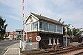 2019 at Beverley station - signal box (front).JPG 1,366 × 910; 483 KB
-
 A165 Roundabout - geograph.org.uk - 1211997.jpg 640 × 480; 73 KB
-
 Albert Street, Bridlington - geograph.org.uk - 3185895.jpg 640 × 480; 70 KB
-
 Albion Terrace, Bridlington - geograph.org.uk - 3247871.jpg 640 × 480; 85 KB
-
 Alexandra Place, Bridlington - geograph.org.uk - 1567002.jpg 640 × 480; 52 KB
-
 Alton Road, Bridlington - geograph.org.uk - 1707530.jpg 800 × 599; 104 KB
-
 Amy Johnson Avenue - geograph.org.uk - 2675895.jpg 1,600 × 1,200; 397 KB
-
 Amy Johnson Avenue - geograph.org.uk - 2675906.jpg 1,600 × 1,200; 437 KB
-
 Amy Johnson Avenue, Bridlington - geograph.org.uk - 2675888.jpg 1,600 × 1,200; 373 KB
-

-
 Applegarth Lane, Bridlington - geograph.org.uk - 1837069.jpg 640 × 480; 68 KB
-
 Applegarth Lane, Bridlington - geograph.org.uk - 2136041.jpg 640 × 480; 64 KB
-
 Applegarth Lane, Bridlington - geograph.org.uk - 2241353.jpg 1,600 × 1,200; 464 KB
-
 Applegarth Lane, Bridlington - geograph.org.uk - 2257342.jpg 1,600 × 1,200; 311 KB
-
 Ashbourne Avenue, Bridlington - geograph.org.uk - 2140685.jpg 640 × 466; 51 KB
-
 Ashville Street, Bridlington - geograph.org.uk - 2219825.jpg 1,600 × 1,200; 391 KB
-
 Auburn Walk, Bridlington - geograph.org.uk - 1709750.jpg 800 × 600; 144 KB
-
 Aysgarth Rise - geograph.org.uk - 1709940.jpg 640 × 480; 57 KB
-
 Aysgarth Rise - geograph.org.uk - 2675944.jpg 1,024 × 805; 120 KB
-
 Aysgarth Rise, Bridlington - geograph.org.uk - 2675929.jpg 1,024 × 768; 202 KB
-
 Aysgarth Rise, Bridlington - geograph.org.uk - 2675932.jpg 1,600 × 1,200; 349 KB
-
 Aysgarth Rise, Bridlington - geograph.org.uk - 2675941.jpg 1,024 × 768; 167 KB
-
 B1254, Promenade - geograph.org.uk - 5424905.jpg 640 × 426; 62 KB
-
 Backstreet Bridlington - geograph.org.uk - 3185918.jpg 640 × 480; 67 KB
-
 Badminton Close, Bridlington - geograph.org.uk - 1709998.jpg 640 × 397; 46 KB
-
 Bay View Hotel, Bridlington - geograph.org.uk - 1701969.jpg 740 × 800; 133 KB
-

-
 Bedford Grove, Bridlington - geograph.org.uk - 3184166.jpg 640 × 480; 64 KB
-
 Bempton Close, Bridlington - geograph.org.uk - 1709944.jpg 800 × 477; 55 KB
-
 Bempton Close, Bridlington - geograph.org.uk - 2721314.jpg 640 × 480; 58 KB
-
 Bempton Crescent, Bridlington - geograph.org.uk - 1706335.jpg 800 × 562; 79 KB
-
 Bempton Crescent, Bridlington - geograph.org.uk - 1709931.jpg 640 × 480; 76 KB
-
 Bempton Crescent, Bridlington - geograph.org.uk - 2714114.jpg 640 × 321; 29 KB
-
 Bempton Crescent, Bridlington - geograph.org.uk - 2721321.jpg 640 × 480; 41 KB
-
 Bempton Drive, Bridlington - geograph.org.uk - 1706324.jpg 800 × 599; 80 KB
-
 Bempton Oval, Bridlington - geograph.org.uk - 1709928.jpg 800 × 600; 75 KB
-
 Bemrose Gardens, Bridlington - geograph.org.uk - 1709945.jpg 640 × 371; 39 KB
-
 Bemrose Grove, Bridlington - geograph.org.uk - 1706326.jpg 800 × 544; 81 KB
-
 Bilsdale Crescent, Bridlington - geograph.org.uk - 1710012.jpg 640 × 480; 54 KB
-
 Blackburn Avenue, Bridlington - geograph.org.uk - 3185924.jpg 640 × 480; 73 KB
-
 Blackburn Avenue, Bridlington - geograph.org.uk - 3185939.jpg 640 × 480; 66 KB
-
 Blackburn Avenue, Bridlington - geograph.org.uk - 3185942.jpg 640 × 480; 79 KB
-
 Bladon Road, Bridlington - geograph.org.uk - 2721352.jpg 1,024 × 544; 102 KB
-
 Borough Road, Bridlington - geograph.org.uk - 2139129.jpg 640 × 480; 50 KB
-
 Borough Road, Bridlington - geograph.org.uk - 2139378.jpg 640 × 480; 64 KB
-
 Borough Road, Bridlington - geograph.org.uk - 2140715.jpg 640 × 480; 64 KB
-
 Borough Road, Bridlington - geograph.org.uk - 2217887.jpg 640 × 480; 74 KB
-
 Borough Road, Bridlington - geograph.org.uk - 2257193.jpg 1,600 × 1,200; 268 KB
-
 Bow Street, Bridlington - geograph.org.uk - 3184201.jpg 640 × 480; 54 KB
-
 Boyes (geograph 5425533).jpg 640 × 426; 39 KB
-
 Boyes, Bridlington (geograph 3185906).jpg 640 × 480; 65 KB
-
 Bransdale Road, Bridlington - geograph.org.uk - 1710004.jpg 640 × 386; 40 KB
-
 Brett Street, Bridlington - geograph.org.uk - 2139133.jpg 640 × 480; 62 KB
-
 Brett Street, Bridlington - geograph.org.uk - 2217915.jpg 640 × 480; 72 KB
-
 Brett Street, Bridlington - geograph.org.uk - 2235109.jpg 1,600 × 1,200; 384 KB
-
 Brett Street, Bridlington - geograph.org.uk - 2239312.jpg 1,600 × 1,200; 201 KB
-
 Brett Street, Bridlington - geograph.org.uk - 2257224.jpg 1,600 × 1,200; 250 KB
-
 Brett Street, Bridlington - geograph.org.uk - 2273232.jpg 1,280 × 960; 452 KB
-

-
 Bridge St, B1254 - geograph.org.uk - 5418785.jpg 640 × 426; 72 KB
-
 Bridge Street, Bridlington - geograph.org.uk - 4091397.jpg 1,600 × 1,064; 708 KB
-
 Bridlington convalescent home Yorkshire England.jpg 1,072 × 840; 116 KB
-
 Bridlington Forum - geograph.org.uk - 761827.jpg 640 × 417; 65 KB
-
 Bridlington Market - geograph.org.uk - 1348980.jpg 455 × 640; 99 KB
-

-
 Bridlington Priory - geograph.org.uk - 287383.jpg 432 × 285; 22 KB
-
 Bridlington Residential - geograph.org.uk - 1207449.jpg 640 × 480; 62 KB
-
 Bridlington the parade (i.e. promenade) Yorkshire England.jpg 1,067 × 837; 153 KB
-
 Bridlington Town Centre - geograph.org.uk - 2252067.jpg 1,024 × 768; 265 KB
-
 Bridlington Workhouse - geograph.org.uk - 820422.jpg 640 × 418; 66 KB
-
 Bridlington, convalescent home, Yorkshire, England-LCCN2002708299.jpg 3,686 × 2,759; 2.54 MB
-
 Bridlington, the parade (i.e., promenade), Yorkshire, England-LCCN2002708301.jpg 3,666 × 2,748; 3.07 MB
-
 Bright Crescent - geograph.org.uk - 1227677.jpg 640 × 427; 57 KB
-
 Bright Crescent - geograph.org.uk - 2472325.jpg 640 × 427; 76 KB
-

-

-
 Brookland Road, Bridlington - geograph.org.uk - 2139136.jpg 640 × 480; 67 KB
-
 Brookland Road, Bridlington - geograph.org.uk - 2235210.jpg 1,600 × 1,200; 246 KB
-
 Brookland Road, Bridlington - geograph.org.uk - 2257227.jpg 1,600 × 1,200; 304 KB
-
 Brookland Road, Bridlington - geograph.org.uk - 2273230.jpg 640 × 480; 60 KB
-
 Burstall Hill, Bridlington - geograph.org.uk - 1709688.jpg 800 × 600; 83 KB
-
 Cadman Road, Bridlington - geograph.org.uk - 1710168.jpg 640 × 480; 43 KB
-
 Calderdale Close, Bridlington - geograph.org.uk - 1710146.jpg 640 × 366; 43 KB
-
 Cambridge Street, Bridlington - geograph.org.uk - 2219733.jpg 1,600 × 1,200; 337 KB
-
 Cambridge Street, Bridlington - geograph.org.uk - 2241326.jpg 1,600 × 1,200; 430 KB
-
 Cardigan Road - geograph.org.uk - 3183535.jpg 640 × 480; 69 KB
-
 Cardigan Road - geograph.org.uk - 3183541.jpg 640 × 480; 67 KB
-
 Cardigan Road - geograph.org.uk - 3184092.jpg 640 × 480; 95 KB
-
 Cardigan Road - geograph.org.uk - 3184100.jpg 640 × 415; 83 KB
-
 Cardigan Road - geograph.org.uk - 3184102.jpg 640 × 480; 77 KB
-
 Cardigan Road at the junction with Horsforth Avenue - geograph.org.uk - 4650072.jpg 4,492 × 3,298; 5.1 MB
-
 Cardigan Road, Bridlington - geograph.org.uk - 2647422.jpg 700 × 519; 131 KB
-
 Cardigan Road, Bridlington - geograph.org.uk - 3183509.jpg 640 × 480; 97 KB
-
 Cardigan Road, Bridlington - geograph.org.uk - 3183513.jpg 640 × 480; 94 KB
-
 Cardigan Road, Bridlington - geograph.org.uk - 3183517.jpg 640 × 480; 103 KB
-
 Cardigan Road, Bridlington - geograph.org.uk - 3183520.jpg 640 × 480; 47 KB
-
 Cardigan Road, Bridlington - geograph.org.uk - 4815414.jpg 3,306 × 2,340; 732 KB
-
 Cardigan Road, Bridlington - geograph.org.uk - 4815417.jpg 640 × 496; 55 KB
-
 Carlisle Street, Bridlington - geograph.org.uk - 2661048.jpg 640 × 397; 50 KB
-
 Carlton Street, Bridlington - geograph.org.uk - 2137390.jpg 640 × 480; 65 KB
-
 Carlton Street, Bridlington - geograph.org.uk - 2137821.jpg 640 × 480; 59 KB
-
 Carlton Street, Bridlington - geograph.org.uk - 2241287.jpg 640 × 480; 67 KB
-
 Carlton Street, Bridlington - geograph.org.uk - 2241325.jpg 1,600 × 1,200; 394 KB
-
 Castle Howard Close, Bridlington - geograph.org.uk - 1709988.jpg 640 × 343; 34 KB
-
 Chapel St - geograph.org.uk - 5424912.jpg 640 × 426; 62 KB
-
 Chapel Street, Bridlington - geograph.org.uk - 2661018.jpg 1,000 × 709; 149 KB
-
 Chapel Street, Bridlington - geograph.org.uk - 4724995.jpg 640 × 507; 106 KB
-
 Chapel Street, Bridlington - geograph.org.uk - 5455995.jpg 2,000 × 1,500; 418 KB
-
 Chatsworth Close, Bridlington - geograph.org.uk - 1707577.jpg 640 × 479; 61 KB
-
 Church Close, Bridlington - geograph.org.uk - 2135995.jpg 640 × 480; 72 KB
-
 Clarence Road, Bridlington - geograph.org.uk - 2695824.jpg 1,600 × 1,200; 346 KB
-
 Clarence Road, Bridlington - geograph.org.uk - 3185923.jpg 640 × 480; 70 KB
-
 Clarence Street, Bridlington - geograph.org.uk - 3184175.jpg 640 × 480; 55 KB
-
 Clarence Street, Bridlington - geograph.org.uk - 3184178.jpg 640 × 480; 60 KB
-
 Cliff Road, Sewerby - geograph.org.uk - 1700414.jpg 800 × 600; 92 KB
-
 Coniston Close, Bridlington - geograph.org.uk - 1706367.jpg 800 × 599; 99 KB
-
 Cottage Farm housing development - geograph.org.uk - 294509.jpg 640 × 480; 78 KB
-
 Coverdale Garth, Bridlington - geograph.org.uk - 1710014.jpg 640 × 371; 35 KB
-
 Dale Road, Bridlington - geograph.org.uk - 2219815.jpg 1,600 × 1,200; 304 KB
-

-
 Danes Croft, Bridlington - geograph.org.uk - 1707580.jpg 800 × 599; 111 KB
-
 Darwin Road, Bridlington - geograph.org.uk - 1706339.jpg 800 × 599; 136 KB
-
 Darwin Road, Bridlington - geograph.org.uk - 2662607.jpg 1,600 × 1,200; 504 KB
-
 Darwin Road, Bridlington - geograph.org.uk - 2675911.jpg 1,600 × 1,200; 387 KB
-
 Darwin Road, Bridlington - geograph.org.uk - 3159282.jpg 640 × 480; 41 KB
-
 Deepdale Close, Bridlington - geograph.org.uk - 1710016.jpg 640 × 480; 42 KB
-
 East Road, Bridlington - geograph.org.uk - 3184107.jpg 640 × 480; 53 KB
-
 East Road, Bridlington - geograph.org.uk - 3184156.jpg 640 × 480; 54 KB
-
 East Road, Bridlington - geograph.org.uk - 3184159.jpg 640 × 480; 52 KB
-

-
 Eastfield Road, Bridlington - geograph.org.uk - 2721345.jpg 640 × 480; 64 KB
-
 Eastfield Road, Bridlington - geograph.org.uk - 2721351.jpg 640 × 480; 59 KB
-
 Eighth Avenue (west), Bridlington - geograph.org.uk - 1858672.jpg 640 × 480; 77 KB
-
 Eighth Avenue - geograph.org.uk - 2654714.jpg 1,600 × 1,200; 490 KB
-
 Eighth Avenue - geograph.org.uk - 2654716.jpg 1,600 × 1,200; 461 KB
-
 Eighth Avenue - geograph.org.uk - 2654726.jpg 1,600 × 1,200; 492 KB
-
 Eighth Avenue - geograph.org.uk - 2654738.jpg 1,600 × 1,200; 456 KB
-
 Eighth Avenue - geograph.org.uk - 2654740.jpg 1,600 × 1,200; 530 KB
-
 Eighth Avenue, Bridlington - geograph.org.uk - 1858648.jpg 640 × 480; 96 KB
-
 Eighth Avenue, Bridlington - geograph.org.uk - 2654717.jpg 640 × 480; 53 KB
-
 Eighth Avenue, Bridlington - geograph.org.uk - 4823095.jpg 640 × 405; 77 KB
-
 Ellerburn Drive, Bridlington - geograph.org.uk - 1709677.jpg 800 × 600; 94 KB
-
 Evesham Croft, Bridlington - geograph.org.uk - 1707853.jpg 800 × 600; 91 KB
-
 Fairfield Road, Bridlington - geograph.org.uk - 3184192.jpg 640 × 480; 57 KB
-
 Fairfield Road, Bridlington - geograph.org.uk - 3184195.jpg 640 × 480; 49 KB
-
 Farndale Road, Bridlington - geograph.org.uk - 1710028.jpg 640 × 480; 46 KB
-
 Ferndale Terrace - geograph.org.uk - 5418771.jpg 640 × 426; 58 KB
-
 Field Road, Bridlington - geograph.org.uk - 2139146.jpg 640 × 480; 58 KB
-
 Field Road, Bridlington - geograph.org.uk - 2239350.jpg 1,600 × 1,200; 318 KB
-
 Fifth Avenue, Bridlington - geograph.org.uk - 1858652.jpg 640 × 480; 66 KB
-
 Fifth Avenue, Bridlington - geograph.org.uk - 2654755.jpg 640 × 480; 54 KB
-
 Fifth Avenue, Bridlington - geograph.org.uk - 4823080.jpg 3,888 × 2,592; 3.86 MB
-
 Fifth Avenue, Bridlington - geograph.org.uk - 4823091.jpg 3,888 × 2,592; 4.3 MB
-
 First and Third Avenues - geograph.org.uk - 5424818.jpg 640 × 426; 55 KB
-

-
 First Avenue - geograph.org.uk - 5424820.jpg 640 × 426; 47 KB
-
 Fishermen's cottages Bridlington. - geograph.org.uk - 511904.jpg 640 × 480; 103 KB
-
 Flamborough Rd, B1254 - geograph.org.uk - 5429921.jpg 640 × 386; 38 KB
-
 Flamborough Rd, B1255 - geograph.org.uk - 5362422.jpg 640 × 429; 64 KB
-
 Flamborough Road (B1254) - geograph.org.uk - 4452501.jpg 640 × 480; 72 KB
-
 Flamborough Road (B1254) - geograph.org.uk - 4452506.jpg 640 × 480; 77 KB
-

-
 Flamborough Road (B1255) - geograph.org.uk - 4324448.jpg 640 × 480; 121 KB
-
 Flamborough Road (B1255) - geograph.org.uk - 4324460.jpg 640 × 557; 78 KB
-
 Fort Terrace - geograph.org.uk - 5424896.jpg 640 × 426; 54 KB
-
 Fort Terrace, Bridlington - geograph.org.uk - 3185915.jpg 640 × 480; 68 KB
-
 Fort Terrace, Bridlington - geograph.org.uk - 4090796.jpg 1,600 × 1,064; 872 KB
-
 Fortyfoot Grove, Bridlington - geograph.org.uk - 1858682.jpg 640 × 480; 77 KB
-
 Fortyfoot, Bridlington - geograph.org.uk - 2674749.jpg 800 × 480; 56 KB
-
 Fortyfoot, Bridlington - geograph.org.uk - 4806381.jpg 640 × 427; 62 KB
-
 Fortyfoot, Bridlington - geograph.org.uk - 4806385.jpg 640 × 441; 81 KB
-
 George Street - geograph.org.uk - 3174217.jpg 640 × 480; 58 KB
-
 Givendale Close, Bridlington - geograph.org.uk - 1710058.jpg 640 × 480; 53 KB
-
 Gordon Road, Bridlington - geograph.org.uk - 2196745.jpg 640 × 480; 62 KB
-
 Grange Road, Bridlington - geograph.org.uk - 1707896.jpg 800 × 600; 79 KB
-
 Greame Road, Bridlington - geograph.org.uk - 3240309.jpg 640 × 480; 49 KB
-
 Greame Road, Bridlington - geograph.org.uk - 3240312.jpg 640 × 384; 42 KB
-
 Greame Road, Bridlington - geograph.org.uk - 3240316.jpg 640 × 480; 60 KB
-
 Greame Road, Bridlington - geograph.org.uk - 3240319.jpg 640 × 480; 62 KB
-
 Great Barn Street, Bridlington - geograph.org.uk - 1707906.jpg 800 × 600; 76 KB
-
 Greenways Close, Bridlington - geograph.org.uk - 1709984.jpg 640 × 353; 52 KB
-
 Gypsey Road, Bridlington - geograph.org.uk - 2139144.jpg 640 × 480; 65 KB
-
 Gypsey Road, Bridlington - geograph.org.uk - 2239330.jpg 1,600 × 1,200; 300 KB
-
 Haddon Road, Bridlington - geograph.org.uk - 1707532.jpg 800 × 599; 90 KB
-
 Harewood Avenue, Bridlington - geograph.org.uk - 1707590.jpg 800 × 599; 93 KB
-
 Harland Road, Bridlington - geograph.org.uk - 2662667.jpg 1,600 × 1,200; 472 KB
-
 Harland Road, Bridlington - geograph.org.uk - 2662677.jpg 1,600 × 1,200; 341 KB
-
 Haslemere Avenue, Bridlington - geograph.org.uk - 3247860.jpg 640 × 480; 70 KB
-
 Haslemere Avenue, Bridlington - geograph.org.uk - 3247862.jpg 640 × 480; 77 KB
-
 Haslemere Avenue, Bridlington - geograph.org.uk - 3247864.jpg 640 × 480; 75 KB
-
 Haslemere Avenue, Bridlington - geograph.org.uk - 4091640.jpg 1,600 × 1,064; 585 KB
-
 Havelock Crescent, Bridlington - geograph.org.uk - 2136068.jpg 640 × 480; 71 KB
-
 Havelock Crescent, Bridlington - geograph.org.uk - 2136110.jpg 640 × 480; 78 KB
-
 Havelock Crescent, Bridlington - geograph.org.uk - 2137409.jpg 640 × 480; 57 KB
-
 Havelock Crescent, Bridlington - geograph.org.uk - 2241335.jpg 640 × 480; 68 KB
-
 Havelock Crescent, Bridlington - geograph.org.uk - 5831053.jpg 1,024 × 773; 141 KB
-
 Havelock Place, Bridlington - geograph.org.uk - 2137396.jpg 640 × 480; 56 KB
-
 Havelock Street, Bridlington - geograph.org.uk - 2136101.jpg 640 × 480; 73 KB
-
 Havelock Street, Bridlington - geograph.org.uk - 2137393.jpg 640 × 480; 65 KB

.JPG)


.jpg)
.jpg)


_(25160530911).jpg)


_Yorkshire_England.jpg)


,_Yorkshire,_England-LCCN2002708301.jpg)


,_Bridlington_-_geograph.org.uk_-_2139161.jpg)


,_Bridlington_-_geograph.org.uk_-_1858672.jpg)


_-_geograph.org.uk_-_4452501.jpg)
_-_geograph.org.uk_-_4452506.jpg)
,_Bridlington_-_geograph.org.uk_-_1858592.jpg)
_-_geograph.org.uk_-_4324448.jpg)
_-_geograph.org.uk_-_4324460.jpg)


