Category:Streets in Birkenhead
Jump to navigation
Jump to search
Streets in Birkenhead, Merseyside, England.
See also Category:Roads in Birkenhead.
To follow existing Wikimedia Commons conventions:-
Category:Streets in Birkenhead is for images of urban, sububurban streets, etc.
Category:Roads in Birkenhead is for images of roads themselves as a means of transport.
Subcategories
This category has the following 30 subcategories, out of 30 total.
A
B
- Belmont, Birkenhead (14 F)
C
D
E
- Egerton Park, Rock Ferry (9 F)
G
H
I
M
O
S
- St John's Square, Birkenhead (6 F)
- School Lane, Bidston (11 F)
- Spring Villas, Oxton (5 F)
V
Media in category "Streets in Birkenhead"
The following 200 files are in this category, out of 342 total.
(previous page) (next page)-
 07-06-77-Silver-Jubilee-Street-Party-scan04.png 1,560 × 1,686; 4.72 MB
-
 27-06-81-Europa-Airship-scan01.png 2,904 × 1,948; 10.1 MB
-
 A552 Borough Road, Birkenhead.JPG 3,648 × 2,736; 3.55 MB
-
 A553 Conway Street, Birkenhead 1.JPG 3,648 × 2,736; 3.51 MB
-
 A553 Conway Street, Birkenhead 2.JPG 3,648 × 2,736; 3.64 MB
-
 A553 Hoylake Road, Birkenhead 1.JPG 3,648 × 2,736; 3.53 MB
-
 A553 Hoylake Road, Birkenhead 2.JPG 3,648 × 2,736; 3.54 MB
-
 A553 Hoylake Road, Birkenhead 3.JPG 3,648 × 2,736; 3.56 MB
-
 A553 Park Road North, Birkenhead 1.JPG 3,648 × 2,736; 3.61 MB
-
 A553 Park Road North, Birkenhead 2.JPG 3,648 × 2,736; 3.59 MB
-
 A553 Park Road North, Birkenhead 3.JPG 3,648 × 2,736; 3.57 MB
-
 Aberdeen Street, Birkenhead.jpg 4,320 × 3,240; 2.57 MB
-
 Ackers Road, Woodchurch - geograph.org.uk - 657967.jpg 640 × 426; 71 KB
-
 Alton Road, Oxton - DSC09386.JPG 3,648 × 2,736; 3.52 MB
-
 Arno Road, Oxton - IMG 1264.JPG 4,320 × 3,240; 4.29 MB
-
 Arno Road, Oxton, Birkenhead.JPG 3,648 × 2,736; 3.59 MB
-
 Beaufort Road, Birkenhead (1).JPG 4,608 × 3,456; 3.39 MB
-
 Beaufort Road, Birkenhead (2).JPG 4,608 × 3,456; 3.3 MB
-
 Benkid77 Cammel Laird 080809.JPG 3,648 × 2,736; 3.61 MB
-
 Benkid77 Cleveland Street, Birkenhead 090809.JPG 3,648 × 2,736; 3.59 MB
-
 Benkid77 Frodsham Street, Tranmere 080809.JPG 3,648 × 2,736; 3.54 MB
-
 Benkid77 Park Road South, Birkenhead 090809.JPG 3,648 × 2,736; 3.59 MB
-
 Benkid77 Park Road South, Birkenhead 2 090809.JPG 3,648 × 2,736; 3.59 MB
-
 Benkid77 Prenton Dell Road 200709.JPG 2,240 × 1,680; 805 KB
-
 Beryl Road, Birkenhead - IMG 1172.JPG 4,320 × 3,240; 3.89 MB
-
 Bidston Avenue, Birkenhead.JPG 3,648 × 2,736; 3.55 MB
-
 Bidston, Birkenhead - DSC03534.JPG 3,648 × 2,736; 3.65 MB
-
 Bidston, Birkenhead - DSC03538.JPG 3,648 × 2,736; 3.62 MB
-
 Bidston, Birkenhead - DSC03539.JPG 3,648 × 2,736; 3.59 MB
-
 Bidston, Birkenhead - DSC03540.JPG 3,648 × 2,736; 3.59 MB
-
 Bidston, Birkenhead - DSC03541.JPG 3,648 × 2,736; 3.45 MB
-
 Bidston, Birkenhead - DSC03543.JPG 3,648 × 2,736; 3.61 MB
-
 Bidston, Birkenhead - DSC03545.JPG 3,648 × 2,736; 3.59 MB
-
 Bidston, Birkenhead - DSC03546.JPG 3,648 × 2,736; 3.58 MB
-
 Bidston, Birkenhead - DSC03547.JPG 3,648 × 2,736; 3.33 MB
-
 Bidston, Birkenhead - DSC03548.JPG 3,648 × 2,736; 3.57 MB
-
 Dead-end street off Campbeltown Road, Birkenhead.JPG 4,320 × 3,240; 3.69 MB
-
 Birkenhead - Carrington Street - geograph.org.uk - 474903.jpg 640 × 480; 80 KB
-
 Bluebell Avenue, Claughton (2).JPG 4,608 × 3,456; 3.42 MB
-
 Bottom of Sandford Street - geograph.org.uk - 1000213.jpg 640 × 426; 94 KB
-
 Bramwell Avenue, Prenton - DSC09334.JPG 3,648 × 2,736; 3.59 MB
-
 Brancote Road, Oxton (1).JPG 4,320 × 3,240; 3.39 MB
-
 Brancote Road, Oxton (2).JPG 4,320 × 3,240; 3.46 MB
-
 Brancote Road, Oxton (3).JPG 4,320 × 3,240; 4.32 MB
-
 Brattan Road, Birkenhead - IMG 0592.JPG 4,320 × 3,240; 3.45 MB
-
 Bridge over the railway, Buccleuch Street, Birkenhead - IMG 0327.JPG 4,320 × 3,240; 3.35 MB
-

-
 Brill Street, Birkenhead.JPG 4,608 × 3,456; 3.3 MB
-
 Brook Street, Birkenhead (1).JPG 4,608 × 3,456; 3.1 MB
-
 Brook Street, Birkenhead (2).jpg 4,320 × 3,240; 2.85 MB
-
 Bryanston Road, Prenton.JPG 4,608 × 3,456; 3.4 MB
-
 Buccleuch Street, Birkenhead - IMG 0326.JPG 4,320 × 3,240; 2.75 MB
-
 Burrell Road, Prenton - DSC09328.JPG 3,648 × 2,736; 3.53 MB
-
 Cammell Lairds Shipbuilding Hangar - geograph.org.uk - 377057.jpg 640 × 480; 87 KB
-
 Carrington Street, Birkenhead (1).JPG 4,000 × 3,000; 2.87 MB
-
 Carrington Street, Birkenhead (2).JPG 4,000 × 3,000; 2.72 MB
-
 Carrington Street, Birkenhead 1.JPG 3,648 × 2,736; 3.6 MB
-
 Carrington Street, Birkenhead 2.JPG 3,648 × 2,736; 3.42 MB
-
 Catherine Street, Birkenhead 1.JPG 3,648 × 2,736; 3.51 MB
-
 Catherine Street, Birkenhead 2.JPG 3,648 × 2,736; 3.49 MB
-
 Cecil Road, Prenton (1).JPG 4,608 × 3,456; 3.47 MB
-
 Cecil Road, Prenton (2).JPG 4,608 × 3,456; 3.49 MB
-
 Chatham Road, Rock Ferry.JPG 3,648 × 2,736; 3.49 MB
-
 Christleton Close, Prenton.JPG 4,320 × 3,240; 3.88 MB
-
 Church Street, Birkenhead (1).JPG 4,320 × 3,240; 3.1 MB
-
 Circular Road, Birkenhead.jpg 4,320 × 3,240; 3.12 MB
-
 Claughton Firs, Oxton 1.JPG 3,648 × 2,736; 3.52 MB
-
 Claughton Firs, Oxton 2.JPG 3,648 × 2,736; 3.62 MB
-
 Claughton Road, Birkenhead (01).jpg 3,072 × 2,304; 1.81 MB
-
 Claughton Road, Birkenhead 1.JPG 3,648 × 2,736; 3.59 MB
-
 Claughton Road, Birkenhead by Gene Hunt.jpg 3,072 × 2,304; 1.78 MB
-
 Claughton, Birkenhead - DSC03529.JPG 3,648 × 2,736; 3.66 MB
-
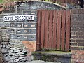
 Clive Road, Birkenhead - IMG 1199.JPG 4,320 × 3,240; 2.26 MB
-
 Clive Road, Oxton - DSC04378.JPG 3,648 × 2,736; 3.5 MB
-
 Construction works on Tower Road, Birkenhead.jpg 4,320 × 3,240; 3 MB
-
 Corfu Street, Birkenhead.jpg 4,965 × 3,204; 9.72 MB
-
 Corner of Buccleuch Street and Tweed Street, Birkenhead - IMG 0329.JPG 4,320 × 3,240; 3.25 MB
-
 Corner of Buccleuch Street and Tweed Street, Birkenhead - IMG 0331.JPG 4,320 × 3,240; 4.17 MB
-
 Corner of Maybank Road, Tranmere.JPG 4,320 × 3,240; 3.08 MB
-
 Cornwall Drive, Prenton.JPG 4,320 × 3,240; 3.37 MB
-
 Corporation Road, Birkenhead (1) (2).jpg 4,320 × 3,240; 2.89 MB
-
 Corporation Road, Birkenhead (1).JPG 4,320 × 3,240; 3.03 MB
-
 Corporation Road, Birkenhead - 2013-04-14.JPG 4,000 × 3,000; 2.71 MB
-
 Croft Edge, Oxton - IMG 0964.JPG 4,320 × 3,240; 5.06 MB
-
 Croft Edge, Oxton - IMG 0966.JPG 4,320 × 3,240; 5.2 MB
-
 Croft Edge, Oxton - IMG 1268.JPG 4,320 × 3,240; 3.97 MB
-
 Curzon Road, Prenton (1).JPG 4,608 × 3,456; 3.44 MB
-
 Curzon Road, Prenton (2).JPG 4,608 × 3,456; 3.56 MB
-
 Dacre Street, Birkenhead (1).JPG 4,608 × 3,456; 3.44 MB
-
 Demolished streets, Rock Ferry (1).JPG 4,608 × 3,456; 3.41 MB
-
 Demolished streets, Rock Ferry (2).JPG 4,608 × 3,456; 3.44 MB
-
 Demolished streets, Rock Ferry (3).JPG 4,608 × 3,456; 3.61 MB
-
 Edinburgh Drive, Prenton - DSC09336.JPG 3,648 × 2,736; 3.57 MB
-
 Elm Street, Birkenhead (3869698133).jpg 3,072 × 2,304; 1.83 MB
-
 Euston Grove, Birkenhead 1.JPG 3,648 × 2,736; 3.61 MB
-
 Euston Grove, Birkenhead 2.JPG 3,648 × 2,736; 3.54 MB
-
 Euston Grove, Birkenhead 3.JPG 3,648 × 2,736; 3.66 MB
-
 Exmouth Street, Birkenhead - DSCF0053.JPG 4,000 × 3,000; 2.87 MB
-
 Exmouth Street, Birkenhead - DSCF0054.JPG 4,000 × 3,000; 2.87 MB
-
 Fallen tree on Tower Wharf, Birkenhead.JPG 4,320 × 3,240; 3.7 MB
-
 Farndon Way, Oxton - IMG 1281.JPG 4,320 × 3,240; 2.31 MB
-
 Farndon Way, Oxton - IMG 1282.JPG 4,320 × 3,240; 2.51 MB
-
 Fountain Street, Tranmere 1.JPG 3,648 × 2,736; 3.48 MB
-
 Fountain Street, Tranmere 2.JPG 3,648 × 2,736; 3.61 MB
-
 Foxdale Close, Oxton - DSC09377.JPG 3,648 × 2,736; 3.45 MB
-
 Frodsham Street, Tranmere.JPG 4,320 × 3,240; 3.33 MB
-
 Gap between houses, Hampden Road, Tranmere.JPG 4,320 × 3,240; 3.02 MB
-
 Gertrude Street, Birkenhead.JPG 4,320 × 3,240; 3.48 MB
-
 Golden Palace, Crofton Road, Tranmere.JPG 4,608 × 3,456; 3.45 MB
-
 Gothic Street, Rock Ferry (2).JPG 4,320 × 3,240; 2.67 MB
-
 Grange Mount, Birkenhead 1.JPG 3,648 × 2,736; 3.61 MB
-
 Grange Mount, Birkenhead 2.JPG 3,648 × 2,736; 3.61 MB
-
 Grange Mount, Birkenhead 3.JPG 3,648 × 2,736; 3.53 MB
-
 Grange Precinct, Birkenhead - 2013-02-24.JPG 4,320 × 3,240; 3.25 MB
-
 Grange Precinct, Birkenhead.jpg 1,719 × 2,292; 465 KB
-
 Green Lane, Birkenhead - IMG 0320.JPG 4,320 × 3,240; 3.98 MB
-
 Hamilton Square and station - geograph.org.uk - 532956.jpg 426 × 640; 109 KB
-
 Harrowby Road South from Fountain Street.JPG 3,648 × 2,736; 3.62 MB
-
 Hemingford Street, Birkenhead 1.JPG 3,648 × 2,736; 3.47 MB
-
 Henthorne Street, Birkenhead 2.JPG 3,648 × 2,736; 3.55 MB
-
 Henthorne Street, Birkenhead.JPG 3,648 × 2,736; 3.5 MB
-
 Holborn Hill, Tranmere.jpg 3,240 × 4,320; 3.89 MB
-
 Holm Lane, Prenton.JPG 4,608 × 3,456; 3.32 MB
-
 Holmlands Drive, Prenton.JPG 4,608 × 3,456; 3.25 MB
-
 Hornby Street, Birkenhead.JPG 3,648 × 2,736; 3.59 MB
-
 Houses on Claughton Road, Birkenhead.JPG 4,320 × 3,240; 3.33 MB
-
 Hughes Lane, Oxton - IMG 1266.JPG 4,320 × 3,240; 4.42 MB
-
 Humber Street, Birkenhead - IMG 0332.JPG 4,320 × 3,240; 4.67 MB
-
 Humber Street, Birkenhead - IMG 0333.JPG 4,320 × 3,240; 4.91 MB
-
 India Terrace, Laird Street, Birkenhead.JPG 3,648 × 2,736; 3.55 MB
-
 Ingestre Road, Oxton - 2013-03-23.JPG 4,608 × 3,456; 3.33 MB
-
 Inglemere Road - geograph.org.uk - 730475.jpg 640 × 480; 98 KB
-
 Ionic Street, Rock Ferry (1).JPG 4,608 × 3,456; 3.39 MB
-
 Ionic Street, Rock Ferry.JPG 4,320 × 3,240; 2.97 MB
-
 Kelvin Road, Tranmere.JPG 4,608 × 3,456; 3.68 MB
-
 Kent Street, Oxton - IMG 1185.JPG 4,320 × 3,240; 4 MB
-
 Layton Avenue, Prenton - DSC09344.JPG 3,648 × 2,736; 3.54 MB
-
 Layton Avenue, Prenton - DSC09345.JPG 3,648 × 2,736; 3.58 MB
-
 Lees Avenue, Rock Ferry (1).JPG 4,320 × 3,240; 3.42 MB
-
 Lees Avenue, Rock Ferry (2).JPG 4,320 × 3,240; 3.24 MB
-
 Liverpool Cathedral from Ashburton Road, Birkenhead - IMG 0576.JPG 4,320 × 3,240; 1.92 MB
-
 Looking towards Thorneycroft Street from Rundle Street, Birkenhead (1).JPG 4,000 × 3,000; 2.74 MB
-
 Looking towards Thorneycroft Street from Rundle Street, Birkenhead (2).JPG 4,000 × 3,000; 3 MB
-
 Mallaby Street, Birkenhead.JPG 3,648 × 2,736; 3.68 MB
-
 Manor Hill, Claughton - DSC09374.JPG 3,648 × 2,736; 3.65 MB
-
 Market Street, Birkenhead - geograph.org.uk - 254459.jpg 640 × 480; 61 KB
-
 Marlborough Grove, Birkenhead - IMG 1189.JPG 4,320 × 3,240; 2.71 MB
-
 Mather Road, Birkenhead.JPG 3,648 × 2,736; 3.58 MB
-
 Merlin Road, Birkenhead (1).JPG 4,320 × 3,240; 3.15 MB
-
 Merlin Road, Birkenhead (2).JPG 4,320 × 3,240; 3.31 MB
-
 Merlin Road, Birkenhead (3).JPG 4,320 × 3,240; 3.24 MB
-
 Merlin Road, Birkenhead (4).JPG 4,320 × 3,240; 3.14 MB
-
 Milner Street - Birkenhead.jpg 2,035 × 1,963; 488 KB
-
 Milner Street, Birkenhead (1).JPG 4,000 × 3,000; 2.74 MB
-
 Milner Street, Birkenhead (2).JPG 4,000 × 3,000; 2.86 MB
-
 Milner Street, Birkenhead (3).JPG 4,000 × 3,000; 2.89 MB
-
 Milner Street, Birkenhead (4).JPG 4,000 × 3,000; 2.86 MB
-
 Milner Street, Birkenhead (5).JPG 4,000 × 3,000; 2.77 MB
-
 Milner Street, Birkenhead (6).JPG 4,000 × 3,000; 2.77 MB
-
 Milner Street, Birkenhead.JPG 3,648 × 2,736; 3.48 MB
-
 Miriam Place, Birkenhead.JPG 3,648 × 2,736; 3.45 MB
-
 Mollington Street, Birkenhead (2).JPG 4,608 × 3,456; 3.48 MB
-
 Mollington Street, Birkenhead (3).JPG 4,608 × 3,456; 3.44 MB
-
 Monks Ferry fingerpost 1.JPG 3,648 × 2,736; 3.64 MB
-
 Mossley Road, Tranmere.JPG 4,320 × 3,240; 2.5 MB
-
 Mount Grove, Birkenhead.JPG 4,608 × 3,456; 3.34 MB
-
 Mount Road, Prenton.JPG 4,320 × 3,240; 3.65 MB
-
 Mountwood Road, Prenton - DSC09319.JPG 3,648 × 2,736; 3.52 MB
-
 Mountwood Road, Prenton - DSC09323.JPG 3,648 × 2,736; 3.61 MB
-
 Mountwood Road, Prenton.JPG 4,320 × 3,240; 5.46 MB
-
 Naylor Road, Birkenhead.jpg 4,608 × 3,456; 3.39 MB
-
 New Hey Road, Woodchurch, Wirral.JPG 4,000 × 3,000; 2.88 MB
-
 Noctorum Dell.jpg 4,955 × 3,300; 22.33 MB
-
 Noctorum, Birkenhead - DSC03632.JPG 3,648 × 2,736; 3.58 MB
-
 Noctorum, Birkenhead - DSC03634.JPG 3,648 × 2,736; 3.56 MB
-
 Noctorum, Birkenhead - DSC03635.JPG 3,648 × 2,736; 3.46 MB
-
 Noctorum, Birkenhead - DSC03636.JPG 3,648 × 2,736; 3.52 MB
-
 Noctorum, Birkenhead - DSC03638.JPG 3,648 × 2,736; 3.48 MB
-
 Noctorum, Birkenhead - DSC03641.JPG 3,648 × 2,736; 3.58 MB
-
 Noctorum, Birkenhead - DSC03642.JPG 3,648 × 2,736; 3.57 MB
-
 Noctorum, Birkenhead - DSC03643.JPG 3,648 × 2,736; 3.56 MB
-
 Noctorum, Birkenhead - DSC03658.JPG 3,648 × 2,736; 3.53 MB
-
 Offices, Birkenhead 1.JPG 3,648 × 2,736; 3.49 MB
-
 Old Bidston Road, Birkenhead (1).jpg 4,320 × 3,240; 3.58 MB
-
 Olive Crescent, Tranmere (2).JPG 4,320 × 3,240; 4.68 MB
-
 Olive Crescent, Tranmere.JPG 3,648 × 2,736; 3.55 MB
-
 Oliver Street, Birkenhead 1.JPG 3,648 × 2,736; 3.58 MB
-
 Oulton Close, Prenton - DSC09348.JPG 3,648 × 2,736; 3.47 MB
-
 Oxton, Birkenhead - DSC03674.JPG 3,648 × 2,736; 3.63 MB
-
 Oxton, Birkenhead - DSC03675.JPG 3,648 × 2,736; 3.6 MB
-
 Oxton, Birkenhead - DSC03676.JPG 3,648 × 2,736; 3.65 MB
-
 Oxton, Birkenhead - DSC03679.JPG 3,648 × 2,736; 3.57 MB
-
 Oxton, Birkenhead - DSC03680.JPG 3,648 × 2,736; 3.54 MB
-
 Oxton, Birkenhead - DSC03681.JPG 3,648 × 2,736; 3.65 MB
-
 Oxton, Birkenhead - DSC03682.JPG 3,648 × 2,736; 3.52 MB
-
 Oxton, Birkenhead - DSC03683.JPG 3,648 × 2,736; 3.61 MB
-
 Palm Hill, Oxton - DSC04318.JPG 3,648 × 2,736; 3.56 MB
-
 Parrs Road, Oxton - IMG 0967.JPG 4,320 × 3,240; 4.73 MB
-
 Parrs Road, Oxton - IMG 1265.JPG 4,320 × 3,240; 4.71 MB
-
 Paterson Street, Birkenhead.jpg 4,960 × 3,273; 10.22 MB


.JPG)
.JPG)


.JPG)


.JPG)
.JPG)
.JPG)


.JPG)
.jpg)


.JPG)
.JPG)


.JPG)
.JPG)


.JPG)


.jpg)


_(2).jpg)
.JPG)


.JPG)
.JPG)
.JPG)
.JPG)
.JPG)
.JPG)

.jpg)


.JPG)


.JPG)


.JPG)
.JPG)

.JPG)
.JPG)


.JPG)
.JPG)
.JPG)
.JPG)

.JPG)
.JPG)
.JPG)
.JPG)
.JPG)
.JPG)


.JPG)
.JPG)


.jpg)
.JPG)


