Category:Streets in Aylesbury
Jump to navigation
Jump to search
Subcategories
This category has the following 4 subcategories, out of 4 total.
Media in category "Streets in Aylesbury"
The following 43 files are in this category, out of 43 total.
-
 Park Street - geograph.org.uk - 1146477.jpg 640 × 480; 68 KB
-
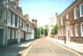 Aylesbury Church Street.jpg 580 × 393; 45 KB
-
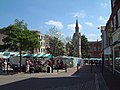
 Aylesbury Market Square Bucks.jpg 468 × 298; 50 KB
-
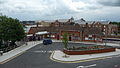
 Aylesbury railway station bus lane.JPG 3,712 × 2,088; 2.98 MB
-
 Aylesbury railway station bus stop.JPG 3,712 × 2,088; 2.92 MB
-
 Aylesbury railway station.JPG 3,712 × 2,088; 3.17 MB
-
 Aylesbury Saturday Market - geograph.org.uk - 725305.jpg 640 × 480; 87 KB
-
 Aylesbury Station Boulevard.JPG 3,712 × 2,088; 2.91 MB
-
 Aylesbury, Bourbon Street - geograph.org.uk - 897471.jpg 640 × 480; 82 KB
-

-
 Aylesbury, Castle Street - geograph.org.uk - 897311.jpg 640 × 480; 69 KB
-
 Aylesbury, Castle Street - geograph.org.uk - 897342.jpg 640 × 480; 60 KB
-
 Aylesbury, Parson's Fee - geograph.org.uk - 897325.jpg 640 × 480; 97 KB
-
 Aylesbury, Penn Road, California - geograph.org.uk - 898429.jpg 640 × 480; 67 KB
-

-

-
 Bicester Road looking east - geograph.org.uk - 58041.jpg 640 × 480; 81 KB
-
 Bicester Road looking west - geograph.org.uk - 58034.jpg 640 × 480; 100 KB
-
 Bicester Road looking west - geograph.org.uk - 58035.jpg 640 × 480; 100 KB
-
 Camborne Avenue - geograph.org.uk - 1145082.jpg 640 × 480; 72 KB
-
 Cambridge Street - Aylesbury - geograph.org.uk - 41623.jpg 640 × 429; 67 KB
-
 Cambridge Street - Aylesbury - geograph.org.uk - 41624.jpg 640 × 429; 86 KB
-
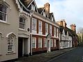 Church Street, Aylesbury.jpg 2,703 × 1,995; 2.84 MB
-
 Dickens Way looking north - geograph.org.uk - 58108.jpg 640 × 480; 115 KB
-
 Ellen Road roundabout - geograph.org.uk - 1146712.jpg 640 × 480; 60 KB
-
 Ellen Road, Aylesbury - geograph.org.uk - 248148.jpg 640 × 480; 92 KB
-
 Exchange Street, Aylesbury. - geograph.org.uk - 731050.jpg 640 × 480; 68 KB
-
 Harvey Road - geograph.org.uk - 1146697.jpg 640 × 480; 86 KB
-
 Holman Street - geograph.org.uk - 1223779.jpg 640 × 480; 65 KB
-
 Intalbury Avenue, Aylesbury - geograph.org.uk - 96968.jpg 640 × 480; 58 KB
-
 Kingsbury, Aylesbury - geograph.org.uk - 649022.jpg 640 × 480; 107 KB
-
 Market Square - Aylesbury - geograph.org.uk - 41429.jpg 640 × 481; 101 KB
-
 Meredith Drive looking east - geograph.org.uk - 58044.jpg 640 × 480; 107 KB
-
 Oakfield Road, Aylesbury - geograph.org.uk - 197599.jpg 480 × 640; 112 KB
-
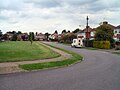
 Road to Walton Court, Aylesbury - geograph.org.uk - 248141.jpg 640 × 487; 95 KB
-
 Service Road, Bedgrove - geograph.org.uk - 197571.jpg 640 × 480; 119 KB
-
 St Mary's Church - Aylesbury.jpg 2,012 × 2,844; 927 KB
-
 St Mary's Square, Aylesbury - geograph.org.uk - 649020.jpg 480 × 640; 98 KB
-
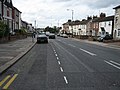
 The A41 leaves Aylesbury - geograph.org.uk - 1588864.jpg 640 × 385; 92 KB
-
 Turnfurlong.jpg 1,037 × 778; 164 KB
-
 Walton Street at Giratory - geograph.org.uk - 731058.jpg 640 × 480; 76 KB
-
 Wellington Road, Aylesbury - geograph.org.uk - 5117925.jpg 1,024 × 715; 162 KB
-
 Wendover Road, Bedgrove - geograph.org.uk - 197310.jpg 480 × 640; 98 KB


