Category:Street maps of Paris 19e arrondissement
Jump to navigation
Jump to search
|
Paris 1 • 2 • 3 • 4 • 5 • 6 • 7 • 8 • 9 • 10 • 11 • 12 • 13 • 14 • 15 • 16 • 17 • 18 • 19 • 20 |
| NO WIKIDATA ID FOUND! Search for Street maps of Paris 19e arrondissement on Wikidata | |
| Upload media |
Subcategories
This category has only the following subcategory.
Media in category "Street maps of Paris 19e arrondissement"
The following 7 files are in this category, out of 7 total.
-
 Paris 19e arrondissement - Eugène Andriveau-Goujon.jpg 4,584 × 3,816; 6.03 MB
-
 Paris 19th arrondissement map with listings - wts.svg 346 × 301; 7.12 MB
-
 Paris 19th arrondissement map with listings 2.png 3,460 × 3,008; 1.42 MB
-
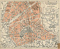
 Paris 19th arrondissement map with listings.png 3,460 × 3,008; 1.14 MB
-
 Paris-atlas by Fernand Bournon - 44. 19e arrondissement - David Rumsey.jpg 4,511 × 5,862; 26.36 MB
-
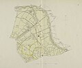
 Paris.carte d'arrondissement.A19.jpg 1,323 × 1,073; 511 KB
-
 Plan atelier photo 4-5 sept 2010-a.png 628 × 686; 394 KB


