Category:Street lights in the Metropolitan Borough of Trafford
Jump to navigation
Jump to search
Media in category "Street lights in the Metropolitan Borough of Trafford"
The following 18 files are in this category, out of 18 total.
-
 Bridgewater Canal at Timperley - geograph.org.uk - 1749679.jpg 2,816 × 2,112; 1 MB
-
 Bridgewater canal entrance to Manchester Ship Canal.jpg 2,048 × 1,536; 674 KB
-
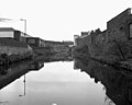 Bridgewater Canal, Central Manchester - geograph.org.uk - 591422.jpg 640 × 512; 76 KB
-
 Bridgewater Canal, Old Trafford - geograph.org.uk - 180429.jpg 640 × 465; 79 KB
-
 St Hilda's Church - geograph.org.uk - 388435.jpg 640 × 480; 95 KB
-
 Hale Barns - Carrwood, looking east - geograph.org.uk - 1134043.jpg 640 × 480; 199 KB
-
 Hale clock tower 2005.jpg 640 × 480; 144 KB
-
 Hale, Greater Manchester (3).JPG 3,240 × 4,320; 2.62 MB
-
 Hasty Lane, Hale Barns - panoramio.jpg 3,072 × 2,304; 1.83 MB
-
 Pomona Bridgewater Canal- 5308.JPG 2,848 × 2,136; 1.57 MB
-
 Pomona Bridgewater Canal- 5309.JPG 2,848 × 2,136; 1.59 MB
-
 Pomona Locks- 5301.JPG 2,848 × 2,136; 1.6 MB
-
 Pomona- 4833.JPG 3,488 × 2,616; 2.18 MB
-
 Pomona- 4834.JPG 3,488 × 2,616; 2.17 MB
-
 Pomona- 4838.JPG 3,488 × 2,616; 2.21 MB
-
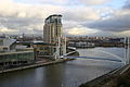 Salford Quays Basin - geograph.org.uk - 291475.jpg 640 × 425; 69 KB
-
 Converted Church on Edge Lane Stretford - geograph.org.uk - 385328.jpg 640 × 480; 118 KB
-
 Timperley Bridge - geograph.org.uk - 125630.jpg 640 × 480; 202 KB


.JPG)


