Category:Street lights in Cheshire
Jump to navigation
Jump to search
Subcategories
This category has only the following subcategory.
A
Media in category "Street lights in Cheshire"
The following 54 files are in this category, out of 54 total.
-
 A49(T) taken from a bridge on B5153 - geograph.org.uk - 17766.jpg 640 × 480; 96 KB
-
 St Michael's Church, Burtonwood.jpg 640 × 427; 480 KB
-

-
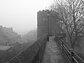
 Chester city walls on a foggy day 10.jpg 2,000 × 1,500; 1.04 MB
-
 Chester city walls on a foggy day 2.jpg 2,000 × 1,500; 1.07 MB
-
 Chester city walls on a foggy day 3.jpg 2,000 × 1,500; 899 KB
-
 Chester city walls on a foggy day 4.jpg 2,000 × 1,500; 1.1 MB
-
 Chester city walls on a foggy day 6.jpg 2,000 × 1,500; 856 KB
-
 Chester city walls on a foggy day 7.jpg 2,000 × 1,500; 868 KB
-
 Chester city walls on a foggy day 8.jpg 2,000 × 1,500; 879 KB
-
 Chester History and Heritage - geograph.org.uk - 627338.jpg 480 × 640; 81 KB
-
 St Michael's, Chester-2.jpg 640 × 480; 157 KB
-
 Commemorative street lamp, Ince, Cheshire.JPG 3,240 × 4,320; 3.11 MB
-
 Cotebrook village - geograph.org.uk - 166461.jpg 640 × 480; 113 KB
-
 Daresbury church tower.jpg 1,944 × 2,592; 915 KB
-
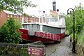 Disused floating restaurant - geograph.org.uk - 274666.jpg 640 × 427; 98 KB
-
 Lych Gate, St Mary's Church, Dodleston - geograph.org.uk - 486142.jpg 640 × 427; 124 KB
-
 Widnes Farnworth St Luke 2.jpg 2,592 × 1,944; 1.05 MB
-
 Widnes Farnworth St Luke.jpg 2,592 × 1,944; 1.14 MB
-
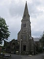
 Trinity Church, Frodsham (1).JPG 3,240 × 4,320; 2.61 MB
-
 Trinity Church, Frodsham (2).JPG 3,240 × 4,320; 2.59 MB
-
 Trinity Church, Frodsham (3).JPG 3,240 × 4,320; 2.58 MB
-
 Trinity Methodist Church, Frodsham - geograph.org.uk - 422607.jpg 480 × 640; 71 KB
-
 Hanging Baskets in Frodsham - geograph.org.uk - 239509.jpg 640 × 480; 130 KB
-
 St. Philip's Church, Kelsall - geograph.org.uk - 111769.jpg 640 × 480; 90 KB
-
 St John's Church , Kingsley - geograph.org.uk - 17738.jpg 640 × 480; 94 KB
-
 Sessions House, Knutsford - geograph.org.uk - 1451969.jpg 640 × 447; 221 KB
-
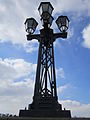
 Lamp cluster on the Grosvenor Bridge, Chester (1).JPG 3,240 × 4,320; 2.27 MB
-
 Lamp cluster on the Grosvenor Bridge, Chester (2).JPG 3,240 × 4,320; 2.24 MB
-
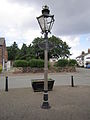
 Lamppost, Shotwick.JPG 2,736 × 3,648; 3.62 MB
-
 59-61 Prestbury Road, Macclesfleld.jpg 702 × 2,256; 1.39 MB
-
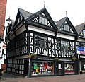
 Houses on Sunderland Street at Lord Street, Macclesfield.jpg 5,412 × 3,714; 13.24 MB
-
 Ropewalks and Catherine St, Macclesfield.jpg 4,920 × 4,032; 14.26 MB
-
 Shaw Street, Macclesfield, from Catherine Street.jpg 5,454 × 3,726; 14.19 MB
-
 View N along Newton Street, Macclesfield.jpg 5,508 × 3,444; 12.27 MB
-
 View S down Catherine St, Macclesfield.jpg 5,802 × 3,612; 12.68 MB
-
 View SW down Prestbury Road, Macclesfield.jpg 5,532 × 3,900; 14.75 MB
-
 Macclesfield United Reformed Church.jpg 480 × 640; 505 KB
-

-
 Churches in Mill St - geograph.org.uk - 522904.jpg 630 × 472; 74 KB
-
 46 High St, Nantwich2.jpg 1,200 × 1,161; 526 KB
-
 Congregational Chapel, Nantwich.jpg 1,200 × 880; 601 KB
-
 North side of Chestergate, Macclesfield, looking west from Churchill Way.jpg 6,000 × 4,032; 8.5 MB
-
 River Dee at Chester with the Old Dee Bridge and the weir in the fog.jpg 2,560 × 1,440; 710 KB
-
 St John the Evangelist Church in Sandiway - geograph.org.uk - 1773583.jpg 3,072 × 2,304; 1.01 MB
-
 The Town Hall, Chester, Cheshire-25051979222.jpg 6,000 × 4,000; 5.06 MB
-
 View of Macclesfield from Macclesfield train station 2014.jpg 3,204 × 2,136; 4.43 MB
-
 View of Macclesfield from Macclesfield train station.jpg 3,264 × 2,448; 3.49 MB
-
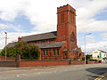 Sacred Heart Church, Warrington.jpg 640 × 480; 439 KB
-
 Sacred Heart Roman Catholic Church - geograph.org.uk - 1305209.jpg 640 × 480; 51 KB
-
 Church of St Paul, Widnes - geograph.org.uk - 408795.jpg 640 × 480; 71 KB
-
 St Paul's Parish Church, Widnes (1).JPG 4,320 × 3,240; 3.49 MB
-
 St Helen's Church, Witton, Cheshire - west tower.jpg 2,048 × 1,536; 824 KB
-
 Witton Church (1114125471).jpg 2,048 × 1,536; 2.03 MB
_taken_from_a_bridge_on_B5153_-_geograph.org.uk_-_17766.jpg)


.JPG)
.JPG)
.JPG)


.JPG)
.JPG)


.JPG)

.jpg)