Category:Street junctions in the London Borough of Wandsworth
Jump to navigation
Jump to search

Media in category "Street junctions in the London Borough of Wandsworth"
The following 77 files are in this category, out of 77 total.
-
 Across the Cross Roads - geograph.org.uk - 4238524.jpg 1,600 × 1,200; 305 KB
-
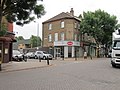
 Al Mirage, Tooting - geograph.org.uk - 3638144.jpg 640 × 430; 72 KB
-
 Alexandra Avenue - geograph.org.uk - 1259858.jpg 640 × 400; 59 KB
-

-
 Battersea Park Road - geograph.org.uk - 3993747.jpg 640 × 480; 115 KB
-

-
-
 Battersea Rise on the corner of Chivalry Road - geograph.org.uk - 3849992.jpg 2,560 × 1,920; 2.05 MB
-
 Brudenell Road at the junction of Upper Tooting Road - geograph.org.uk - 4417072.jpg 2,560 × 1,920; 2.01 MB
-
 Bynton Rd - geograph.org.uk - 3630969.jpg 640 × 430; 59 KB
-
 Carmina Rd off Ritherdon Rd - geograph.org.uk - 1932324.jpg 640 × 430; 137 KB
-
 Corner of Broomwood Rd - geograph.org.uk - 3984953.jpg 640 × 430; 60 KB
-
 Crossroads in Putney - geograph.org.uk - 4120556.jpg 3,872 × 2,592; 3.5 MB
-
 Crowborough Road at the junction of Ramsdale Road - geograph.org.uk - 3896983.jpg 2,560 × 1,920; 2.01 MB
-
 Crowborough Road at the junction of Ramsdale Road - geograph.org.uk - 3896989.jpg 2,560 × 1,920; 2.01 MB
-
 Dighton Road where it meets Alma Road - geograph.org.uk - 3519930.jpg 1,600 × 1,200; 556 KB
-
 Edgel Street where it meets Old York Road - geograph.org.uk - 3519919.jpg 1,600 × 1,200; 656 KB
-
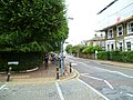
 Endlesham Road - geograph.org.uk - 614839.jpg 640 × 610; 138 KB
-
 Festing Road joins Lower Richmond Road - geograph.org.uk - 2708293.jpg 1,600 × 1,952; 484 KB
-
 Fieldview off Magdalen Rd - geograph.org.uk - 2491830.jpg 640 × 430; 91 KB
-

-
 Forfar Road - geograph.org.uk - 1259849.jpg 640 × 480; 93 KB
-
 Garratt Lane at the corner of Keble Street - geograph.org.uk - 3994337.jpg 2,304 × 1,728; 873 KB
-
 Garratt Lane at the junction of Keble Street - geograph.org.uk - 3994319.jpg 2,304 × 1,728; 840 KB
-
 Hebdon Rd - geograph.org.uk - 3644545.jpg 640 × 430; 67 KB
-
 Hendham Road at the junction of Trinity Road - geograph.org.uk - 3676979.jpg 2,048 × 1,536; 1.41 MB
-
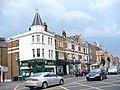
 Hereward Rd - geograph.org.uk - 3638155.jpg 640 × 430; 64 KB
-
 Houses in Oakhill Road, Wandsworth - geograph.org.uk - 2382847.jpg 4,000 × 3,000; 3.16 MB
-
 Houses on the corner - geograph.org.uk - 2931624.jpg 640 × 480; 103 KB
-
 Junction of Aspley Road and St Anns Crescent, Wandswoth - geograph.org.uk - 2996604.jpg 3,264 × 2,448; 1.96 MB
-

-

-

-
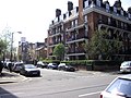
 Lavender Hill, Clapham - geograph.org.uk - 2779066.jpg 640 × 480; 62 KB
-
 Longley Road at the junction of Charlmont Road - geograph.org.uk - 3897014.jpg 2,560 × 1,920; 1.99 MB
-

-
-
 Merivale Rd and Deodar Rd junction - geograph.org.uk - 2102371.jpg 640 × 430; 125 KB
-
 Merton Road, Wandsworth - geograph.org.uk - 5160858.jpg 1,600 × 1,079; 488 KB
-
 Mini roundabout on Wimbledon Park Road - geograph.org.uk - 2234323.jpg 1,600 × 1,200; 590 KB
-

-
 Multon Rd off Magdalen Rd - geograph.org.uk - 2491641.jpg 640 × 430; 71 KB
-
 Noyna Rd - geograph.org.uk - 3650226.jpg 640 × 430; 73 KB
-
 Openview off Magdalen Rd - geograph.org.uk - 2491869.jpg 640 × 430; 68 KB
-
 Penwith Rd at Ravensbury Terrace - geograph.org.uk - 2496106.jpg 640 × 430; 56 KB
-
 Princes Way at the junction of Augustus Road - geograph.org.uk - 4105256.jpg 2,304 × 1,728; 805 KB
-
 Princes Way at the junction of Woodspring Road - geograph.org.uk - 4105218.jpg 2,220 × 1,610; 1.71 MB
-
 Putney Hill at the junction of the South Circular Road - geograph.org.uk - 4204208.jpg 2,048 × 1,480; 899 KB
-

-
 Putney, The 'Railway' - geograph.org.uk - 3527605.jpg 4,320 × 3,240; 5.88 MB
-
 Road Junction at Tooting - geograph.org.uk - 2828388.jpg 3,627 × 2,414; 7.69 MB
-
 Road junction on Danebury Avenue - geograph.org.uk - 3286589.jpg 4,288 × 3,216; 4.97 MB
-
 Road junction on Lavender Hill - geograph.org.uk - 2932141.jpg 640 × 480; 93 KB
-

-
 Road Junction, Lavender Hill - geograph.org.uk - 1383542.jpg 640 × 480; 82 KB
-
 Road junction, Tooting - geograph.org.uk - 3630956.jpg 640 × 430; 71 KB
-
 Road off Putney Embankment - geograph.org.uk - 2106027.jpg 640 × 430; 141 KB
-
 Road off Smugglers Way - geograph.org.uk - 2101651.jpg 640 × 430; 127 KB
-

-
 Roundabout south of Wandsworth Bridge. - geograph.org.uk - 24963.jpg 640 × 480; 68 KB
-
 Southcroft Road at the end of Crowborough Road - geograph.org.uk - 3897006.jpg 2,560 × 1,920; 1.99 MB
-
 Southfields - geograph.org.uk - 2168747.jpg 640 × 454; 44 KB
-
 Southfields main crossroads - geograph.org.uk - 3954473.jpg 800 × 600; 93 KB
-
 Strathville Rd off Penwith Rd - geograph.org.uk - 2496105.jpg 640 × 430; 67 KB
-
 Summerstown - geograph.org.uk - 1734432.jpg 640 × 366; 53 KB
-
 Swaby Rd off Magdalen Rd - geograph.org.uk - 2491929.jpg 640 × 430; 77 KB
-
 The end of Ritherdon Rd - geograph.org.uk - 3993532.jpg 640 × 430; 76 KB
-
 The end of Stapleton Rd - geograph.org.uk - 3650369.jpg 640 × 430; 80 KB
-

-
 Tibbet's Corner from the north-east. - geograph.org.uk - 20695.jpg 640 × 480; 63 KB
-
 Tilehurst Rd - geograph.org.uk - 2491806.jpg 640 × 430; 62 KB
-
 Titchwell Rd - geograph.org.uk - 2491643.jpg 640 × 430; 69 KB
-
 Tranmere Rd - geograph.org.uk - 2491936.jpg 640 × 430; 75 KB
-
 Upper Richmond Road at junction with Putney Hill - geograph.org.uk - 2233564.jpg 1,600 × 1,200; 309 KB
-
 Upper Richmond Road at junction with Putney Hill - geograph.org.uk - 2349542.jpg 1,600 × 1,200; 501 KB
-
 Where the A306 leaves the A3 - geograph.org.uk - 2407541.jpg 3,872 × 2,592; 4.01 MB
-
 York Road-Plough Road junction. - geograph.org.uk - 1554648.jpg 640 × 480; 61 KB


