Category:Streams in Saxony
Jump to navigation
Jump to search
Federal states of Germany:
Subcategories
This category has the following 84 subcategories, out of 84 total.
A
- Abfluss Trutzmühlteich (3 F)
B
- Bertsdorfer Wasser (3 F)
- Butterwasser (14 F)
C
- Cunnersdorfer Wasser (4 F)
D
- Dorfbach Schirgiswalde (2 F)
E
- Eckartsbach (Neiße) (3 F)
F
- Flössertgraben (5 F)
G
- Gorbitzbach (26 F)
H
- Hammerbach (Mulde) (6 F)
- Hammerbach (Wiederitz) (4 F)
- Hasengraben (Leipzig) (5 F)
- Hertigswalder Bach (3 F)
I
J
- Jauerbach (4 F)
K
- Kleine Triebisch (29 F)
- Kuhschnappelbach (4 F)
L
- Langes Wasser (Schwarze Elster) (14 F)
M
N
- Naundorfer Wasser (6 F)
O
- Omsewitzer Graben (15 F)
P
- Puschwitzer Wasser (3 F)
R
- Rietzschke (10 F)
- Rotes Bächel (7 F)
S
- Schwarzes Teich (26 F)
- Steinbach (Große Röder) (18 F)
- Striebsbrunnenbach (1 F)
- Söllichaubach (4 F)
T
- Tummelsbach (8 F)
W
- Wahnsdorfer Bach (3 F)
- Bílý potok (přítok Křinice) (9 F)
- Wölkisches Wasser (2 F)
Z
Media in category "Streams in Saxony"
The following 149 files are in this category, out of 149 total.
-
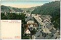
 00465-Kipsdorf-1898-Kurhaus Schäfermühle-Brück & Sohn Kunstverlag.jpg 1,500 × 1,000; 569 KB
-
 00843-Tharandt-1898-Hauptstraße, Blick von der Ruine-Brück & Sohn Kunstverlag.jpg 1,521 × 1,000; 527 KB
-
 00996-Wilsdruff-1899-Stadtansicht-Brück & Sohn Kunstverlag.jpg 1,496 × 1,000; 600 KB
-
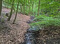
 01 Der Ruppertsgrüner Bach im Kleppergrund.jpg 3,632 × 5,456; 6.54 MB
-
 01189 Dresden, Coselweg Bach 01 2023-06-11.jpg 3,869 × 2,864; 10.79 MB
-
 01189 Dresden, Coselweg Bach 02 2023-06-11.jpg 3,800 × 2,924; 10.65 MB
-
 02 Totholz im Kleppergrund.jpg 3,632 × 5,456; 7.53 MB
-
 14 Eines der vielen Seitentälchen.jpg 3,632 × 5,456; 7.21 MB
-
 20140812030DR Röhrsdorf (Dohna) Schloßpark Röhrsdorfer Grund.jpg 3,264 × 2,441; 4.1 MB
-
 20140812035DR Röhrsdorf (Dohna) Schloßpark Röhrsdorfer Grund.jpg 3,264 × 2,445; 4.47 MB
-
 20140812040DR Röhrsdorf (Dohna) Schloßpark Röhrsdorfer Grund.jpg 3,264 × 2,439; 4.95 MB
-
 20140812050DR Röhrsdorf (Dohna) Schloßpark Röhrsdorfer Grund.jpg 3,264 × 2,445; 4.36 MB
-
 20140812055DR Röhrsdorf (Dohna) Schloßpark Röhrsdorfer Grund.jpg 3,264 × 2,438; 4.63 MB
-
 20140812065DR Röhrsdorf (Dohna) Schloßpark Röhrsdorfer Grund.jpg 3,264 × 1,940; 3.71 MB
-
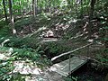
 20180520180DR Golberode (Bannewitz) Furt im Geberbach.jpg 3,648 × 2,732; 7.89 MB
-
 20180524100DR Tronitz (Dohna) Dorfbach+Weltkriegsdenkmal.jpg 3,648 × 2,596; 7.81 MB
-
 20180524105DR Tronitz (Dohna) Dorf- und Feuerlöschteich.jpg 3,648 × 2,280; 5.92 MB
-
 20180524110DR Tronitz (Dohna) Dorf- und Feuerlöschteich.jpg 3,648 × 2,770; 6.67 MB
-
 20180524120DR Tronitz (Dohna) Dorfbach-Auwiese.jpg 3,648 × 2,732; 6.51 MB
-
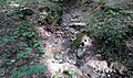
 20180524135DR Tronitz (Dohna) Quellteich Spargrundbach.jpg 3,648 × 2,442; 6.3 MB
-
 20180524200DR Maxen (Müglitztal) An der Winterleite-Quelle.jpg 3,648 × 2,420; 7.11 MB
-
 20180524205DR Maxen (Müglitztal) An der Winterleite-Quelle.jpg 3,648 × 2,608; 6.43 MB
-
 20180524210DR Maxen (Müglitztal) An der Winterleite-Quelle.jpg 3,648 × 2,700; 7.07 MB
-
 20180524215DR Maxen (Müglitztal) An der Winterleite-Quelle.jpg 3,648 × 2,732; 6.9 MB
-
 20180524240DR Maxen (Müglitztal) Stauteich der Winterleite.jpg 3,648 × 2,495; 6.86 MB
-
 20180524245DR Maxen (Müglitztal) Stauteich der Winterleite.jpg 3,648 × 2,726; 6.06 MB
-
 20180524250DR Maxen (Müglitztal) Stauteich der Winterleite.jpg 3,648 × 2,736; 6.35 MB
-
 25386-Oberschlema-1930-Floßgraben-Brück & Sohn Kunstverlag.jpg 1,522 × 1,000; 555 KB
-
 25389-Oberschlema-1930-Floßgraben-Brück & Sohn Kunstverlag.jpg 1,000 × 1,538; 507 KB
-
 25639-Grünhain-1931-Genesungsheim-Brück & Sohn Kunstverlag.jpg 1,000 × 1,559; 318 KB
-
 25904-Oberschlema-1932-Floßgraben-Brück & Sohn Kunstverlag.jpg 1,000 × 1,543; 706 KB
-
 26557-Annaberg-1935-Frohnauer Hammer-Brück & Sohn Kunstverlag.jpg 1,000 × 1,522; 668 KB
-
 26605-Elbtal b. Meißen-1935-Pioniere beim Brückenschlagen-Brück & Sohn Kunstverlag.jpg 1,538 × 1,000; 627 KB
-
 26624-Annaberg-1935-Frohnauer Hammer-Brück & Sohn Kunstverlag.jpg 1,522 × 1,000; 798 KB
-
 28638-Technitz-1954-bei Döbeln, Kirche-Brück & Sohn Kunstverlag.jpg 1,000 × 1,540; 422 KB
-
 29140-Sohland-1956-Kirche - Winter-Brück & Sohn Kunstverlag.jpg 1,534 × 1,000; 363 KB
-
 29499-Roßwein-1957-Wolfstal-Brück & Sohn Kunstverlag.jpg 1,407 × 1,000; 578 KB
-
 Albrechtsbach.jpg 1,920 × 1,280; 1.37 MB
-
 Am Querenbach 1-8 in Stollberg..2H1A1730WI.jpg 5,472 × 3,648; 9.55 MB
-
 Am Querenbach 1-8 in Stollberg..2H1A1731WI.jpg 3,360 × 5,042; 6.8 MB
-
 Reichenmühle.JPG 2,864 × 2,144; 1.41 MB
-
 Badestelle Weixdorf 22.jpg 1,816 × 3,288; 1.48 MB
-
 BerbersdorfBach1.JPG 3,594 × 2,670; 1.41 MB
-
 BerbersdorfBach2.JPG 3,648 × 2,736; 1.13 MB
-
 BerbersdorfBach3.JPG 3,579 × 2,677; 1.14 MB
-
 Brettmühlenteich (Zschornaer Teichgebiet) 14.jpg 2,448 × 3,264; 3.83 MB
-
 Burgker Bach.JPG 3,000 × 4,000; 4.9 MB
-
 Doeschuetz Steinbogenbruecke-01.jpg 6,000 × 3,750; 15.95 MB
-
 Doeschuetz Steinbogenbruecke.jpg 5,333 × 4,000; 15.5 MB
-
 TauraS-Trafo.JPG 2,864 × 2,144; 1.22 MB
-
 Entwässerungsgraben Dresden.jpg 4,608 × 3,456; 2.62 MB
-
-

-

-

-

-

-

-
 Fotothek df rp-d 0780014 Oppach. Grenzmühlteich.jpg 800 × 517; 164 KB
-

-

-
 Fotothek df rp-e 0330045 Kodersdorf-Rengersdorf. Schöpslandschaft.jpg 800 × 397; 150 KB
-
 Freiberg Albertpark Goldbach.jpg 2,094 × 3,141; 4.33 MB
-
 Köttwitzschtal1.JPG 2,864 × 2,144; 1.89 MB
-
 GadewitzBach.JPG 3,409 × 2,618; 1.85 MB
-
 Gimmlitzlichtenberg.jpg 1,928 × 2,892; 3.19 MB
-
 OybinGoldbachHauptstr.JPG 3,556 × 2,718; 2.44 MB
-
 Goldbachinfreiberg.jpg 2,215 × 3,323; 4.75 MB
-
 AltmittweidaO.jpg 2,864 × 2,144; 1.43 MB
-
 Grenzbach Schweinitz01.jpg 6,000 × 4,000; 30.61 MB
-
 Grenzbach Schweinitz02.jpg 6,000 × 4,000; 29.73 MB
-
 VogelgesangHst.JPG 3,602 × 2,674; 2.4 MB
-
 HartauPfaffenbach.jpg 2,864 × 2,144; 1.18 MB
-
 KlitzschenHeidebach.JPG 3,648 × 2,736; 2.02 MB
-
 Heidewiesenbach (Zschornaer Teichgebiet) 07.jpg 2,448 × 3,264; 3.92 MB
-

-
 Hopfenbach Moritzburg 01.jpg 3,456 × 4,608; 4.62 MB
-
 Hopfenbach Moritzburg 02.jpg 4,608 × 3,456; 3.97 MB
-
 Hopfenbach Moritzburg 03.jpg 3,456 × 4,608; 4.91 MB
-
 Höllbachtal1.JPG 3,648 × 2,736; 1.97 MB
-
 Höllbachtal2.JPG 3,648 × 2,736; 2.19 MB
-
 Höllbachtal3.JPG 3,648 × 2,736; 2.76 MB
-
 Höllbachtal4.JPG 3,648 × 2,736; 2.36 MB
-
 NarsdorfKatze.JPG 3,488 × 2,616; 1.06 MB
-
 Kemlitzbach Lausitzer Neiße 2010-08-04 00.jpg 3,395 × 2,651; 1.95 MB
-
 Kranichbach-Rummel.JPG 3,585 × 2,651; 1.94 MB
-
 Krostitz, the brook Leine.jpg 2,551 × 1,701; 1.24 MB
-
 Langenleuba-OberhLeuba.jpg 2,864 × 2,144; 895 KB
-

-

-
 WellerswaldeBrückeNeueStr.JPG 3,589 × 2,673; 1.77 MB
-
 Malkwitz Dahlener Strasse Strassenbruecke-01.jpg 5,333 × 4,000; 15.39 MB
-
 Malkwitz Dahlener Strasse Strassenbruecke.jpg 5,333 × 4,000; 12.52 MB
-
 Malte-Grund - panoramio.jpg 3,648 × 2,056; 4.34 MB
-
 MaustalKohRüd.JPG 3,488 × 2,616; 2.64 MB
-
 RüdigsdorfGellertbrunnen.JPG 3,472 × 2,515; 1.91 MB
-
 Maus-ob-Rüdigsdorf.JPG 3,648 × 2,736; 1.77 MB
-
 MoselerBach.JPG 3,648 × 2,736; 1.55 MB
-
 NemtMühlbach.JPG 3,648 × 2,736; 2.27 MB
-
 MühlauBach.JPG 3,648 × 2,736; 2.37 MB
-
 DehnitzMühlb.JPG 3,488 × 2,616; 2.09 MB
-
 Mühlbachtal2.JPG 3,648 × 2,736; 1.88 MB
-
 Mühlbachtal4.JPG 3,648 × 2,736; 2.13 MB
-
 NiederpickenhainRatte.JPG 3,455 × 2,601; 1.22 MB
-
 NiederschindmaasBachMühlenhof.JPG 3,556 × 2,702; 1,003 KB
-
 OlbersdorfGoldbach.JPG 3,648 × 2,736; 1.87 MB
-
 Pennrich 08.jpg 4,608 × 3,456; 6.99 MB
-
 PösgrabenKolm.JPG 3,488 × 2,616; 1.35 MB
-
 Raikokochalbrechtsbach01.jpg 3,648 × 2,736; 2.14 MB
-
 RathendorfRatte.JPG 3,648 × 2,736; 1.31 MB
-
 KohrenMittelmühle2.JPG 3,488 × 2,616; 1.92 MB
-
 KohrenRatte.JPG 3,488 × 2,616; 1.71 MB
-
 Regenbachtal 01.jpg 1,536 × 2,048; 1.54 MB
-
 Regenbachtal 02.jpg 2,048 × 1,536; 1.53 MB
-
 Regenbachtal 03.jpg 2,048 × 1,536; 1.55 MB
-
 Regenbachtal 04.jpg 1,536 × 2,048; 1.54 MB
-
 Schanzenbach-Giks.JPG 3,648 × 2,736; 3.04 MB
-
 Schanzenmühle1.JPG 3,648 × 2,736; 2.09 MB
-
 ScheergrundRuine.JPG 3,582 × 2,640; 1.94 MB
-
 SchrebitzBach.JPG 3,582 × 2,699; 1.01 MB
-
 Schwarzbach-Görschlitz.JPG 3,648 × 2,736; 2.21 MB
-
 StaudaBach.JPG 3,648 × 2,736; 2.53 MB
-
 Staupenbach vor Mündung.JPG 3,648 × 2,736; 2.58 MB
-
 BLausickSteingrundBr.JPG 2,864 × 2,144; 1.71 MB
-
 Sternmühlental 03.jpg 4,000 × 3,000; 4.18 MB
-
 Sternmühlental 04.jpg 4,000 × 3,000; 3.54 MB
-
 Theusdorf2.JPG 3,648 × 2,736; 2.23 MB
-
 Theusdorf4.JPG 3,575 × 2,655; 2.38 MB
-
 Waldbad Weixdorf 18.jpg 2,268 × 4,032; 4.67 MB
-
 Waldbad Weixdorf 19.jpg 2,268 × 4,032; 3.95 MB
-
 Waldbad Weixdorf 20.jpg 4,032 × 2,268; 4.11 MB
-
 Waldbad Weixdorf 21.jpg 4,032 × 2,268; 3.58 MB
-
 Waldbad Weixdorf 43.jpg 3,264 × 1,836; 3.24 MB
-
 Waldbad Weixdorf 44.jpg 4,032 × 2,268; 5.03 MB
-
 EichgrundBach.JPG 3,648 × 2,736; 2.28 MB
-
 Warnsdorfer Bach.jpg 3,648 × 2,736; 3.06 MB
-
 WedelwitzBach.JPG 3,567 × 2,644; 1.01 MB
-
 Weißiger Keppbach.jpg 4,608 × 3,456; 2.94 MB
-
 Wellerswalde Handwerkergasse 9a Bruecke-01.jpg 5,333 × 4,000; 3.21 MB
-
 Wellerswalde Handwerkergasse 9a Bruecke-02.jpg 5,333 × 4,000; 3.29 MB
-
 Wellerswalde Handwerkergasse 9a Bruecke-03.jpg 5,333 × 4,000; 3.44 MB
-
 Wellerswalde Handwerkergasse 9a Bruecke-04.jpg 5,796 × 3,864; 3.6 MB
-
 Wellerswalde Neue Strasse Bruecke-01.jpg 6,000 × 4,000; 3.83 MB
-
 Wellerswalde Neue Strasse Bruecke-02.jpg 5,333 × 4,000; 3.38 MB
-
 Wüstung Luschdorf (Stolpen) 02.jpg 3,000 × 3,512; 3.55 MB
-
 Wüstung Luschdorf (Stolpen) 03.jpg 3,000 × 4,000; 4.08 MB
-
 Bahnbrücke-ZinnaerFlut.JPG 3,585 × 2,669; 1.93 MB
-
 ZschackwitzBach.JPG 3,522 × 2,632; 1 MB
-
 ZschampertKanal.jpg 3,523 × 2,644; 2.15 MB


_Schlo%C3%9Fpark_R%C3%B6hrsdorfer_Grund.jpg)
_Schlo%C3%9Fpark_R%C3%B6hrsdorfer_Grund.jpg)
_Schlo%C3%9Fpark_R%C3%B6hrsdorfer_Grund.jpg)
_Schlo%C3%9Fpark_R%C3%B6hrsdorfer_Grund.jpg)
_Schlo%C3%9Fpark_R%C3%B6hrsdorfer_Grund.jpg)
_Schlo%C3%9Fpark_R%C3%B6hrsdorfer_Grund.jpg)
_Furt_im_Geberbach.jpg)
_Dorfbach%2BWeltkriegsdenkmal.jpg)
_Dorf-_und_Feuerl%C3%B6schteich.jpg)
_Dorf-_und_Feuerl%C3%B6schteich.jpg)
_Dorfbach-Auwiese.jpg)
_Quellteich_Spargrundbach.jpg)
_An_der_Winterleite-Quelle.jpg)
_An_der_Winterleite-Quelle.jpg)
_An_der_Winterleite-Quelle.jpg)
_An_der_Winterleite-Quelle.jpg)
_Stauteich_der_Winterleite.jpg)
_Stauteich_der_Winterleite.jpg)
_Stauteich_der_Winterleite.jpg)


_14.jpg)


_07.jpg)


_02.jpg)
_03.jpg)


