Category:Streams in Inverclyde
Jump to navigation
Jump to search
Council areas (municipalities) of Scotland: Aberdeen · Aberdeenshire · Angus · Argyll and Bute · Clackmannanshire · Dumfries and Galloway · Dundee · East Ayrshire · East Dunbartonshire · East Lothian · East Renfrewshire · Edinburgh · Falkirk · Fife · Glasgow · Highland · Inverclyde · Midlothian · Moray · North Ayrshire · North Lanarkshire · Orkney Islands · Perth and Kinross · Renfrewshire · Scottish Borders · Shetland Islands · South Ayrshire · South Lanarkshire · Stirling · West Dunbartonshire · West Lothian

Subcategories
This category has the following 15 subcategories, out of 15 total.
B
- Birkmyre Park burn (2 F)
- Blacketty Water (9 F)
- Burnbrae Burn (3 F)
C
- Calder Water, Queenside Muir (4 F)
- Coplie Burn (5 F)
D
- Daff Burn (10 F)
E
- Everton ford, Inverclyde (3 F)
F
- Finlaystone Burn (8 F)
G
K
L
M
- Millbank Burn (4 F)
N
Media in category "Streams in Inverclyde"
The following 19 files are in this category, out of 19 total.
-
 Brueacre Burn - geograph.org.uk - 1557626.jpg 640 × 480; 160 KB
-
 Burn at Lunderston Bay - geograph.org.uk - 944262.jpg 640 × 480; 78 KB
-
 Burn in Auchmountain Glen - geograph.org.uk - 1164232.jpg 480 × 640; 131 KB
-
 Burn in Auchmountain Glen - geograph.org.uk - 1164246.jpg 640 × 480; 115 KB
-
 Burn in Spango Valley - geograph.org.uk - 1216063.jpg 640 × 480; 111 KB
-
 Burn in Spango Valley - geograph.org.uk - 1216075.jpg 640 × 480; 107 KB
-
 Burn in Spango Valley - geograph.org.uk - 1216575.jpg 480 × 640; 146 KB
-
 Cartsburn - geograph.org.uk - 1188652.jpg 480 × 640; 135 KB
-
 Footbridge - geograph.org.uk - 37028.jpg 640 × 480; 80 KB
-
 Gourock Park - geograph.org.uk - 896920.jpg 640 × 480; 104 KB
-
 IBM canteen - geograph.org.uk - 1164064.jpg 640 × 432; 90 KB
-
 Looking north - geograph.org.uk - 67737.jpg 640 × 480; 81 KB
-
 Meander on the burn at Everton - geograph.org.uk - 1780055.jpg 640 × 429; 228 KB
-
 Spango Valley - geograph.org.uk - 1216089.jpg 640 × 480; 104 KB
-
 Stream beside Old Largs Road - geograph.org.uk - 1471717.jpg 640 × 480; 88 KB
-
 Streams meet beside Old Largs Road - geograph.org.uk - 1471822.jpg 640 × 480; 87 KB
-
 Water channel - geograph.org.uk - 1164452.jpg 640 × 480; 122 KB
-
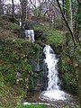
 Waterfalls - geograph.org.uk - 441255.jpg 480 × 640; 130 KB
-
 Waterfalls near Cloch Road - geograph.org.uk - 709058.jpg 480 × 640; 140 KB


