Category:Stream gauges in the United States
Jump to navigation
Jump to search
Countries of the Americas: United States of America
Media in category "Stream gauges in the United States"
The following 43 files are in this category, out of 43 total.
-

-
 2013-10-15 13 40 52 USGS stream gauge along Lamoille Creek at Power House Picnic Site.JPG 2,448 × 3,264; 4.19 MB
-
 Blackfoot Abv Nevada Creek USGS.jpg 2,592 × 1,728; 1.57 MB
-
 Cedar Rapids Iowa stream guage rebuild.jpg 3,008 × 2,000; 1.48 MB
-
 Cgs00995 - Flickr - NOAA Photo Library.jpg 1,944 × 2,592; 821 KB
-
 DNRC Stream Gage below Nevada Reservoir on Nevada Creek.jpg 5,184 × 3,456; 8.16 MB
-
 Eel River (CA) at Fernbridge gage 020817.jpg 609 × 466; 249 KB
-
 Eel River (CA) at Fernbridge gage 022519.jpeg 1,218 × 966; 283 KB
-
 Eel River (CA) at Fernbridge gage 022719.jpg 1,248 × 962; 288 KB
-
 Esopus Creek from Hurley Mountain Road bridge, Lomontville, NY.jpg 2,694 × 2,094; 5.02 MB
-
 Ewing Ditch (Colorado) gaging station.JPG 3,911 × 3,944; 13.68 MB
-
 Flood elevation river gages and Natchez–Vidalia Bridge.jpg 2,048 × 1,371; 507 KB
-
 Gage into the Sky (18891263491).jpg 5,100 × 3,400; 18.05 MB
-
 High Water Mark sign along Little River in Snowville Phillips WX4SNO.jpg 2,736 × 3,648; 3.5 MB
-
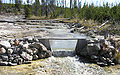 If-tantalusweir large.jpg 800 × 500; 142 KB
-
 Installing a temporary stream gage Cedar Rapids IA.jpg 3,008 × 2,000; 1.54 MB
-
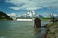 JacksonLakeDam1997.JPG 3,120 × 2,080; 1.03 MB
-
 Little Patuxent River at Allview - May 2018 flood.png 600 × 465; 17 KB
-
 Little Patuxent River near Guilford - May 2018 flood.png 600 × 465; 17 KB
-
 Little Patuxent River near Savage - May 2018 flood.png 600 × 465; 17 KB
-
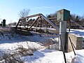 Meridian Highway North Fork bridge from NE.JPG 2,560 × 1,920; 2.33 MB
-
 Meridian Highway North Fork bridge from S 1.JPG 2,359 × 1,211; 1.13 MB
-
 Meridian Highway North Fork bridge S gaging station.JPG 1,448 × 1,701; 1 MB
-

-
 Patapsco River at Ellicott City - May 2018 flood.png 600 × 465; 17 KB
-
 Patapsco River near Catonsville - May 2018 flood.png 600 × 465; 17 KB
-

-
 RahwayRiverUSGSwaterguageKenilworthBlvd.tif 531 × 729; 898 KB
-
 Snoqualmie Gaging Station 04135.JPG 1,828 × 2,490; 1.19 MB
-
 Snoqualmie River gage 2006-11-07.png 576 × 384; 5 KB
-
 Snoqualmie River gage 2006-11-07B.png 576 × 384; 4 KB
-
 Spring creek 2 (6466595177).jpg 1,856 × 2,784; 3.21 MB
-
 Stream Station on Nevada Creek Above Reservoir.jpg 5,184 × 3,456; 4.96 MB
-
 Stream-gauge-Estillfork-al.jpg 4,000 × 3,000; 6.82 MB
-
 Streamflow gauge on Esopus Creek at Big Indian, NY.jpg 2,000 × 3,264; 4.35 MB
-
 Streamgage vs. Streamgauge (16526796620).jpg 1,854 × 2,497; 3.06 MB
-
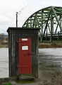
 USGS gauging station on Fishing Creek at Bloomsburg (closeup).JPG 1,504 × 2,256; 1.88 MB
-
 USGS gauging station on Fishing Creek at Bloomsburg.JPG 1,301 × 2,256; 1.86 MB
-
 USGS Stream Gage on Nevada Creek Above Reservoir.jpg 5,184 × 3,456; 5.21 MB
-
 USGS Stream Gaging Station (24641689816).jpg 5,760 × 3,840; 11.6 MB
-
 USGS Stream Monitoring Site on the North Fork of the Blackfoot River.jpg 5,184 × 3,456; 8.55 MB
-
 USGS Streamgage at Soper Branch Creek.jpg 3,888 × 2,592; 7 MB
-
 Willow Beach Gaging Station.jpg 1,186 × 783; 190 KB


_at_Fernbridge_gage_020817.jpg)
_at_Fernbridge_gage_022519.jpeg)
_at_Fernbridge_gage_022719.jpg)

_gaging_station.JPG)

.jpg)


.jpg)


.jpg)
.JPG)


.jpg)


