Category:Strathcarron, Highland
Jump to navigation
Jump to search
human settlement in Highland, Scotland, UK   | |||||
| Upload media | |||||
| Instance of | |||||
|---|---|---|---|---|---|
| Location |
| ||||
 | |||||
English: Strathcarron is a small village, situated at the head of the sea loch, Loch Carron, between the rivers, River Carron and River Taodail, in west Ross-shire, Scottish Highlands and is in the Scottish council area of Highland.
Nederlands: Strathcarron ( Schots-Gaelisch: Strath Carran) is een dorp in de Schotse council Highland in de Lieutenancy area Ross and Cromarty.
Subcategories
This category has the following 4 subcategories, out of 4 total.
Media in category "Strathcarron, Highland"
The following 87 files are in this category, out of 87 total.
-

-
 Birch Plantation in Strathcarron - geograph.org.uk - 167136.jpg 640 × 426; 173 KB
-
 Birchwoods, Strath Carron - geograph.org.uk - 1372940.jpg 640 × 480; 123 KB
-
 Creagan na Meighich - geograph.org.uk - 797221.jpg 640 × 480; 84 KB
-
 Curious sheep, Gruinards, Strathcarron - geograph.org.uk - 1746948.jpg 640 × 480; 147 KB
-
 Dalabheairn - geograph.org.uk - 797573.jpg 640 × 480; 76 KB
-
 Fire Point - panoramio.jpg 4,320 × 3,240; 8.9 MB
-
 Inside geodesic dome, Attadale Gardens. - panoramio.jpg 4,416 × 3,312; 4.31 MB
-
 Iron Man (Woman) - panoramio.jpg 4,320 × 3,240; 6.61 MB
-
 Island - panoramio (21).jpg 3,871 × 2,006; 3.35 MB
-
 It's Not A Race - panoramio.jpg 4,000 × 3,000; 2.61 MB
-
 Lake near Moruisg - panoramio.jpg 4,320 × 3,240; 3.2 MB
-
 Level Crossing - geograph.org.uk - 171277.jpg 640 × 480; 68 KB
-
 Loch Carron - panoramio.jpg 3,008 × 2,000; 1.06 MB
-
 Loch Carron. (A pleasant view from the train^). - panoramio.jpg 4,928 × 3,264; 3.44 MB
-
 Loch Shieldaig - panoramio.jpg 4,320 × 2,432; 3.35 MB
-
 Loch Shieldaig from Applecross. - panoramio.jpg 4,928 × 3,264; 4.96 MB
-
 Loch Shieldaig. - panoramio (2).jpg 4,785 × 2,324; 3.77 MB
-
 Loch Torridon - panoramio.jpg 4,000 × 3,000; 2.83 MB
-
 Loner, Applecross. - panoramio.jpg 4,290 × 2,496; 8.86 MB
-
 Low Tide - panoramio (3).jpg 4,320 × 2,432; 4.33 MB
-
 Low tide, Applecross Bay. - panoramio.jpg 4,873 × 2,115; 8.2 MB
-
 No Hurry. Strath Carron railway station. - panoramio.jpg 4,309 × 3,191; 3.36 MB
-
 Path from Whale Cottage - geograph.org.uk - 796871.jpg 640 × 426; 78 KB
-
 Railway Terrace, Strathcarron - geograph.org.uk - 2712231.jpg 1,280 × 856; 137 KB
-
 Railway Terrace, Strathcarron - geograph.org.uk - 2713455.jpg 1,280 × 856; 140 KB
-
 Rush-hour, Strath Carron station. - panoramio.jpg 4,317 × 3,074; 4.06 MB
-
 Scotland-6 (8035289807).jpg 4,272 × 2,462; 2.79 MB
-
 Sheep, Strathcarron - geograph.org.uk - 797588.jpg 640 × 480; 102 KB
-
 Strathcarron (27211721204).jpg 4,704 × 2,461; 1.95 MB
-
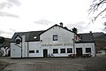 Strathcarron Hotel - geograph.org.uk - 1140875.jpg 640 × 427; 46 KB
-
 Strathcarron Hotel - geograph.org.uk - 1601715.jpg 640 × 480; 116 KB
-
 Strathcarron Post Office - geograph.org.uk - 1601708.jpg 640 × 480; 84 KB
-
 Telephone exchange - geograph.org.uk - 797557.jpg 640 × 480; 144 KB
-
 The Myopic Chicken. "Now where did I put my glasses" Strath Carron. - panoramio.jpg 4,416 × 3,312; 3.81 MB
-
 Water ^ silhouettes - Agua y siluetas - panoramio.jpg 4,752 × 3,168; 887 KB
-
 Window on the world. Waiting train, Scotrail, Strath Carron station. - panoramio.jpg 4,416 × 3,312; 3.11 MB
-
 Allt Loch Moin a' Chriathair - geograph.org.uk - 230085.jpg 640 × 480; 298 KB
-

-
 Annat to Coulags Track - geograph.org.uk - 750780.jpg 640 × 480; 55 KB
-
 Aonach Baile na Creige - geograph.org.uk - 206440.jpg 640 × 480; 64 KB
-
 Approaching Coulags - geograph.org.uk - 1418836.jpg 640 × 480; 83 KB
-
 Bealach a' Choire Ghairbh - geograph.org.uk - 1418756.jpg 640 × 480; 72 KB
-
 Beinn Liath Mhór from Sgorr Ruadh - geograph.org.uk - 829161.jpg 640 × 480; 103 KB
-
 Bendronaig track - geograph.org.uk - 758229.jpg 640 × 480; 73 KB
-
 Blue and White - geograph.org.uk - 515068.jpg 640 × 445; 50 KB
-
 Burn, Meall nan Ceapairean - geograph.org.uk - 229990.jpg 480 × 640; 287 KB
-
 Clach nan Con-fionn - geograph.org.uk - 1418781.jpg 640 × 480; 71 KB
-
 Clach nan Con-fionn - geograph.org.uk - 229394.jpg 640 × 480; 248 KB
-
 Cnoc Ban - geograph.org.uk - 206443.jpg 640 × 480; 131 KB
-
 Coire Fionnairich - geograph.org.uk - 14136.jpg 600 × 484; 35 KB
-
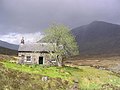 Coire Fionnaraich bothy - geograph.org.uk - 1418796.jpg 640 × 480; 74 KB
-
 Coire Fionnaraich bothy - geograph.org.uk - 526915.jpg 640 × 477; 117 KB
-
 Coire Lair - geograph.org.uk - 209389.jpg 640 × 480; 126 KB
-
 Coire Lair. - geograph.org.uk - 203450.jpg 640 × 480; 151 KB
-
 Downhill joy - geograph.org.uk - 758179.jpg 640 × 480; 81 KB
-
 Entering Strathcarron on the A890 - geograph.org.uk - 1404475.jpg 640 × 427; 71 KB
-

-
 Fionn-abhainn - geograph.org.uk - 229400.jpg 480 × 640; 309 KB
-
 Fionn-abhainn at Coulags Bridge - geograph.org.uk - 629979.jpg 640 × 425; 162 KB
-
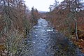
 Fionnaraich River - geograph.org.uk - 14198.jpg 550 × 300; 33 KB
-
 Footbridge, Fionn-abhainn - geograph.org.uk - 229387.jpg 640 × 480; 242 KB
-

-
 Forest in Strath Carron - geograph.org.uk - 618642.jpg 640 × 480; 159 KB
-
 Forest Track in Strathcarron - geograph.org.uk - 167139.jpg 640 × 426; 140 KB
-
 Gorge of Eas Ban - geograph.org.uk - 594956.jpg 640 × 427; 63 KB
-
 Haunted Bothy - geograph.org.uk - 105600.jpg 640 × 424; 68 KB
-
 Loch a' Mhuillin - geograph.org.uk - 622639.jpg 640 × 427; 43 KB
-
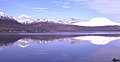 Loch Carron - geograph.org.uk - 8247.jpg 640 × 329; 109 KB
-
 Lochan - geograph.org.uk - 208616.jpg 640 × 480; 179 KB
-
 Lochan - geograph.org.uk - 209378.jpg 640 × 480; 149 KB
-
 Lochan Dubha - geograph.org.uk - 409810.jpg 562 × 640; 160 KB
-
 Lochan, Sail Gharbh - geograph.org.uk - 231537.jpg 640 × 480; 150 KB
-
 Maol Chean-dearg - geograph.org.uk - 515038.jpg 640 × 452; 66 KB
-
 Maol Chean-dearg - geograph.org.uk - 515046.jpg 453 × 640; 61 KB
-
 Meall nan Ceapairean - geograph.org.uk - 527632.jpg 800 × 600; 682 KB
-
 Pairc na Froise - geograph.org.uk - 167146.jpg 640 × 426; 134 KB
-
 Path to Bealach a' Choire Ghairbh - geograph.org.uk - 527618.jpg 800 × 600; 239 KB
-
 Sgorr Ruadh - geograph.org.uk - 290037.jpg 640 × 447; 66 KB
-
 Sgorr Ruadh - geograph.org.uk - 486054.jpg 640 × 437; 111 KB
-
 Sgorr Ruadh - geograph.org.uk - 515033.jpg 448 × 640; 64 KB
-

-
 Strathcarron Hotel - geograph.org.uk - 216771.jpg 640 × 480; 79 KB
-
 Track branch, Fionn-abhainn - geograph.org.uk - 229985.jpg 640 × 480; 248 KB
-
 Track to Arineckaig - geograph.org.uk - 171292.jpg 640 × 480; 96 KB
-
 View towards Beinn Eighe - geograph.org.uk - 379488.jpg 640 × 480; 115 KB
-
 Waterfalls, Allt Loch Moin a' Chriathair - geograph.org.uk - 230092.jpg 640 × 480; 324 KB


_-_panoramio.jpg)
.jpg)


._-_panoramio.jpg)


.jpg)


.jpg)


.jpg)

.jpg)


