Category:Strangford
Jump to navigation
Jump to search


village in County Down, Northern Ireland, United Kingdom .JPG) | |||||
| Upload media | |||||
| Instance of | |||||
|---|---|---|---|---|---|
| Location | County Down, Northern Ireland | ||||
 | |||||
Subcategories
This category has the following 7 subcategories, out of 7 total.
Media in category "Strangford"
The following 200 files are in this category, out of 409 total.
(previous page) (next page)-
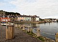
 "The Cuan", Strangford - geograph.org.uk - 1359324.jpg 640 × 451; 66 KB
-
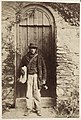 'Old Macartan', postman, County Down (26933990476).jpg 1,033 × 1,532; 329 KB
-

-
 'Strawberry Fair', Strangford - geograph.org.uk - 4249811.jpg 640 × 468; 93 KB
-

-

-

-

-
 About to dock - geograph.org.uk - 3044745.jpg 640 × 480; 42 KB
-
 An Fánán (The Slip), Strangford - geograph.org.uk - 3044643.jpg 640 × 480; 52 KB
-

-
 Arrival at Strangford - geograph.org.uk - 640933.jpg 640 × 602; 61 KB
-
 Audley Castle - geograph.org.uk - 2610467.jpg 1,024 × 763; 130 KB
-
 Audley's Castle from the Narrows - geograph.org.uk - 5476458.jpg 3,405 × 2,197; 1.34 MB
-
 Bar sign, Strangford - geograph.org.uk - 1607029.jpg 640 × 502; 80 KB
-
 Barber Shop, Strangford - geograph.org.uk - 3044660.jpg 640 × 480; 52 KB
-
 Bench mark, Strangford - geograph.org.uk - 5400176.jpg 1,280 × 1,280; 2.15 MB
-
 Bends on Castleward Road - geograph.org.uk - 3530204.jpg 1,024 × 768; 146 KB
-
 Birds, Strangford Lough - geograph.org.uk - 2907546.jpg 640 × 480; 66 KB
-
 Boarding the MV Portaferry II at the Strangford slip - geograph.org.uk - 4612332.jpg 1,600 × 1,200; 363 KB
-
 Boat, Portaferry - geograph.org.uk - 3044751.jpg 640 × 480; 69 KB
-
 Boats in Strangford Harbour - geograph.org.uk - 3531642.jpg 1,024 × 767; 191 KB
-
 Boats moored off the Old Quay at Strangford - geograph.org.uk - 2995001.jpg 1,024 × 768; 185 KB
-
 Boats, Strangford, June 2011 (01).JPG 4,272 × 2,848; 5.03 MB
-
 Boats, Strangford, June 2011 (02).JPG 4,272 × 2,848; 4.06 MB
-
 Boats, Strangford, June 2011 (03).JPG 4,272 × 2,848; 4.98 MB
-
 Boats, Strangford, June 2011 (04).JPG 2,848 × 4,272; 3.69 MB
-

-
 Busy time at the Strangford Ferry Slip - geograph.org.uk - 5515277.jpg 2,822 × 1,647; 780 KB
-
 Calm waters off the Quay at Strangford - geograph.org.uk - 5476445.jpg 4,000 × 3,000; 2.29 MB
-
 Car park in Stella Maris Street, Portaferry - geograph.org.uk - 2997162.jpg 1,024 × 767; 147 KB
-
 Castle Street, Strangford (3) - geograph.org.uk - 2324074.jpg 640 × 369; 99 KB
-
 Castle Street, Strangford - geograph.org.uk - 2995041.jpg 1,024 × 768; 201 KB
-
 Castle Street, Strangford - geograph.org.uk - 3044653.jpg 640 × 480; 60 KB
-
 Castle Street, Strangford - geograph.org.uk - 4701377.jpg 1,600 × 1,200; 404 KB
-
 Castleward Bay from the A25 - geograph.org.uk - 2610482.jpg 1,024 × 768; 136 KB
-
 Castleward Road, Strangford - geograph.org.uk - 3044656.jpg 640 × 480; 47 KB
-
 Castleward Road, Strangford - geograph.org.uk - 3044720.jpg 640 × 480; 40 KB
-
 Castleward Road, Strangford - geograph.org.uk - 3044730.jpg 640 × 480; 74 KB
-
 Castleward Road, Strangford - geograph.org.uk - 3044821.jpg 640 × 481; 49 KB
-
 Chain, Strangford, June 2011 (01).JPG 4,272 × 2,848; 4.65 MB
-
 Chain, Strangford, June 2011 (02).JPG 2,848 × 4,272; 3.87 MB
-

-
 Coach, Strangford - geograph.org.uk - 850922.jpg 640 × 421; 111 KB
-
 Cottages in Castleward Road, Strangford - geograph.org.uk - 3531585.jpg 1,024 × 768; 187 KB
-
 Cottages in Castleward Road, Strangford - geograph.org.uk - 3545363.jpg 1,024 × 768; 200 KB
-
 Cottages in Quay Lane - geograph.org.uk - 3531591.jpg 1,024 × 634; 151 KB
-
 Cottages on Downpatrick Road, Strangford - geograph.org.uk - 4613336.jpg 1,600 × 1,198; 395 KB
-
 Crane's Corner. Strangford Lough (2) - geograph.org.uk - 2324193.jpg 640 × 339; 106 KB
-
 Cropland on the east side of Castleward Bay - geograph.org.uk - 3545727.jpg 1,024 × 768; 109 KB
-
 Lives of the Lords Strangford, with their ancestors and contemporaries through ten generations (IA cu31924027931157).pdf 712 × 1,175, 324 pages; 7.47 MB
-
 Cuan Mews Apartments on The Square - geograph.org.uk - 4701389.jpg 1,600 × 1,200; 476 KB
-
 Departing Strangford on the ferry to Portaferry - geograph.org.uk - 3530939.jpg 1,024 × 768; 167 KB
-
 Double fronted houses on Quay Road - geograph.org.uk - 4702603.jpg 1,600 × 1,200; 513 KB
-
 Dry dock at Strangford - geograph.org.uk - 3585411.jpg 1,024 × 768; 267 KB
-
 Dry dock slipway at Strangford - geograph.org.uk - 3585271.jpg 1,024 × 768; 202 KB
-
 Dufferin Avenue, Strangford - geograph.org.uk - 1562782.jpg 640 × 401; 138 KB
-
 Ebbing dock at Strangford - geograph.org.uk - 5495856.jpg 3,997 × 2,288; 1.51 MB
-

-
 Entering Portaferry from the South along Shore Road - geograph.org.uk - 5476014.jpg 4,000 × 3,000; 2.49 MB
-
 Fallen tree, Strangford - geograph.org.uk - 1562970.jpg 612 × 393; 138 KB
-
 Farmland on the shores of the Strangford Narrows - geograph.org.uk - 4138603.jpg 1,024 × 768; 158 KB
-
-
 Farmland west of Dufferin Avenue - geograph.org.uk - 2995287.jpg 1,024 × 768; 403 KB
-
 Fast moving currents in the Strangford Narrows - geograph.org.uk - 3853999.jpg 1,024 × 768; 155 KB
-
 Ferry terminal at Strangford - geograph.org.uk - 3584154.jpg 1,024 × 768; 182 KB
-
 Field gate, Strangford - geograph.org.uk - 2324279.jpg 640 × 361; 116 KB
-
 Fine Georgian House in Castle Street, Strangford - geograph.org.uk - 2995037.jpg 963 × 1,024; 175 KB
-
 Fire hydrant, Strangford - geograph.org.uk - 1563067.jpg 586 × 392; 121 KB
-
 Fishwick's coach, Strangford - geograph.org.uk - 808296.jpg 640 × 378; 64 KB
-
 Flat rocks at the entrance to Castleward Bay - geograph.org.uk - 3531756.jpg 1,024 × 768; 215 KB
-
 Flat rocks overlooking The Narrows - geograph.org.uk - 3531749.jpg 1,024 × 768; 176 KB
-
 Floats and shackles, Strangford - geograph.org.uk - 839581.jpg 640 × 429; 66 KB
-
 Flush Bracket, Strangford - geograph.org.uk - 5399224.jpg 1,280 × 1,280; 2.69 MB
-
 Foot passenger ready to board - geograph.org.uk - 4702619.jpg 1,600 × 1,180; 393 KB
-
-

-
 Former Presbyterian church, Strangford - geograph.org.uk - 1494117.jpg 613 × 407; 119 KB
-
 Full speed ahead - Portaferry II leaving Strangford - geograph.org.uk - 4701091.jpg 1,600 × 1,200; 334 KB
-
 Gated entrance to The Lodge on Shore Road - geograph.org.uk - 2994896.jpg 1,024 × 768; 291 KB
-
 Gates leading to Dufferin Avenue - geograph.org.uk - 3545427.jpg 1,024 × 767; 168 KB
-
 Gates, Strangford - geograph.org.uk - 2324130.jpg 640 × 353; 72 KB
-
 Heading out into The Narrows - geograph.org.uk - 4702628.jpg 1,600 × 1,200; 525 KB
-
 Heavy load being driven on to the Portaferry II - geograph.org.uk - 2972597.jpg 1,024 × 748; 174 KB
-
 High tide at Castleward Bay, Strangford - geograph.org.uk - 4613345.jpg 1,600 × 1,200; 348 KB
-
 Horse Ferry House, Strangford - geograph.org.uk - 3531635.jpg 768 × 1,024; 193 KB
-

-
 Houses in Quarry Hill - geograph.org.uk - 2995453.jpg 1,024 × 768; 332 KB
-
 Houses in Quay Road, Strangford - geograph.org.uk - 5475613.jpg 3,893 × 2,920; 2.65 MB
-
 Houses in Stella Maris Street, Strangford - geograph.org.uk - 4613103.jpg 1,600 × 1,200; 520 KB
-
 Houses on The Green at Strangford - geograph.org.uk - 3601546.jpg 1,024 × 754; 232 KB
-
 Houses on the Shore Road, Strangford - geograph.org.uk - 4138555.jpg 1,024 × 768; 183 KB
-
 Houses on the southern outskirts of Portaferry - geograph.org.uk - 5476018.jpg 4,000 × 3,000; 2.89 MB
-
 Houses overlooking The Narrows at Strangford - geograph.org.uk - 2995010.jpg 1,024 × 573; 127 KB
-
 Houses overlooking the Old Quay at Strangford - geograph.org.uk - 2995007.jpg 1,024 × 768; 249 KB
-
 Houses overlooking the Quay at Strangford - geograph.org.uk - 2973583.jpg 1,024 × 768; 280 KB
-
 Inscription, Weighbridge, Strangford - geograph.org.uk - 3044729.jpg 640 × 480; 94 KB
-
 Inter-tidal mud, Strangford Lough - geograph.org.uk - 2324232.jpg 640 × 423; 109 KB
-

-
 Kayaker off Strangford - geograph.org.uk - 5472050.jpg 3,486 × 1,901; 1.1 MB
-
 Kevin Og, Strangford - geograph.org.uk - 3044650.jpg 640 × 480; 60 KB
-
 Kildare Street, Strangford - geograph.org.uk - 3044719.jpg 640 × 480; 47 KB
-
 Kildare Street, Strangford - geograph.org.uk - 850963.jpg 640 × 438; 71 KB
-
 Leafy path, Strangford - geograph.org.uk - 1562805.jpg 594 × 384; 116 KB
-
 Lifebelt. Portaferry ferry - geograph.org.uk - 3044748.jpg 640 × 480; 73 KB
-
 Loughshore near Ballyhenry Island - geograph.org.uk - 738499.jpg 640 × 462; 83 KB
-
 Lowering the ramp on to the Strangford slip - geograph.org.uk - 3531533.jpg 1,024 × 753; 132 KB
-

-
 Modern terraced houses in Stella Maris Street, Strangford - geograph.org.uk - 5475632.jpg 4,000 × 3,000; 3.28 MB
-
 Mooring post, Strangford - geograph.org.uk - 2501756.jpg 640 × 387; 70 KB
-
 MV Portaferry II approaching touchdown at Strangford Quay - geograph.org.uk - 5470844.jpg 4,000 × 3,000; 2.58 MB
-
 MV Portaferry II at Strangford Slip - geograph.org.uk - 4613220.jpg 1,600 × 1,200; 352 KB
-
 MV Portaferry II loading at Strangford - geograph.org.uk - 4702592.jpg 1,600 × 977; 296 KB
-
 MV Portaferry II loading at Strangford Slip - geograph.org.uk - 2994993.jpg 1,024 × 723; 151 KB
-
 MV Strangford Ferry (11), October 2009.JPG 4,272 × 2,848; 5.58 MB
-
 MV Strangford Ferry at Strangford's New Quay - geograph.org.uk - 4701318.jpg 1,600 × 1,186; 460 KB
-
 MV Strangford II moored at Strangford - geograph.org.uk - 5489301.jpg 4,000 × 3,000; 2.58 MB
-
 Narwhal unsinkable rescue RIB on the Portaferry II - geograph.org.uk - 5472039.jpg 3,630 × 2,353; 1.43 MB
-
 Navigation light, Strangford - geograph.org.uk - 1462757.jpg 640 × 335; 61 KB
-
 Navigational marker at the eastern end of Swan Island - geograph.org.uk - 5483482.jpg 4,000 × 3,000; 2.87 MB
-
 New houses at Ferry Quarter, Strangford - geograph.org.uk - 4138500.jpg 1,024 × 768; 262 KB
-
 New Houses in Stella Maris Street, Strangford - geograph.org.uk - 2997149.jpg 1,024 × 683; 147 KB
-
 New houses on Shore Road - geograph.org.uk - 4138521.jpg 1,024 × 768; 220 KB
-
 New houses, Strangford - geograph.org.uk - 1463222.jpg 640 × 464; 84 KB
-

-

-
 Newry Quay, Strangford - geograph.org.uk - 3531506.jpg 1,024 × 768; 170 KB
-

-

-
 Old anchor, Strangford - geograph.org.uk - 1563106.jpg 503 × 456; 115 KB
-
 Old cart, Strangford - geograph.org.uk - 2324328.jpg 640 × 414; 158 KB
-
 Old Court, Strangford - geograph.org.uk - 5476472.jpg 3,998 × 2,231; 1.84 MB
-

-
 Old Pooley weighbridge, Strangford (2) - geograph.org.uk - 2502122.jpg 640 × 353; 118 KB
-
 Old pump, Strangford (2) - geograph.org.uk - 2502288.jpg 584 × 404; 101 KB
-
 Old shelter, Strangford - geograph.org.uk - 1563021.jpg 618 × 436; 132 KB
-
 Old sign, Strangford - geograph.org.uk - 1563034.jpg 640 × 417; 118 KB
-
 On board the Strangford Ferry - geograph.org.uk - 3028656.jpg 640 × 480; 123 KB
-
 Ordnance Survey One-Inch Sheet 10 Mid-Down, Published 1953.jpg 15,937 × 8,306; 14.1 MB
-
 Outbuildings at Isle O'Valla Farm - geograph.org.uk - 4138625.jpg 1,024 × 767; 125 KB
-

-
 Period houses, Strangford - geograph.org.uk - 3044718.jpg 640 × 480; 56 KB
-
 Piling, Strangford - geograph.org.uk - 2324439.jpg 640 × 370; 96 KB
-
 Pillar box, Strangford - geograph.org.uk - 2325563.jpg 640 × 605; 79 KB
-
 Ploughed field, Strangford - geograph.org.uk - 2324372.jpg 640 × 298; 101 KB
-
 Portaferry from the Narrows - geograph.org.uk - 5483723.jpg 3,480 × 2,418; 1.69 MB
-

-

-
 Portaferry II departing Strangford - geograph.org.uk - 4701131.jpg 1,600 × 1,181; 273 KB
-
 Portaferry II discharging at Strangford - geograph.org.uk - 2994018.jpg 1,024 × 768; 187 KB
-
 Portaferry II loading at Strangford - geograph.org.uk - 4701076.jpg 1,600 × 1,200; 326 KB
-

-
 Portaferry, County Down, April 1984 (03).jpg 3,504 × 2,400; 471 KB
-

-
 Quay Lane, Strangford - geograph.org.uk - 4702585.jpg 1,600 × 1,199; 348 KB
-
 Quay Road, Strangford - geograph.org.uk - 3044737.jpg 640 × 480; 43 KB
-
 Quay Road, Strangford - geograph.org.uk - 3601550.jpg 1,024 × 768; 181 KB
-
 Quay Road, Strangford - geograph.org.uk - 4702546.jpg 1,600 × 1,174; 438 KB
-
 Quay Road, Strangford - geograph.org.uk - 5475627.jpg 4,000 × 3,000; 3.22 MB
-
 RC Church, Strangford - geograph.org.uk - 3044722.jpg 640 × 480; 61 KB
-

-
 Road sign, Strangford - 1606994.jpg 320 × 240; 16 KB
-
 Road sign, Strangford - geograph.org.uk - 1606994.jpg 640 × 420; 41 KB
-
 Rowing boats below Shore Road one hour after High Water - geograph.org.uk - 5515241.jpg 4,000 × 3,000; 2.78 MB
-
 Ruined tower at Strangfrod - geograph.org.uk - 4613244.jpg 1,600 × 1,200; 506 KB
-

-

-
 Sheltered waters at Strangford - geograph.org.uk - 5483917.jpg 4,000 × 3,000; 3.36 MB
-

-

-
 Shore Road entering Strangford from the south - geograph.org.uk - 3585259.jpg 1,024 × 768; 217 KB
-
 Shore Road, Strangford - geograph.org.uk - 3044723.jpg 640 × 480; 54 KB
-
 Shoreline, Strangford - geograph.org.uk - 2005995.jpg 640 × 433; 117 KB
-
 St Joseph's Catholic Primary School, Strangford - geograph.org.uk - 2994971.jpg 1,024 × 768; 267 KB
-

-
 St Mary's Star of the Sea Catholic Chapel, Strangford - geograph.org.uk - 5471990.jpg 4,000 × 3,000; 2.77 MB
-

-

-
 Stella Maris Street, Strangford - geograph.org.uk - 3028664.jpg 640 × 480; 138 KB
-
 Stella Maris Street, Strangford - geograph.org.uk - 5483439.jpg 3,997 × 2,224; 2.03 MB
-
 Stella Maris Street, Strangford - geograph.org.uk - 850928.jpg 640 × 444; 82 KB
-

-
 Strangford (01), October 2009.JPG 4,272 × 2,848; 3.87 MB
-
 Strangford (02), October 2009.JPG 4,272 × 2,848; 4.6 MB
-
 Strangford (05), August 2009.JPG 4,272 × 2,848; 4.73 MB
-
 Strangford (08), August 2009.JPG 2,848 × 4,272; 4.28 MB
-
 Strangford (09), August 2009.JPG 2,848 × 4,272; 3.5 MB
-
 Strangford (10), August 2009.JPG 2,848 × 4,272; 3.67 MB
-
 Strangford (12), August 2009.JPG 2,848 × 4,272; 5.1 MB
-
 Strangford (13), August 2009.JPG 4,272 × 2,848; 5.17 MB
-
 Strangford (14), August 2009.JPG 4,272 × 2,848; 3.52 MB
-
 Strangford (15), August 2009.JPG 4,272 × 2,848; 3.36 MB
-
 Strangford (16), August 2009.JPG 4,272 × 2,848; 2.38 MB
-
 Strangford (17), August 2009.JPG 4,272 × 2,848; 3.65 MB
-
 Strangford (18), August 2009.JPG 4,272 × 2,848; 3.53 MB
-
 Strangford (18c), August 2009.JPG 3,776 × 2,832; 3.15 MB
-
 Strangford (20), August 2009.JPG 2,848 × 4,272; 2.86 MB
-
 Strangford (25), August 2009.JPG 4,272 × 2,848; 3.2 MB
-
 Strangford (38), August 2009.JPG 4,272 × 2,848; 5.15 MB
-
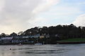
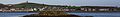 Strangford banner View of Portaferry.JPG 4,200 × 600; 1.08 MB

.jpg)


,_Strangford_-_geograph.org.uk_-_3044643.jpg)


.JPG)
.JPG)
.JPG)
.JPG)


_-_geograph.org.uk_-_2324074.jpg)


.JPG)
.JPG)


_-_geograph.org.uk_-_2324193.jpg)


_-_geograph.org.uk_-_1868338.jpg)


,_October_2009.JPG)


_-_geograph.org.uk_-_2502096.jpg)
_-_geograph.org.uk_-_2502122.jpg)
_-_geograph.org.uk_-_2502288.jpg)


.jpg)


,_October_2009.JPG)
,_October_2009.JPG)
,_August_2009.JPG)
,_August_2009.JPG)
,_August_2009.JPG)
,_August_2009.JPG)
,_August_2009.JPG)
,_August_2009.JPG)
,_August_2009.JPG)
,_August_2009.JPG)
,_August_2009.JPG)
,_August_2009.JPG)
,_August_2009.JPG)
,_August_2009.JPG)
,_August_2009.JPG)
,_August_2009.JPG)
,_August_2009.JPG)