Category:Strait of Belle Isle
Jump to navigation
Jump to search
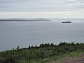
waterway in eastern Canada  Strait of Belle Isle as seen from L'Anse-au-Loup  | |||||
| Upload media | |||||
| Instance of | |||||
|---|---|---|---|---|---|
| Part of | |||||
| Location | Newfoundland and Labrador, Canada | ||||
| Width |
| ||||
 | |||||
Subcategories
This category has the following 2 subcategories, out of 2 total.
B
M
Media in category "Strait of Belle Isle"
The following 6 files are in this category, out of 6 total.
-
 Blanc Sablon, Qc - panoramio.jpg 4,000 × 3,000; 2.41 MB
-
 FMIB 34408 Berg off Belle Isle.jpeg 922 × 592; 77 KB
-
 Ice-Pack-In-Strait-Of-Belle-Isle.jpg 353 × 259; 12 KB
-
 L'Anse-au-Loup.jpg 5,444 × 3,629; 718 KB
-
 Sea Ice in the Strait of Belle Isle (MODIS 2024-04-14).jpg 2,774 × 2,156; 666 KB
-
 Sobi.jpg 1,600 × 982; 211 KB


.jpg)
