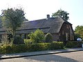
Category:Strabrecht 32, Heeze
Jump to navigation
Jump to search
| Object location | | View all coordinates using: OpenStreetMap |
|---|
farmhouse in Heeze-Leende, Netherlands  | |||||
| Upload media | |||||
| Instance of | |||||
|---|---|---|---|---|---|
| Location | Heeze, North Brabant, Netherlands | ||||
| Street address |
| ||||
| Heritage designation |
| ||||
 | |||||
|
This is a category about rijksmonument number 21294
|
| Address |
|
Media in category "Strabrecht 32, Heeze"
The following 19 files are in this category, out of 19 total.
-
 32, aanzicht - Strabrecht - 20206302 - RCE.jpg 1,200 × 813; 206 KB
-
 Interieur, broodoven en spitsboogvormige nis in de herd - Heeze - 20336876 - RCE.jpg 1,181 × 1,200; 229 KB
-
 Interieur, detail van balkkop met kruismotief - Heeze - 20336874 - RCE.jpg 1,195 × 1,200; 288 KB
-
 Interieur, detail van gesneden balkkop in de broodoven - Heeze - 20336878 - RCE.jpg 1,200 × 1,190; 236 KB
-
 Interieur, detail van holle stijl - Heeze - 20336875 - RCE.jpg 1,186 × 1,200; 266 KB
-
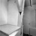
 Interieur, gedeelte draagbalk met bewerkte balkkop - Heeze - 20336735 - RCE.jpg 1,174 × 1,200; 174 KB
-
 Interieur, gedeelte gebint met windverband - Heeze - 20336873 - RCE.jpg 1,176 × 1,200; 177 KB
-

-
 Interieur, muurkastje in de herd - Heeze - 20336877 - RCE.jpg 1,176 × 1,200; 222 KB
-
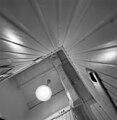
 Interieur, overzicht draagconstructie met trap - Heeze - 20336732 - RCE.jpg 1,190 × 1,200; 229 KB
-
 Interieur, overzicht gebint - Heeze - 20336734 - RCE.jpg 1,186 × 1,200; 217 KB
-
 Interieur, overzicht trapbordes - Heeze - 20336733 - RCE.jpg 1,179 × 1,200; 235 KB
-
 Overzicht achterzijde vanaf tuin - Heeze - 20336725 - RCE.jpg 1,186 × 1,200; 363 KB
-
 Overzicht en ligging vanaf straat - Heeze - 20336724 - RCE.jpg 1,176 × 1,200; 351 KB
-
 Overzicht tuin met afgedekt zwembad - Heeze - 20336726 - RCE.jpg 1,179 × 1,200; 313 KB
-
 Overzicht zijgevel met entree - Heeze - 20336729 - RCE.jpg 1,171 × 1,200; 342 KB
-
 Strabrecht 32 Heeze Monument 21294.jpg 4,320 × 3,240; 5.7 MB
-
 Zijgevel - Heeze - 20336727 - RCE.jpg 1,181 × 1,200; 387 KB
-
 Zijgevel - Heeze - 20336728 - RCE.jpg 1,169 × 1,200; 189 KB


