Category:Stowupland
Jump to navigation
Jump to search
English: Stowupland is a small village east of Stowmarket, Suffolk, England. Stowupland High School is found in the village.
village and civil parish in Suffolk, United Kingdom  | |||||
| Upload media | |||||
| Instance of | |||||
|---|---|---|---|---|---|
| Location | Mid Suffolk, Suffolk, East of England, England | ||||
| Population |
| ||||
 | |||||
Subcategories
This category has the following 6 subcategories, out of 6 total.
C
- Columbine Hall (3 F)
- The Crown, Stowupland (3 F)
R
- The Retreat, Stowupland (1 F)
S
- Stowupland War Memorial (3 F)
Media in category "Stowupland"
The following 200 files are in this category, out of 295 total.
(previous page) (next page)-
 'The Crown' at Stowupland with a new look - geograph.org.uk - 5361795.jpg 3,456 × 2,592; 3.94 MB
-
 'The Retreat' public house at Stowupland - geograph.org.uk - 5361770.jpg 3,456 × 2,592; 3.91 MB
-
 A bend in Creeting Lane - geograph.org.uk - 4790406.jpg 640 × 480; 87 KB
-
 A Suffolk Lane - geograph.org.uk - 1925902.jpg 1,200 × 1,600; 723 KB
-
 A1120 Bell's Lane ^ footpath - geograph.org.uk - 3906046.jpg 3,072 × 2,034; 1.02 MB
-
 A1120 Bell's Lane, Saxham Street - geograph.org.uk - 3906050.jpg 3,072 × 2,116; 829 KB
-
 A1120 Bell's Lane, Saxham Street - geograph.org.uk - 3906054.jpg 3,072 × 1,994; 790 KB
-
 A1120 Bell's Lane, Saxham Street - geograph.org.uk - 3906056.jpg 3,072 × 2,105; 813 KB
-
 A1120 Bell's Lane, Stowupland - geograph.org.uk - 4202129.jpg 3,072 × 2,304; 1.14 MB
-
 A1120 Church Road, Stowupland - geograph.org.uk - 4191694.jpg 3,072 × 2,304; 1.73 MB
-
 A1120 Church Road, Stowupland - geograph.org.uk - 4192798.jpg 3,072 × 2,304; 2.25 MB
-
 A1120 Church Road, Stowupland - geograph.org.uk - 4899592.jpg 3,072 × 2,304; 1.88 MB
-
 A1120 Church Road, Stowupland - geograph.org.uk - 4900836.jpg 3,046 × 2,282; 4.45 MB
-
 A1120 Church Road, Stowupland - geograph.org.uk - 5675932.jpg 4,608 × 3,072; 1.93 MB
-
 A1120 Church Road, Stowupland - geograph.org.uk - 6220965.jpg 4,608 × 3,456; 3.88 MB
-
 A1120 Church Road, Stowupland - geograph.org.uk - 6221075.jpg 4,608 × 3,456; 3.98 MB
-
 A1120 through Stowupland - geograph.org.uk - 1044813.jpg 640 × 461; 107 KB
-
 A1120 through Stowupland - geograph.org.uk - 1044829.jpg 640 × 425; 64 KB
-
 A14 over B1113 - geograph.org.uk - 3792709.jpg 640 × 480; 88 KB
-
 A14 slip Road, Stowupland - geograph.org.uk - 4903796.jpg 3,072 × 2,304; 3.67 MB
-
 A14 slip Road, Stowupland - geograph.org.uk - 4903833.jpg 3,072 × 2,304; 1.81 MB
-
 A14 viaduct north of Stowmarket - geograph.org.uk - 6266199.jpg 1,600 × 1,064; 321 KB
-
 A14, Layby near Stowmarket - geograph.org.uk - 3853519.jpg 640 × 480; 295 KB
-
 A14, Stowmarket bypass - geograph.org.uk - 4790913.jpg 640 × 426; 48 KB
-
 A14, westbound - geograph.org.uk - 4121071.jpg 640 × 430; 51 KB
-
 Approaching the A14 - geograph.org.uk - 3906059.jpg 3,072 × 2,146; 844 KB
-
 Approaching the A14 - geograph.org.uk - 3906063.jpg 3,072 × 2,120; 792 KB
-
 Approaching the A14 - geograph.org.uk - 3906255.jpg 3,072 × 2,112; 879 KB
-
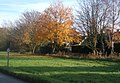 Autumnal scene at Stowupland - geograph.org.uk - 1044726.jpg 640 × 444; 106 KB
-
 Autumnal scene by Gipping Road - geograph.org.uk - 1044758.jpg 640 × 446; 74 KB
-
 B1115 bridge, A14 - geograph.org.uk - 4121066.jpg 640 × 430; 57 KB
-
 B1115 Stowmarket Road, Stowupland - geograph.org.uk - 4438858.jpg 3,072 × 2,304; 1.81 MB
-
 B1115 Stowmarket Road, Stowupland - geograph.org.uk - 4438922.jpg 3,072 × 2,304; 1.92 MB
-
 B1115 Stowmarket Road, Stowupland - geograph.org.uk - 4438925.jpg 3,072 × 2,304; 1.56 MB
-
 B1115 Stowmarket Road, Stowupland - geograph.org.uk - 4438943.jpg 3,072 × 2,304; 1.85 MB
-
 B1115 Stowmarket Road, Stowupland - geograph.org.uk - 4438966.jpg 3,072 × 2,304; 1.83 MB
-
 B1115 Stowmarket Road, Stowupland - geograph.org.uk - 4438973.jpg 3,072 × 2,304; 2.77 MB
-
 Birch Close sign - geograph.org.uk - 4905442.jpg 3,072 × 2,304; 1.85 MB
-
 Birch Close, Stowupland - geograph.org.uk - 4905437.jpg 2,935 × 2,199; 2.03 MB
-
 Bloor Homes sign - geograph.org.uk - 6221080.jpg 2,650 × 3,542; 2.46 MB
-
 Bowl of Hygieia on Stowupland monument - geograph.org.uk - 6601280.jpg 1,632 × 1,224; 890 KB
-
 Bridge over the A14 near Stowmarket - geograph.org.uk - 3853515.jpg 640 × 480; 273 KB
-

-
 Broomspath Estate Postbox - geograph.org.uk - 4438900.jpg 3,072 × 2,304; 1.89 MB
-
 Broomspath Estate Postbox - geograph.org.uk - 4438902.jpg 2,304 × 3,072; 2.53 MB
-
 Bungalows on Thorney Green Road - geograph.org.uk - 1044743.jpg 640 × 419; 56 KB
-
 Celandine Close sign - geograph.org.uk - 6221042.jpg 4,608 × 3,456; 3.95 MB
-
 Celandine Close, Stowupland - geograph.org.uk - 6221038.jpg 4,608 × 3,456; 3.75 MB
-
 Church Road (A1120) - geograph.org.uk - 4790413.jpg 640 × 480; 78 KB
-
 Church Road sign - geograph.org.uk - 5675929.jpg 3,973 × 2,646; 5.35 MB
-
 Church Road, Stowupland - geograph.org.uk - 6224205.jpg 1,920 × 1,280; 912 KB
-
 Church Road, Stowupland - geograph.org.uk - 6224211.jpg 1,850 × 1,168; 1.01 MB
-
 Clover Close sign - geograph.org.uk - 6221070.jpg 4,608 × 3,456; 3.66 MB
-
 Clover Close, Stowupland - geograph.org.uk - 6221069.jpg 4,608 × 3,456; 3.91 MB
-
 Columbine Hall - geograph.org.uk - 1961002.jpg 640 × 480; 112 KB
-
 Columbyne Close sign - geograph.org.uk - 4906142.jpg 3,072 × 2,304; 1.8 MB
-
 Columbyne Close, Stowupland - geograph.org.uk - 4906141.jpg 3,072 × 2,304; 1.84 MB
-
 Concrete Hardstanding off Creeting Lane - geograph.org.uk - 4900828.jpg 3,072 × 2,304; 1.81 MB
-
 Converted farm buildings - geograph.org.uk - 6396175.jpg 800 × 533; 89 KB
-
 Corner and junction on the B1113 - geograph.org.uk - 1008346.jpg 640 × 405; 71 KB
-
 Creeting Lane - geograph.org.uk - 4790411.jpg 640 × 480; 61 KB
-
 Creeting Lane approaching the A1120 - geograph.org.uk - 1044807.jpg 640 × 381; 48 KB
-
 Creeting Lane ^ Concrete Hardstanding - geograph.org.uk - 4900825.jpg 3,072 × 2,304; 1.97 MB
-
 Creeting Lane ^ footpath - geograph.org.uk - 4899809.jpg 3,072 × 2,304; 2.02 MB
-
 Creeting Lane ^ footpath - geograph.org.uk - 4899820.jpg 2,930 × 2,169; 1.99 MB
-
 Creeting Lane, Creeting St.Peter - geograph.org.uk - 4899807.jpg 3,072 × 2,304; 1.96 MB
-
 Creeting Lane, Stowupland - geograph.org.uk - 4899596.jpg 3,072 × 2,304; 2.08 MB
-
 Creeting Lane, Stowupland - geograph.org.uk - 4899600.jpg 3,072 × 2,304; 1.86 MB
-
 Creeting Lane, Stowupland - geograph.org.uk - 4899607.jpg 3,072 × 2,304; 1.83 MB
-
 Creeting St.Peter Village Name sign - geograph.org.uk - 4899805.jpg 3,072 × 2,304; 1.97 MB
-
 Cut Mark Stowupland Holy Trinity Church - geograph.org.uk - 5834468.jpg 2,231 × 2,231; 2.89 MB
-
 Debenham Lane Postbox - geograph.org.uk - 4202624.jpg 2,251 × 3,004; 3.42 MB
-
 Debenham Lane, Saxham Street - geograph.org.uk - 4213358.jpg 3,072 × 2,304; 1.9 MB
-
 Devon Road sign - geograph.org.uk - 4438883.jpg 3,072 × 2,304; 1.84 MB
-
 Devon Road, Stowupland - geograph.org.uk - 4438870.jpg 3,072 × 2,304; 1.75 MB
-

-
 Eastbound A14, Stowmarket - geograph.org.uk - 3846025.jpg 640 × 427; 274 KB
-
 Electricity Sub-Station on Oxlip Way - geograph.org.uk - 6221058.jpg 4,608 × 3,456; 4.39 MB
-
 End of Mill Street - geograph.org.uk - 4906902.jpg 3,072 × 2,304; 1.88 MB
-
 Entering Creeting St.Peter on Creeting Lane - geograph.org.uk - 4899804.jpg 3,072 × 2,304; 1.73 MB
-
 Entering Stowupland - geograph.org.uk - 1044752.jpg 640 × 420; 60 KB
-
 Entering Stowupland on Saxham Street - geograph.org.uk - 4213340.jpg 3,072 × 2,304; 1.71 MB
-
 Entrance of Stowupland Town Farm - geograph.org.uk - 4202297.jpg 2,557 × 2,301; 2.17 MB
-
 Entrance to Palgrave Farm - geograph.org.uk - 4210702.jpg 3,072 × 2,304; 1.82 MB
-
 Entrance to Stowupland Hall - geograph.org.uk - 4202586.jpg 3,072 × 2,304; 1.74 MB
-
 Farm building, Stowupland Hall - geograph.org.uk - 4790414.jpg 640 × 480; 57 KB
-
 Farm buildings, Poplar Farm - geograph.org.uk - 4675534.jpg 640 × 480; 47 KB
-

-
 Farmers Hardstanding - geograph.org.uk - 1343215.jpg 640 × 480; 76 KB
-
 Farmland near Grange Farm - geograph.org.uk - 4790432.jpg 640 × 480; 94 KB
-
 Farmland near Stowupland - geograph.org.uk - 1044784.jpg 640 × 393; 94 KB
-
 Farmland, Saxham Street - geograph.org.uk - 4790436.jpg 640 × 480; 66 KB
-
 Felix Road sign - geograph.org.uk - 4438918.jpg 3,072 × 2,304; 1.86 MB
-
 Field by Church Road, Stowupland - geograph.org.uk - 6224209.jpg 1,886 × 1,226; 1.1 MB
-
 Footpath Junction - geograph.org.uk - 2163256.jpg 1,600 × 1,200; 678 KB
-
 Footpath off Creeting Lane - geograph.org.uk - 4675525.jpg 640 × 480; 65 KB
-
 Footpath off Mill Street - geograph.org.uk - 4906915.jpg 3,072 × 2,304; 2.35 MB
-
 Footpath off Rendall Lane - geograph.org.uk - 4192747.jpg 1,582 × 1,768; 978 KB
-
 Footpath off Rendall Lane - geograph.org.uk - 4192776.jpg 2,304 × 3,072; 1.8 MB
-
 Footpath to Bell's Lane - geograph.org.uk - 4899811.jpg 3,072 × 2,122; 2.63 MB
-
 Footpath to Medlesham Green - geograph.org.uk - 4790441.jpg 640 × 480; 47 KB
-
 Footpath to Park Farm - geograph.org.uk - 4899821.jpg 3,072 × 2,304; 2.06 MB
-
 Footpath to Stonebridge Lane - geograph.org.uk - 4906169.jpg 2,304 × 3,072; 2.02 MB
-
 Footpath to Stonebridge Lane - geograph.org.uk - 4906233.jpg 3,072 × 2,304; 1.78 MB
-
 Footpath to Stowupland - geograph.org.uk - 1044718.jpg 640 × 370; 76 KB
-
 Footpath to the A1120 Church Road - geograph.org.uk - 4906066.jpg 3,072 × 2,304; 1.75 MB
-
 Footpath to the A1120 Church Road - geograph.org.uk - 4906933.jpg 2,304 × 3,072; 3.11 MB
-
 Footpath to the A1120 Church Road - geograph.org.uk - 4906941.jpg 2,304 × 3,072; 3.45 MB
-
 Footpath to the A14 - geograph.org.uk - 4906237.jpg 3,072 × 2,304; 1.93 MB
-
 Footpath towards Creeting St Peter - geograph.org.uk - 1107402.jpg 640 × 380; 71 KB
-
 Footpath, Hammond's Corner - geograph.org.uk - 4790408.jpg 640 × 480; 51 KB
-
 Footway in Stowupland - geograph.org.uk - 1044849.jpg 640 × 480; 151 KB
-
 Gipping Farm - geograph.org.uk - 302859.jpg 640 × 480; 79 KB
-

-
 Gipping Road ^ footpath - geograph.org.uk - 4906059.jpg 3,072 × 2,304; 1.74 MB
-
 Gipping Road, Mendlesham Green - geograph.org.uk - 4210710.jpg 3,072 × 2,304; 2.56 MB
-
 Gipping Road, Stowupland - geograph.org.uk - 4192771.jpg 3,072 × 2,304; 1.91 MB
-
 Gipping Road, Stowupland - geograph.org.uk - 4192782.jpg 3,072 × 2,304; 1.87 MB
-
 Gipping Road, Stowupland - geograph.org.uk - 4903825.jpg 3,072 × 2,304; 1.89 MB
-
 Gipping Road, Stowupland - geograph.org.uk - 4906041.jpg 2,879 × 2,157; 1.53 MB
-
 Gipping Road, Stowupland - geograph.org.uk - 4906086.jpg 3,062 × 2,257; 1.65 MB
-
 Gipping Road, Stowupland - geograph.org.uk - 4906155.jpg 3,072 × 2,304; 1.64 MB
-
 Grange Farm Cottage, Stowupland - geograph.org.uk - 4750087.jpg 5,472 × 3,648; 2.83 MB
-
 Green Farm - geograph.org.uk - 6396844.jpg 800 × 533; 129 KB
-
 Grey Skies - geograph.org.uk - 2063314.jpg 1,600 × 1,200; 307 KB
-
 Hanging sign for 'The Crown' at Stowupland - geograph.org.uk - 5361806.jpg 2,592 × 3,456; 2.81 MB
-
 Heading north east on Creeting Lane - geograph.org.uk - 4790407.jpg 640 × 480; 103 KB
-

-
 Heading north on Creeting Lane - geograph.org.uk - 4790412.jpg 640 × 480; 64 KB
-
 Heading North, Saxham Street - geograph.org.uk - 4790438.jpg 640 × 480; 80 KB
-
 Heavy Soil - geograph.org.uk - 2163235.jpg 1,600 × 1,200; 584 KB
-
 House, Poplar Farm - geograph.org.uk - 4675538.jpg 640 × 480; 57 KB
-
 House, Stowupland Town Farm - geograph.org.uk - 4675533.jpg 640 × 480; 80 KB
-

-
 Lane through Suffolk countryside - geograph.org.uk - 1008336.jpg 640 × 480; 95 KB
-
 Layby on Westbound A14 near Stowmarket - geograph.org.uk - 3868156.jpg 640 × 480; 252 KB
-

-
 Line of houses in Stowupland - geograph.org.uk - 1044854.jpg 640 × 446; 104 KB
-
 Lingering autumn colours by Rendall Lane - geograph.org.uk - 1044780.jpg 640 × 480; 104 KB
-

-
 Main Road, Saxham Street - geograph.org.uk - 4210615.jpg 3,072 × 2,304; 1.92 MB
-
 Main Road, Saxham Street - geograph.org.uk - 4210619.jpg 3,072 × 2,304; 1.83 MB
-
 Mill Lane, Stowupland - geograph.org.uk - 4903118.jpg 3,072 × 2,304; 1.74 MB
-
 Mill Saddlery ^ Riding Wear, Stowupland - geograph.org.uk - 4906956.jpg 3,072 × 2,304; 2.28 MB
-
 Mill Street Postbox - geograph.org.uk - 4438951.jpg 3,072 × 2,304; 1.93 MB
-
 Mill Street Postbox - geograph.org.uk - 4438952.jpg 3,072 × 2,304; 1.9 MB
-
 Mill Street Postbox - geograph.org.uk - 4438955.jpg 2,304 × 3,072; 3.53 MB
-
 Mill Street Postbox - geograph.org.uk - 4438961.jpg 2,304 × 3,072; 3.96 MB
-
 Mill Street sign - geograph.org.uk - 4438978.jpg 3,072 × 2,304; 1.88 MB
-
 Mill Street sign - geograph.org.uk - 4906961.jpg 3,072 × 2,304; 1.95 MB
-
 Mill Street ^ Footpath - geograph.org.uk - 4906924.jpg 2,946 × 2,207; 1.51 MB
-
 Mill Street ^ Footpath - geograph.org.uk - 4906939.jpg 2,970 × 2,225; 2.85 MB
-
 Mill Street, Stowmarket - geograph.org.uk - 4905029.jpg 3,072 × 2,212; 1.6 MB
-
 Mill Street, Stowupland - geograph.org.uk - 4438959.jpg 2,304 × 3,072; 2.49 MB
-
 Mill Street, Stowupland - geograph.org.uk - 4438960.jpg 3,072 × 2,304; 1.94 MB
-
 Mill Street, Stowupland - geograph.org.uk - 4906904.jpg 3,072 × 2,304; 1.77 MB
-
 Mill Street, Stowupland - geograph.org.uk - 4906950.jpg 2,935 × 2,044; 3.6 MB
-
 Minor road towards Gipping - geograph.org.uk - 4790440.jpg 640 × 480; 81 KB
-
 Minor road towards Gipping - geograph.org.uk - 4790443.jpg 640 × 480; 72 KB
-
 Monument to William Henry Law, Pharmacist and Physician - geograph.org.uk - 6602848.jpg 2,250 × 2,880; 4.58 MB
-
 Mr Allard's Farm Shop ^ Post Office - geograph.org.uk - 4906076.jpg 3,072 × 2,304; 1.88 MB
-
 Oxlip Way sign - geograph.org.uk - 6220988.jpg 4,608 × 3,456; 3.86 MB
-
 Oxlip Way, Stowupland - geograph.org.uk - 6221027.jpg 4,000 × 2,874; 2.87 MB
-
 Oxlip Way, Stowupland - geograph.org.uk - 6221035.jpg 4,608 × 3,456; 3.96 MB
-
 Oxlip Way, Stowupland - geograph.org.uk - 6221056.jpg 4,608 × 3,456; 3.79 MB
-
 Oxlip Way, Stowupland - geograph.org.uk - 6221061.jpg 4,608 × 3,456; 4.15 MB
-
 Oxlip Way, Stowupland - geograph.org.uk - 6221065.jpg 4,608 × 3,456; 4.16 MB
-
 Oxlip Way, Stowupland - geograph.org.uk - 6221066.jpg 4,608 × 3,456; 4.3 MB
-
 Oxlip Way, Stowupland - geograph.org.uk - 6221074.jpg 3,948 × 2,895; 3.72 MB
-
 Palgrave Farm sign - geograph.org.uk - 4210707.jpg 2,162 × 2,886; 2.34 MB
-
 Pile of manure and pylon - geograph.org.uk - 4617920.jpg 1,240 × 930; 471 KB
-
 Playing field off Thorney Green Road - geograph.org.uk - 4906232.jpg 3,072 × 2,304; 1.85 MB
-
 Poplars on minor road, Saxham Street, Suffolk - geograph.org.uk - 2905421.jpg 1,600 × 1,110; 648 KB
-
 Post Office Church Road Postbox - geograph.org.uk - 4905987.jpg 3,072 × 2,304; 1.85 MB
-
 Post Office Church Road Postbox - geograph.org.uk - 4905993.jpg 3,072 × 2,304; 1.87 MB
-
 Post Office Church Road Postbox - geograph.org.uk - 4905998.jpg 2,291 × 3,046; 2.9 MB
-
 Post Office Church Road Postbox - geograph.org.uk - 4906143.jpg 2,291 × 3,046; 3.7 MB
-
 Post Office Church Road Postbox - geograph.org.uk - 4906144.jpg 2,304 × 3,072; 2.43 MB
-
 Post Office on Gipping Road - geograph.org.uk - 4192780.jpg 3,049 × 2,290; 2.3 MB
-
 Postbox, Saxham Street - geograph.org.uk - 4790435.jpg 640 × 480; 127 KB
-
 Private Postbox at Grange Farm - geograph.org.uk - 4213354.jpg 2,155 × 2,880; 3.49 MB
-
 Reduce Speed Now - geograph.org.uk - 2063293.jpg 1,600 × 1,200; 761 KB
-
 Reeds Way, Stowupland - geograph.org.uk - 1044740.jpg 640 × 439; 55 KB
-
 Rendall Lane - geograph.org.uk - 6396198.jpg 800 × 533; 146 KB
-
 Rendall Lane - geograph.org.uk - 6396209.jpg 533 × 800; 156 KB
-

-
 Rendall Lane sign - geograph.org.uk - 4191699.jpg 3,072 × 2,304; 1.94 MB
-
 Rendall Lane ^ footpath - geograph.org.uk - 4192553.jpg 3,072 × 2,304; 1.92 MB
-
 Rendall Lane ^ Rendalls Lane Postbox - geograph.org.uk - 4192760.jpg 3,072 × 2,304; 1.97 MB
-
 Rendall Lane, Stowupland - geograph.org.uk - 4191697.jpg 3,072 × 2,304; 1.9 MB
-
 Rendall Lane, Stowupland - geograph.org.uk - 4192769.jpg 3,072 × 2,304; 1.9 MB
-
 Rendall Lane, Stowupland - geograph.org.uk - 4192774.jpg 3,072 × 2,304; 1.78 MB
-
 Rendall Lane, Stowupland - geograph.org.uk - 4192781.jpg 3,072 × 2,304; 1.69 MB
-
 Rendall Lane, Stowupland - geograph.org.uk - 4192783.jpg 3,072 × 2,304; 1.82 MB
-
 Rendall Lane, Stowupland - geograph.org.uk - 4192786.jpg 3,072 × 2,304; 1.27 MB
-
 Rendall Lane, Stowupland - geograph.org.uk - 4192790.jpg 3,072 × 2,179; 1.53 MB
-
 Rendall Lane, Stowupland - geograph.org.uk - 4617921.jpg 1,240 × 930; 530 KB
-
 Rendalls Lane Postbox - geograph.org.uk - 4192763.jpg 3,030 × 2,276; 1.44 MB
-
 Rendalls Lane Postbox - geograph.org.uk - 4192764.jpg 3,072 × 2,304; 1.99 MB
-
 Rendalls Lane Postbox - geograph.org.uk - 4192773.jpg 2,205 × 2,943; 2.14 MB


_-_geograph.org.uk_-_4790413.jpg)


_near_Grange_Farm_-_geograph.org.uk_-_4675531.jpg)


