Category:Stow Bardolph
Jump to navigation
Jump to search
English: Stow Bardolph is a civil parish in the English county of Norfolk, lying between King's Lynn and Downham Market on the A10.
village and civil parish in Norfolk, United Kingdom  | |||||
| Upload media | |||||
| Instance of | |||||
|---|---|---|---|---|---|
| Location | King's Lynn and West Norfolk, Norfolk, East of England, England | ||||
| Population |
| ||||
| Area |
| ||||
 | |||||
Subcategories
This category has the following 5 subcategories, out of 5 total.
Media in category "Stow Bardolph"
The following 200 files are in this category, out of 296 total.
(previous page) (next page)-

-
 A windbreak in the fens - geograph.org.uk - 1732224.jpg 640 × 480; 92 KB
-
 A zig-zagging track - geograph.org.uk - 1732215.jpg 640 × 480; 112 KB
-
 A10 heading north - geograph.org.uk - 5684772.jpg 640 × 428; 76 KB
-
 A10 heading north - geograph.org.uk - 5684785.jpg 640 × 428; 77 KB
-
 Agricultural land near West Head Farm - geograph.org.uk - 3503926.jpg 4,320 × 3,240; 2.88 MB
-
 Almshouses and The Cottage, Stow Bardolph - geograph.org.uk - 4444102.jpg 4,300 × 3,212; 5.67 MB
-
 Almshouses by Stow Bardolph Hall - geograph.org.uk - 1737283.jpg 577 × 640; 167 KB
-
 Almshouses in Stow Bardolph, Norfolk - geograph.org.uk - 5113132.jpg 4,053 × 3,041; 3.8 MB
-
 Alpacas by Barroway Drove - geograph.org.uk - 4582963.jpg 2,560 × 1,920; 1.32 MB
-
 An eclectic mix of feed silos in Norfolk - geograph.org.uk - 5110746.jpg 4,315 × 3,235; 2.34 MB
-

-
 At Cherry Farm, Stow Bardolph. - geograph.org.uk - 72246.jpg 640 × 480; 122 KB
-
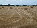 Baled straw in Barroway Drove, Norfolk - geograph.org.uk - 3095623.jpg 4,320 × 3,240; 5.69 MB
-
 Baled straw off Cuckoo Road, Barroway Drove - geograph.org.uk - 5092721.jpg 4,320 × 3,240; 5.83 MB
-
 Bales along Outwell Road at Mortons Farm - geograph.org.uk - 5323495.jpg 800 × 519; 112 KB
-
 Bamfords' "PERFECT" Root Cutter - geograph.org.uk - 5309141.jpg 480 × 640; 476 KB
-
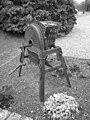 Bamfords' "PERFECT" Root Cutter - geograph.org.uk - 5309143.jpg 480 × 640; 264 KB
-
 Bamfords' "PERFECT" Root Cutter - geograph.org.uk - 5309146.jpg 550 × 640; 524 KB
-
 Banks of the Middle Level Main Drain - geograph.org.uk - 2681439.jpg 3,872 × 2,592; 2.95 MB
-
 Bardolph Farm, Cuckoo Road - geograph.org.uk - 4583732.jpg 2,560 × 1,920; 1.6 MB
-
 Barn at Willow Farm - geograph.org.uk - 5309170.jpg 640 × 480; 311 KB
-
 Barn by West Head Road - geograph.org.uk - 4583778.jpg 2,560 × 1,920; 1.55 MB
-
 Barroway Drove - geograph.org.uk - 4582788.jpg 2,560 × 1,920; 1.8 MB
-
 Barroway Drove - geograph.org.uk - 4582805.jpg 2,560 × 1,860; 1.19 MB
-
 Barroway Drove, aerial 2017 - geograph.org.uk - 5537069.jpg 640 × 427; 61 KB
-
 Battered bush next to Morton's Bridge - geograph.org.uk - 3126028.jpg 4,320 × 3,240; 5.79 MB
-
 Bethesda Chapel, Stow Bridge - geograph.org.uk - 3503977.jpg 4,320 × 3,240; 3.39 MB
-
 Between a field and a ditch - geograph.org.uk - 1732220.jpg 640 × 480; 104 KB
-
 Bridge at Stow Bridge - geograph.org.uk - 6270270.jpg 5,278 × 3,522; 2.92 MB
-
 Bridge Farm and Outwell Road - geograph.org.uk - 5323469.jpg 800 × 448; 116 KB
-
 Bridge over small drain at the roadside - geograph.org.uk - 4444483.jpg 4,320 × 3,240; 3 MB
-
 Bridge over the Great Ouse - geograph.org.uk - 6270328.jpg 6,000 × 4,000; 4.57 MB
-
 Bridge to farmland near Fences Farm - geograph.org.uk - 5090522.jpg 4,320 × 3,240; 5.98 MB
-
 Bridleway by the Great Ouse - geograph.org.uk - 6270320.jpg 6,000 × 4,000; 5.03 MB
-
 Bridleway crossing Lady Drove - geograph.org.uk - 4583708.jpg 2,560 × 1,920; 1.89 MB
-
 Bridleway from Lady Drove - geograph.org.uk - 4583036.jpg 2,560 × 1,920; 1.96 MB
-
 Bridleway from Lady Drove - geograph.org.uk - 4583048.jpg 2,560 × 1,920; 2.04 MB
-
 Bridleway from Lady Drove - geograph.org.uk - 4583456.jpg 2,560 × 1,920; 2.11 MB
-
 Buildings on Cherry Farm, Stow Fen - geograph.org.uk - 6067378.jpg 3,264 × 2,448; 1.35 MB
-
 Bus stop, Barroway Drove - geograph.org.uk - 4582799.jpg 2,560 × 1,920; 1.56 MB
-
 Car park next to Morton's Bridge - geograph.org.uk - 5237460.jpg 800 × 600; 125 KB
-
 Car park of the Heron public house - geograph.org.uk - 5309137.jpg 640 × 480; 311 KB
-
 Cart shed beside West Head Road - geograph.org.uk - 5309124.jpg 640 × 480; 274 KB
-
 Channel beside the Great River Ouse - geograph.org.uk - 1872157.jpg 640 × 480; 36 KB
-
 Church sign in Stow Bridge - geograph.org.uk - 5090704.jpg 4,320 × 3,240; 5.79 MB
-
 Common Lode - geograph.org.uk - 4583853.jpg 2,560 × 1,920; 2.01 MB
-
 Common Lode near Barroway Drove - geograph.org.uk - 5092701.jpg 4,320 × 3,240; 5.65 MB
-
 Concrete road crossing Stow Bardolph Fen - geograph.org.uk - 5090575.jpg 4,320 × 3,240; 5.89 MB
-
 Concreted farm roadway to silos in the distance - geograph.org.uk - 4521887.jpg 1,024 × 768; 249 KB
-
 Converted stable block, Stow Hall, Norfolk - geograph.org.uk - 5831036.jpg 5,184 × 3,888; 4.4 MB
-
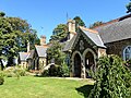
 Cottages adjoining Holy Trinity church - geograph.org.uk - 1737299.jpg 480 × 640; 141 KB
-

-
 Cottages by Hill Farm by West Head - geograph.org.uk - 1732189.jpg 640 × 480; 121 KB
-
 Cottages by Holy Trinity church - geograph.org.uk - 1737273.jpg 640 × 480; 101 KB
-
 Cottages by Holy Trinity church - geograph.org.uk - 1737298.jpg 640 × 499; 114 KB
-
 Cottages by Stow Bardolph Hall - geograph.org.uk - 1737295.jpg 640 × 486; 117 KB
-
 Crabb's Abbey Farm near Stow Bridge - geograph.org.uk - 6067500.jpg 3,264 × 2,448; 1.84 MB
-
 Cracked concrete - geograph.org.uk - 1732251.jpg 480 × 640; 115 KB
-
 Crop field near Stow Bardolph - geograph.org.uk - 5431977.jpg 640 × 480; 54 KB
-
 Crop field off Fincham Road - geograph.org.uk - 5432304.jpg 640 × 480; 89 KB
-
 Crop field towards Blackmeadow Wood - geograph.org.uk - 5432301.jpg 640 × 480; 66 KB
-
 Crop field towards woodland - geograph.org.uk - 5432036.jpg 640 × 480; 76 KB
-
 Cuckoo Road - geograph.org.uk - 4583712.jpg 2,560 × 1,920; 1.68 MB
-
 Cuckoo Road - geograph.org.uk - 4583752.jpg 2,560 × 1,920; 1.74 MB
-
 Cuckoo Road - geograph.org.uk - 4583758.jpg 2,560 × 1,920; 1.82 MB
-
 Cuckoo Road - geograph.org.uk - 4583829.jpg 2,560 × 1,920; 1.94 MB
-
 Cuckoo Road past Common Lode Farm - geograph.org.uk - 4583859.jpg 2,560 × 1,920; 1.94 MB
-
 Daffodils next to Outwell Road - geograph.org.uk - 5323571.jpg 800 × 609; 191 KB
-
 Dewpond in a low lying marsh - geograph.org.uk - 6067516.jpg 3,264 × 2,448; 1.7 MB
-
 Distant view of the Heron - geograph.org.uk - 5838586.jpg 1,024 × 560; 110 KB
-
 Ditch across Stow Bardolph Fen - geograph.org.uk - 4583051.jpg 2,560 × 1,920; 2.01 MB
-
 Ditch off Middle Drove - geograph.org.uk - 4581667.jpg 2,560 × 1,920; 1.93 MB
-
 Ditch off White City Road - geograph.org.uk - 4582954.jpg 2,560 × 1,920; 2.2 MB
-

-
 Drain by Outwell Road - geograph.org.uk - 2681397.jpg 2,592 × 3,872; 3.39 MB
-
 Drain north of Outwell Road - geograph.org.uk - 5323563.jpg 800 × 600; 166 KB
-
 Drain off Outwell Road - geograph.org.uk - 4583507.jpg 2,560 × 1,920; 1.61 MB
-
 Drain south of Common Lode and Cuckoo Road - geograph.org.uk - 5092691.jpg 4,320 × 3,240; 5.64 MB
-
 Drainage channel - geograph.org.uk - 1872171.jpg 640 × 480; 30 KB
-
 Elizabeth II postbox on Fincham Road, Stow Bardolph - geograph.org.uk - 5436491.jpg 1,048 × 2,021; 393 KB
-
 Embankment of the Great Ouse - geograph.org.uk - 5024665.jpg 640 × 426; 50 KB
-
 Entrance gates to Stow Gardens in Stow Bardolph, Norfolk - geograph.org.uk - 5113123.jpg 4,198 × 3,148; 3.66 MB
-

-
 Entrance to Park Farm, Stow Bardolph - geograph.org.uk - 2172243.jpg 587 × 435; 106 KB
-

-
 Epitaph to Sir Thomas Hare - geograph.org.uk - 2650187.jpg 640 × 427; 62 KB
-
 Farm access bridge along Outwell Road - geograph.org.uk - 5323526.jpg 800 × 495; 117 KB
-

-
 Farm track east of Borroway Drove - geograph.org.uk - 1734429.jpg 465 × 640; 106 KB
-
 Farm track, Stow Bardolph - geograph.org.uk - 5432042.jpg 640 × 480; 69 KB
-
 Farmland and buildings - geograph.org.uk - 6053763.jpg 5,202 × 3,465; 4.03 MB
-

-
 Farmland at Stow Bridge - geograph.org.uk - 5325922.jpg 800 × 693; 220 KB
-
 Farmland near Stow Bridge - geograph.org.uk - 6270316.jpg 6,000 × 4,000; 5.38 MB
-
 Farms on Marshland Fen - geograph.org.uk - 5323705.jpg 800 × 471; 89 KB
-
 Fenced off buildings. Ward's Chase - geograph.org.uk - 4583928.jpg 2,560 × 1,920; 2.21 MB
-
 Fenland fields north of Hill Farm - geograph.org.uk - 1732268.jpg 640 × 477; 91 KB
-
 Fenland fields south of West Head - geograph.org.uk - 1734013.jpg 640 × 480; 97 KB
-
 Fenland north of West Head - geograph.org.uk - 5323622.jpg 800 × 554; 151 KB
-
 Ferdlant Stud - geograph.org.uk - 4583472.jpg 2,560 × 1,920; 1.88 MB
-
 Field by Outwell Road - geograph.org.uk - 4582977.jpg 2,560 × 1,920; 1.76 MB
-
 Field by West Head Road - geograph.org.uk - 4583478.jpg 2,560 × 1,920; 1.65 MB
-
 Field by West Head Road - geograph.org.uk - 4583786.jpg 2,560 × 1,920; 1.55 MB
-
 Field on the edge of Bardolph Fen - geograph.org.uk - 1734176.jpg 640 × 480; 128 KB
-
 Field towards Slubberdike Wood - geograph.org.uk - 5431978.jpg 640 × 480; 64 KB
-
 Fields by Cuckoo Road - geograph.org.uk - 4583735.jpg 2,560 × 1,920; 2.11 MB
-
 Fields by Cuckoo Road - geograph.org.uk - 4583765.jpg 2,560 × 1,920; 1.98 MB
-
 Fields by Outwell Road - geograph.org.uk - 4582993.jpg 2,560 × 1,790; 1.34 MB
-
 Fields by Ward's Chase - geograph.org.uk - 4583934.jpg 2,560 × 1,920; 2.02 MB
-
 Fields to the East of Church Farm - geograph.org.uk - 2576214.jpg 640 × 481; 55 KB
-
 Fincham Road - geograph.org.uk - 5432309.jpg 640 × 480; 71 KB
-
 Fincham Road past Stow Bardolph Hall - geograph.org.uk - 1737292.jpg 640 × 513; 172 KB
-
 Fincham Road, Stow Bardolph - geograph.org.uk - 5432038.jpg 640 × 480; 63 KB
-
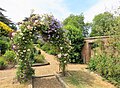 Flowering shrub arch in Stow Hall Gardens, Norfolk - geograph.org.uk - 5831032.jpg 5,059 × 3,723; 6.11 MB
-

-

-
 Grassland by the River Great Ouse - geograph.org.uk - 5024668.jpg 640 × 354; 33 KB
-
 Grazing, Stow Bridge - geograph.org.uk - 5540810.jpg 640 × 447; 40 KB
-
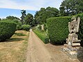 Griffin in the walled garden, Stow Hall, Norfolk - geograph.org.uk - 5831039.jpg 5,184 × 3,888; 6.95 MB
-
 Half-ploughed field - geograph.org.uk - 2681379.jpg 3,872 × 2,592; 2.89 MB
-
 Hedge and harvest near Cherry Farm - geograph.org.uk - 5090547.jpg 4,320 × 3,240; 5.81 MB
-
 Heron's Plantation - geograph.org.uk - 5036069.jpg 640 × 426; 46 KB
-
 High Bridge - geograph.org.uk - 1734070.jpg 640 × 480; 98 KB
-
 Highbridge Road - geograph.org.uk - 1734057.jpg 640 × 480; 78 KB
-

-
 Hill Farm - geograph.org.uk - 3503933.jpg 4,320 × 3,240; 2.97 MB
-
 Holme Road near Stow Bridge village hall - geograph.org.uk - 6067509.jpg 3,264 × 2,448; 1.73 MB
-
 Horse paddock and cut grass - geograph.org.uk - 4583865.jpg 2,560 × 1,920; 1.79 MB
-
 Horse Paddocks, Barroway Drove - geograph.org.uk - 4583474.jpg 2,560 × 1,920; 1.71 MB
-
 House by Barroway Drove - geograph.org.uk - 4582920.jpg 2,560 × 1,920; 1.31 MB
-
 House in Barroway Drove - geograph.org.uk - 4583459.jpg 2,560 × 1,920; 1.34 MB
-
 House on Fincham Road, Stow Bardolph - geograph.org.uk - 5436493.jpg 2,848 × 2,136; 1.18 MB
-
 House on Stow Bridge Road - geograph.org.uk - 5431972.jpg 640 × 480; 97 KB
-
 Houses next to the River Great Ouse - geograph.org.uk - 4444369.jpg 4,320 × 3,240; 2.97 MB
-
 Houses next to the River Great Ouse - geograph.org.uk - 5325981.jpg 800 × 577; 126 KB
-
 Houses on the bank of the Great Ouse - geograph.org.uk - 3503965.jpg 4,320 × 3,240; 2.91 MB
-
 Houses on the west side of River Great Ouse - geograph.org.uk - 6053748.jpg 5,202 × 3,465; 2.75 MB
-
 Inside the walled garden at Stow Hall Park, Norfolk - geograph.org.uk - 5831006.jpg 5,184 × 3,684; 7.4 MB
-
 Junction of Cuckoo Road and Barroway Drove - geograph.org.uk - 3503904.jpg 4,320 × 3,240; 2.94 MB
-
 Junction of Lady Drove and the Drove - geograph.org.uk - 3503855.jpg 4,320 × 3,240; 2.97 MB
-
 Lake near Stowbridge in Norfolk - geograph.org.uk - 5110305.jpg 4,303 × 3,227; 4.92 MB
-
 Landscaped pond in Barroway Drove - geograph.org.uk - 5092774.jpg 4,320 × 3,240; 5.38 MB
-
 Large agricultural buildings at West Head - geograph.org.uk - 6067384.jpg 2,788 × 2,091; 1.04 MB
-
 Last year's potato field - geograph.org.uk - 5431963.jpg 640 × 480; 62 KB
-
 Loading up - geograph.org.uk - 2681415.jpg 3,872 × 2,592; 2.73 MB
-
 Localised flooding - geograph.org.uk - 5838448.jpg 1,024 × 681; 87 KB
-
 Looking down from West Head Road - geograph.org.uk - 4583945.jpg 2,560 × 1,920; 1.57 MB
-
 Looking north from a layby on the A10 Lynn Road - geograph.org.uk - 6067552.jpg 3,264 × 2,448; 1.73 MB
-
 Low Road in Stow Bridge - geograph.org.uk - 5326010.jpg 800 × 492; 121 KB
-
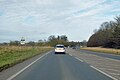
 Lynn Road (A10) - geograph.org.uk - 5431981.jpg 640 × 480; 53 KB
-
 Lynn Road (A10) - geograph.org.uk - 5431989.jpg 640 × 480; 50 KB
-
-
 Marshland House on Middle Drove - geograph.org.uk - 6067364.jpg 3,033 × 2,275; 1.39 MB
-
 Middle Drove north of Newbridge Farm - geograph.org.uk - 3126002.jpg 4,320 × 3,240; 5.62 MB
-
 Middle Level Main Drain - geograph.org.uk - 2681464.jpg 3,872 × 2,592; 2.77 MB
-
 Middle Level Main Drain - geograph.org.uk - 2681468.jpg 3,872 × 2,592; 3.48 MB
-

-

-

-
 Morton's Bridge crossing The Middle Level Main Drain - geograph.org.uk - 3126284.jpg 4,320 × 3,240; 5.82 MB
-

-

-

-

-
 Morton's Bridge over the Middle Level Drain - geograph.org.uk - 4444507.jpg 4,320 × 3,240; 3.3 MB
-
 Morton’s Bridge - geograph.org.uk - 2681428.jpg 3,872 × 2,592; 2.8 MB
-
 MRC Modular Buildings - geograph.org.uk - 4582928.jpg 2,560 × 1,920; 1.12 MB
-
 National Cycle Route 11 - geograph.org.uk - 5431969.jpg 640 × 480; 54 KB
-
 Nest box - geograph.org.uk - 2681447.jpg 2,592 × 3,872; 2.72 MB
-
 New house by West Head Road - geograph.org.uk - 4583953.jpg 2,560 × 1,920; 1.69 MB
-
 Newbridge Farm on Outwell Road - geograph.org.uk - 6067369.jpg 3,264 × 2,448; 1.62 MB
-
 Newling's Farm on Outwell Road - geograph.org.uk - 6067372.jpg 2,973 × 2,230; 1.18 MB
-
 Now where did I leave that weed^ - geograph.org.uk - 1872182.jpg 640 × 480; 59 KB
-
 Off Barroway Drove - geograph.org.uk - 6196362.jpg 5,472 × 3,648; 6.94 MB
-
 Oilseed rape crop near Stow Bardolph - geograph.org.uk - 5431985.jpg 640 × 480; 62 KB
-
 Old corrugated metal sheds in Barroway Drove - geograph.org.uk - 5092798.jpg 4,320 × 3,240; 5.76 MB
-
 Old Milestone - geograph.org.uk - 1714797.jpg 1,600 × 1,200; 708 KB
-
 Old Milestone - geograph.org.uk - 1714801.jpg 1,200 × 1,600; 801 KB
-
 Ordnance Survey Cut Mark - geograph.org.uk - 4293813.jpg 4,000 × 3,000; 3.2 MB
-
 Ordnance Survey Flush Bracket 10565 - geograph.org.uk - 4293795.jpg 4,000 × 3,000; 2.19 MB
-
 Outside the walled garden, Stow Hall, Norfolk - geograph.org.uk - 5831029.jpg 5,184 × 3,888; 5.42 MB
-
 Outwell Road - geograph.org.uk - 4583000.jpg 2,560 × 1,920; 1.69 MB
-
 Outwell Road at Fences Farm - geograph.org.uk - 5323509.jpg 800 × 529; 125 KB
-
 Outwell Road near Newlings Farm - geograph.org.uk - 5323501.jpg 800 × 514; 108 KB
-
 Outwell Road to Cherry Farm - geograph.org.uk - 4582995.jpg 2,560 × 1,797; 1.37 MB
-
 Phone box, Stow Bardolph - geograph.org.uk - 1244811.jpg 2,000 × 3,008; 2.99 MB
-
 Pincushion Drove - geograph.org.uk - 710368.jpg 2,000 × 3,008; 2.87 MB
-
 Pincushion Drove, A Murder of Crows - geograph.org.uk - 6195687.jpg 5,280 × 3,520; 2.49 MB
-
 Pontoon near The Heron, Stowbridge, Norfolk - geograph.org.uk - 5109068.jpg 4,299 × 3,225; 2.65 MB
-
 Potato field by Barroway Drove - geograph.org.uk - 4583466.jpg 2,560 × 1,920; 1.44 MB
-
 Poultry House by Outwell Road - geograph.org.uk - 4583500.jpg 2,560 × 1,920; 1.55 MB
-
 Poultry Houses - geograph.org.uk - 1734051.jpg 640 × 535; 101 KB
-
 Power line across the Middle Level Main Drain - geograph.org.uk - 2681458.jpg 3,872 × 2,592; 2.8 MB
-
 Private parkland near Stow Hall in Norfolk - geograph.org.uk - 5113289.jpg 4,320 × 3,240; 3.8 MB
-
 Private Road to Manor Farm near Stow Bridge - geograph.org.uk - 5090685.jpg 4,320 × 3,240; 5.41 MB
-

-
 Pumping station near River Great Ouse - geograph.org.uk - 4583893.jpg 2,560 × 1,920; 1.66 MB
-
 Railings and dike west of Newbridge Farm - geograph.org.uk - 3125985.jpg 4,320 × 3,240; 5.43 MB
-
 Railings and The Relief Channel, Stowbridge, Norfolk - geograph.org.uk - 5109085.jpg 4,291 × 3,219; 3.02 MB


_-_geograph.org.uk_-_5431981.jpg)
_-_geograph.org.uk_-_5431989.jpg)


