Category:Stourton, Staffordshire
Jump to navigation
Jump to search
English: Stourton (pronounced 'Store-ton') is a hamlet in Staffordshire, England a few miles to the northwest of Stourbridge. The nearest sizeable villages are Wollaston and Kinver, the nearest hamlets are Prestwood and Dunsley. It lies on the River Stour. The Staffordshire and Worcestershire Canal and Stourbridge Canal meet at Stourton Junction, which places Stourton on the Stourport Ring, a navigable waterway popular with narrowboat holidaymakers.
human settlement in Staffordshire, United Kingdom  | |||||
| Upload media | |||||
| Instance of | |||||
|---|---|---|---|---|---|
| Location | Kinver, South Staffordshire, Staffordshire, West Midlands, England | ||||
 | |||||
Subcategories
This category has the following 2 subcategories, out of 2 total.
S
Media in category "Stourton, Staffordshire"
The following 59 files are in this category, out of 59 total.
-
 A449 near Stourton - geograph.org.uk - 2055262.jpg 640 × 480; 58 KB
-

-
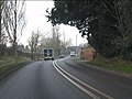 A458 climbing west from Stourton - geograph.org.uk - 2772839.jpg 640 × 480; 65 KB
-

-
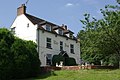
 Apartments at the Stewponey - geograph.org.uk - 246945.jpg 500 × 385; 140 KB
-

-
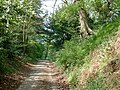
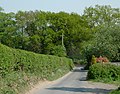
 Bridleway near Stourton, Staffordshire - geograph.org.uk - 2374885.jpg 493 × 640; 181 KB
-
 Bridleway near Stourton, Staffordshire - geograph.org.uk - 2374891.jpg 480 × 640; 182 KB
-
 Bridleway near Stourton, Staffordshire - geograph.org.uk - 2374902.jpg 800 × 600; 281 KB
-
-

-

-

-

-

-

-
-
 Cottage next to Stourton Lock No 18 - geograph.org.uk - 5222044.jpg 800 × 589; 137 KB
-
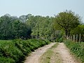
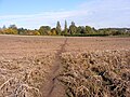
 Farmland west of Stourton - geograph.org.uk - 841061.jpg 640 × 428; 102 KB
-
 Flats on The Stewponey, Stourton - geograph.org.uk - 4002728.jpg 1,600 × 1,216; 796 KB
-

-

-
 Fox Inn, Stourton - geograph.org.uk - 308147.jpg 640 × 480; 98 KB
-

-
-

-

-
 Leaving sewage works lane - geograph.org.uk - 892025.jpg 640 × 480; 368 KB
-
 Narrow boats at Stewponey - geograph.org.uk - 765297.jpg 640 × 480; 94 KB
-
 Ordnance Survey bench mark on Stourton Lock no.18 - geograph.org.uk - 3476477.jpg 2,560 × 1,920; 1.03 MB
-

-

-

-
 River Stour upstream of Stewponey Bridge - geograph.org.uk - 744144.jpg 640 × 480; 347 KB
-
 Smestow River north of Stourton - geograph.org.uk - 2379091.jpg 640 × 469; 137 KB
-

-

-

-

-
 StaffsWorcs Stourton Junction.jpg 1,824 × 1,368; 375 KB
-
 Stourton Bridge View - geograph.org.uk - 3191099.jpg 800 × 600; 220 KB
-
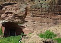
 Stourton Castle (medieval gate tower) - geograph.org.uk - 4357789.jpg 3,648 × 2,736; 2.85 MB
-
 Stourton Castle - geograph.org.uk - 196085.jpg 600 × 430; 121 KB
-
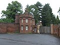
 Stourton Castle Entrance - geograph.org.uk - 3191675.jpg 800 × 600; 135 KB
-
 Stourton Farm, Greensforge Lane - geograph.org.uk - 2573086.jpg 640 × 428; 107 KB
-
 Stourton Field Path - geograph.org.uk - 3193977.jpg 800 × 600; 181 KB
-
 Stourton Park - geograph.org.uk - 2041858.jpg 800 × 600; 131 KB
-
 Stourton Park - geograph.org.uk - 4835159.jpg 3,648 × 2,736; 2.86 MB
-
 Stourton Path - geograph.org.uk - 3191064.jpg 800 × 600; 129 KB
-
 Stourton Top Lock - geograph.org.uk - 841184.jpg 640 × 428; 73 KB
-
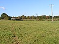
 Stourton View - geograph.org.uk - 765358.jpg 640 × 480; 71 KB
-
 Stourton Village Hall - geograph.org.uk - 5403510.jpg 3,648 × 2,736; 2.59 MB
-

-
 The Fox Inn - geograph.org.uk - 3811191.jpg 3,648 × 2,736; 2.84 MB
-
 The Fox, Stourton - geograph.org.uk - 840602.jpg 640 × 428; 101 KB
-
 The Gate House, Stourton Castle.jpg 800 × 600; 127 KB
-
 The Slads - geograph.org.uk - 421906.jpg 640 × 480; 99 KB
-
 Toll House, Stewponey - geograph.org.uk - 744584.jpg 640 × 480; 234 KB
-
 Wheatfield, Stourton - geograph.org.uk - 3162528.jpg 1,024 × 768; 141 KB


_-_geograph.org.uk_-_4357789.jpg)


