Category:Stourpaine
Jump to navigation
Jump to search
English: Stourpaine is a village in north Dorset, England, situated on the River Stour and A350 road in the south east corner of the Blackmore Vale, under Cranborne Chase, three miles north west of Blandford Forum. The village has a population of 608 .
village in United Kingdom  | |||||
| Upload media | |||||
| Instance of | |||||
|---|---|---|---|---|---|
| Location | Dorset, South West England, England | ||||
| Population |
| ||||
| Said to be the same as | Stourpaine (Wikimedia duplicated page, civil parish) | ||||
 | |||||
Subcategories
This category has the following 5 subcategories, out of 5 total.
Media in category "Stourpaine"
The following 85 files are in this category, out of 85 total.
-
 A350 south of Stourpaine - geograph.org.uk - 371908.jpg 640 × 480; 123 KB
-
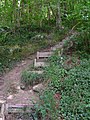 Anglers' steps by the River Stour - geograph.org.uk - 645571.jpg 480 × 640; 132 KB
-
 Church of the Holy Trinity, Stourpaine - geograph.org.uk - 6691866.jpg 1,024 × 576; 180 KB
-
 Clever Sheep - geograph.org.uk - 369252.jpg 640 × 480; 67 KB
-
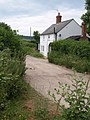
 Cottage at Havelins, Stourpaine - geograph.org.uk - 6691888.jpg 1,024 × 672; 166 KB
-
 Cottage on Manor Road, Stourpaine - geograph.org.uk - 6691844.jpg 1,024 × 768; 221 KB
-

-

-

-
 Fields below Hod Hill - geograph.org.uk - 6573372.jpg 1,024 × 683; 182 KB
-
 Flood-plain grazing - geograph.org.uk - 372655.jpg 640 × 480; 82 KB
-
 Footpath beside a stream - geograph.org.uk - 6691603.jpg 1,024 × 576; 244 KB
-
 Footpath into France Firs - geograph.org.uk - 3561088.jpg 2,346 × 3,128; 2.8 MB
-
 Footpath near Stourpaine - geograph.org.uk - 1390020.jpg 640 × 480; 139 KB
-
 France Down - geograph.org.uk - 3468692.jpg 640 × 480; 48 KB
-
 France Oaks Cottage - geograph.org.uk - 1949146.jpg 480 × 640; 94 KB
-
 Gate on the slope of Hod Hill - geograph.org.uk - 6573367.jpg 1,024 × 683; 233 KB
-
 Great Dorset Steam Fair – 1974 - geograph.org.uk - 6836343.jpg 1,280 × 854; 398 KB
-
 Green lane to Stourpaine - geograph.org.uk - 1425303.jpg 640 × 480; 115 KB
-

-
 Hod Drive - geograph.org.uk - 6689167.jpg 1,024 × 576; 209 KB
-
 Hod Hill Iron Age hillfort - geograph.org.uk - 6689290.jpg 1,024 × 576; 154 KB
-
 Hod Hill, entrance - geograph.org.uk - 4823135.jpg 1,024 × 768; 177 KB
-
 Hod Hill, entrance - geograph.org.uk - 4823158.jpg 1,024 × 768; 181 KB
-
 Hod Hill, outer ditch - geograph.org.uk - 4823148.jpg 1,024 × 768; 147 KB
-
 Hod Hill, Roman ditch - geograph.org.uk - 4823175.jpg 1,024 × 768; 178 KB
-
 Hod Hill, site of Roman fort - geograph.org.uk - 4823187.jpg 1,024 × 768; 261 KB
-
 Holy Trinity Church, Stourpaine - geograph.org.uk - 6574128.jpg 1,024 × 683; 259 KB
-
 House entrance on Shaston Road, Stourpaine - geograph.org.uk - 6532492.jpg 1,880 × 1,218; 1.66 MB
-
 Iwerne Stepleton, Ash Down - geograph.org.uk - 4801282.jpg 1,024 × 768; 125 KB
-
 Jubilee Trail in France Firs - geograph.org.uk - 1949107.jpg 640 × 480; 129 KB
-
 Moated Site at Stourpaine (geograph 6691879).jpg 1,024 × 576; 162 KB
-

-
 Ordnance Survey Flush Bracket S3037 - geograph.org.uk - 3917798.jpg 4,000 × 3,000; 4.34 MB
-
 River Iwerne - geograph.org.uk - 1425614.jpg 640 × 480; 113 KB
-
 River Stour - geograph.org.uk - 369930.jpg 640 × 427; 132 KB
-
 River Stour at Pressham Wood - geograph.org.uk - 3289122.jpg 640 × 480; 115 KB
-
 River Stour below Hod Hill - geograph.org.uk - 6573366.jpg 1,024 × 683; 270 KB
-
 Roman fort and hillfort at Hod Hill - geograph.org.uk - 6689304.jpg 1,024 × 576; 178 KB
-
 Roman fort at Hod Hill - geograph.org.uk - 6689314.jpg 1,024 × 576; 167 KB
-
 Rose Cottage, Havelins, Stourpaine - geograph.org.uk - 1425095.jpg 640 × 480; 70 KB
-
 Rowlands Road, Stourpaine - geograph.org.uk - 1949178.jpg 640 × 480; 106 KB
-
 Shaftesbury Lane - geograph.org.uk - 1949009.jpg 640 × 480; 94 KB
-
 Shaston Road, Ash - geograph.org.uk - 6532493.jpg 1,633 × 1,088; 939 KB
-
 Shaston Road, Stourpaine - geograph.org.uk - 6528037.jpg 1,818 × 1,102; 1.6 MB
-
 Shaston Road, Stourpaine - geograph.org.uk - 6532491.jpg 1,872 × 1,204; 1.24 MB
-
 Start of track to Stourpaine bushes - geograph.org.uk - 5529647.jpg 640 × 392; 66 KB
-
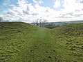
 Stourpaine Down - geograph.org.uk - 530208.jpg 640 × 480; 44 KB
-
 Stourpaine Village Hall - geograph.org.uk - 3339119.jpg 1,024 × 768; 222 KB
-
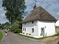
 Stourpaine, 'The Wee Thatch' - geograph.org.uk - 524592.jpg 411 × 640; 79 KB
-

-
 Stourpaine, Everley Hill signpost - geograph.org.uk - 1509676.jpg 640 × 480; 105 KB
-
 Stourpaine, former chapel - geograph.org.uk - 2373975.jpg 1,024 × 768; 200 KB
-
 Stourpaine, Holy Trinity - geograph.org.uk - 5473089.jpg 4,608 × 3,456; 5.21 MB
-
 Stourpaine, playground - geograph.org.uk - 3339123.jpg 1,024 × 768; 202 KB
-
 Stourpaine, postbox No. DT11 109 - geograph.org.uk - 1434088.jpg 480 × 640; 78 KB
-

-
 Stourpaine, the post office - geograph.org.uk - 1152954.jpg 480 × 640; 79 KB
-
 Stourpaine, village shop - geograph.org.uk - 3339114.jpg 1,024 × 766; 130 KB
-
 Stourpaine.jpg 1,024 × 729; 337 KB
-
 Thatching in progress - geograph.org.uk - 1425624.jpg 640 × 480; 68 KB
-
 The Village of Stourpaine from Hod Hill - geograph.org.uk - 1278856.jpg 640 × 412; 316 KB
-
 Towards Durweston - geograph.org.uk - 1949169.jpg 640 × 446; 102 KB
-
 Trailway at Stourpaine - geograph.org.uk - 6574127.jpg 1,024 × 683; 190 KB
-
 View across the Iwerne valley from Hod Hill - geograph.org.uk - 6574120.jpg 1,024 × 683; 155 KB
-
 Wood, Stourpaine Bushes - geograph.org.uk - 1949027.jpg 640 × 480; 86 KB
-
 Woodland, France Firs - geograph.org.uk - 1949121.jpg 480 × 640; 141 KB
-
 Charcoal kiln in Hillcombe Coppice Dorset - geograph.org.uk - 276251.jpg 480 × 640; 119 KB
-
 Copse circled by Cereal - geograph.org.uk - 369354.jpg 640 × 480; 80 KB
-
 Curvy A350 - geograph.org.uk - 369257.jpg 640 × 480; 119 KB
-
 Down Smuggler's Lane - geograph.org.uk - 369338.jpg 640 × 480; 192 KB
-
 Edge of the covert, Stourpaine Downs - geograph.org.uk - 623023.jpg 640 × 480; 132 KB
-
 Enford Bottom - geograph.org.uk - 365875.jpg 640 × 427; 73 KB
-
 Enford Bottom - geograph.org.uk - 373448.jpg 640 × 427; 105 KB
-
 Farm track near Gain's Cross Farm - geograph.org.uk - 372612.jpg 480 × 640; 83 KB
-
 Farmland - geograph.org.uk - 276216.jpg 640 × 480; 126 KB
-
 Farmland - geograph.org.uk - 276227.jpg 640 × 365; 112 KB
-
 Field by Bushes Road - geograph.org.uk - 369362.jpg 640 × 480; 65 KB
-
 France Firs - geograph.org.uk - 623020.jpg 640 × 480; 118 KB
-

-
 Sheep grazing - geograph.org.uk - 279165.jpg 640 × 480; 76 KB
-
 Smuggler's Lane - geograph.org.uk - 369319.jpg 640 × 480; 155 KB
-
 Stourpaine Downs - geograph.org.uk - 622859.jpg 640 × 480; 76 KB
-
 Stourpaine, Post Office and pub - geograph.org.uk - 258946.jpg 640 × 372; 88 KB
-
 Toll house on A357 - geograph.org.uk - 163333.jpg 600 × 450; 53 KB


.jpg)


