Category:Stour Row
Jump to navigation
Jump to search
English: Stour Row is a village in north Dorset, England, situated beside Duncliffe hill three miles south west of Shaftesbury.
village in United Kingdom  | |||||
| Upload media | |||||
| Instance of | |||||
|---|---|---|---|---|---|
| Location | Stour Provost, Dorset, South West England, England | ||||
 | |||||
Subcategories
This category has the following 2 subcategories, out of 2 total.
S
- The Ship Inn, Shaftesbury (12 F)
Media in category "Stour Row"
The following 26 files are in this category, out of 26 total.
-
 All Saints Chapel - geograph.org.uk - 2813808.jpg 800 × 600; 152 KB
-
 Entering Duncliffe Wood - geograph.org.uk - 408853.jpg 430 × 640; 164 KB
-
 Parish Hall former Chapel in Stour Row - geograph.org.uk - 3923548.jpg 4,000 × 3,000; 3.54 MB
-
 Bluebells and footpath in Duncliffe Wood - geograph.org.uk - 410847.jpg 640 × 430; 173 KB
-
 Blynfield Farm near Stour Row - geograph.org.uk - 361120.jpg 640 × 480; 160 KB
-

-
 Clearing in Duncliffe Woods - geograph.org.uk - 410864.jpg 640 × 430; 156 KB
-
 Climbing Duncliffe Hill - geograph.org.uk - 410860.jpg 430 × 640; 158 KB
-
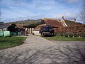
 Doncliffe Hall Farm - geograph.org.uk - 408894.jpg 640 × 430; 85 KB
-
 Entrance to Lower Hartgrove Farm - geograph.org.uk - 335790.jpg 640 × 480; 83 KB
-
 Footpath to Duncliffe Wood-Hill - geograph.org.uk - 409083.jpg 640 × 430; 110 KB
-
 Gateway off Green Lane - geograph.org.uk - 335802.jpg 640 × 480; 142 KB
-

-
 Jolliffe's Farm, Stour Row - geograph.org.uk - 361236.jpg 640 × 480; 88 KB
-
 Junction at Cherry Orchard Farm - geograph.org.uk - 410839.jpg 640 × 430; 117 KB
-
 Lane to Hunt's Farm and Ruddock's Farm - geograph.org.uk - 409075.jpg 430 × 640; 152 KB
-
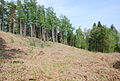
 Lower slopes of Duncliffe Hill - geograph.org.uk - 410843.jpg 640 × 430; 95 KB
-
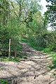
 Main track through Duncliffe Woods - geograph.org.uk - 410893.jpg 430 × 640; 135 KB
-
 Milking area at Venns Farm - geograph.org.uk - 335798.jpg 640 × 480; 78 KB
-

-
 Road from Stour Row, heading south - geograph.org.uk - 409067.jpg 640 × 430; 102 KB
-
 Ruddock's Farm - geograph.org.uk - 409071.jpg 640 × 430; 94 KB
-
 Southeast corner of Duncliffe Wood - geograph.org.uk - 408852.jpg 640 × 430; 97 KB
-
 Sweet's House, Stour Row - geograph.org.uk - 361841.jpg 640 × 480; 116 KB
-
 Tile House Farm - geograph.org.uk - 408896.jpg 640 × 430; 82 KB
-
 View towards Duncliffe Hill - geograph.org.uk - 408881.jpg 640 × 430; 98 KB


