Category:Stoughton, Leicestershire
Jump to navigation
Jump to search
English: It is just east of Leicester, and sits in countryside between two protusions of the Leicester urban area (Thurnby to the north and Oadby to the south). The closest part of the city of Leicester is Evington. Other nearby places are Houghton on the Hill and Great Stretton.
village and civil parish in Leicestershire, England, UK .jpg) | |||||
| Upload media | |||||
| Pronunciation audio | |||||
|---|---|---|---|---|---|
| Instance of | |||||
| Location | Harborough, Leicestershire, East Midlands, England | ||||
| Population |
| ||||
| Area |
| ||||
 | |||||
Subcategories
This category has the following 3 subcategories, out of 3 total.
L
Media in category "Stoughton, Leicestershire"
The following 150 files are in this category, out of 150 total.
-
 At the southern edge of Leicester Airport - geograph.org.uk - 2316765.jpg 2,145 × 1,371; 1.24 MB
-
 Autumn along Houghton Lane - geograph.org.uk - 3227322.jpg 2,689 × 2,105; 1.84 MB
-
 Autumn berries along Houghton Lane - geograph.org.uk - 3227389.jpg 4,000 × 3,000; 4.09 MB
-
 Bluebells along Gaulby Lane - geograph.org.uk - 2950344.jpg 2,835 × 2,066; 2.57 MB
-
 Bridleway from Gaulby Lane to Gartree Road - geograph.org.uk - 5044190.jpg 2,000 × 1,500; 653 KB
-
 Bridleway near Evington - geograph.org.uk - 2326319.jpg 2,239 × 1,402; 1.31 MB
-
 Bridleway to Evington - geograph.org.uk - 2326299.jpg 2,219 × 1,612; 1.69 MB
-
 Bridleway to Houghton Lane - geograph.org.uk - 2326287.jpg 3,221 × 2,070; 2.83 MB
-
 Bridleway towards Stoughton Road - geograph.org.uk - 5925492.jpg 4,000 × 3,000; 3.5 MB
-
 Church Lane in Stoughton - geograph.org.uk - 6411622.jpg 541 × 800; 192 KB
-
 Church of St Mary and All Saints, Stoughton - geograph.org.uk - 6245520.jpg 3,776 × 2,520; 3.95 MB
-
 Churchyard Cross - geograph.org.uk - 2241124.jpg 426 × 640; 98 KB
-
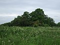
 Clarke's Bush - geograph.org.uk - 4005454.jpg 640 × 480; 66 KB
-
 Clarke's Bush along Houghton Lane - geograph.org.uk - 3812059.jpg 1,600 × 1,185; 432 KB
-
 Crop field and woodland - geograph.org.uk - 4005435.jpg 640 × 480; 64 KB
-
 Crop field, Stoughton - geograph.org.uk - 4005444.jpg 640 × 480; 47 KB
-

-

-

-

-
 Entering Stoughton on Cycle Route 63 - geograph.org.uk - 6275511.jpg 3,776 × 2,520; 3.05 MB
-
 Farmland along Houghton Lane - geograph.org.uk - 3227292.jpg 3,482 × 2,832; 3.49 MB
-
 Farmland along Houghton Lane - geograph.org.uk - 3227379.jpg 4,000 × 3,000; 3.61 MB
-
 Farmland near Leicester Airport - geograph.org.uk - 2950366.jpg 2,955 × 2,115; 2.91 MB
-
 Farmland near Leicester Airport - geograph.org.uk - 2950367.jpg 2,716 × 2,233; 3.38 MB
-
 Farmland north of Leicester Airport - geograph.org.uk - 5850826.jpg 800 × 593; 73 KB
-
 Farmland south of Thurnby - geograph.org.uk - 2326280.jpg 3,264 × 2,125; 2.82 MB
-
 Field edge by Clarke's Bush - geograph.org.uk - 5441237.jpg 640 × 480; 125 KB
-
 Field north of Stoughton Lane - geograph.org.uk - 5097537.jpg 640 × 469; 88 KB
-
 Field north of Stoughton Lane - geograph.org.uk - 5180842.jpg 640 × 428; 64 KB
-
 Field south of Stoughton Lane - geograph.org.uk - 5097538.jpg 640 × 454; 89 KB
-
 Field to the north of Gaulby Lane - geograph.org.uk - 5042313.jpg 2,000 × 1,500; 519 KB
-

-
 Fields of Oil seed rape - geograph.org.uk - 2950353.jpg 3,260 × 2,256; 3.48 MB
-
 Fly Tipping, Houghton Lane - geograph.org.uk - 4473405.jpg 640 × 480; 165 KB
-
 Footpath from Gartree Road to Stoughton - geograph.org.uk - 5415023.jpg 4,000 × 3,000; 3.57 MB
-
 Footpath from Houghton Lodge Farm to Gaulby Lane - geograph.org.uk - 5932977.jpg 4,000 × 3,000; 2.69 MB
-
 Footpath from Houghton Lodge Farm to Gaulby Lane - geograph.org.uk - 5932983.jpg 4,000 × 3,000; 2.84 MB
-

-
 Footpath from Newhaven Road to Stoughton Road - geograph.org.uk - 5130179.jpg 1,500 × 2,000; 653 KB
-

-
 Footpath to Evington - geograph.org.uk - 2316790.jpg 3,248 × 2,186; 2.62 MB
-
 Footpath to Evington - geograph.org.uk - 2316791.jpg 2,909 × 2,281; 2.85 MB
-
 Footpath to Houghton Lane - geograph.org.uk - 2316792.jpg 2,962 × 1,859; 2.43 MB
-
 Footpath to Houghton on the Hill - geograph.org.uk - 5097553.jpg 640 × 475; 90 KB
-
 G-BUUB Slingsby T67M - geograph.org.uk - 2253017.jpg 2,830 × 1,801; 1.55 MB
-
 G-ZIII Pitts S-2B - geograph.org.uk - 2253023.jpg 3,058 × 1,783; 1.49 MB
-
 Gartree Road towards Great Stretton - geograph.org.uk - 5097529.jpg 640 × 499; 123 KB
-
 Gas pipeline marker along Houghton Lane - geograph.org.uk - 3811599.jpg 1,600 × 1,385; 818 KB
-

-

-
 Gaulby Lane - geograph.org.uk - 2473604.jpg 640 × 480; 140 KB
-
 Gaulby Lane - geograph.org.uk - 2950326.jpg 3,248 × 2,362; 3.46 MB
-
 Gaulby Lane - geograph.org.uk - 4005441.jpg 640 × 480; 87 KB
-
 Gaulby Lane - geograph.org.uk - 5441221.jpg 640 × 480; 112 KB
-
 Gaulby Lane along the perimeter of Leicester Airport (left) - geograph.org.uk - 6275518.jpg 3,776 × 2,520; 2.98 MB
-

-
 Gaulby Lane heading towards Stoughton - geograph.org.uk - 6275513.jpg 3,776 × 2,520; 3.13 MB
-
 Gaulby Lane in Stoughton - geograph.org.uk - 4170014.jpg 1,600 × 1,120; 508 KB
-
 Gaulby Lane near Leicester Airport - geograph.org.uk - 2316787.jpg 2,537 × 1,690; 1.92 MB
-
 Gaulby Lane near Leicester Airport - geograph.org.uk - 2950362.jpg 1,607 × 1,164; 777 KB
-
 Gaulby Lane near Leicester Airport - geograph.org.uk - 5475016.jpg 800 × 507; 92 KB
-
 Gaulby Lane towards Stoughton - geograph.org.uk - 5097533.jpg 640 × 467; 80 KB
-
 Gaulby Lane towards Stoughton - geograph.org.uk - 5097555.jpg 640 × 518; 72 KB
-

-
 Hangar at Leicester Airport - geograph.org.uk - 4524787.jpg 640 × 480; 49 KB
-
 Hangar at Leicester Airport - geograph.org.uk - 4524792.jpg 640 × 480; 30 KB
-
 Helicopter hangar - geograph.org.uk - 4524779.jpg 640 × 480; 50 KB
-
 Horse in field - geograph.org.uk - 1052171.jpg 640 × 480; 104 KB
-
 Houghton Lane - pipeline crossing point - geograph.org.uk - 5441231.jpg 640 × 480; 129 KB
-
 Houghton Lane at Clarke's Bush - geograph.org.uk - 3227310.jpg 4,000 × 3,000; 3.55 MB
-
 Houghton Lane near Stoughton - geograph.org.uk - 3227285.jpg 4,000 × 3,000; 3.71 MB
-
 Houghton Lane towards Houghton Lodge - geograph.org.uk - 1052169.jpg 640 × 480; 60 KB
-
 Houghton Lane towards Hougton Lodge - geograph.org.uk - 1050873.jpg 640 × 480; 74 KB
-
 Houghton Lane towards Stoughton - geograph.org.uk - 1050874.jpg 640 × 480; 94 KB
-
 Houghton Lodge - geograph.org.uk - 2950339.jpg 2,675 × 2,175; 2.16 MB
-
 House on Church Lane - geograph.org.uk - 2241137.jpg 640 × 426; 86 KB
-
 Jones's Spinney along Stoughton Lane - geograph.org.uk - 3811573.jpg 1,600 × 1,200; 617 KB
-
 Junction on Gaulby Lane - geograph.org.uk - 6283645.jpg 3,776 × 2,520; 3.11 MB
-
 Leicester Airport - geograph.org.uk - 2095683.jpg 2,533 × 1,529; 1.36 MB
-
 Leicester Airport - geograph.org.uk - 2095684.jpg 2,040 × 1,134; 800 KB
-
 Leicester Airport - geograph.org.uk - 2128312.jpg 800 × 531; 73 KB
-
 Leicester Airport Control Tower - geograph.org.uk - 5206949.jpg 640 × 640; 60 KB
-
 Leicestershire - Stoughton - geograph.org.uk - 2951209.jpg 640 × 480; 70 KB
-
 Leicestershire Aero Club building - geograph.org.uk - 4524782.jpg 640 × 480; 61 KB
-
 Looking over fields to Houghton Lodge Farm - geograph.org.uk - 5932969.jpg 4,000 × 3,000; 2.84 MB
-
 Muddy track along Thurnby Lane - geograph.org.uk - 3275638.jpg 2,969 × 2,331; 941 KB
-
 National Cycle Route 63 - geograph.org.uk - 4005436.jpg 640 × 480; 84 KB
-
 National Cycle Route 63 - geograph.org.uk - 4005438.jpg 640 × 480; 86 KB
-
 National Cycle Route 63 - geograph.org.uk - 4005456.jpg 640 × 480; 45 KB
-
 National Cycle Route 63 - geograph.org.uk - 4005460.jpg 640 × 480; 63 KB
-
 National Cycle Route 63 - geograph.org.uk - 4005464.jpg 640 × 480; 61 KB
-
 Oil seed rape near Stoughton - geograph.org.uk - 2950295.jpg 2,121 × 1,640; 1.46 MB
-
 Oil seed rape next to Stoughton Lane - geograph.org.uk - 2950270.jpg 2,827 × 1,929; 2.35 MB
-
 Oilseed rape crop - geograph.org.uk - 4005440.jpg 640 × 480; 82 KB
-
 Oilseed rape crop and woodland - geograph.org.uk - 4005463.jpg 640 × 480; 68 KB
-
 Oilseed rape crop off Gaulby Lane - geograph.org.uk - 4005458.jpg 640 × 480; 66 KB
-

-
 Parkland view - geograph.org.uk - 2241145.jpg 640 × 426; 75 KB
-
 Playing fields near Judgemeadow Community College - geograph.org.uk - 3811539.jpg 1,600 × 1,233; 374 KB
-
 Postbox along Stoughton Lane - geograph.org.uk - 3811499.jpg 1,600 × 1,233; 601 KB
-
 Public bridleway across the fields - geograph.org.uk - 3275657.jpg 3,669 × 2,659; 3.09 MB
-
 Rapeseed Field - geograph.org.uk - 4473398.jpg 640 × 360; 121 KB
-
 Remains of former RAF Leicester East - geograph.org.uk - 4005446.jpg 640 × 480; 57 KB
-

-
 Saint Mary and All Saints church - geograph.org.uk - 5043117.jpg 2,000 × 1,500; 435 KB
-
 Seat and path along Stoughton Lane - geograph.org.uk - 3811588.jpg 1,600 × 1,218; 747 KB
-
 Sheltered spot along Houghton Lane - geograph.org.uk - 2316789.jpg 2,110 × 1,624; 1.6 MB
-
 Sign on gas pipeline marker 1 - geograph.org.uk - 5097540.jpg 640 × 524; 62 KB
-
 Sign on gas pipeline marker 2 - geograph.org.uk - 5097541.jpg 640 × 506; 57 KB
-
 Sign on telegraph pole 1 - geograph.org.uk - 5097542.jpg 640 × 439; 66 KB
-
 Sign on telegraph pole 2 - geograph.org.uk - 5097543.jpg 640 × 552; 97 KB
-
 Small patch of woodland near Evington - geograph.org.uk - 2326310.jpg 3,264 × 2,448; 3.33 MB
-
 St Mary and All Saints Church, Stoughton - geograph.org.uk - 2473601.jpg 640 × 480; 104 KB
-

-
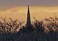 St Mary ^ All Saints church spire - geograph.org.uk - 3275644.jpg 2,048 × 1,474; 551 KB
-
 St Mary ^ All Saints churchyard - geograph.org.uk - 3275767.jpg 4,000 × 3,000; 1.65 MB
-
 St.Mary's church - geograph.org.uk - 2241121.jpg 640 × 426; 89 KB
-
 Stoughton Lane - geograph.org.uk - 4766497.jpg 800 × 600; 167 KB
-
 Stoughton Lane approaching Stoughton - geograph.org.uk - 6245528.jpg 3,776 × 2,520; 4.26 MB
-
 Stoughton Lane bridleway - geograph.org.uk - 2241059.jpg 640 × 426; 86 KB
-
 Stoughton Lane in Stoughton - geograph.org.uk - 2950280.jpg 3,241 × 1,946; 2.78 MB
-
 Stoughton Lane in Stoughton - geograph.org.uk - 6306700.jpg 800 × 426; 141 KB
-
 Stoughton Lane towards Evington - geograph.org.uk - 5097544.jpg 640 × 469; 124 KB
-
 Stoughton Lane towards Evington - geograph.org.uk - 5181567.jpg 640 × 463; 133 KB
-
 Stoughton Lane towards Stoughton - geograph.org.uk - 5097545.jpg 640 × 479; 128 KB
-

-
 Stoughton parkland - geograph.org.uk - 2241148.jpg 640 × 426; 65 KB
-
Stoughton.ogg 3.4 s; 36 KB
-
 Sunset at St Mary ^ All Saints church - geograph.org.uk - 3275756.jpg 3,524 × 2,631; 1.37 MB
-
 Tank at Leicester Airport - geograph.org.uk - 2095679.jpg 2,761 × 2,076; 2.48 MB
-

-

-
 Thurnby - geograph.org.uk - 2241046.jpg 640 × 426; 60 KB
-
 View across the farmland towards Thurnby - geograph.org.uk - 3227298.jpg 3,969 × 2,606; 3.46 MB
-
 View towards Clarke's Bush - geograph.org.uk - 2950312.jpg 2,448 × 2,658; 3.14 MB
-
 View towards the city of Leicester - geograph.org.uk - 5475033.jpg 800 × 524; 70 KB
-
 View towards Thurnby - geograph.org.uk - 2326262.jpg 2,692 × 1,493; 1.78 MB
-
 Vulcan XH558 on flyby - geograph.org.uk - 4524785.jpg 480 × 640; 19 KB
-
 Wasp's nest - geograph.org.uk - 2241129.jpg 640 × 426; 104 KB
-
 West along Gaulby Lane - geograph.org.uk - 2950358.jpg 3,264 × 2,448; 3.36 MB
-

-
 Woodland, former RAF Leicester East - geograph.org.uk - 4005449.jpg 640 × 480; 73 KB
-

-

-

-

-

-
 Houghton Lane, Leicestershire - geograph.org.uk - 456197.jpg 480 × 640; 104 KB
-
 Public Bridleway to Stoughton - geograph.org.uk - 456224.jpg 523 × 640; 88 KB


_-_geograph.org.uk_-_4005445.jpg)


_-_geograph.org.uk_-_6275518.jpg)


