Category:Stort Navigation
Jump to navigation
Jump to search
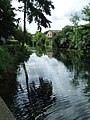
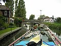
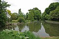
English: The Stort Navigation is the canalised section of the River Stort.
- It runs from the town of Bishop's Stortford, Hertfordshire downstream to its confluence with the Lee Navigation at Feildes Weir near Rye House, Hoddesdon, Hertfordshire.
river in the United Kingdom  | |||||
| Upload media | |||||
| Instance of | |||||
|---|---|---|---|---|---|
| Location |
| ||||
| Mouth of the watercourse | |||||
 | |||||
Subcategories
This category has the following 2 subcategories, out of 2 total.
B
C
Media in category "Stort Navigation"
The following 86 files are in this category, out of 86 total.
-
 "Navigation" bridge - geograph.org.uk - 241877.jpg 640 × 427; 113 KB
-
 Aid to navigation - geograph.org.uk - 1058595.jpg 640 × 480; 75 KB
-
 April Island, River Stort - geograph.org.uk - 932894.jpg 640 × 480; 108 KB
-
 Barges on the River Stort - geograph.org.uk - 1347632.jpg 640 × 480; 89 KB
-
-
 Bridge 82 plaque - geograph.org.uk - 1317452.jpg 428 × 640; 102 KB
-
-
 Calopteryx splendens - geograph.org.uk - 1317065.jpg 428 × 640; 41 KB
-
 Cardinal Beetle - geograph.org.uk - 1317096.jpg 640 × 428; 60 KB
-
 Chill-out zone - geograph.org.uk - 707985.jpg 640 × 480; 109 KB
-
 Daybreak in the Snow - geograph.org.uk - 1323587.jpg 640 × 428; 92 KB
-
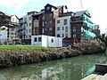
 Development by the River Stort - geograph.org.uk - 1616507.jpg 480 × 640; 108 KB
-
 Field by River Stort - geograph.org.uk - 1323716.jpg 499 × 327; 50 KB
-
 Foot Bridge - geograph.org.uk - 1324796.jpg 640 × 425; 88 KB
-
 Footbridge - geograph.org.uk - 258523.jpg 640 × 480; 124 KB
-
 Footbridge over the River Stort - geograph.org.uk - 707952.jpg 640 × 480; 117 KB
-
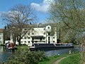
 Hallingbury Mill - geograph.org.uk - 299145.jpg 640 × 480; 82 KB
-
 Hallingbury Mill.jpg 2,048 × 1,536; 419 KB
-
 Harlow Outdoor Pursuits Centre - geograph.org.uk - 1469139.jpg 640 × 480; 67 KB
-
 Kecksy's Bridge - geograph.org.uk - 241941.jpg 640 × 427; 162 KB
-
 Lea and Stort Navigation - geograph.org.uk - 193966.jpg 427 × 640; 97 KB
-

-

-
 Metal Footbridge - geograph.org.uk - 501967.jpg 640 × 480; 92 KB
-
 Modern flats - geograph.org.uk - 546096.jpg 640 × 454; 196 KB
-
 Narrowboat leaving Twyford Lock - geograph.org.uk - 241925.jpg 640 × 427; 171 KB
-
 Narrowboat on the River Stort - geograph.org.uk - 708996.jpg 640 × 480; 148 KB
-
 Narrowboats on the River Stort - geograph.org.uk - 708999.jpg 640 × 480; 116 KB
-
 National Cycle Route 1, Lee Valley - geograph.org.uk - 93351.jpg 640 × 480; 155 KB
-
 New Family - geograph.org.uk - 748246.jpg 640 × 426; 92 KB
-
 New Flats - geograph.org.uk - 707937.jpg 640 × 480; 103 KB
-
 New flats - geograph.org.uk - 707945.jpg 640 × 480; 105 KB
-
 New footbridge on the River Stort - geograph.org.uk - 945147.jpg 640 × 480; 92 KB
-
 Ordnance Survey One-Inch Sheet 96 Hertford, Published 1919.jpg 12,145 × 8,466; 19.37 MB
-
 Parndon Mill - geograph.org.uk - 7706.jpg 640 × 480; 171 KB
-
 Pylons and canal, Edmonton - geograph.org.uk - 93365.jpg 640 × 480; 101 KB
-
 Queue for Hunsdon Lock - geograph.org.uk - 1317377.jpg 640 × 428; 93 KB
-
 Railway bridge over the River Stort - geograph.org.uk - 707942.jpg 640 × 480; 131 KB
-
 Railway bridge over the River Stort - geograph.org.uk - 707947.jpg 480 × 640; 114 KB
-
 River Stort (Navigation) - geograph.org.uk - 1518903.jpg 640 × 480; 81 KB
-
 River Stort (Navigation) - geograph.org.uk - 1518905.jpg 640 × 480; 73 KB
-
 River Stort (Navigation) - geograph.org.uk - 1518907.jpg 640 × 480; 87 KB
-
 River Stort - geograph.org.uk - 1058588.jpg 640 × 480; 67 KB
-
 River Stort - geograph.org.uk - 1058935.jpg 640 × 480; 72 KB
-
 River Stort - geograph.org.uk - 1058938.jpg 480 × 640; 62 KB
-
 River Stort - geograph.org.uk - 1064642.jpg 640 × 480; 55 KB
-
 River Stort - geograph.org.uk - 1188429.jpg 640 × 480; 60 KB
-
 River Stort - geograph.org.uk - 1188462.jpg 640 × 480; 49 KB
-
 River Stort - geograph.org.uk - 1368035.jpg 640 × 479; 98 KB
-
 River Stort - geograph.org.uk - 546087.jpg 480 × 640; 155 KB
-
 River Stort - geograph.org.uk - 592332.jpg 480 × 640; 114 KB
-
 River Stort - geograph.org.uk - 592339.jpg 640 × 480; 84 KB
-
 River Stort - geograph.org.uk - 592348.jpg 480 × 640; 103 KB
-
 River Stort - geograph.org.uk - 592355.jpg 503 × 640; 81 KB
-
 River Stort - geograph.org.uk - 592367.jpg 480 × 640; 84 KB
-
 River Stort - geograph.org.uk - 592373.jpg 640 × 480; 162 KB
-
 River Stort - geograph.org.uk - 707980.jpg 640 × 480; 82 KB
-
 River Stort - geograph.org.uk - 707982.jpg 640 × 497; 86 KB
-
 River Stort - geograph.org.uk - 945130.jpg 640 × 480; 96 KB
-
 River Stort footbridges in Sawbridgeworth, Hertfordshire.jpg 640 × 480; 104 KB
-

-
 River Stort Navigation - geograph.org.uk - 9143.jpg 640 × 480; 167 KB
-

-
 River Stort, Bishops Stortford - geograph.org.uk - 154819.jpg 640 × 480; 72 KB
-
 River Stort, Kekseys farm - geograph.org.uk - 934501.jpg 640 × 480; 97 KB
-
 River Stort, Roydon (25879796697).jpg 4,608 × 3,456; 5.14 MB
-
 Riverside housing - geograph.org.uk - 546111.jpg 640 × 480; 198 KB
-
 Roydon Bridge - geograph.org.uk - 1317444.jpg 640 × 428; 111 KB
-
 Roydon From Canal.jpg 1,600 × 1,200; 266 KB
-
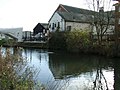
 Roydon Mill - geograph.org.uk - 112068.jpg 640 × 480; 92 KB
-
 Roydon railway bridge.jpg 2,048 × 1,536; 509 KB
-
 Stort at Roydon - geograph.org.uk - 1317005.jpg 640 × 428; 99 KB
-
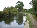
 Stort Navigation - geograph.org.uk - 1307741.jpg 428 × 640; 86 KB
-
 Stort Navigation - geograph.org.uk - 1317343.jpg 640 × 428; 77 KB
-
 Stort Navigation, Sawbridgeworth - geograph.org.uk - 39286.jpg 640 × 422; 134 KB
-
 Stort Traffic - geograph.org.uk - 1317017.jpg 428 × 640; 93 KB
-
-
 The Moorhen, Harlow - geograph.org.uk - 132579.jpg 640 × 426; 107 KB
-
 The Navigation Inn - geograph.org.uk - 748231.jpg 640 × 427; 74 KB
-
-
 Twyford Lock, Bishops Stortford - geograph.org.uk - 154817.jpg 640 × 480; 65 KB
-
 Water stop - geograph.org.uk - 592336.jpg 640 × 541; 131 KB
-
 Your global journey starts here - geograph.org.uk - 1445031.jpg 640 × 480; 250 KB
-

-
 Harlow Outdoor Pursuits Centre - geograph.org.uk - 258520.jpg 640 × 480; 113 KB
-


_-_geograph.org.uk_-_1518903.jpg)
_-_geograph.org.uk_-_1518905.jpg)
_-_geograph.org.uk_-_1518907.jpg)


.jpg)


_-_geograph.org.uk_-_132574.jpg)

