Category:Storeton - Thingwall footpath
Jump to navigation
Jump to search

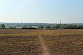
This footpath starts in Landican Lane, Storeton, crosses the M53 via a footbridge, then passes to the south of Stanley Wood, across the Borderlands railway line, and cuts through Lower Heath Wood to emerge on Lower Thingwall Lane. Between Storeton and the Borderlands Line it is designated FP8 in the Wirral Council Definitive Statement of 2013 and is 0.175 miles long; it becomes FP17 on the remaining section to Lower Thingwall Lane, which is 0.667 miles long.
Subcategories
This category has the following 5 subcategories, out of 5 total.
Media in category "Storeton - Thingwall footpath"
The following 24 files are in this category, out of 24 total.
-
 Storeton - Thingwall footpath - start.jpg 4,533 × 3,438; 10.25 MB
-
 Sign, Landican Lane, Storeton (geograph 2966310).jpg 683 × 1,024; 114 KB
-
 Footpath from Storeton to Thingwall.jpg 5,076 × 3,384; 11.06 MB
-
 Storeton - Thingwall, path across first field 1.jpg 3,309 × 4,410; 14.51 MB
-
 Storeton - Thingwall, path across first field 2.jpg 3,321 × 4,428; 13.77 MB
-
 Footpath near Storeton - geograph.org.uk - 674990.jpg 640 × 480; 94 KB
-
 Storeton - Thingwall footpath - Brickfields Farm field 1-1.jpg 3,348 × 4,584; 12.42 MB
-
 Storeton - Thingwall footpath - Brickfields Farm field 1-2.jpg 3,303 × 4,581; 12.12 MB
-
 Storeton - Thingwall footpath - Brickfields Farm field 1-3.jpg 3,387 × 4,584; 12.89 MB
-
 Storeton - Thingwall footpath - Brickfields Farm field 1-4.jpg 4,407 × 3,297; 14.7 MB
-
 Footpath near Storeton. - geograph.org.uk - 734742.jpg 480 × 640; 108 KB
-
 Storeton - Thingwall footpath - Brickfields Farm field 2-1.jpg 3,456 × 4,608; 15.52 MB
-
 Storeton - Thingwall footpath - Brickfields Farm field 2-2.jpg 4,409 × 3,307; 15.14 MB
-
 Storeton - Thingwall footpath - Brickfields Farm field 2-3.jpg 4,425 × 3,318; 16.45 MB
-
 Benchmark on Storeton - Thingwall footpath.jpg 3,456 × 4,608; 16.05 MB
-
 Storeton - Thingwall footpath beyond the level crossing.jpg 3,385 × 4,513; 15.68 MB
-
 Storeton - Thingwall footpath, gate at field exit.jpg 4,600 × 3,450; 15.73 MB
-
 Benkid77 Thingwall public footpath 1 200709.JPG 2,240 × 1,680; 932 KB
-
 Storeton - Thingwall footpath, field boundary.jpg 4,600 × 3,450; 18.52 MB
-
 Storeton - Thingwall footpath, last gate.jpg 4,608 × 3,456; 13.91 MB
-
 Storeton - Thingwall footpath, near the end.jpg 5,196 × 3,452; 21.75 MB
-
 Benkid77 Thingwall public footpath 2 200709.JPG 2,240 × 1,680; 901 KB
-
 Storeton - Thingwall footpath, junction with road.jpg 5,147 × 3,125; 20.05 MB
-
 Fingerpost on Lower Thingwall Lane.jpg 3,278 × 4,371; 13.81 MB

.jpg)


