Category:Stonesby
Jump to navigation
Jump to search
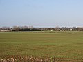
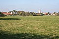
English: Stonesby is a small village within the Melton borough of Leicestershire, England. It is southeast of Waltham on the Wolds.
village in Leicestershire, United Kingdom  | |||||
| Upload media | |||||
| Instance of | |||||
|---|---|---|---|---|---|
| Location | Sproxton, Melton, Leicestershire, East Midlands, England | ||||
 | |||||
Subcategories
This category has the following 2 subcategories, out of 2 total.
Q
S
Media in category "Stonesby"
The following 95 files are in this category, out of 95 total.
-
 Bench in Stonesby Cemetery - geograph.org.uk - 1884105.jpg 1,650 × 1,189; 810 KB
-
 Bench mark, 23 Main Street, Stonesby - geograph.org.uk - 5196711.jpg 1,280 × 960; 532 KB
-
 Bench mark, The Hovel. Stonesby - geograph.org.uk - 5196728.jpg 926 × 1,280; 516 KB
-
 Church Farm, Stonesby - geograph.org.uk - 5188239.jpg 1,280 × 960; 357 KB
-
 Church Farm, Stonesby - geograph.org.uk - 5202454.jpg 1,024 × 768; 183 KB
-
 Datestone, The Manor House, Stonesby - geograph.org.uk - 5196709.jpg 1,280 × 960; 585 KB
-
 Entrance to Stonesby Cemetery - geograph.org.uk - 3498868.jpg 640 × 473; 53 KB
-
 Farmland east of Stonesby - geograph.org.uk - 1874263.jpg 3,258 × 2,287; 3.31 MB
-
 Farmland near Stonesby - geograph.org.uk - 3016431.jpg 640 × 480; 47 KB
-
 Farmland south of Stonesby - geograph.org.uk - 1868873.jpg 2,929 × 2,101; 2.53 MB
-
 Glenroy, Back Lane, Stonesby - geograph.org.uk - 5196720.jpg 1,280 × 960; 336 KB
-
 Gorse Farmhouse, Stonesby - geograph.org.uk - 5196723.jpg 1,280 × 960; 299 KB
-
 Hall Farm, Stonesby taken from Kings st Lane, Stonesby.jpg 4,000 × 3,000; 3.36 MB
-
 Hall Farmhouse, Stonesby - geograph.org.uk - 5196738.jpg 1,280 × 945; 417 KB
-
 Home Farmhouse, Stonesby - geograph.org.uk - 5196714.jpg 1,280 × 960; 345 KB
-
 House in Stonesby - geograph.org.uk - 3016434.jpg 640 × 480; 58 KB
-
 House on The Green, Stonesby - geograph.org.uk - 5202469.jpg 1,024 × 768; 180 KB
-
 King Street Lane near Stonesby - geograph.org.uk - 1873372.jpg 2,317 × 1,997; 1.87 MB
-
 King Street Lane towards Stonesby - geograph.org.uk - 1873374.jpg 2,712 × 2,090; 2.46 MB
-
 King Street Lane towards Stonesby - geograph.org.uk - 1873382.jpg 2,914 × 2,344; 2.82 MB
-
 Lane out of Stonesby - geograph.org.uk - 3016450.jpg 640 × 480; 51 KB
-
 Lane south of Stonesby - geograph.org.uk - 1868879.jpg 2,716 × 1,619; 1.83 MB
-
 Main Street leaving Stonesby - geograph.org.uk - 1884097.jpg 3,060 × 1,979; 2.53 MB
-
 Main Street, Stonesby - geograph.org.uk - 5196712.jpg 1,280 × 960; 451 KB
-
 Manor House - Stonesby.jpg 4,000 × 3,000; 2.26 MB
-
 Methodist Church and Community Centre, Chapel Lane, Stonesby - geograph.org.uk - 5456211.jpg 3,776 × 2,520; 3.94 MB
-
 New bridleway (E65a) past Stonesby Spinney - geograph.org.uk - 5456234.jpg 3,776 × 2,520; 4.02 MB
-
 New bridleway (E65a) to Stonesby Spinney - geograph.org.uk - 5456230.jpg 3,776 × 2,520; 3.88 MB
-
 Opal Cottage, Main Street, Stonesby - geograph.org.uk - 5196741.jpg 1,280 × 960; 671 KB
-
 Stable range, Church farm, Stonesby - geograph.org.uk - 5196721.jpg 1,280 × 960; 405 KB
-
 Stonesby Cemetery - geograph.org.uk - 3498872.jpg 640 × 469; 47 KB
-
 Stonesby Cemetery gates - geograph.org.uk - 3498873.jpg 640 × 474; 68 KB
-
 Stonesby Cemetery seat - geograph.org.uk - 3498874.jpg 640 × 474; 32 KB
-
 Stonesby Lodge - geograph.org.uk - 1873491.jpg 3,185 × 1,439; 2.05 MB
-
 Stonesby Methodist Church - geograph.org.uk - 5196731.jpg 1,280 × 960; 273 KB
-
 Stonesby PSD (petroleum storage depot) - geograph.org.uk - 594114.jpg 640 × 427; 113 KB
-
 Stonesby, The Green - geograph.org.uk - 1873367.jpg 3,084 × 1,767; 2.4 MB
-
 Stonesby.jpg 640 × 427; 86 KB
-
 The approach to the church, Stonesby - geograph.org.uk - 5202027.jpg 1,024 × 745; 186 KB
-

-
 The end of Back Lane, Stonesby - geograph.org.uk - 5188242.jpg 1,280 × 900; 262 KB
-
 The Green, Stonesby - geograph.org.uk - 5196724.jpg 1,280 × 960; 301 KB
-
 The Green, Stonesby - geograph.org.uk - 5196742.jpg 1,280 × 960; 393 KB
-
 The Green, Stonesby - geograph.org.uk - 594142.jpg 640 × 427; 97 KB
-
 The Hovel, Waltham Road, Stonesby - geograph.org.uk - 5196729.jpg 1,280 × 960; 313 KB
-
 The Main Street of Stonesby - geograph.org.uk - 1884089.jpg 3,161 × 1,938; 2.57 MB
-
 The Manor House, Stonesby - geograph.org.uk - 5134373.jpg 1,024 × 768; 219 KB
-
 The Manor House, Stonesby - geograph.org.uk - 5196706.jpg 1,280 × 903; 340 KB
-
 The Old School, Back Lane, Stonesby - geograph.org.uk - 5196718.jpg 1,280 × 960; 421 KB
-
 The pinfold, Stonesby - geograph.org.uk - 5196744.jpg 1,280 × 960; 675 KB
-
 The Red House, Back Lane, Stonesby - geograph.org.uk - 5196716.jpg 1,280 × 960; 424 KB
-
 The Redlands, Back Lane, Stonesby - geograph.org.uk - 5188241.jpg 1,280 × 960; 313 KB
-
 Traffic lights in the middle of nowhere^ - geograph.org.uk - 67422.jpg 640 × 483; 155 KB
-
 View from the churchyard - geograph.org.uk - 594130.jpg 640 × 427; 103 KB
-
 View towards Stonesby in Leicestershire - geograph.org.uk - 1856449.jpg 3,134 × 1,915; 2.8 MB
-
 View towards Stonesby in Leicestershire - geograph.org.uk - 1873463.jpg 2,760 × 1,676; 1.91 MB
-
 View towards Stonesby Spinney - geograph.org.uk - 1873410.jpg 3,264 × 1,913; 2.38 MB
-
 Waltham road entering Stonesby - geograph.org.uk - 5456204.jpg 3,776 × 2,520; 2.84 MB
-
 Waltham Road in Stonesby - geograph.org.uk - 1868890.jpg 2,723 × 2,199; 2.56 MB
-
 Window and datestone, Stonesby Methodist Church - geograph.org.uk - 5196733.jpg 1,280 × 906; 403 KB
-
 Back Lane, Stonesby - geograph.org.uk - 594133.jpg 640 × 427; 77 KB
-
 Bescaby Lane - geograph.org.uk - 608281.jpg 640 × 427; 86 KB
-
 Bescaby Oaks - geograph.org.uk - 33172.jpg 640 × 480; 135 KB
-
 Bird scarer off Mary Lane - geograph.org.uk - 608406.jpg 640 × 480; 107 KB
-
 Bridleway near Bescaby - geograph.org.uk - 33182.jpg 640 × 480; 123 KB
-
 Church Farm, Stonesby - geograph.org.uk - 594131.jpg 640 × 427; 97 KB
-
 Country Road near Stonesby - geograph.org.uk - 77524.jpg 640 × 427; 189 KB
-
 Electrician's junk - geograph.org.uk - 594116.jpg 640 × 537; 156 KB
-
 Farm track near Stonesby - geograph.org.uk - 700619.jpg 427 × 640; 100 KB
-
 Farm track near Stonesby - geograph.org.uk - 700665.jpg 640 × 427; 104 KB
-
 Farmland near Stonesby - geograph.org.uk - 67400.jpg 640 × 480; 134 KB
-
 Farmland near Stonesby - geograph.org.uk - 700644.jpg 640 × 427; 109 KB
-
 Farmland near Stonesby - geograph.org.uk - 77520.jpg 640 × 480; 102 KB
-
 Farmland near Stonesby - geograph.org.uk - 77532.jpg 640 × 427; 116 KB
-
 Farmland near Stonesby quarry. - geograph.org.uk - 592844.jpg 640 × 427; 108 KB
-

-

-
 Giant haystack near Stonesby - geograph.org.uk - 67391.jpg 640 × 480; 165 KB
-
 Home Farm, Stonesby - geograph.org.uk - 594137.jpg 640 × 427; 87 KB
-
 King Street Lane - geograph.org.uk - 594122.jpg 640 × 427; 82 KB
-
 King Street Lane, near Stonesby - geograph.org.uk - 77521.jpg 480 × 640; 164 KB
-

-
 Public footpath at Bescaby - geograph.org.uk - 33163.jpg 640 × 480; 166 KB
-

-
 Racecourse Farm, Bescaby - geograph.org.uk - 608284.jpg 640 × 427; 101 KB
-
 River Eye at Hamwell Spring, Bescaby - geograph.org.uk - 124742.jpg 640 × 480; 178 KB
-
 Spring seepage at Hamwell Spring, Bescaby - geograph.org.uk - 124754.jpg 640 × 480; 181 KB
-
 Stonesby - geograph.org.uk - 594118.jpg 640 × 427; 89 KB
-
 Stonesby Road - geograph.org.uk - 700670.jpg 640 × 427; 117 KB
-
 Stonesby Spinney - geograph.org.uk - 77526.jpg 640 × 427; 123 KB
-
 Stonesby, Leicestershire - geograph.org.uk - 67397.jpg 640 × 480; 128 KB
-

-
 The Mowbray Way - geograph.org.uk - 594112.jpg 640 × 427; 99 KB
-
 The Old School - geograph.org.uk - 594132.jpg 640 × 427; 125 KB
-
 Towards Stonesby Road - geograph.org.uk - 700631.jpg 640 × 427; 105 KB


_past_Stonesby_Spinney_-_geograph.org.uk_-_5456234.jpg)
_to_Stonesby_Spinney_-_geograph.org.uk_-_5456230.jpg)


_-_geograph.org.uk_-_594114.jpg)


